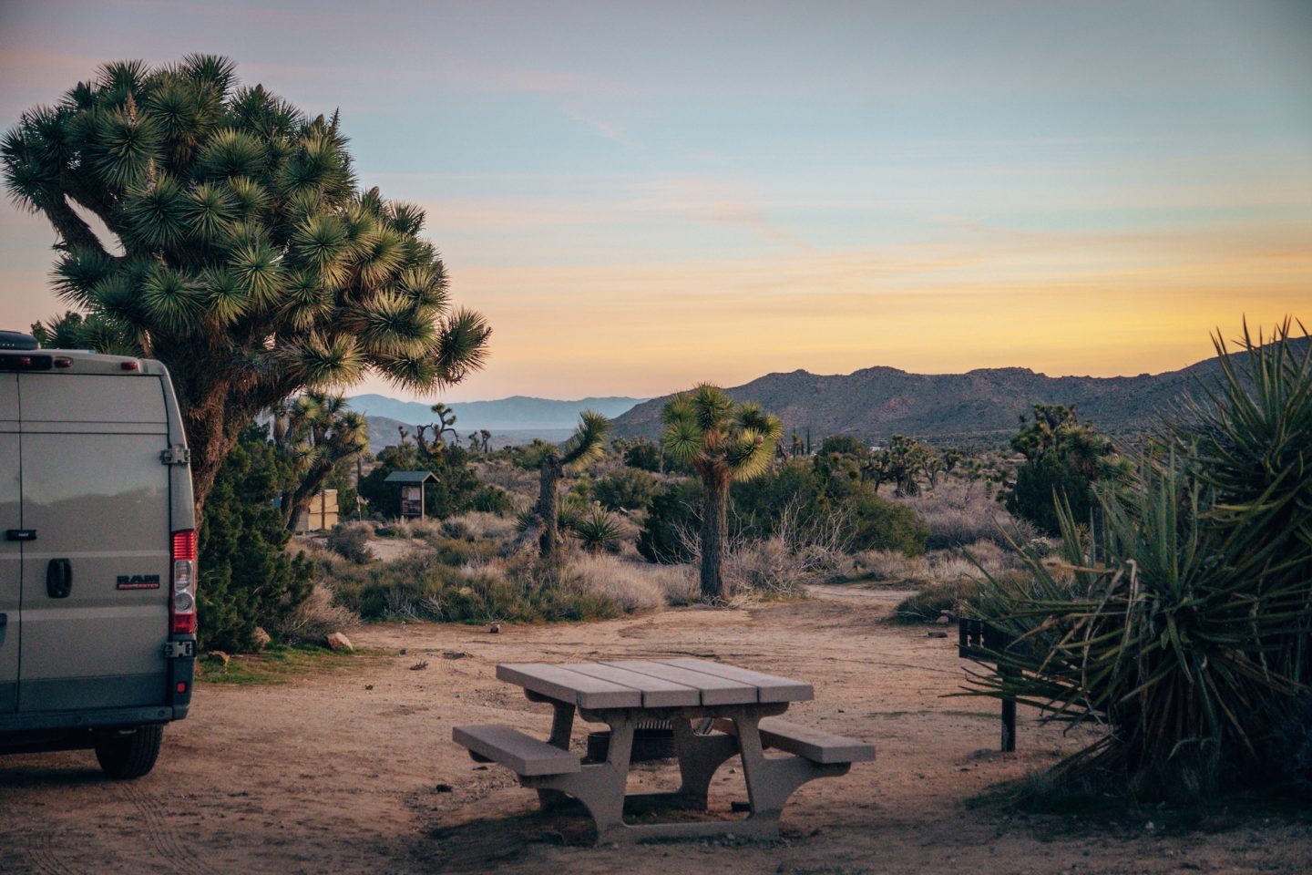
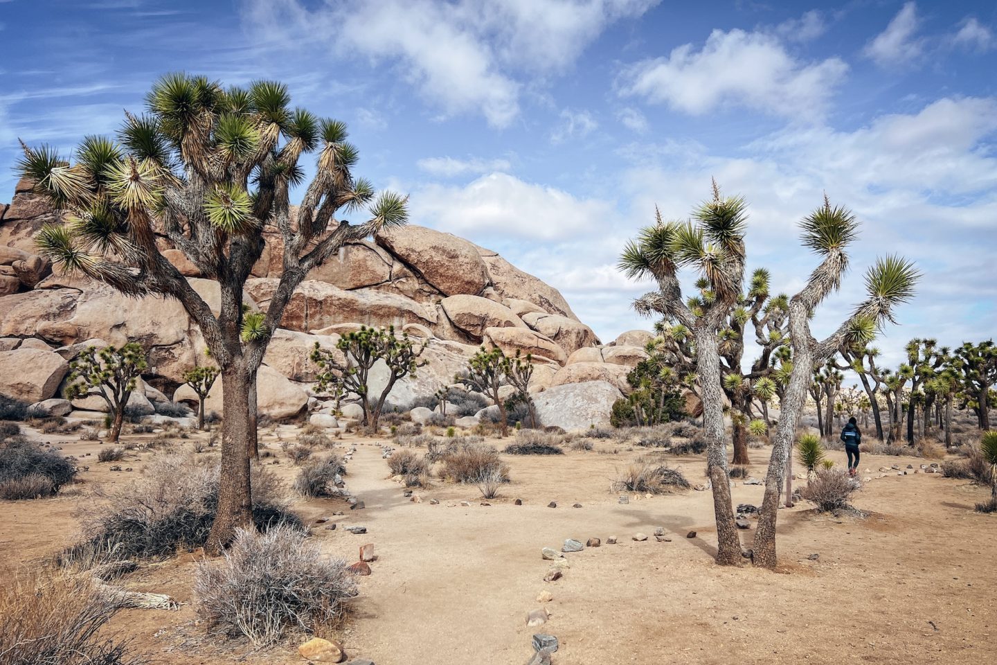
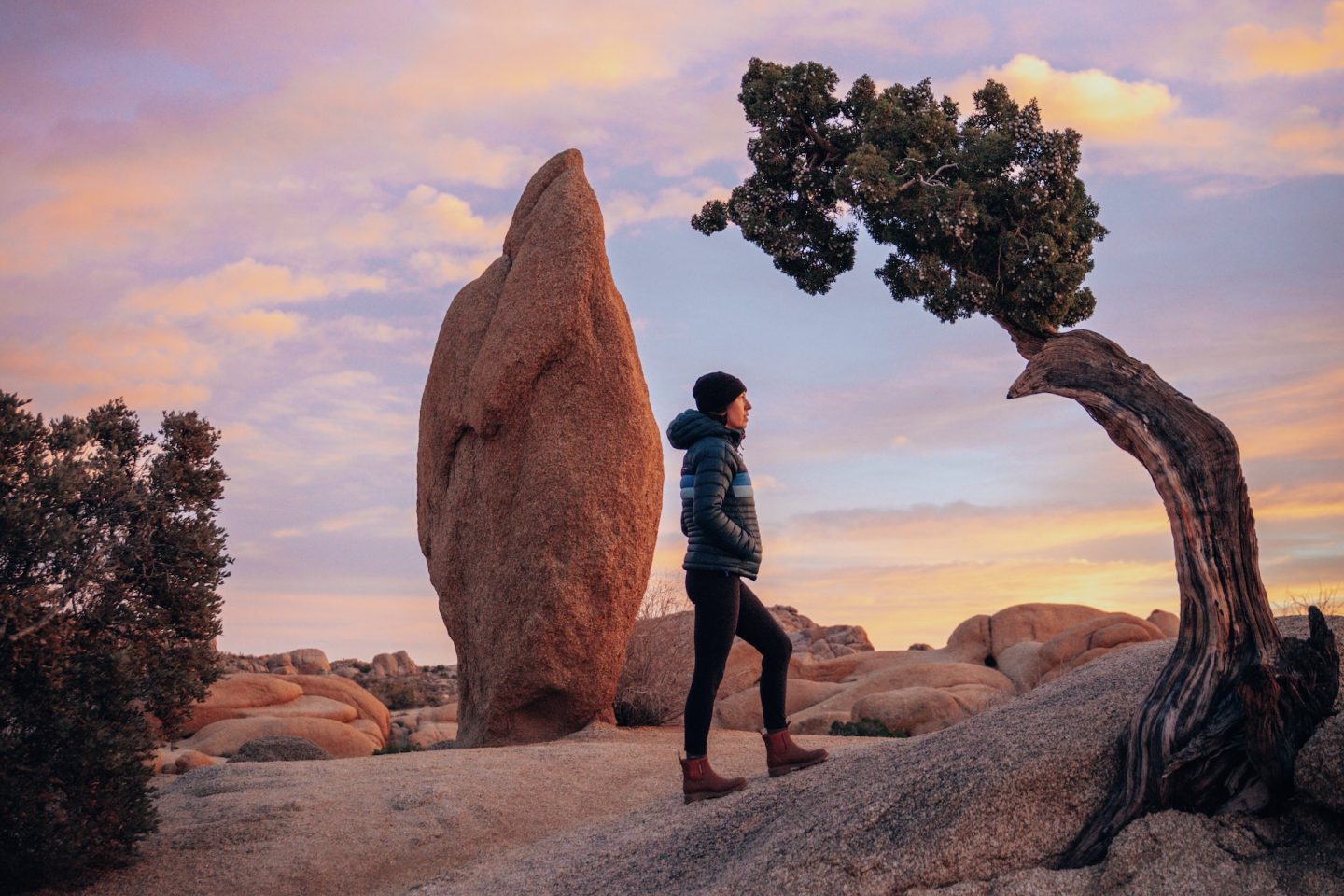
Camping in Joshua Tree National Park offers one of the best ways to fully experience the park’s rugged desert landscapes and quiet nights. Instead of setting up in one place for your entire trip, this Itinerary moves between campgrounds to explore different areas of the park along the way. This approach allows you to experience a wider range of scenery. From classic Joshua tree forests and massive rock formations to the more remote desert landscapes in the park’s southern section. This guide walks through how to plan a camping-focused trip through the park. Including 3 campgrounds, and a handful of hikes and scenic spots along the way.
If you want to learn more about the park Itself, weather conditions, best times to visit and more, check out our JOSHUA TREE NATIONAL PARK: HOW TO PLAN YOUR VISIT article!
- GENERAL INFORMATION
- MAP OF JOSHUA TREE NATIONAL PARK
- JOSHUA TREE CAMPGROUNDS
- CAMPING YOUR WAY THROUGH JOSHUA TREE
- CAMPING IN JOSHUA TREE NATIONAL PARK: A GUIDE TO CAMPING YOUR WAY THROUGH THE PARK
- CALIFORNIA BUCKET LIST MAP
- OTHER JOSHUA TREE ARTICLES
GENERAL INFORMATION
As mentioned above, this guide will follow a specific route running from the northern part of the park, down to the southern part of the park. If your travel plans dictate, you could could very easily just reverse the order of this route to do south to north. Realistically, you could do this in 3 nights / 4 days, but we’d recommend doing at least 4 nights so you can slow down and truly enjoy the park.
- Park entry fee: None (campground reservations cover entry fees)
- Number of campgrounds in itinerary: 3
- Number of hikes in itinerary: 7-10
- Recommended number of days: 4-6
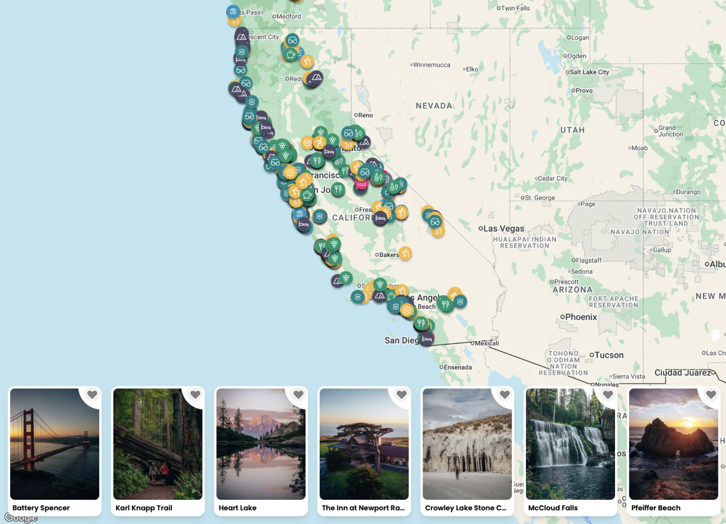
MAP OF JOSHUA TREE NATIONAL PARK
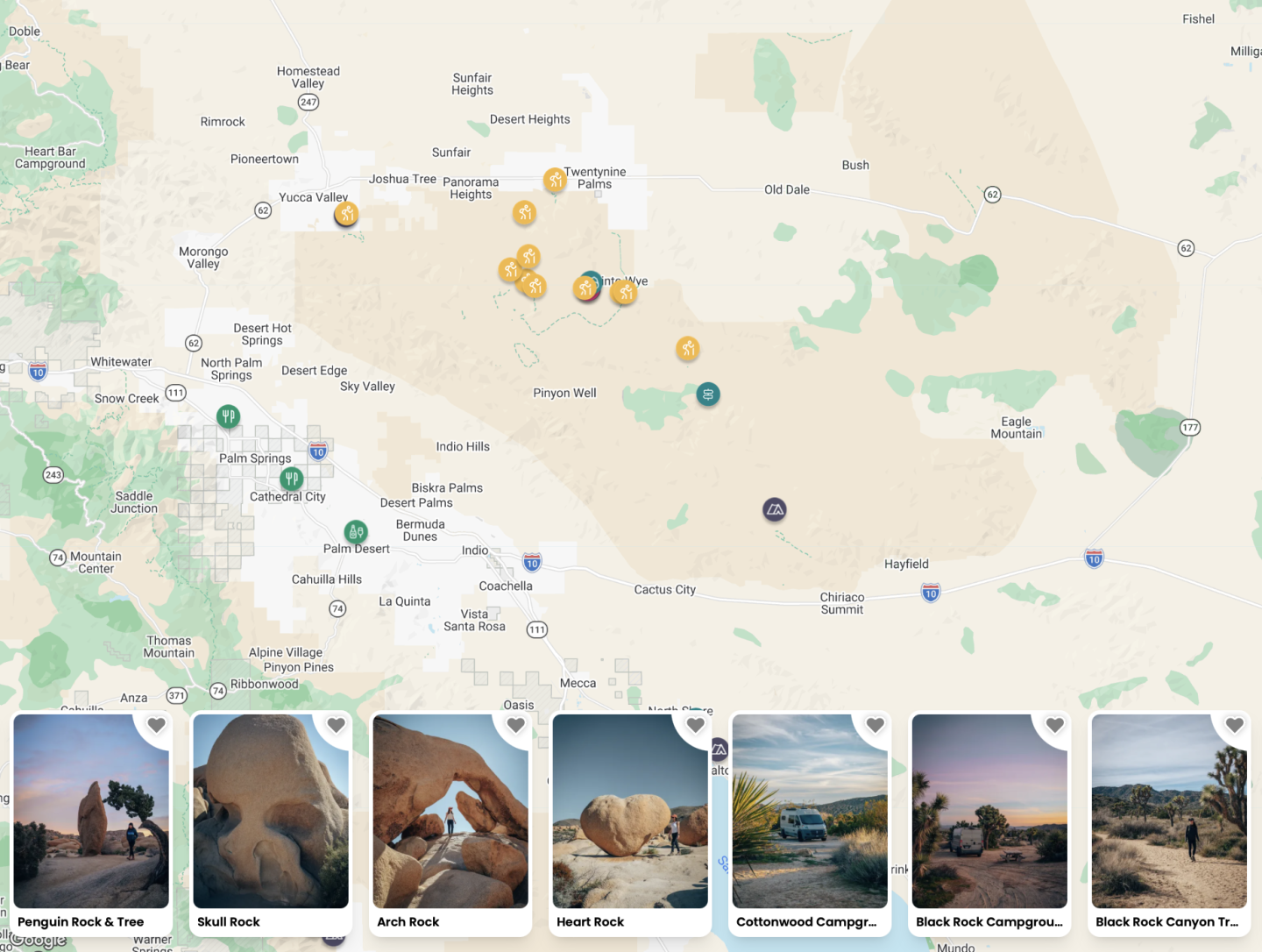
Want to see all these locations in an interactive map that offers a detailed look at top locations within Joshua Tree National Park? Our California bucket list map and guide included campgrounds, scenic viewpoints, hiking trails, and hidden gems. Each pin on the map is clickable and includes helpful info to make your visit easier. Click on the map below to check it out!
JOSHUA TREE CAMPGROUNDS
Nine campgrounds operate within Joshua Tree National Park. Each offers a slightly different camping experience depending on location, scenery, and amenities. Larger campgrounds such as Jumbo Rocks, Hidden Valley, and Black Rock sit among the park’s famous rock formations and dense Joshua tree forests. These areas provide easy access to some of the park’s most popular hiking trails and viewpoints, which makes them especially popular with first-time visitors. Several of these campgrounds also offer potable water and reservable campsites, making them a bit more convenient for longer stays.
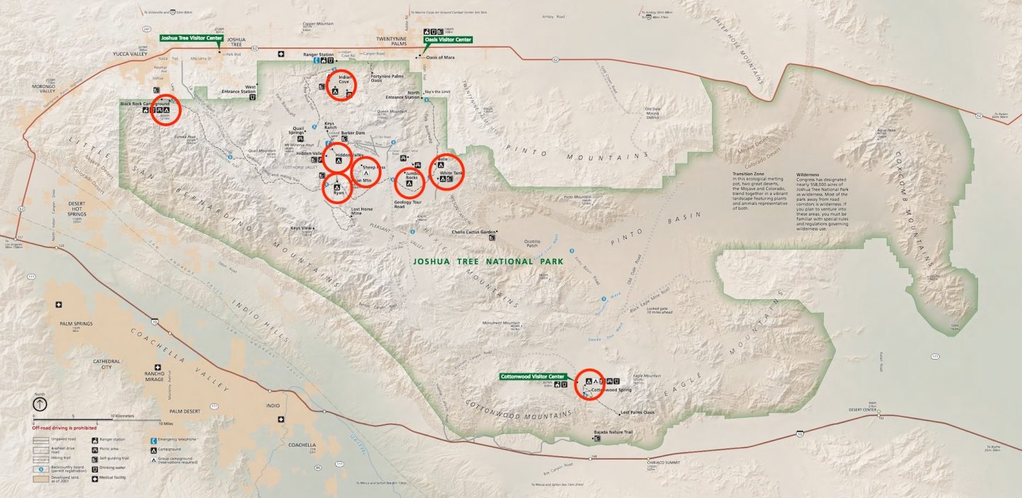
Other campgrounds provide a quieter and more remote experience in different parts of the park. Cottonwood Campground sits in the park’s southern section and often sees fewer crowds due to its distance from the main entrances. Indian Cove Campground lies just outside the main park boundary but still places campers among towering boulders and scenic desert landscapes. Smaller campgrounds such as Ryan Campground, White Tank Campground, and Belle Campground offer a more primitive experience with fewer amenities but quieter surroundings. Choosing the right campground often depends on whether you prioritize scenery, amenities, availability, or proximity to specific hikes and attractions.
A ninth campground, Sheep Pass Campground, is reserved exclusively for large groups, so it isn’t relevant for most individual camping itineraries.
CAMPING YOUR WAY THROUGH JOSHUA TREE
This guide follows a simple route through the park that begins at Black Rock Campground on the park’s northwest edge and ends at Cottonwood Campground near the southern entrance. Traveling this direction allows you to experience the park’s changing landscapes, from higher-elevation Joshua tree forests to the more open desert terrain in the south. Along the way, we’ll highlight some of the best hikes, viewpoints, and stops that naturally fit into the drive, making it easy to explore the park while moving between campgrounds.
BLACK ROCK CAMPGROUND
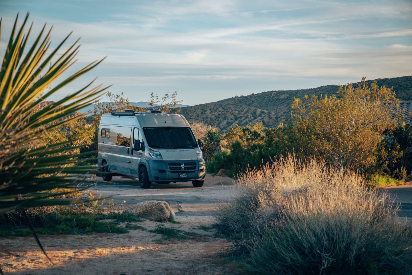
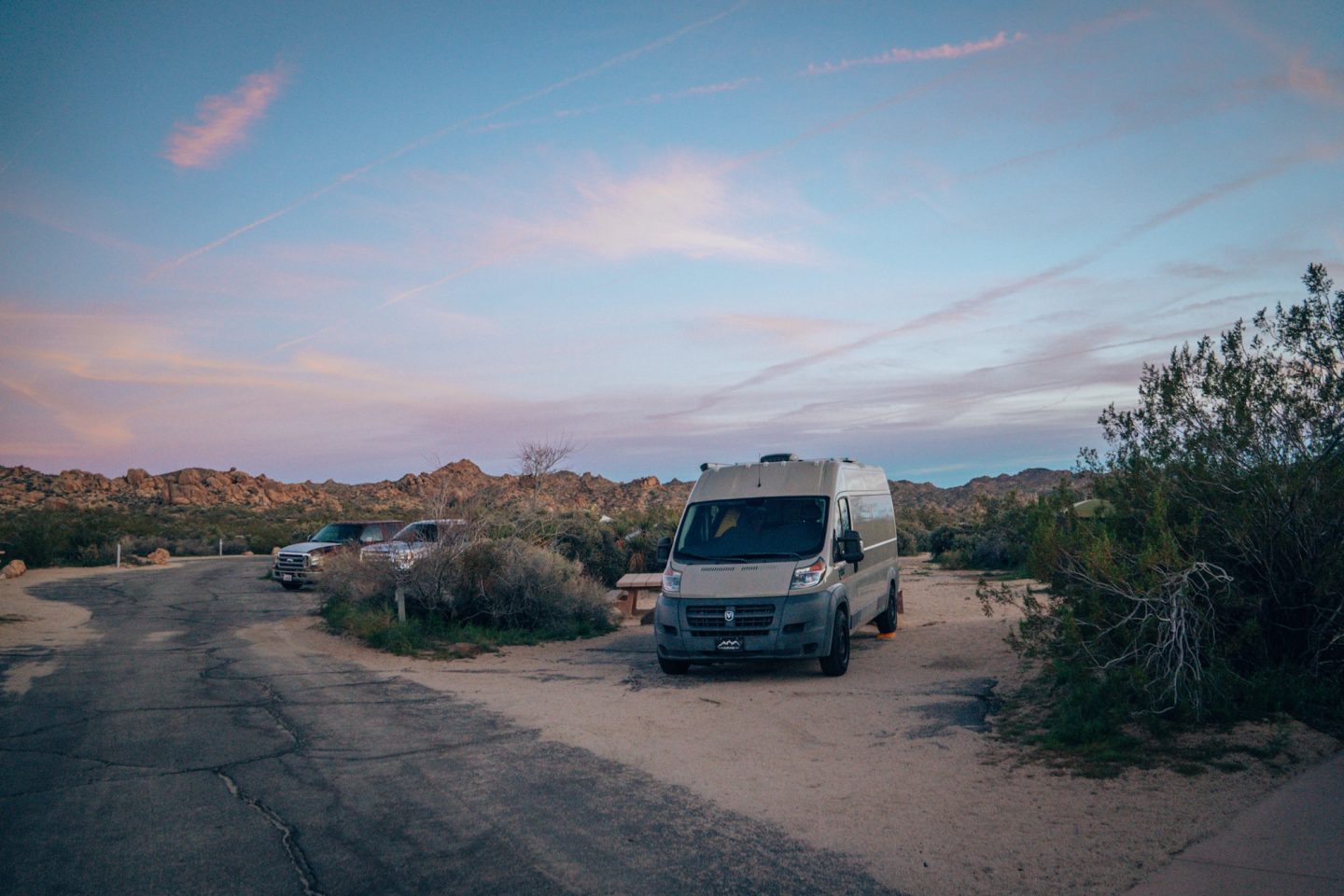
The first stop, located on the northwest edge of Joshua Tree National Park near the town of Yucca Valley, Black Rock Campground offers one of the most accessible and comfortable camping experiences in the park. This area sits at a slightly higher elevation than many other campgrounds, which often means cooler temperatures and a landscape filled with dense stands of Joshua trees. Because the campground sits near the park boundary, it also provides quick access to nearby services like grocery stores, restaurants, and gas stations in Yucca Valley.
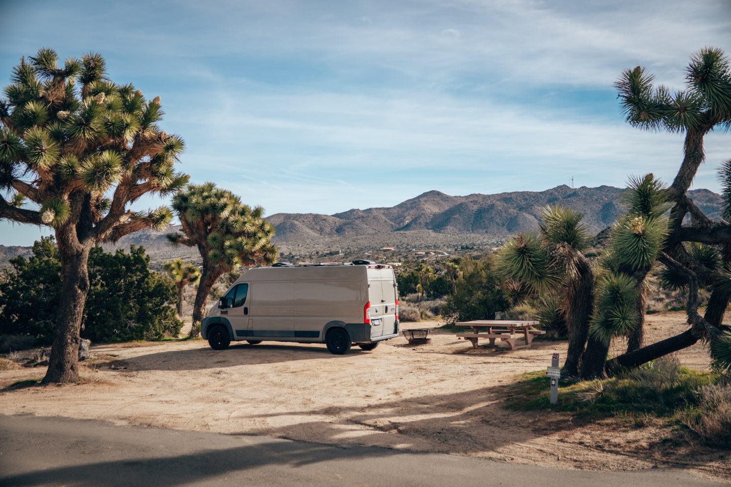
Compared to the more rugged campgrounds deeper inside the park, Black Rock feels a bit more developed and organized. The campground includes over 90 campsites suitable for tents and RVs, along with flush toilets, potable water, and a dump station for RVs. Several hiking trails also begin directly from the campground, including routes that lead into the park’s quieter western wilderness. While it doesn’t sit among the massive granite formations found in other areas, the peaceful desert setting, convenient amenities, and strong Joshua tree presence make it a great starting point for a camping trip through the park.
- Sites start at $35/night
- Recommended sites: 40-49 & 60-69 for denser Joshua Trees
- Bathrooms: Yes
- Showers: No
- Potable water: Yes
- Dump station: Yes
Depending on how long you’d like to spend inside the park, we’d recommend 1-2 nights stay at this campground.
An alternate option to this combo, would be to stay at the Indian Cove Campground where there are also a number of hikes right from the campground.
BLACK ROCK CANYON TRAIL
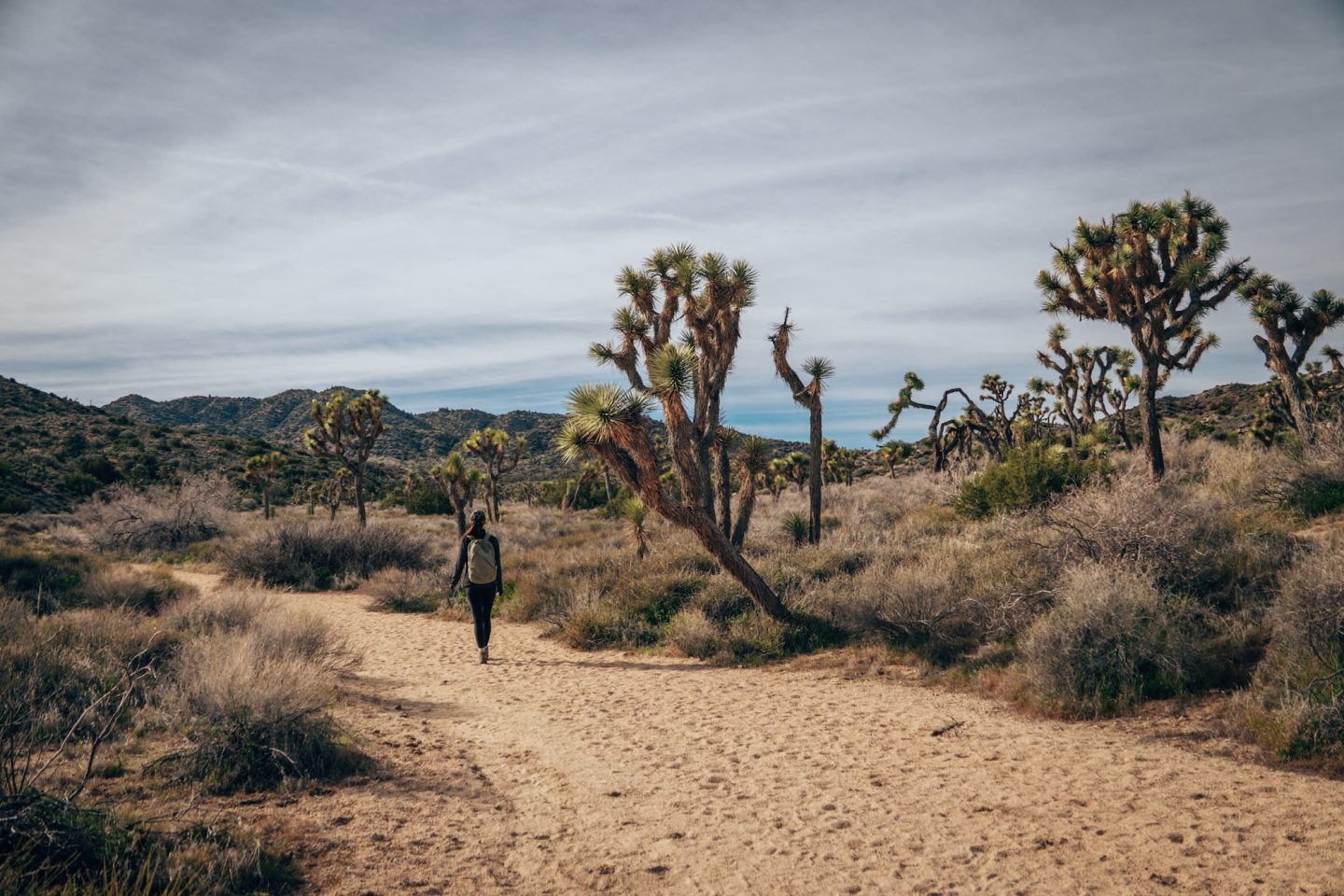
Several rewarding hikes begin right from Black Rock Campground. The first, Black Rock Canyon Trail offers a moderate 4‑mile hike through scenic desert terrain with some of the most dense areas of Joshua trees, and panoramic vistas of the surrounding canyon. While this hike is just under 4 miles long, we found it to be a very easy going stroll with some of the best Joshua Tree views in the park.
- DIFFICULTY – Easy
- LENGTH – 3.8mi / 6.1km
- ELEVATION – 465ft
- TIME NEEDED – 2 hours
- PET FRIENDLY – No
PANORAMA LOOP TRAIL
The Panorama Loop shares the Black Rock Canyon Trail and continues on, adding roughly another 2–3 miles, climbing gently to ridges that provide sweeping views of the Morongo Valley and the park’s northern desert landscape. If you’re looking for a hike that provides sweeping views, this is an ideal choice.
- DIFFICULTY – Moderate to difficult
- LENGTH – 6.5mi / 10.5km
- ELEVATION – 1,200ft
- TIME NEEDED – 3-4 hours
- PET FRIENDLY – No
WARREN PEAK TRAIL
For hikers seeking more challenge and elevation, the Warren Peak Trail rises about 1,000 feet and delivers expansive views of the San Bernardino Mountains, the Little San Bernardino Mountains, and distant desert plains.
- DIFFICULTY – Moderate to difficult
- LENGTH – 5.7mi / 9.1km
- ELEVATION – 1,100ft
- TIME NEEDED – 3 hours
- PET FRIENDLY – No
HIDDEN VALLEY TRAIL
The next campground stay, is the Jumbo Rocks Campground, which lays in the center of the park and is roughly a 1-hour drive from Black Rock Campground. The good news is that there are some must-do hikes along the way, starting with the Hidden Valley Trail.
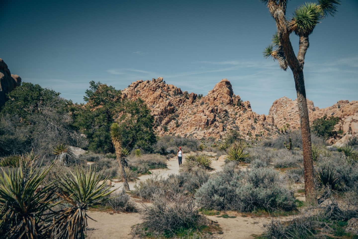
The Hidden Valley Trail offers a short, easy loop of about one mile through a naturally enclosed valley surrounded by massive boulders. This trail is perfect for families or anyone looking for a quick, scenic hike. Along the way, you’ll pass interesting rock formations, Joshua trees, and occasional wildlife, making it a great introduction to the park’s desert landscape. The trail also provides opportunities for bouldering and photography, with dramatic views around every bend, all within a peaceful, sheltered setting.
- DIFFICULTY – Easy
- LENGTH – 1.0mi / 1.6km
- ELEVATION –110ft
- TIME NEEDED – 30 minutes
- PET FRIENDLY – No
BARKER DAM
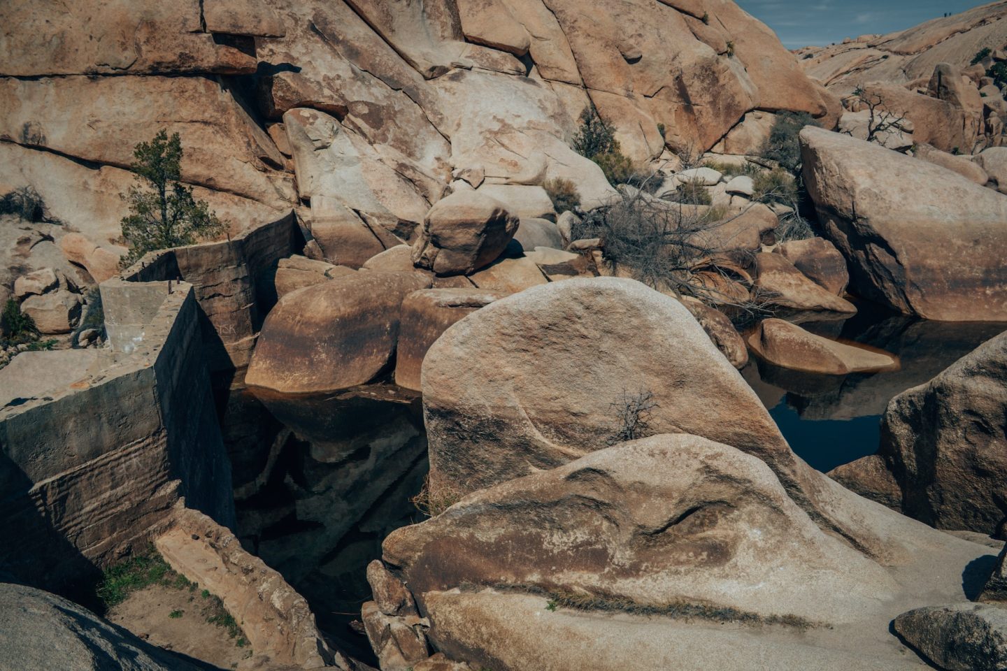
The next stop along the route is the area around Barker Dam, where two popular trails offer a mix of history, wildlife, and iconic desert scenery. The Barker Dam Trail is an easy 1.5‑mile loop that passes a historic water reservoir and provides excellent opportunities to spot birds, bighorn sheep, and seasonal desert flowers.
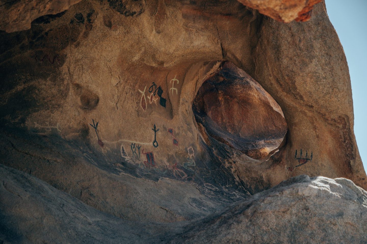
Just off this trail, hikers can explore the short Petroglyphs Trail, which leads to a small rock art site featuring ancient Native American carvings. Together, these trails offer a unique combination of natural beauty and cultural history, making them a must‑visit stop for anyone traveling through Joshua Tree.
- DIFFICULTY – Easy
- LENGTH – 1.7mi / 2.7km
- ELEVATION – 65ft
- TIME NEEDED – 1 hour
- PET FRIENDLY – No
HALL OF HORRORS AREA
The next stop along the route is the Hall of Horrors, a looped trail that winds through a maze of dramatic rock formations and narrow canyons. The main loop is a short and accessible 0.6 mile loop, offering great photo opportunities and a fun walk among towering boulders.
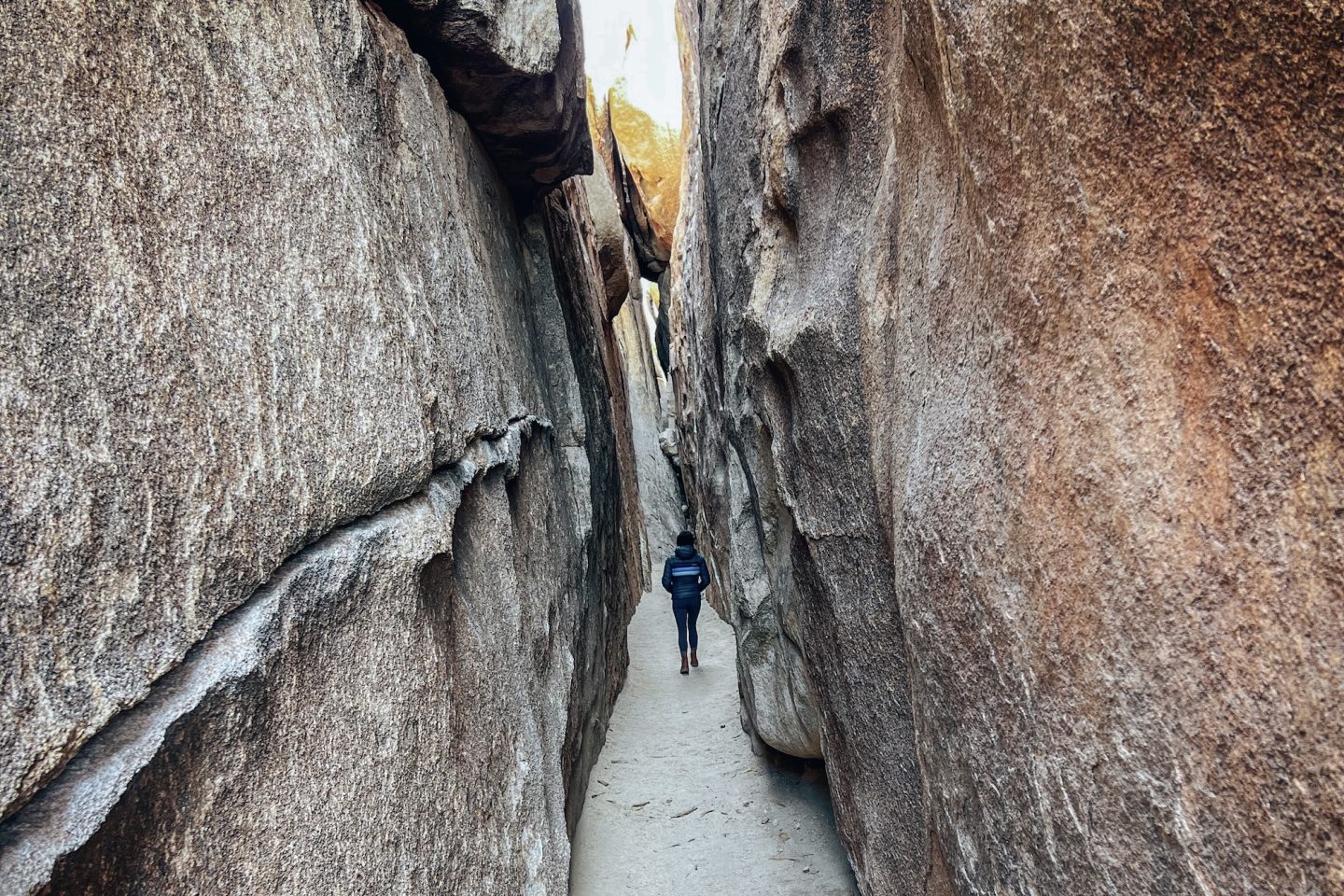
For those seeking a more adventurous experience, several sections of the trail feature tight, crawl‑through passages that add a mild challenge and a true sense of exploration. Whether you stick to the loop or venture into the narrower spots, the Hall of Horrors provides a unique and memorable way to experience the park’s iconic rock landscapes.
- DIFFICULTY – Easy to moderate
- LENGTH – 0.6mi / 0.97km
- ELEVATION – 30ft
- TIME NEEDED – 30 minutes – 1 hour
- PET FRIENDLY – No
JUMBO ROCKS CAMPGROUND
Located in the heart of Joshua Tree National Park, Jumbo Rocks Campground sits among some of the park’s most iconic granite boulders, offering some of the best camping in Joshua Tree. The campground is slightly more spread out than others, giving campers plenty of space to enjoy the dramatic rock formations and scattered Joshua trees right from their sites. Its central location makes it a convenient base for exploring nearby hiking trails, climbing areas, and viewpoints, while still offering a sense of seclusion despite its popularity.
Jumbo Rocks features over 120 campsites, accommodating tents, vans, and small RVs, though there are no hookups available. Each site includes a picnic table and fire ring, and vault toilets are scattered throughout the campground. While it can get busy during peak season, the unique scenery and proximity to trails like Skull Rock Loop and other unique rock formations make it one of the park’s most sought-after camping spots. The combination of towering boulders, open desert, and starry night skies creates a quintessential Joshua Tree experience.
For a full write-up on camping at Jumbo Rocks, check out our JUMBO ROCKS: CAMPING IN JOSHUA TREE NATIONAL PARK article.
- Sites start at $30/night
- Recommended sites: sites along the outer rim for more private and scenic views
- Bathrooms: Yes
- Showers: No
- Potable water: No
- Dump station: No
Depending on how long you’d like to spend inside the park, we’d recommend 1-2 nights stay at this campground.
An alternate option to this combo, would be to stay at the Hidden Valley Campground where there are also a number of hikes right from the campground.
PENGUIN ROCK
Located inside the Jumbo Rocks Campground area of Joshua Tree National Park, Penguin Rock is a quirky granite formation that looks surprisingly like a penguin standing upright. It’s a quick and easy stop for visitors staying at Jumbo Rocks. The rock has become a fun photo spot thanks to its unusual shape, and many visitors enjoy trying to find the best angle that makes the penguin resemblance pop. While it’s not a major destination on its own, Penguin Rock adds a bit of personality to the park’s already fascinating landscape of stacked boulders and weathered granite formations.
To find this unique formation, we recommend starting from around campsite 20, and looking for the uniquely shaped tree next to Penguin Rock.
- DIFFICULTY – Easy
- LENGTH – 0.1mi / 0.2km
- ELEVATION – 50ft
- TIME NEEDED – 15 minutes
- PET FRIENDLY – No
SKULL ROCK TRAIL
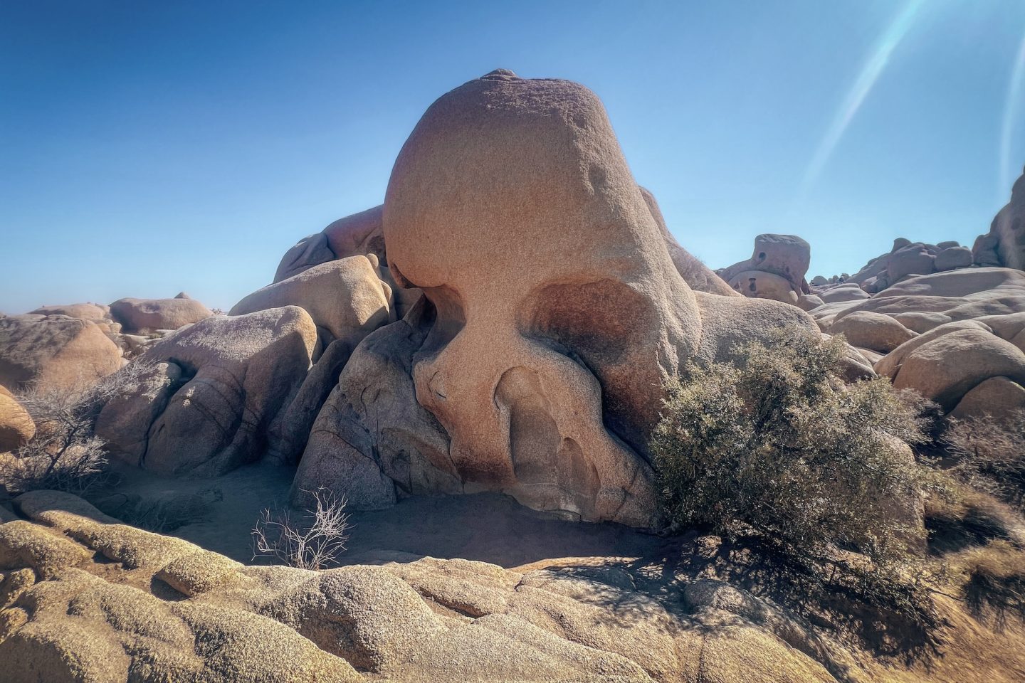
Several great hikes start right from Jumbo Rocks Campground, giving campers easy access to some of the park’s most famous formations. Starting with the Skull Rock Trail, which is a relatively easy 1.7‑mile loop that is accessible right from the campground. This trail passes the park’s iconic skull-shaped boulder and winds through desert landscapes dotted with Joshua trees and interesting rock formations. Because of Skull Rock’s close proximity to the main Park Blvd, this area is quite popular and heavily trafficked. You’ll be glad you hiked it from the campground as opposed to trying to park on the side of the road.
- DIFFICULTY – Easy
- LENGTH – 1.7mi / 2.7km
- ELEVATION – 110ft
- TIME NEEDED – 1 hour
- PET FRIENDLY – No
SPLIT ROCK TRAIL
For those looking for a slightly longer trek, the Split Rock Trail offers a roughly 2‑mile loop that takes hikers past massive granite outcrops and narrow passages, perfect for climbing, scrambling, or photography. Both trails are accessible directly from the campground, but Split Rock is a little bit of a further walk. Both make them ideal for morning or evening adventures without needing to drive elsewhere in the park.
- DIFFICULTY – Easy to moderate
- LENGTH – 2.5mi / 4.0km
- ELEVATION – 310ft
- TIME NEEDED – 1.5 hours
- PET FRIENDLY – No
ARCH ROCK NATURE TRAIL
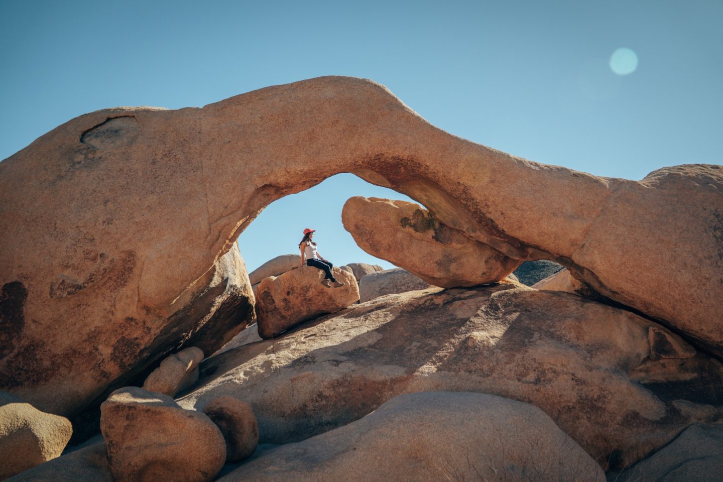
Another must-do hike near Jumbo Rocks Campground is the Arch Rock Trail, a short and easy 1.2‑mile hike that leads to a natural granite arch. The trail winds through classic desert scenery, dotted with Joshua trees and scattered boulders, making it perfect for photography and casual exploration. While the trail itself is relatively quick and accessible, the area around the arch invites light scrambling and climbing for those who want to get a closer view or explore the surrounding rock formations. Its proximity to the campground makes it an ideal option for either something to do while staying at Jumbo Rocks, or as you make your way on to the next campground.
- DIFFICULTY – Easy
- LENGTH – 1.2mi / 1.9km
- ELEVATION – 100ft
- TIME NEEDED – 1-1.5 hours
- PET FRIENDLY – No
HEART ROCK
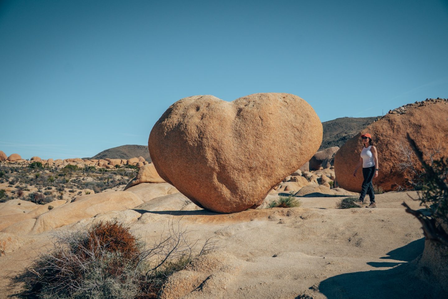
For a bit of extra adventure, hikers can extend the Arch Rock Trail to reach Heart Rock, a naturally shaped heart formation etched into the granite. This short detour adds only a few minutes but offers a fun photo opportunity and a unique landmark that’s easy to spot among the surrounding boulders. The terrain remains mostly gentle, making it accessible to most visitors, and the combination of the arch and the heart provides a memorable way to experience the park’s signature rock formations. Adding Heart Rock to your hike is a simple way to make a short trail feel even more rewarding.
- DIFFICULTY – Easy
- LENGTH – 1.7mi / 2.7km
- ELEVATION – 110ft
- TIME NEEDED – 1-1.5 hours
- PET FRIENDLY – No
CHOLLA CACTUS GARDEN
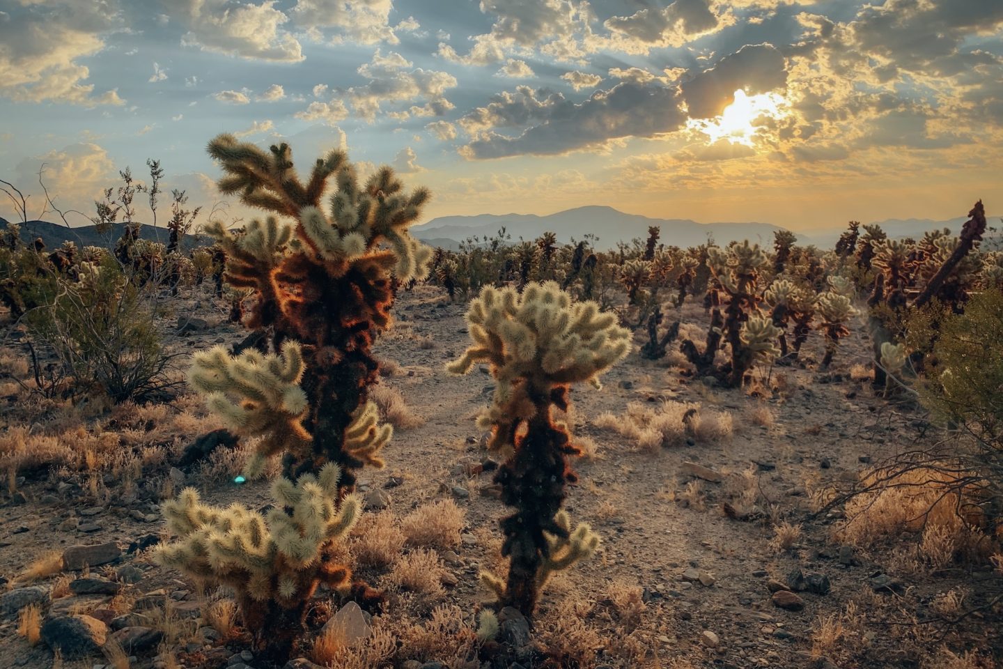
As you make your way south from Jumbo Rocks Campground, the next highlight along the route is the Cholla Cactus Garden. This unique stop showcases dense stands of golden cholla cacti, which glow brilliantly in the morning or late afternoon light. The easy, short loop trail allows for up-close views of these iconic desert plants while providing excellent photo opportunities without straying far from the road. Visiting the Cholla Cactus Garden makes a natural break between Jumbo Rocks and the park’s southern section, letting hikers and campers enjoy a distinctive slice of the desert before continuing toward Cottonwood Campground.
DISCLAIMER: As of March 5, 2026, this trail is closed until late spring for trail maintenance. See Joshua Tree park website for up to date info.
- DIFFICULTY – Easy
- LENGTH – 0.3mi / 0.5km
- ELEVATION – 0ft
- TIME NEEDED – 15-30 minutes
- PET FRIENDLY – No
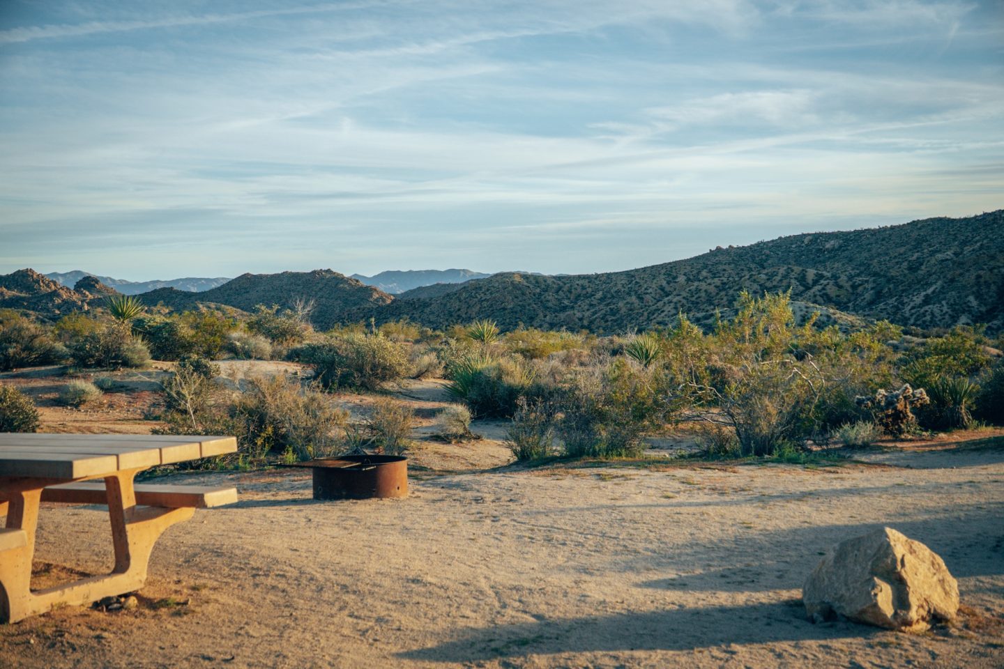
COTTONWOOD CAMPGROUND
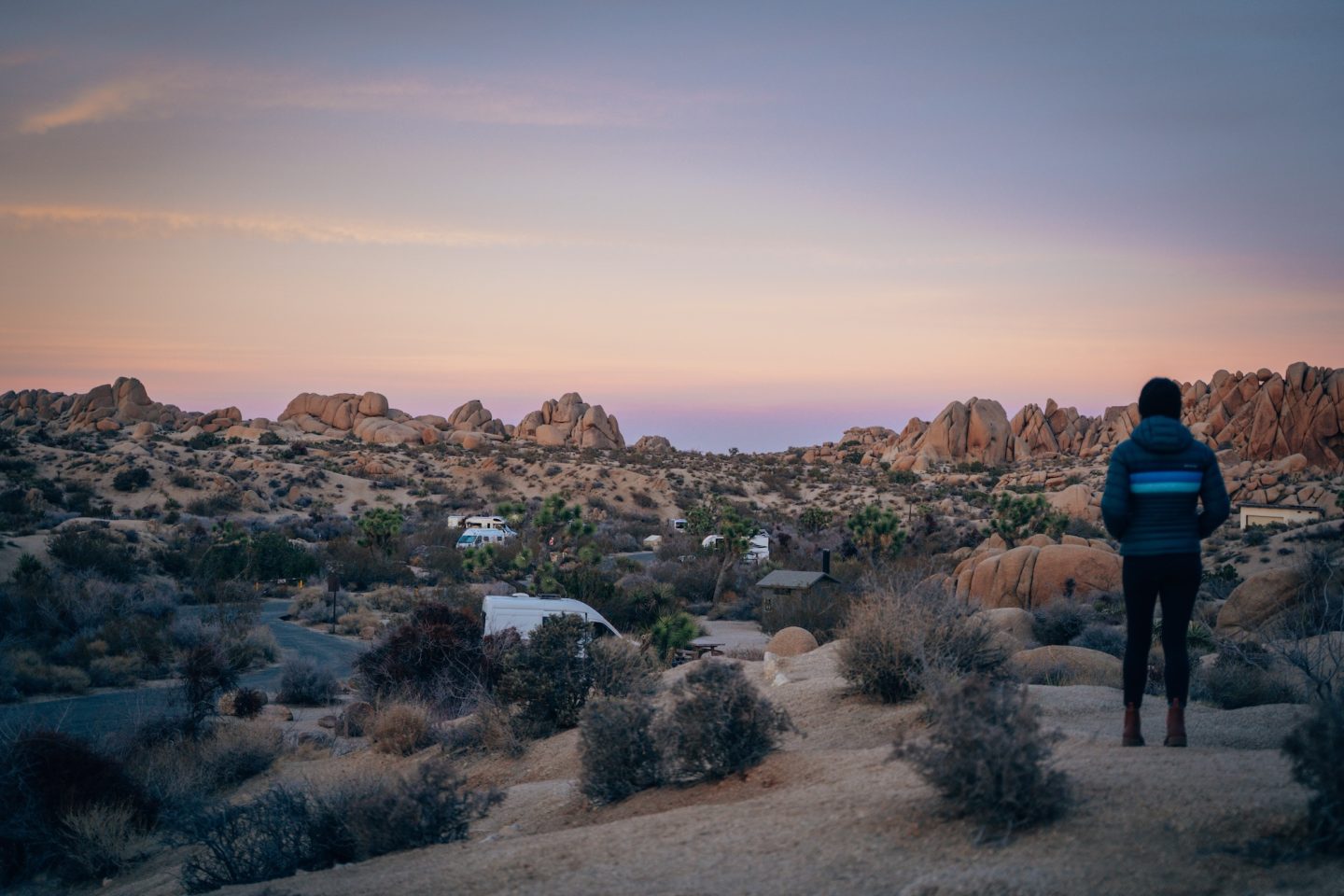
Located near the southern entrance of Joshua Tree National Park, Cottonwood Campground sits along the Mojave Desert’s southern edge, offering a unique contrast to the higher-elevation campgrounds in the north. The surrounding landscape features open desert plains dotted with Joshua trees, creosote bushes, and dramatic rock outcrops, giving campers a true feel for the park’s vast southern terrain. Its location also provides convenient access to nearby natural attractions like the Cottonwood Spring Oasis, while still being just a short drive from the park’s main southern access points. For anyone planning camping in Joshua Tree, Cottonwood makes an ideal final stop when traveling south through the park.
Cottonwood Campground has over 100 campsites accommodating tents, vans, and small RVs, making it one of the park’s largest campgrounds. Each site includes a picnic table and fire ring, and vault toilets and potable water are available onsite, though there are no RV hookups. The campground serves as an excellent base for exploring the southern section of Joshua Tree, including scenic trails, wildlife viewing, and stargazing in the clear desert skies. Its open layout and desert setting create a peaceful, spacious atmosphere for campers concluding a route through the park.
- Sites start at $35/night
- Recommended sites: sites along the outer rim for more private and scenic views
- Bathrooms: Yes
- Showers: No
- Potable water: Yes
- Dump station: Yes
Depending on how long you’d like to spend inside the park, we’d recommend 1-2 nights stay at this campground.
COTTONWOOD CAMPGROUND LOOP
One of the highlights and easiest trails near Cottonwood Campground is the Cottonwood Campground Loop Trail. It’s an easy 1‑mile loop that winds through the southern desert landscape. The trail passes open Joshua tree forests, creosote flats, and scattered rock formations, offering plenty of opportunities for photography, wildlife spotting, and quiet reflection. Its looped design makes it easy to start and finish at the campground, allowing campers to enjoy a morning or afternoon hike without needing to drive elsewhere. The combination of desert scenery, gentle elevation changes, and proximity to the campground makes this trail a perfect way to experience the southern section of the park during a camping trip.
- DIFFICULTY – Easy
- LENGTH – 1.3mi / 2.1km
- ELEVATION – 130ft
- TIME NEEDED – 30-45 minutes
- PET FRIENDLY – No
MASTODON PEAK
For those looking for a more a slightly more challenging hike near Cottonwood Campground, the Mastodon Peak Trail offers a rewarding adventure. This 2.5‑mile looped trail climbs through classic desert terrain, passing Joshua tree forests, rocky outcrops, and wide-open desert vistas. At the summit, hikers are treated to sweeping views of the surrounding Mojave Desert, nearby mountains, and the park’s southern expanse. The trail’s moderate elevation gain and exposed sections make it best suited for experienced hikers, but the panoramic scenery at the top provides ample reward for the effort. Mastodon Peak is a standout hike for anyone camping in Joshua Tree and wanting to explore beyond the more accessible trails near Cottonwood.
- DIFFICULTY – Easy to moderate
- LENGTH – 2.5mi / 4.0km
- ELEVATION – 400ft
- TIME NEEDED – 1-2 hours
- PET FRIENDLY – No
LOST PALMS OASIS TRAIL
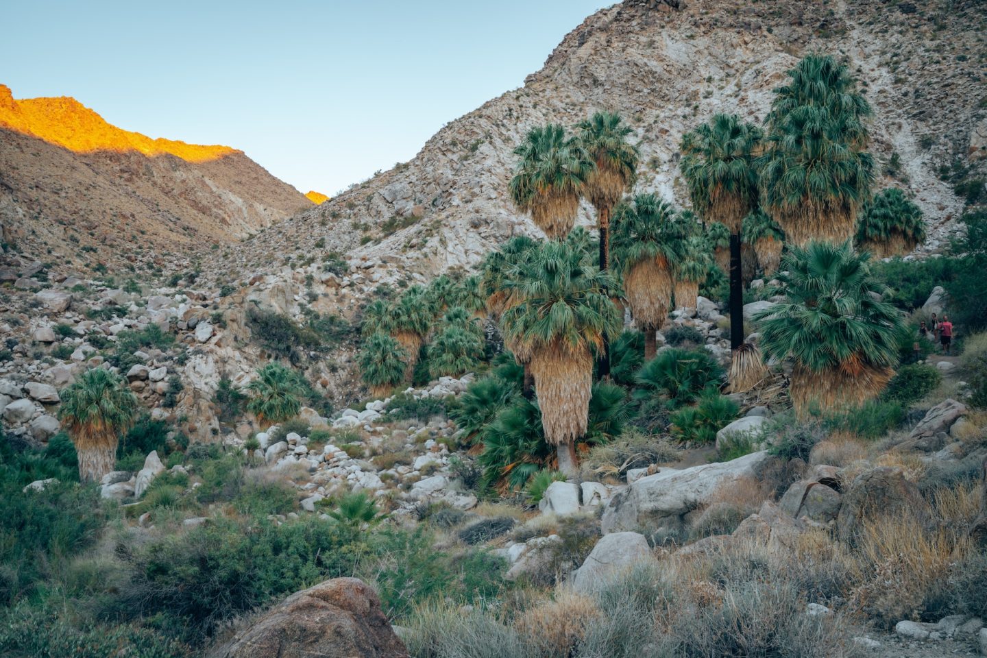
Another must-do hike in the southern section of Joshua Tree National Park is the Lost Palms Oasis Trail, a longer and more strenuous trek of about 7.2 miles round trip. The trail winds through open desert, rocky washes, and rugged terrain before arriving at a hidden palm oasis, one of the park’s most unique natural features. Hikers can enjoy the contrast of lush palms against the surrounding arid landscape, as well as occasional wildlife sightings along the way. Due to its length and exposure to the sun, the trail is best attempted during cooler hours or seasons, and visitors should carry plenty of water. The Lost Palms Oasis Trail is an iconic adventure for anyone camping in Joshua Tree and seeking a full-day desert hike.
- DIFFICULTY – Moderate to challenging
- LENGTH – 7.2mi / 11.6km
- ELEVATION – 1,000ft
- TIME NEEDED – 3-4 hours
- PET FRIENDLY – No
CAMPING IN JOSHUA TREE NATIONAL PARK: A GUIDE TO CAMPING YOUR WAY THROUGH THE PARK
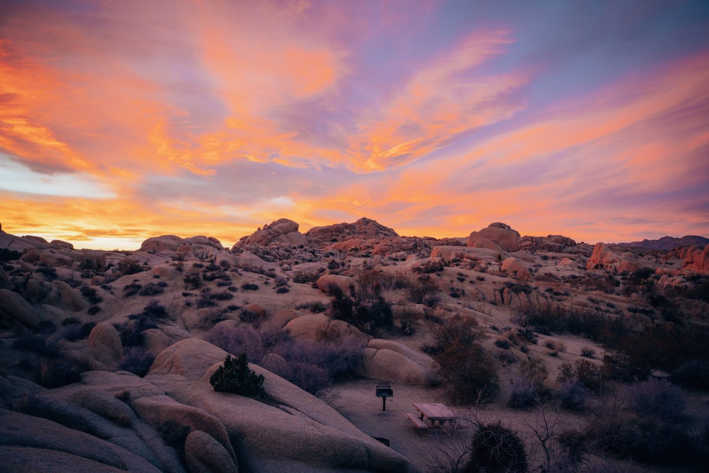
Camping in Joshua Tree offers a truly unforgettable way to experience the park’s diverse landscapes, from the high-elevation Joshua tree forests near Black Rock to the wide-open southern desert around Cottonwood. Following a route through these campgrounds allows you to combine scenic drives, easy access to trails, and opportunities for stargazing, photography, and wildlife viewing along the way. Whether you’re tackling shorter loops like the Cottonwood Campground Trail or longer adventures like the Lost Palms Oasis Trail, each stop offers its own unique perspective on the park’s beauty.
By planning your route strategically and taking advantage of the variety of campgrounds and hikes, you can maximize your time in the park and enjoy the best that Joshua Tree has to offer. From iconic rock formations and natural arches to hidden oases and panoramic desert views, camping in Joshua Tree provides a hands-on way to connect with one of California’s most iconic national parks and create lasting memories under its star-filled skies.
CALIFORNIA BUCKET LIST MAP
Want to see other things to do in the area? Or around the state? If so, our California Bucket List Map is for you. Not only does our interactive map of California have ALL the details and location info for this park, but it also has over 850 other points of interest in California in it. With all of the location specific details and information like GPS location, dog-friendliness, cost, and more. And with an itinerary creator, this map is the perfect trip planning companion.
Not much of a planner? No worries! We also have curated itineraries to make the planning process easier for you. And if that isn’t enough, book a call with us or have us create a custom itinerary for you! We are here to help!
OTHER JOSHUA TREE ARTICLES
Looking for more inspiration? Here’s everything we have on this incredible national park:
- JOSHUA TREE NATIONAL PARK: HOW TO PLAN YOUR VISIT
- 8 MUST-DO ACTIVITIES IN JOSHUA TREE NATIONAL PARK IN CALIFORNIA
- ONE DAY IN JOSHUA TREE NATIONAL PARK CALIFORNIA
- JUMBO ROCKS: CAMPING IN JOSHUA TREE NATIONAL PARK
