As a born-and-raised Californian, even I can fall subject to the illusion that it is always sunny and warm in the Golden State. Growing up in the South San Francisco Bay Area, rain was uncommon and snow didn’t exist. So how is it possible that certain parts of the state are inaccessible for 6 months out of the year?? It wasn’t until we started truly exploring every corner, we found that there are quite a few California destinations you can only visit in summer.
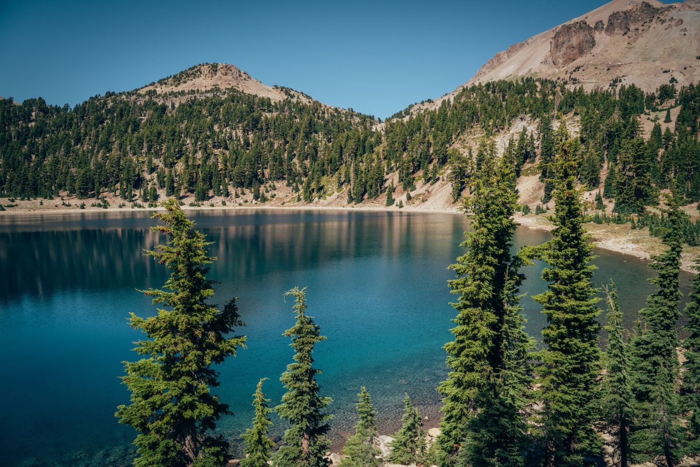
California is home to some of the most diverse landscapes in the country. The highest peak, the deepest canyon, the lowest point in North America. The tallest trees, oldest trees, and largest trees on Earth. But not all of them are accessible year-round. Every winter, heavy snowfall and storms close mountain roads, hiking trails, and even entire sections of national parks. As the snow melts each spring and summer, these incredible destinations reopen, offering visitors a limited window to experience some of California’s most spectacular scenery.
From towering waterfalls and volcanic landscapes to alpine lakes and giant sequoias, these are the places we look forward to visiting every summer. If you’re planning a California road trip, these seasonal destinations deserve a spot at the top of your bucket list before winter closes them once again.
- WHY THESE PLACES ARE ONLY OPEN IN SUMMER
- HOW TO CHECK FOR SEASONAL OPENINGS BEFORE YOUR TRIP
- DEVILS POSTPILE NATIONAL MONUMENT
- LASSEN VOLCANIC NATIONAL PARK
- SEQUOIA NATIONAL PARK
- KINGS CANYON NATIONAL PARK
- BISHOP & THE EASTERN SIERRA
- YOSEMITE NATIONAL PARK
- TIPS FOR VISITING CALIFORNIA’S SEASONAL DESTINATIONS
- CALIFORNIA DESTINATIONS YOU CAN ONLY VISIT IN SUMMER
WHY THESE PLACES ARE ONLY OPEN IN SUMMER
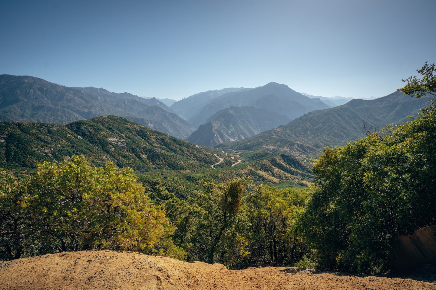
One of the things that surprises many visitors is just how much of California becomes inaccessible during the winter months. While lower elevations remain open year-round, many mountain roads close due to heavy snowfall, icy conditions, and avalanche hazards. In some cases, roads don’t reopen until late June or even July, depending on snowfall. Many of these iconic destinations run along two-lane roads that are not maintained or cleared in winter months.
Because of these seasonal closures, many of California’s most iconic hikes, viewpoints, lakes, and natural attractions can only be visited during a relatively short summer season. Planning ahead is essential, especially if you’re hoping to experience several of these destinations on one trip. We share more tips on what to look at for later on!
HOW TO CHECK FOR SEASONAL OPENINGS BEFORE YOUR TRIP
Because California’s mountain destinations receive vastly different amounts of snow each winter, there’s no single date when these locations reopen. Some years, roads are accessible by late May, while exceptionally snowy winters can delay openings until July. And some years there are surprise storms that close roads after they’ve opened for the season. And sadly, each year, California does experience fire season. All of these natural occurrences make planning a little more difficult, but it can help to make your trip a success!
Before finalizing your itinerary, we always recommend checking current road conditions, trail statuses, and seasonal closures through the official park websites. We tend to check three resources before finalizing our travel plans.
- CalTrans Quickmap – Search any California Highway or location to get current road information and winter road conditions and alerts.
- AllTrails – Even if roads are open, trails can still require seasonal maintenance. Check on both before deciding to visit!
- Watch Duty – See active wildfires and containment percentages.
DEVILS POSTPILE NATIONAL MONUMENT
Tucked into the Sierra Nevada near Mammoth Lakes, Devils Postpile National Monument is home to one of the United States’ finest examples of basalt columns, along with the spectacular Rainbow Falls. Unlike many national park service destinations, reaching the monument requires traveling the steep Reds Meadow Road, which typically closes from late fall through early summer due to heavy snowfall. The monument usually welcomes visitors from June through October, making it one of California’s shortest—but most rewarding—travel seasons.
- Typical Season: Mid-June through October
- What Opens: Devils Postpile, Rainbow Falls, Reds Meadow Road, shuttle service
- Check Current Conditions: Devils Postpile Current Conditions page
- Book Your Shuttle: Eastern Sierra Transit – Reds Meadow Shuttle
** Reds Meadow Road Reconstruction Project requires booking a shuttle to access Devils Postpile and Rainbow Falls for 2026 season.
DEVILS POSTPILE

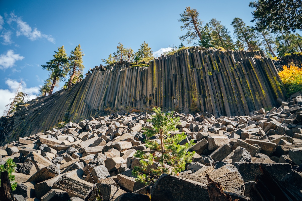
Just a short hike from the shuttle drop-off sits one of California’s most unique geologic formations. Devils Postpile features towering basalt columns formed by cooling lava thousands of years ago, creating nearly perfect hexagonal shapes unlike anything else in the state. Continue on for a longer hike and see Rainbow Falls, too! Both attractions makes for one of our favorite summer day trips in the Eastern Sierra.
- ALLTRAILS: Devils Postpile Loop
- DISTANCE: 1.2 miles
- ELEVATION: 223 ft.
- DIFFICULTY: Easy
RAINBOW FALLS
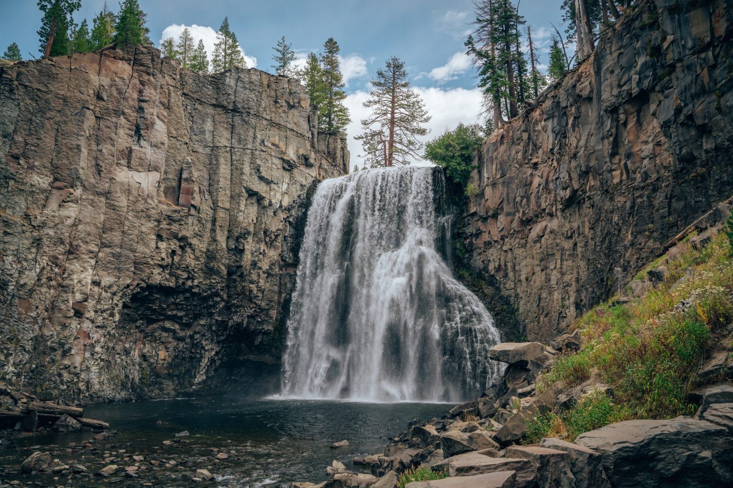
Rainbow Falls is one of the tallest waterfalls in the Eastern Sierra, plunging more than 100 feet into the San Joaquin River. On sunny afternoons, mist from the falls often creates vibrant rainbows, giving the waterfall its fitting name. Since the road into Devils Postpile closes each winter, this spectacular hike is only accessible during the summer season.
- ALLTRAILS: Rainbow Falls via Devils Postpile Trail
- DISTANCE: 5.0 miles
- ELEVATION: 501 ft.
- DIFFICULTY: Moderate
LASSEN VOLCANIC NATIONAL PARK
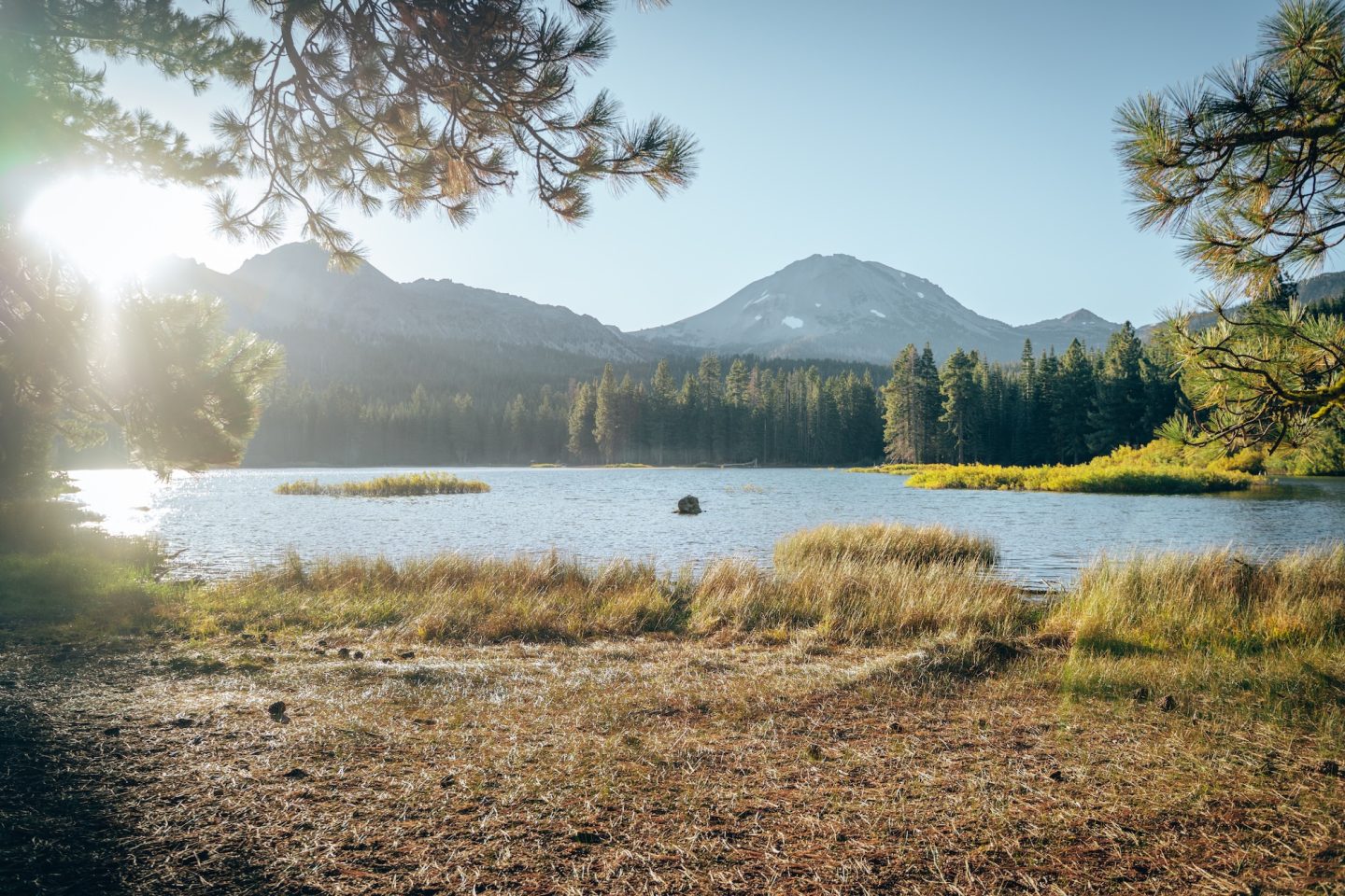
Lassen Volcanic National Park is one of the few places in the world where you can experience all four types of volcanoes in one park. Beyond its volcanic landscapes, the park features bubbling mud pots, steaming fumaroles, alpine lakes, and colorful hydrothermal areas that rival Yellowstone on a smaller scale. Because much of the park sits above 6,000 feet, snow can linger well into late spring, and sections of the main park road often remain closed until June or July. Some areas receive more than 30 feet of snow during particularly snowy winters. If you’re short on time, check out our article on how to spend ONE DAY AT LASSEN VOLCANIC NATIONAL PARK.
- Typical Season: June through October
- What Opens: Lassen Park Road, Bumpass Hell Trail, Butte Lake Road, Cinder Cone Trail
- Check Current Conditions: Lassen Volcanic National Park Current Conditions
BUMPASS HELL
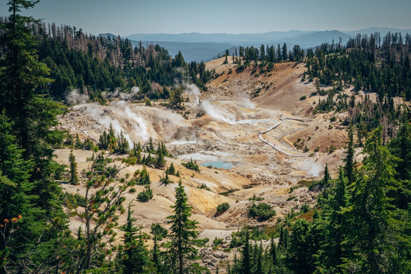
Bumpass Hell is the largest hydrothermal area in Lassen Volcanic National Park and one of the park’s most popular hikes. A boardwalk winds past steaming fumaroles, bubbling mud pots, and colorful hot springs, offering a glimpse into the volcanic forces still shaping the landscape today. Because snow lingers well into the season, the trail typically doesn’t open until summer. Another thing that lingers is the smell of sulfur – it doesn’t bother us, but it is shocking at first!
- ALLTRAILS: Bumpass Hell Trail
- DISTANCE: 3.0 miles
- ELEVATION: 439 ft.
- DIFFICULTY: Moderate
CINDER CONE & PAINTED DUNES
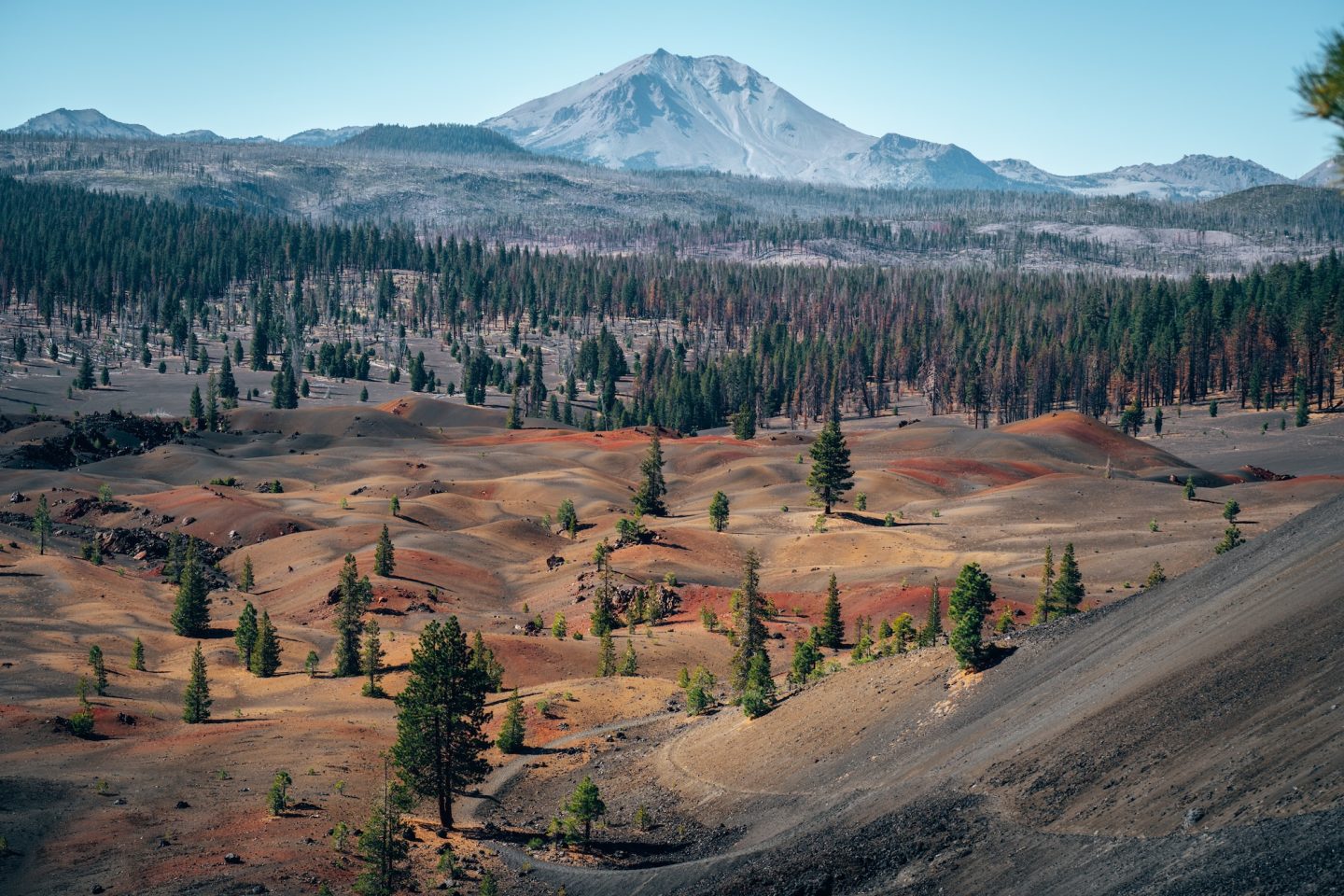
If you’re looking for one of California’s most unique hikes, Cinder Cone should be near the top of your list. The trail climbs to the rim of an ancient volcanic cone before overlooking the colorful Painted Dunes below. Access to Butte Lake and the trailhead is seasonal, making this another unforgettable summer adventure. Take more water than you think you’ll need and hiking poles if you’ve got them. You can thank us later.
- ALLTRAILS: Cinder Cone Trail
- DISTANCE: 4.7 miles
- ELEVATION: 1,095 ft.
- DIFFICULTY: Hard
SEQUOIA NATIONAL PARK
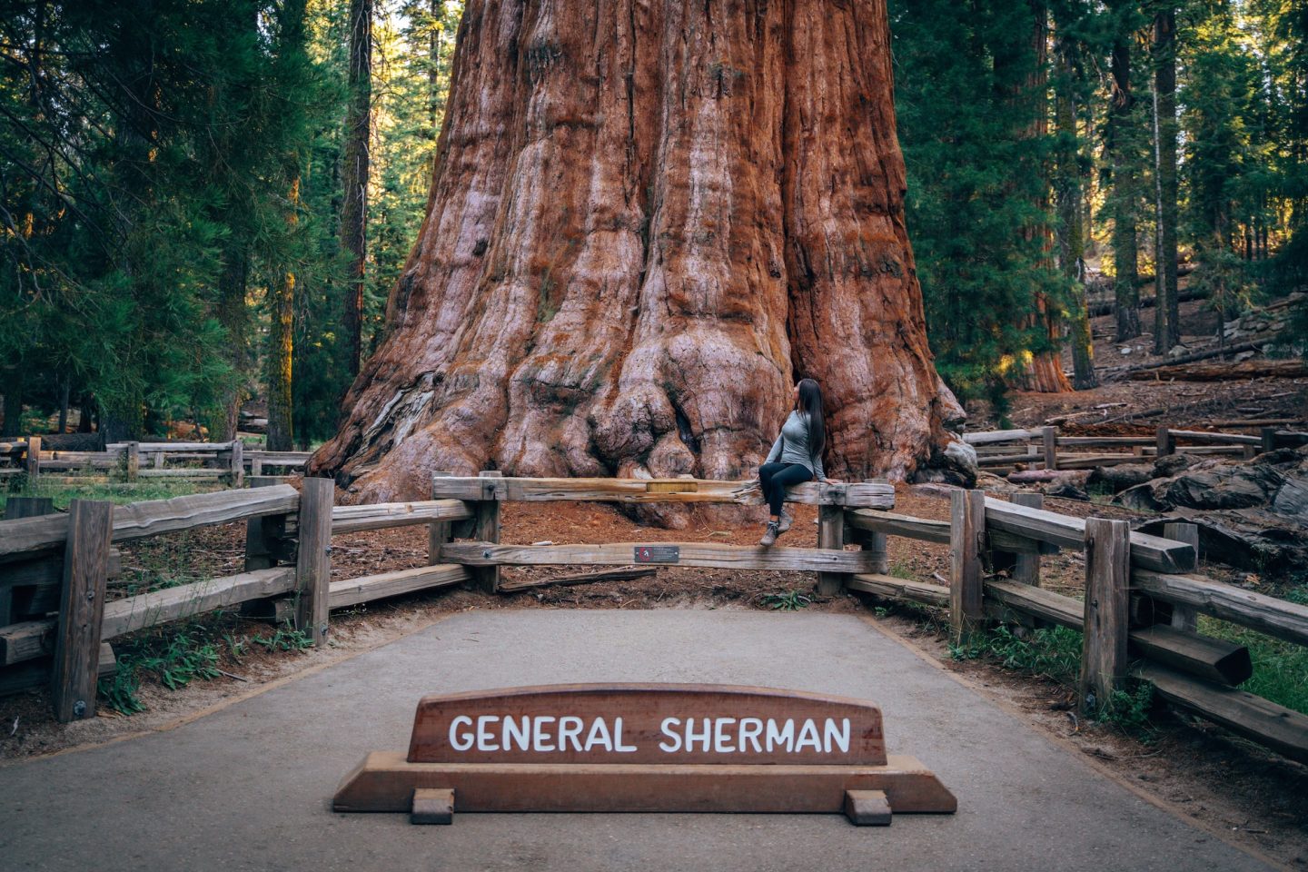
While Sequoia National Park is best known for its giant sequoia trees, the park stretches from foothill oak woodlands to alpine peaks exceeding 14,000 feet. This dramatic change in elevation means that while the Giant Forest is accessible year-round, higher-elevation attractions and seasonal experiences are often only available during the warmer months. Crystal Cave, one of the park’s most popular attractions, typically opens from late spring through early fall, offering a limited opportunity to explore the park beneath the surface. See one of our most popular posts: HOW TO SPEND ONE DAY IN SEQUOIA NATIONAL PARK.
- Typical Season: Crystal Cave tours generally operate from late spring through early fall
- What Opens: Crystal Cave tours, seasonal ranger programs, higher-elevation trails
- Check Current Conditions: Sequoia & Kings Canyon National Parks Current Conditions
CRYSTAL CAVE
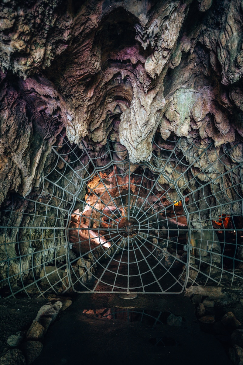
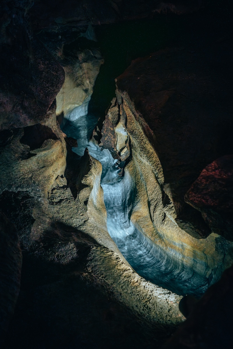
Hidden beneath the giant sequoias, Crystal Cave is one of Sequoia National Park’s most fascinating attractions. Guided tours take visitors through marble passageways filled with impressive formations, underground streams, and dramatic chambers. Since tours only operate during the warmer months, visiting Crystal Cave is a true seasonal experience. Tickets are required to visit Crystal Cave, for more details (and photos!): CRYSTAL CAVE IN SEQUOIA NATIONAL PARK: HOW TO PLAN YOUR VISIT.
- ALLTRAILS: Crystal Cave Trail
- DISTANCE: 1.0 miles
- ELEVATION: 278 ft.
- DIFFICULTY: Easy / Moderate
- Book Your Tour: Crystal Cave Tour Tickets
GENERALS HIGHWAY
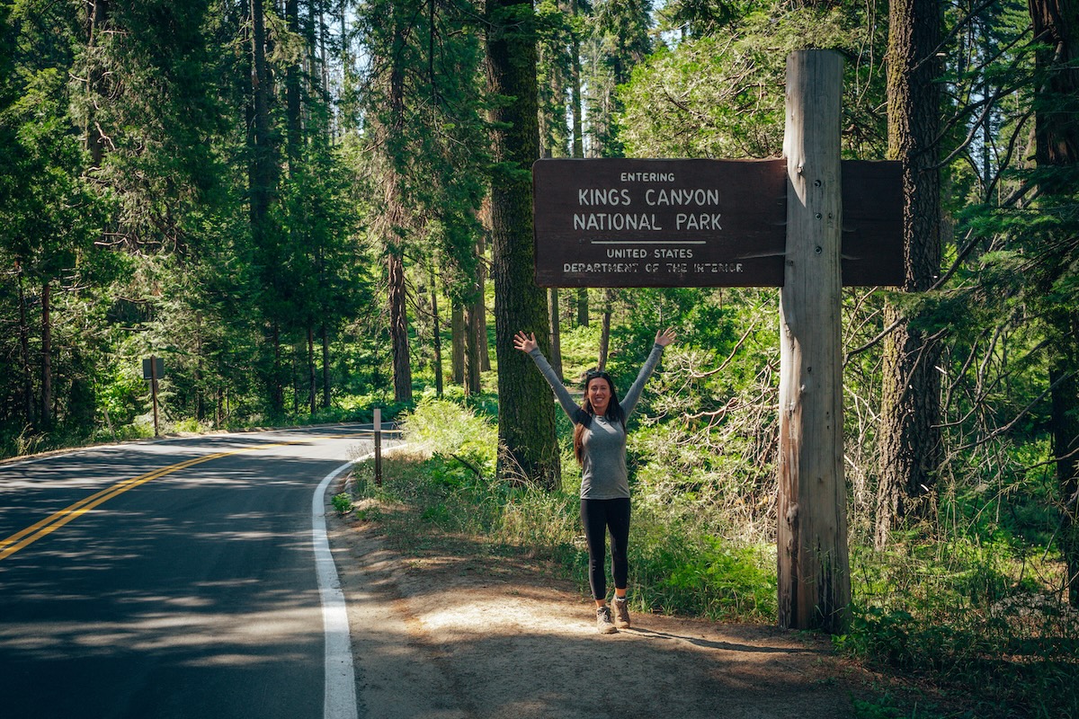
Generals Highway is the scenic roadway connecting Sequoia and Kings Canyon National Parks. While the highway itself remains open year-round in most years, severe weather can close the road at time. Several of the park’s most popular attractions become much easier to access during summer when snow has melted and seasonal roads, campgrounds, and facilities reopen. Since summer is also the only time to explore destinations like Crystal Cave, Cedar Grove, Grizzly Falls, and Roaring River Falls, making Generals Highway one of California’s most rewarding scenic drives during the warmer months.
KINGS CANYON NATIONAL PARK
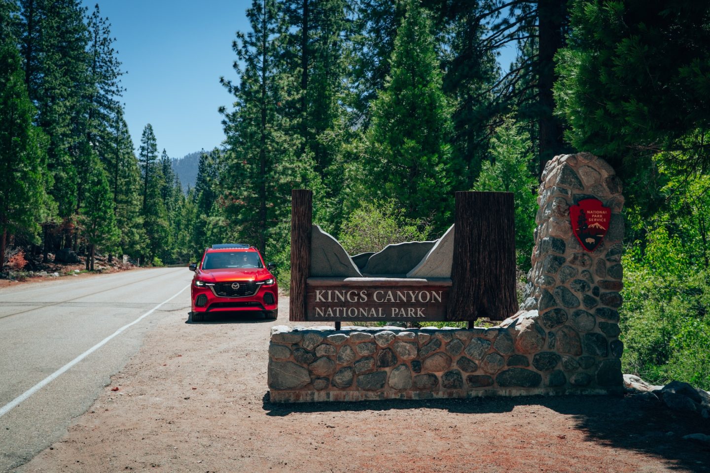
Kings Canyon National Park is home to one of North America’s deepest river canyons, with towering granite cliffs, roaring waterfalls, and dramatic mountain scenery often compared to Yosemite—but with fewer crowds. The park’s Cedar Grove area sits deep within the canyon and is reached via the Kings Canyon Scenic Byway, which closes each winter because of snow, rockfall, and avalanche hazards. The road generally reopens between late April and early June, depending on weather conditions, allowing visitors access to waterfalls, hiking trails, and some of the park’s most spectacular scenery. Here’s what we’d suggest for HOW TO SPEND ONE DAY IN KINGS CANYON NATIONAL PARK.
- Typical Season: May through October (Cedar Grove opening varies each year)
- What Opens: Kings Canyon Scenic Byway, Cedar Grove, Grizzly Falls, Roaring River Falls
- Check Current Conditions: Sequoia & Kings Canyon National Parks Current Conditions
GRIZZLY FALLS
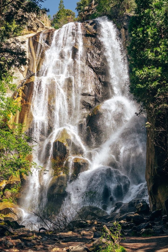
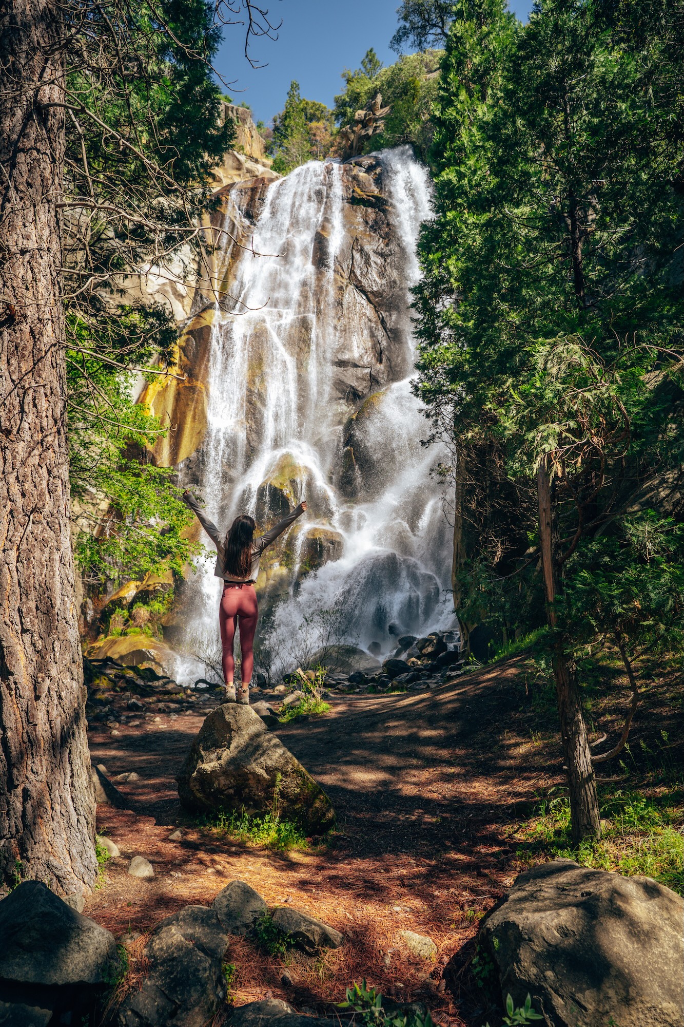
Grizzly Falls is one of California’s easiest roadside waterfalls and one of our favorite quick stops in Kings Canyon National Park. Fed by snowmelt from the Sierra Nevada, the waterfall is especially impressive during the summer months when nearby roads are fully open. You can see a glimpse of it from the parking lot making this a very accessible summer destination!
- ALLTRAILS: Grizzly Falls Trail
- DISTANCE: 0.1 miles
- ELEVATION: 32 ft.
- DIFFICULTY: Easy
ROARING RIVER FALLS
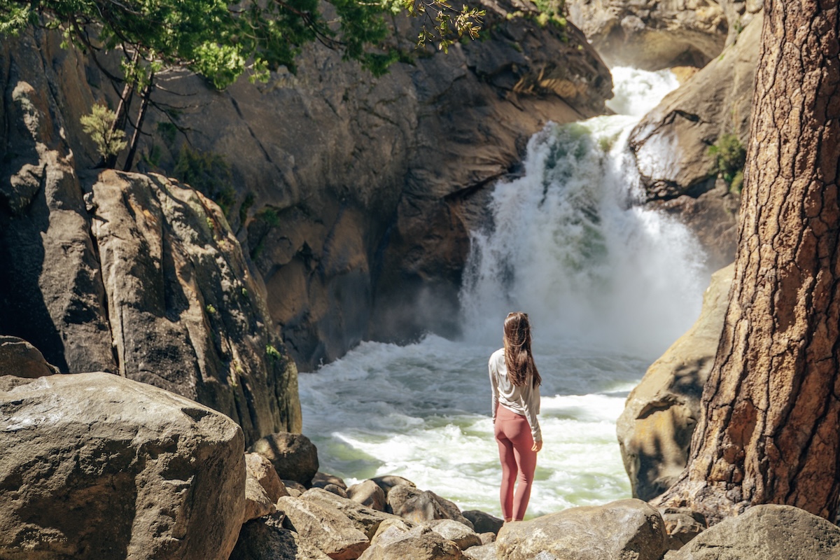
Roaring River Falls may also require only a short walk from the parking area, but the payoff is spectacular. You can hear this fall before you see it. Surrounded by towering granite walls, the powerful waterfall crashes through a narrow canyon, making it one of Kings Canyon’s most memorable attractions.
- ALLTRAILS: Roaring River Falls Trail
- DISTANCE: 0.3 miles
- ELEVATION: 26 ft.
- DIFFICULTY: Easy
KINGS CANYON SCENIC BYWAY (HIGHWAY 180)
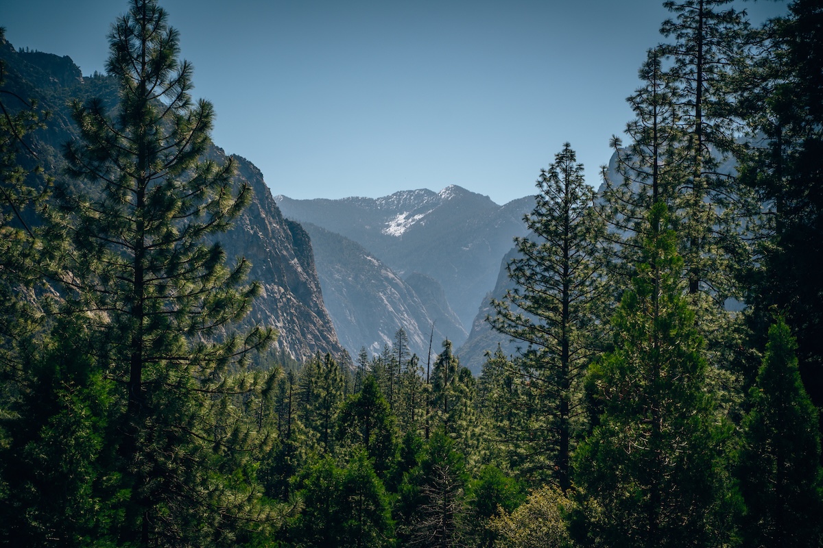
Kings Canyon Scenic Byway descends deep into Kings Canyon, providing access to Cedar Grove, Grizzly Falls, Roaring River Falls, and several trailheads along the Kings River. Due to its steep canyon location and winter rockfall hazards, this portion of Highway 180 closes each winter and typically reopens in late spring or early summer. Once accessible, it unlocks one of California’s most scenic drives and a few of the destinations featured in this guide.
BISHOP & THE EASTERN SIERRA
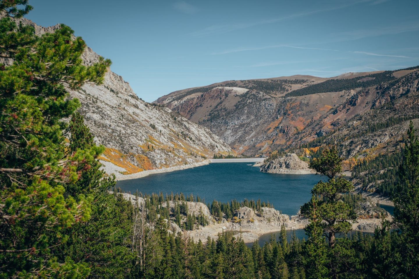
The Eastern Sierra is one of California’s premier destinations for alpine lakes, granite peaks, and world-class hiking. The communities surrounding Bishop provide access to dozens of high-elevation lakes, trailheads, and mountain passes, many of which sit above 8,000 feet. Roads leading to destinations like Lake Sabrina and South Lake typically close after the first significant snowfall in late fall and don’t reopen until late spring or early summer. The timing varies each year based on snowpack, but the short summer season rewards visitors with wildflowers, waterfalls, and crystal-clear alpine lakes. For a full road trip itinerary, check out our HIGHWAY 395: BEGINNER’S GUIDE TO CALIFORNIA’S EASTERN SIERRA
- Typical Season: Late May through October
- What Opens: Lake Sabrina Road, South Lake Road, high-elevation trailheads
- Check Current Conditions: Inyo County Road Open/Close Status
LAKE SABRINA
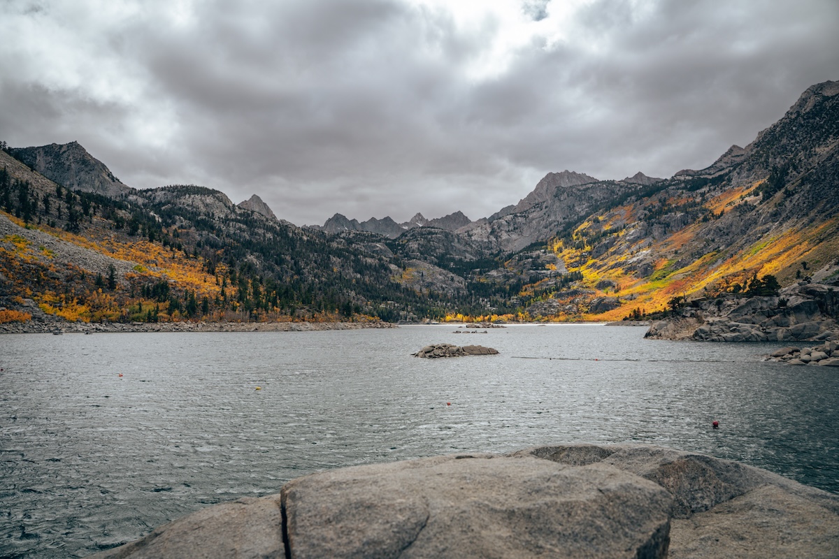
Nestled high in the Sierra Nevada, Lake Sabrina offers crystal-clear water surrounded by towering granite peaks. It’s an excellent destination for kayaking, fishing, hiking, or simply enjoying one of California’s most scenic alpine lakes. Because the access road closes during winter, Lake Sabrina becomes one of the Eastern Sierra’s most anticipated summer destinations. Rent boats or kayaks, visit the cafe, or just enjoy the views! By the time we visited, it was already too cold to enjoy Lake Sabrina – so we will be back in summer!
SOUTH LAKE & TREASURE LAKES
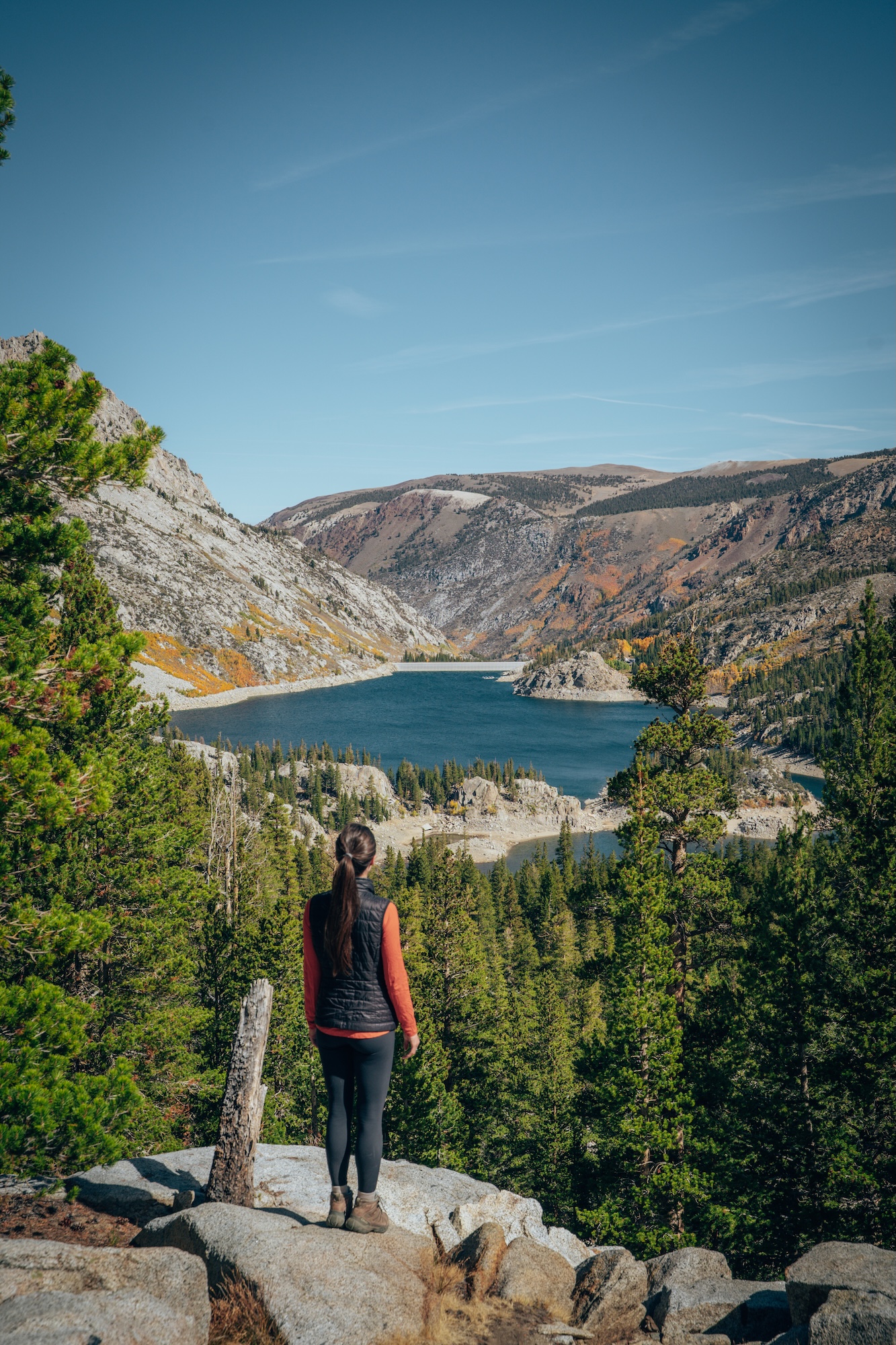
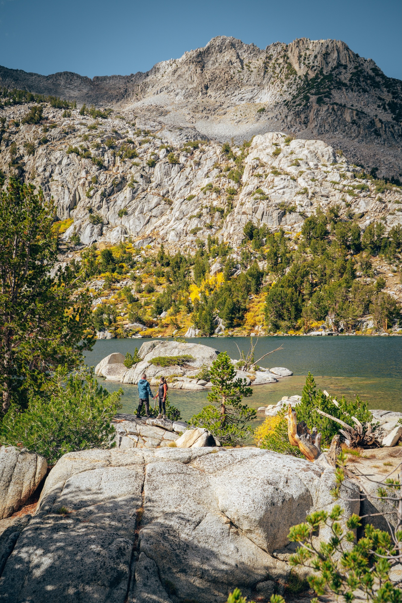
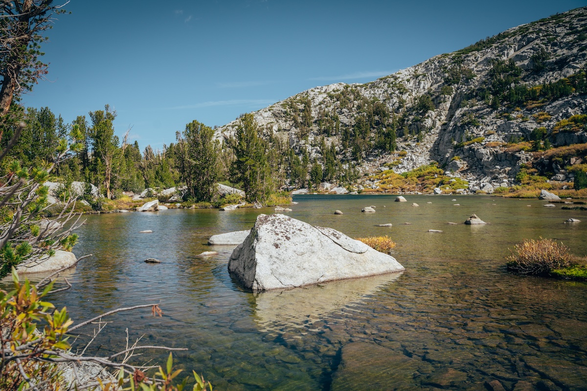
South Lake serves as the gateway to countless alpine adventures, including the stunning Treasure Lakes Trail. Wildflowers, waterfalls, granite peaks, and pristine mountain lakes make this one of our favorite summer hikes near Bishop. Like many high-elevation destinations, snow determines when the road and trails reopen each year. For those of you that aren’t used to these areas, it is required to store all scented items in a bear box at the trailhead. Additionally, if you’re not used to high elevation––this hike IS TOUGH.
- ALLTRAILS: Treasure Lakes Trail
- DISTANCE: 5.6 miles
- ELEVATION: 1,371 ft.
- DIFFICULTY: Moderate / Hard
YOSEMITE NATIONAL PARK
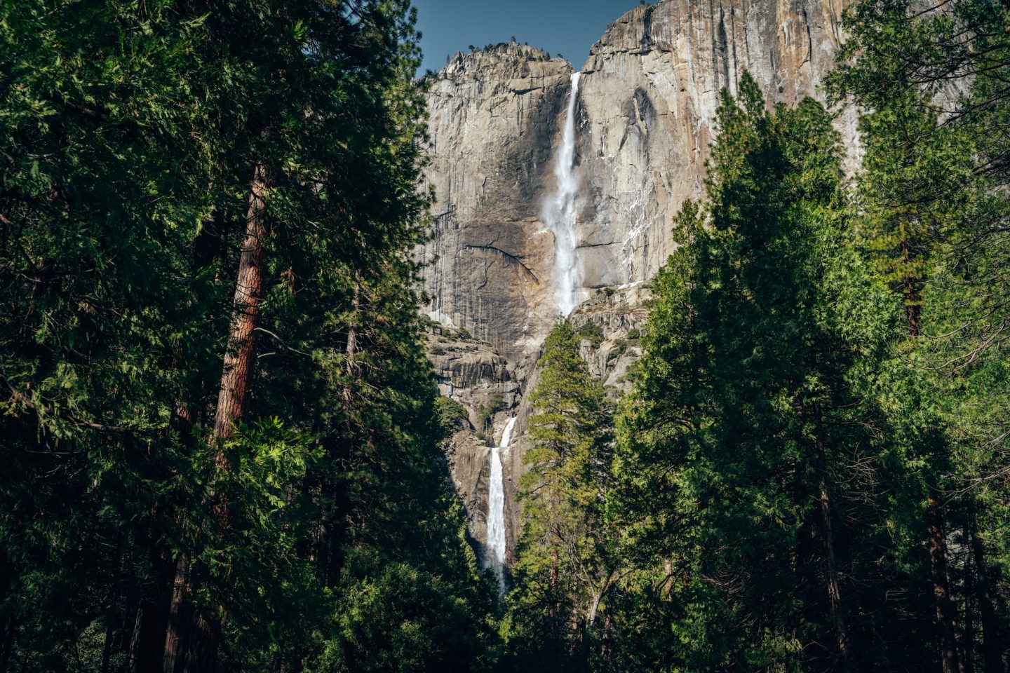
While most of Yosemite National Park is popular and accessible year-round, there are areas of the park that are closed each season. Yosemite National Park is famous for its granite cliffs, giant waterfalls, and iconic landmarks like Half Dome and El Capitan, but some of its most breathtaking scenery lies beyond Yosemite Valley. High-elevation areas such as Tuolumne Meadows and Glacier Point are accessed by roads that close each winter because of heavy snowfall. Tioga Road climbs to nearly 10,000 feet and often doesn’t reopen until late May, June, or even July following heavy snow years. Once open, it provides access to alpine lakes, granite domes, expansive meadows, and some of Yosemite’s best hiking opportunities.
- Typical Season: Late May through October (Tioga Road often opens between late May and early July)
- What Opens: Glacier Point Road, Tioga Road, Tuolumne Meadows, Tenaya Lake
- Check Current Conditions: Yosemite National Park Current Conditions
GLACIER POINT
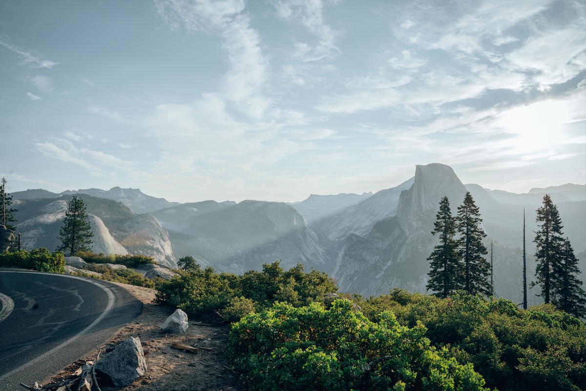
Few viewpoints in California rival Glacier Point. Perched more than 3,000 feet above Yosemite Valley, it offers panoramic views of Half Dome, Yosemite Falls, and the High Sierra. Glacier Point Road closes every winter, making this iconic overlook a seasonal destination. This one view can take your breath away! It is very popular, so we recommend visiting at sunrise to attempt to avoid crowds.
TULOUMNE MEADOWS
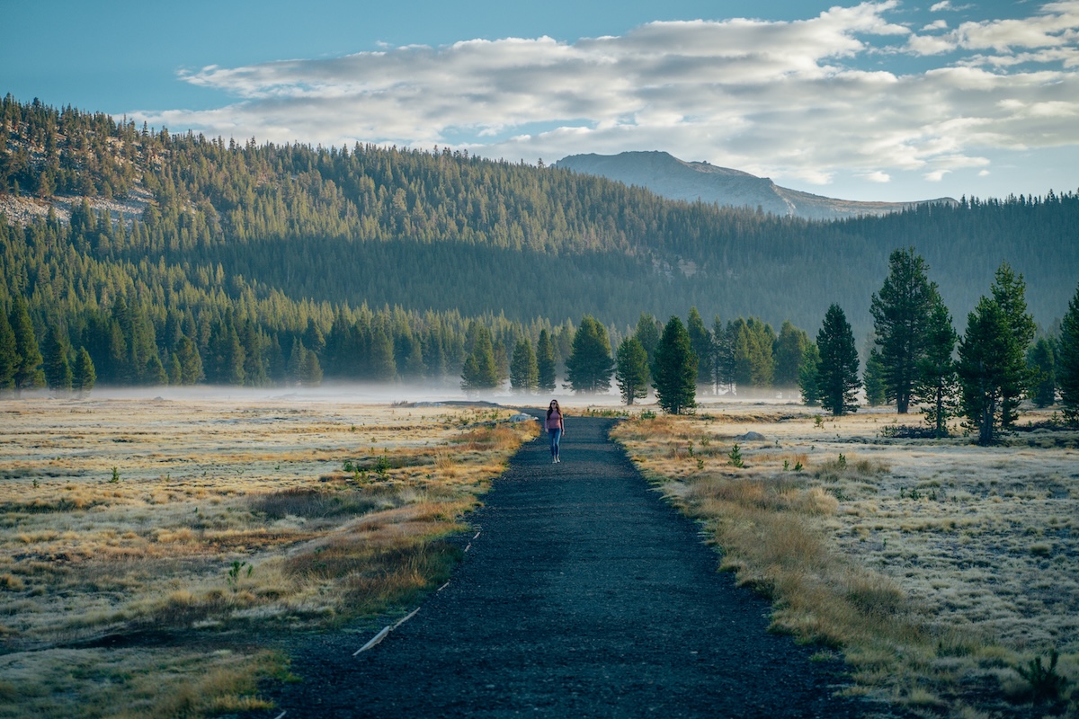
Tuolumne Meadows showcases an entirely different side of Yosemite National Park. Instead of waterfalls and crowded valley viewpoints, visitors are greeted by alpine meadows, granite domes, winding rivers, and incredible hiking trails. Access depends on the seasonal opening of Tioga Road, which typically opens sometime between late spring and early summer. We visited at the end of the season and would love to revisit as a summer destination to see the meadows lush and green!
TIOGA PASS (HIGHWAY 120)
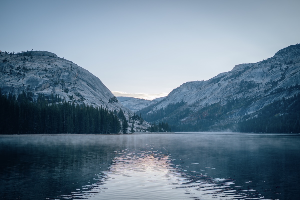
Tioga Road is Yosemite National Park’s only east-west route across the Sierra Nevada, connecting Yosemite Valley to the Eastern Sierra and communities like Lee Vining and Mammoth Lakes. Because the road climbs to nearly 10,000 feet, heavy snowfall forces it to close each winter, typically reopening sometime between late May and early July, depending on snowpack. Once open, Tioga Road provides access to some of Yosemite’s most spectacular destinations, including Tuolumne Meadows, Tenaya Lake, Olmsted Point, and countless alpine hiking trails.
TIPS FOR VISITING CALIFORNIA’S SEASONAL DESTINATIONS
CHECK ROAD CONDITIONS
In case we haven’t said it enough, be sure to check the road conditions before you go! Many of these destinations rely on roads that open and close based on snowfall, so opening dates can vary significantly from year to year, and storm to storm.
DON’T ASSUME ‘SUMMER’ MEANS EVERYTHING IS OPEN
High-elevation areas like Tioga Road, Glacier Point Road, and Devils Postpile often remain closed well into June or even July after heavy snow years. Parks can be open while some roads and trails can still but closed for the season.
BOOK LODGING AND CAMPGROUNDS EARLY
These destinations have a short peak season, so accommodations and campsites often fill months in advance. Planning ahead can be tricky since no open dates are guaranteed, but it’s best to start looking as far out as you can.
PACK LAYERS AND START HIKES EARLY
Even in July, mornings and evenings at elevations above 7,000 feet can be surprisingly chilly, while lower elevations will be experiencing full summer heat. Then of course, afternoon thunderstorms are common in the Sierra Nevada during summer, and popular trails become increasingly crowded as the day goes on.
CALIFORNIA DESTINATIONS YOU CAN ONLY VISIT IN SUMMER
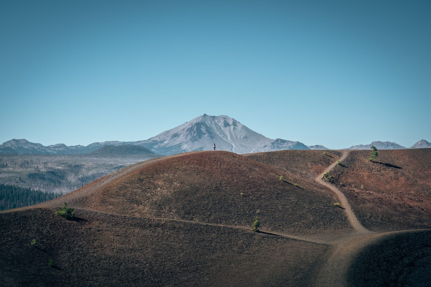
Summer in California is more than warm weather and beach days—it’s your chance to experience destinations that spend much of the year hidden beneath snow. From hiking to steaming geothermal features in Lassen Volcanic National Park to standing beneath Rainbow Falls or gazing across Yosemite from Glacier Point, these seasonal adventures showcase a side of California that many visitors never get to see.
If these places are on your bucket list, don’t wait too long to plan your trip. Their season is short, reservations fill quickly, and before you know it, winter will once again close the roads and you’ll need to be planning for next summer.
BUCKET LIST CALIFORNIA MAP & GUIDE
We’ve spent over 10 years exploring and mapping out this incredible state. And we put all the details, info, links, tips and recommendations in to a single California Bucket List Guide. Like GPS location, dog-friendliness, cost, and more. This guide now has over 850 unique locations and things to do around California, with some bonus locations in Oregon and Nevada. So if you’re looking for things to do, or places to go, this guide is for you!
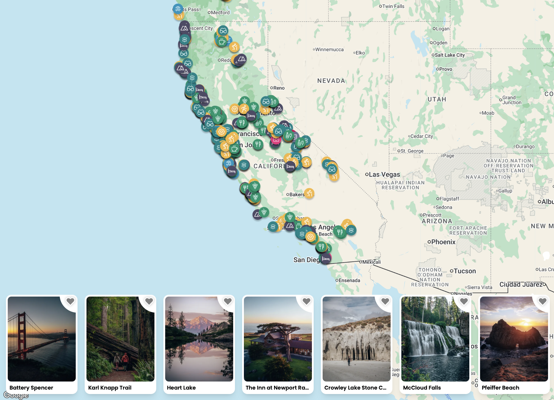


Not much of a planner? No worries! We also have curated itineraries to make the planning process easier for you. And if that isn’t enough, book a call with us or have us create a custom itinerary for you! We are here to help!
Let us know if you have any questions in the comments below. And happy soft adventuring!
Happy Soft Adventuring!
- Katy & Ryan
