When people search for the best hikes near me, they’re usually looking for a trail that’s actually worth the drive, the effort, and the time spent on the trail. After more than a decade of exploring California, we’ve hiked hundreds of trails across the state. But only a handful have earned a permanent spot on our favorites list. These are the hikes that left us speechless, surprised us with their scenery, or simply keep pulling us back year after year. From waterfalls and redwood forests to coastal cliffs and alpine lakes, this collection represents some of the most memorable hiking experiences California has to offer. Whether you live in Southern California, the Bay Area, the Sierra Nevada, or along the North Coast, there’s a good chance you’ll find one of the best hikes near you right here in this guide.
- HOW WE CHOSE THE BEST HIKES
- WHAT TO KNOW BEFORE HIKING IN CALIFORNIA
- THE BEST HIKES NEAR ME IN CALIFORNIA
- CINDER CONE & PAINTED DUNES (LASSEN VOLCANIC NATIONAL PARK)
- VERNAL FALLS VIA MIST TRAIL (YOSEMITE NATIONAL PARK)
- BORREGO PALM CANYON TRAIL (ANZA-BORREGO DESERT STATE PARK)
- HEART LAKE VIA CASTLE LAKE (CASTLE CRAGS WILDERNESS)
- KARL KNAPP TRAIL, BIG TREE & CATHEDRAL TREES LOOP (PRAIRIE CREEK REDWOODS STATE PARK)
- CONGRESS TRAIL (SEQUOIA NATIONAL PARK)
- BIRD ISLAND & SOUTH PLATEAU LOOP (POINT LOBOS STATE NATURAL RESERVE)
- BUMPASS HELL TRAIL (LASSEN VOLCANIC NATIONAL PARK)
- TREASURE LAKES TRAIL (SOUTH LAKE / BISHOP AREA)
- RED BUTTE, YUCCA POINT & RAZOR POINT LOOP (TORREY PINES STATE NATURAL RESERVE)
- STILLWATER COVE CANYON TRAIL (SONOMA COAST)
- RUSSIAN GULCH FERN CANYON & WATERFALL LOOP (MENDOCINO COAST)
- SANDSTONE PEAK (SANTA MONICA MOUNTAINS)
- NORTH RIDGE & SUNSET LOOP (ANGEL ISLAND STATE PARK)
- MOUNT UMUNHUM TRAIL (FROM BALD MOUNTAIN PARKING LOT)
- THE BEST HIKES NEAR ME IN CALIFORNIA
- CALIFORNIA BUCKET LIST MAP & GUIDE
HOW WE CHOSE THE BEST HIKES
When putting together this list of the best hikes near me, we looked beyond popularity and social media hype. We focused on trails that offer something unique, whether that’s a towering waterfall, an ancient redwood grove, a volcanic landscape, or a dramatic coastal viewpoint. We also gravitated toward hikes that showcase a variety of scenery rather than the same view from start to finish.
Most importantly, these are the trails that made us stop, look around, and appreciate just how beautiful California can be. Many include a bit of challenge, but the payoff is always worth the effort. While every hiker has different preferences, these are the trails that have consistently left a lasting impression on us and represent some of the most incredible landscapes we’ve experienced throughout the state.
WHAT TO KNOW BEFORE HIKING IN CALIFORNIA
The biggest piece of advice we would give you for hiking and exploring in California is this: Plan ahead but be flexible. Some places in the state require reservations months in advance, and some do not require reservations at all. Some are lesser known, and therefore less crowded. While others will have lines of vehicles waiting to get in for hours. If you’re planning to visit on a weekend, GO EARLY. As close to sunrise as possible. This will give you the best chance of getting a parking spot, and seeing the areas you’d like to see without massive crowds.
THE BEST HIKES NEAR ME IN CALIFORNIA
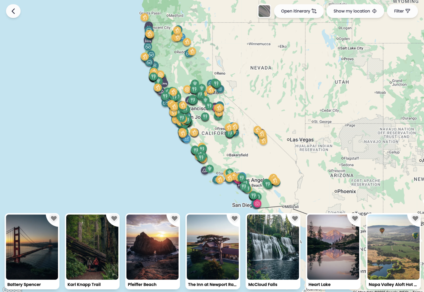
Want to search through over 200 hikes around California to find the best hikes near you? Click on the map above to check out our California Bucket List Guide. It has not only 200 hikes around California, but over 650 other things to do also!
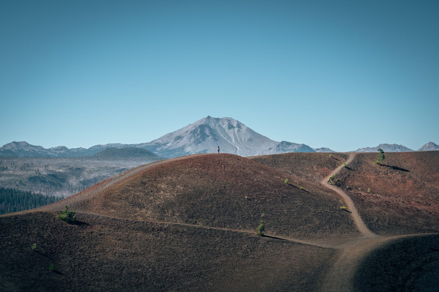
CINDER CONE & PAINTED DUNES (LASSEN VOLCANIC NATIONAL PARK)
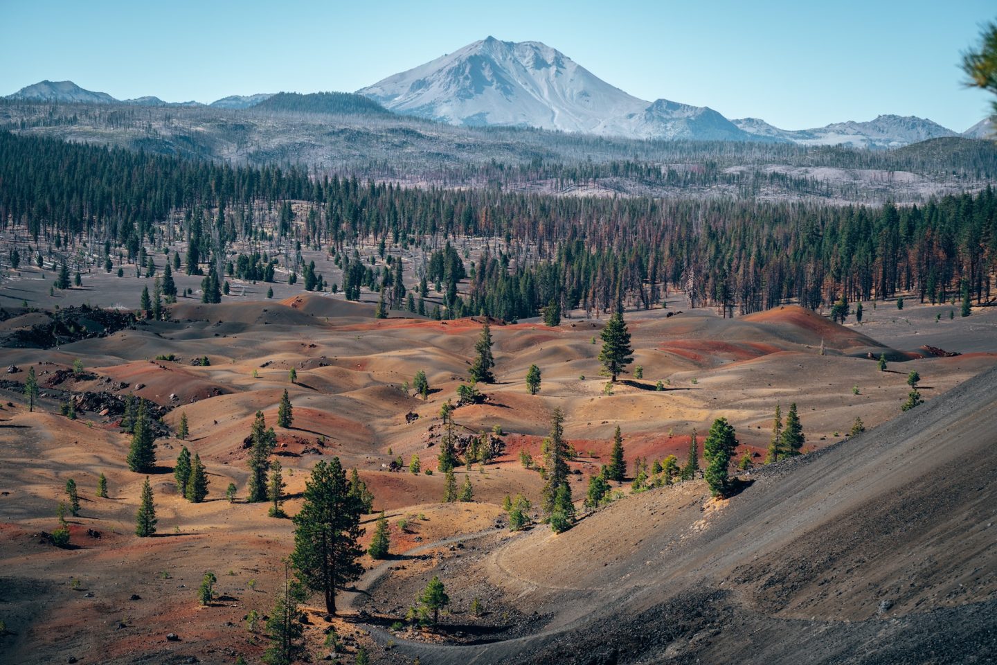
Located in Lassen Volcanic National Park, this is one of the most visually unusual hikes in California. And it feels completely disconnected from anything else in the state. The landscape is raw, exposed, and shaped almost entirely by volcanic history. Every direction you look feels like a different version of the same geological story. It’s quiet in a way that makes the scenery feel even more extreme.
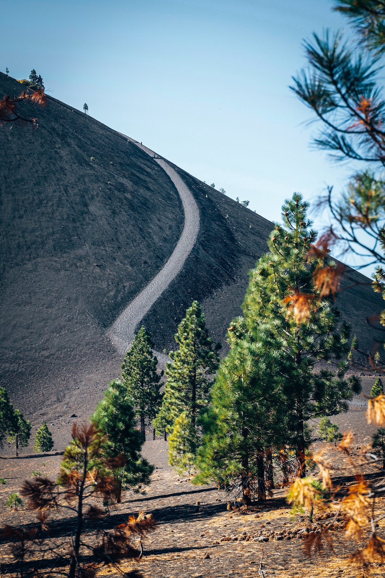
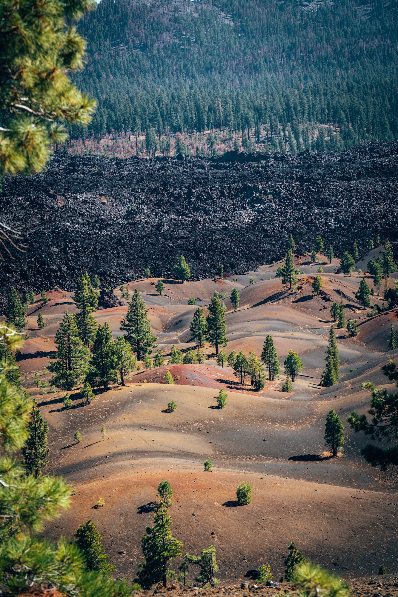
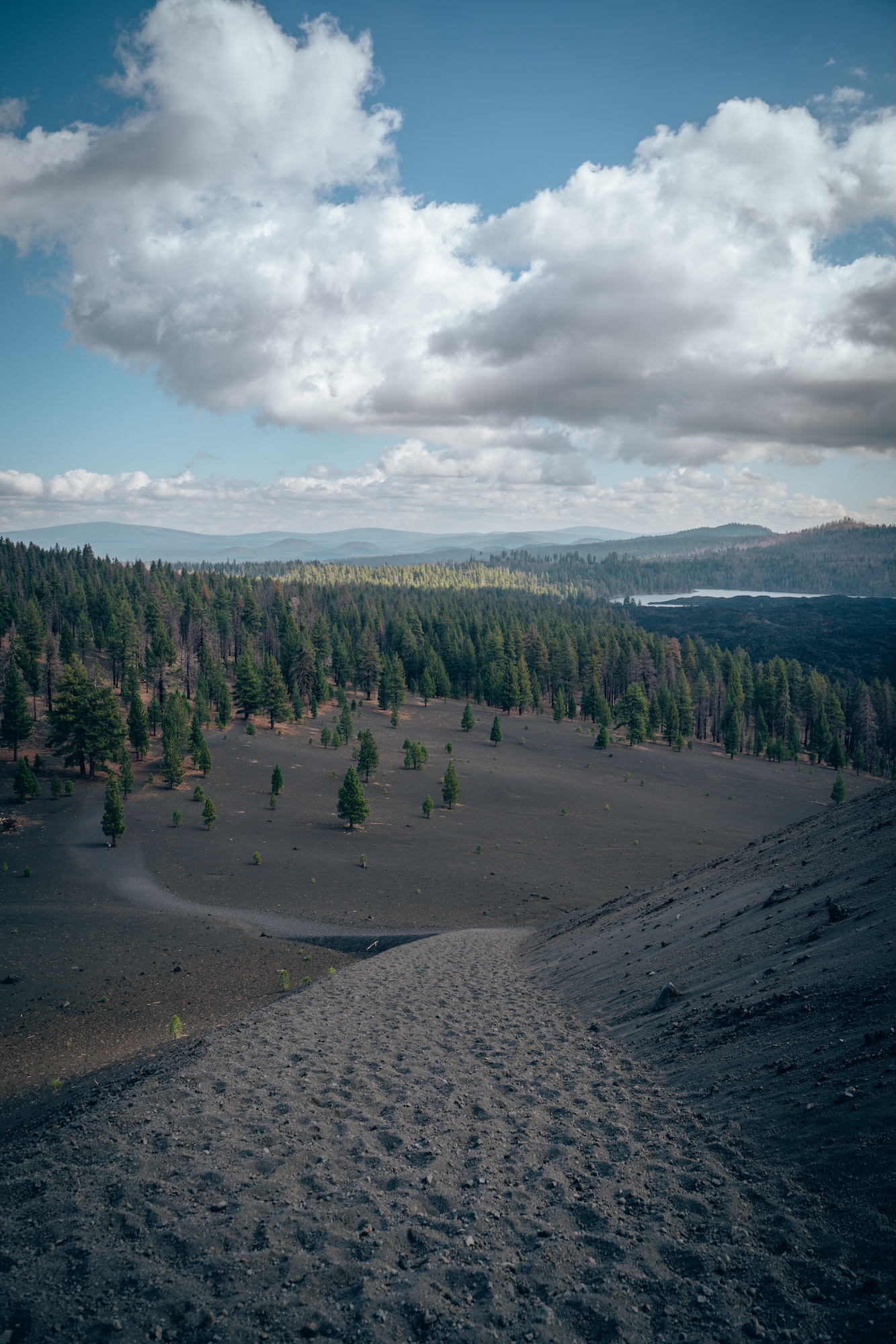
What makes this hike so memorable is the constant contrast between color, texture, and elevation. Black lava fields sit next to bright, almost surreal sand formations. The climb is incredibly challenging, but the reward is more than worth it. It’s one of those rare hikes where the environment does most of the talking.
- DIFFICULTY – Challenging
- LENGTH – 4.7mi / 7.6km
- ELEVATION GAIN – 1,095 ft
- TIME NEEDED – 3-4 hours
- PET FRIENDLY – Pets are not permitted
- Save the hike on AllTrails
FIND EVERYTHING YOU NEED TO KNOW ABOUT VISITING THIS PARK: ULTIMATE GUIDE TO LASSEN VOLCANIC NATIONAL PARK IN CALIFORNIA AND ONE DAY AT LASSEN VOLCANIC NATIONAL PARK.
VERNAL FALLS VIA MIST TRAIL (YOSEMITE NATIONAL PARK)
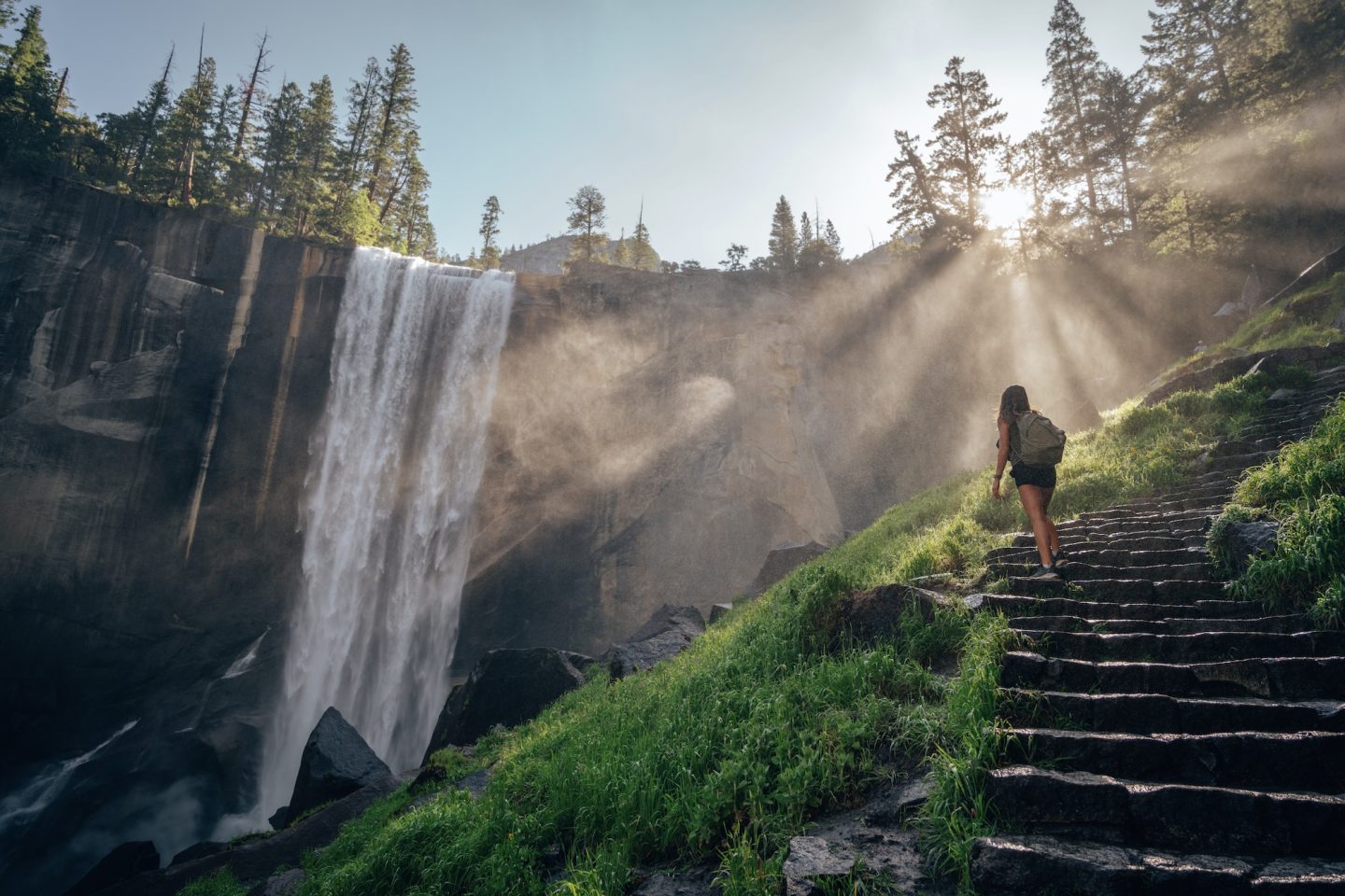
Few hikes in California hit as hard as this one from the moment you step onto the trail. It combines raw power, iconic scenery, and constant movement from start to finish. You’re never just walking through Yosemite National Park here, you’re climbing directly into it. The sound of the Merced River builds as you approach the falls, setting the tone early.
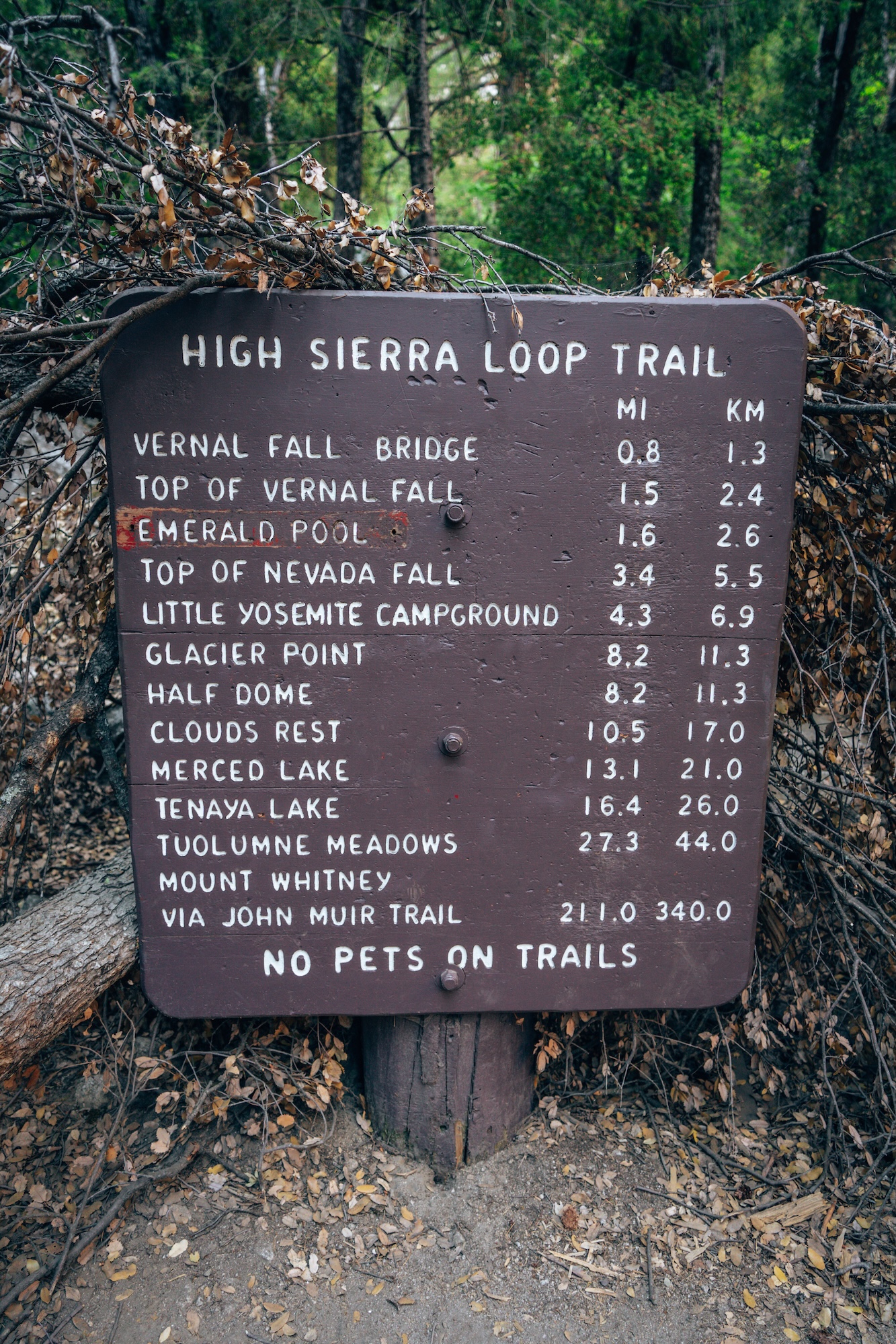
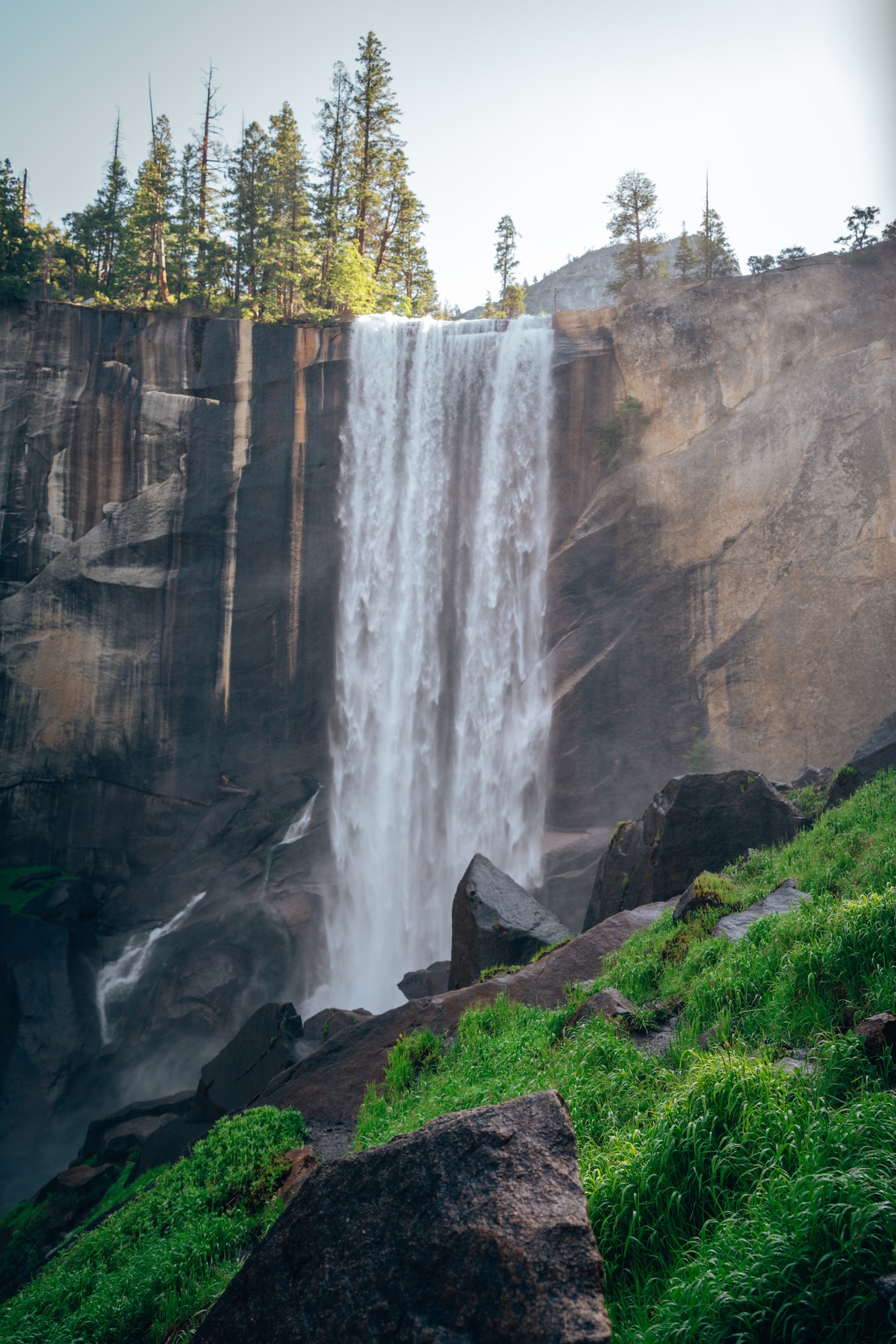
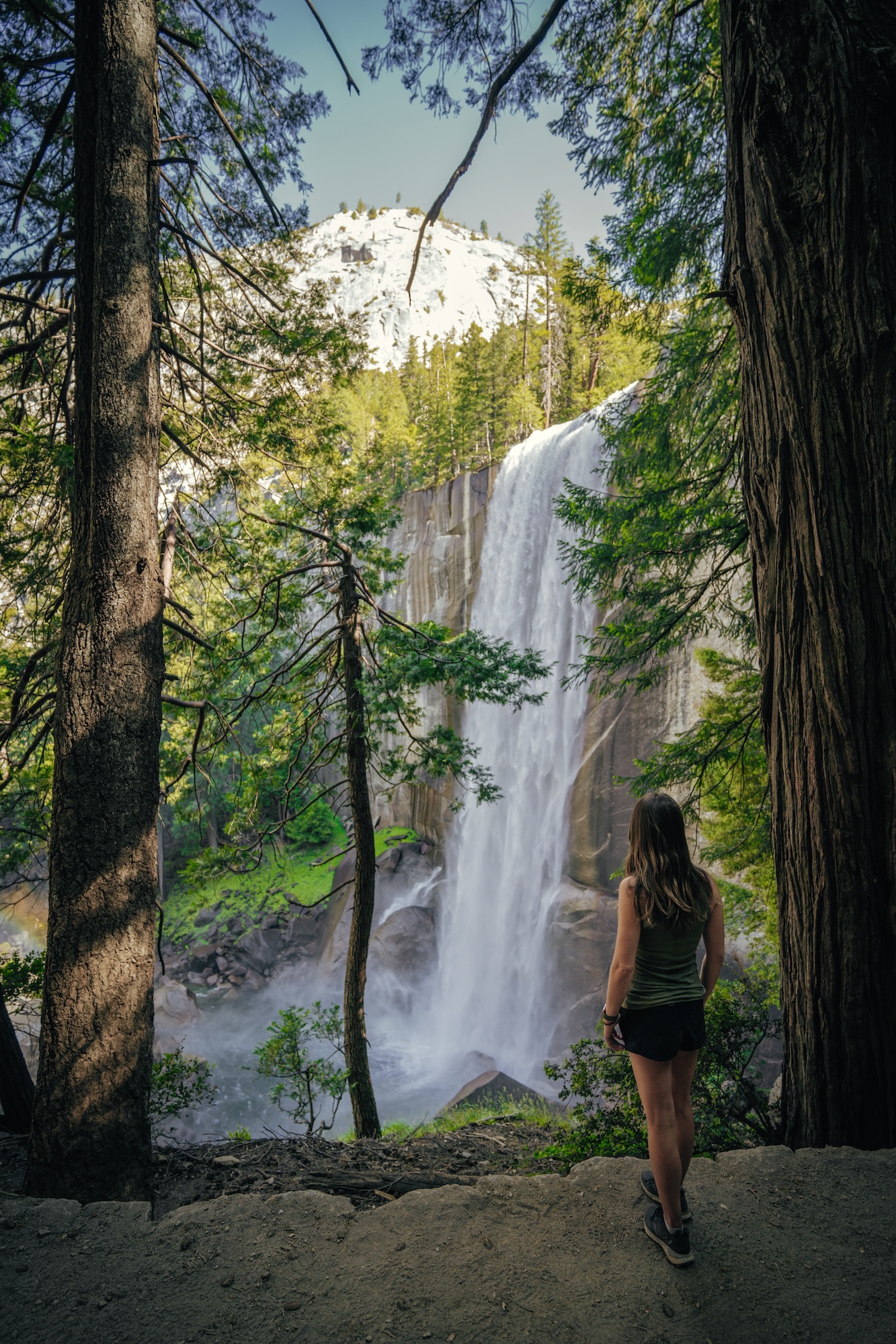
What makes this hike stand out is how quickly it delivers one of Yosemite’s most powerful viewpoints. You don’t need a full-day effort or backcountry plan to experience something this dramatic. The waterfall appears almost suddenly as the canyon tightens, and the energy of the trail shifts immediately. The climb up can be challenging with over 600 steps. But similar to Cinder Cone, the reward is absolutely worth it.
- DIFFICULTY – Challenging
- LENGTH – 3.3mi / 5.3km out and back
- ELEVATION GAIN – 1,131 ft
- TIME NEEDED – 2-3 hours
- PET FRIENDLY – Pets are not permitted
- Save the hike on AllTrails
WHAT TO DO IN YOSEMITE? CHECK OUT DAY TRIP TO YOSEMITE NATIONAL PARK: YOUR ULTIMATE GUIDE AND ULTIMATE GUIDE TO YOSEMITE NATIONAL PARK CALIFORNIA!
BORREGO PALM CANYON TRAIL (ANZA-BORREGO DESERT STATE PARK)
This hike feels like an anomaly in the middle of the desert. The surrounding landscape in Anza-Borrego Desert State Park is dry, open, and harsh, which makes the canyon feel even more unexpected. As you move deeper, the environment slowly changes from rock and sand into something more alive. The contrast is immediate and noticeable.
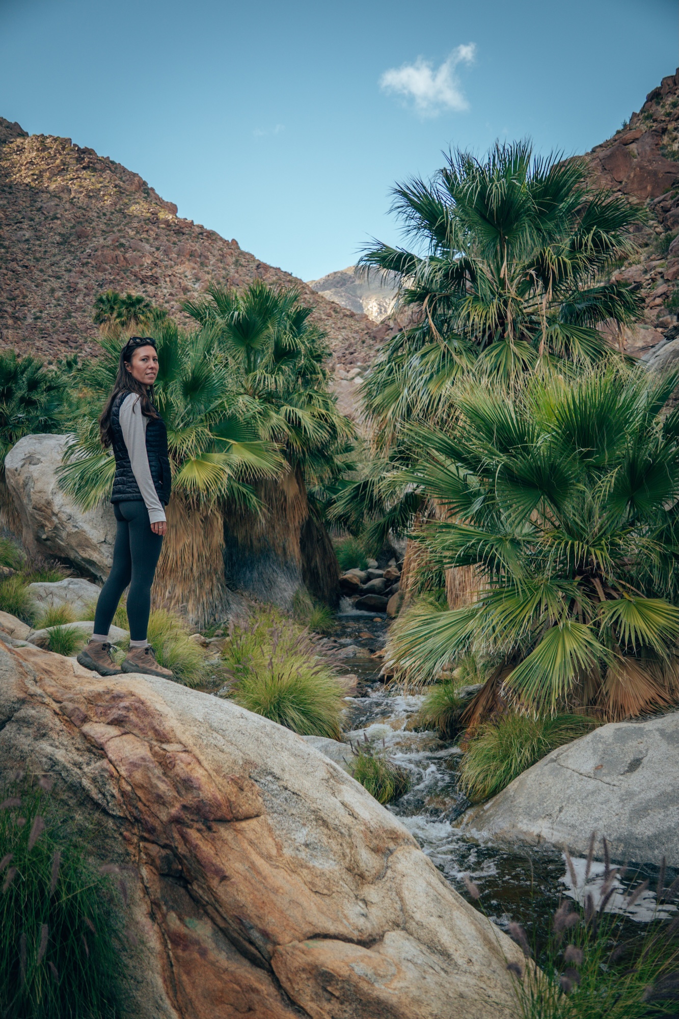
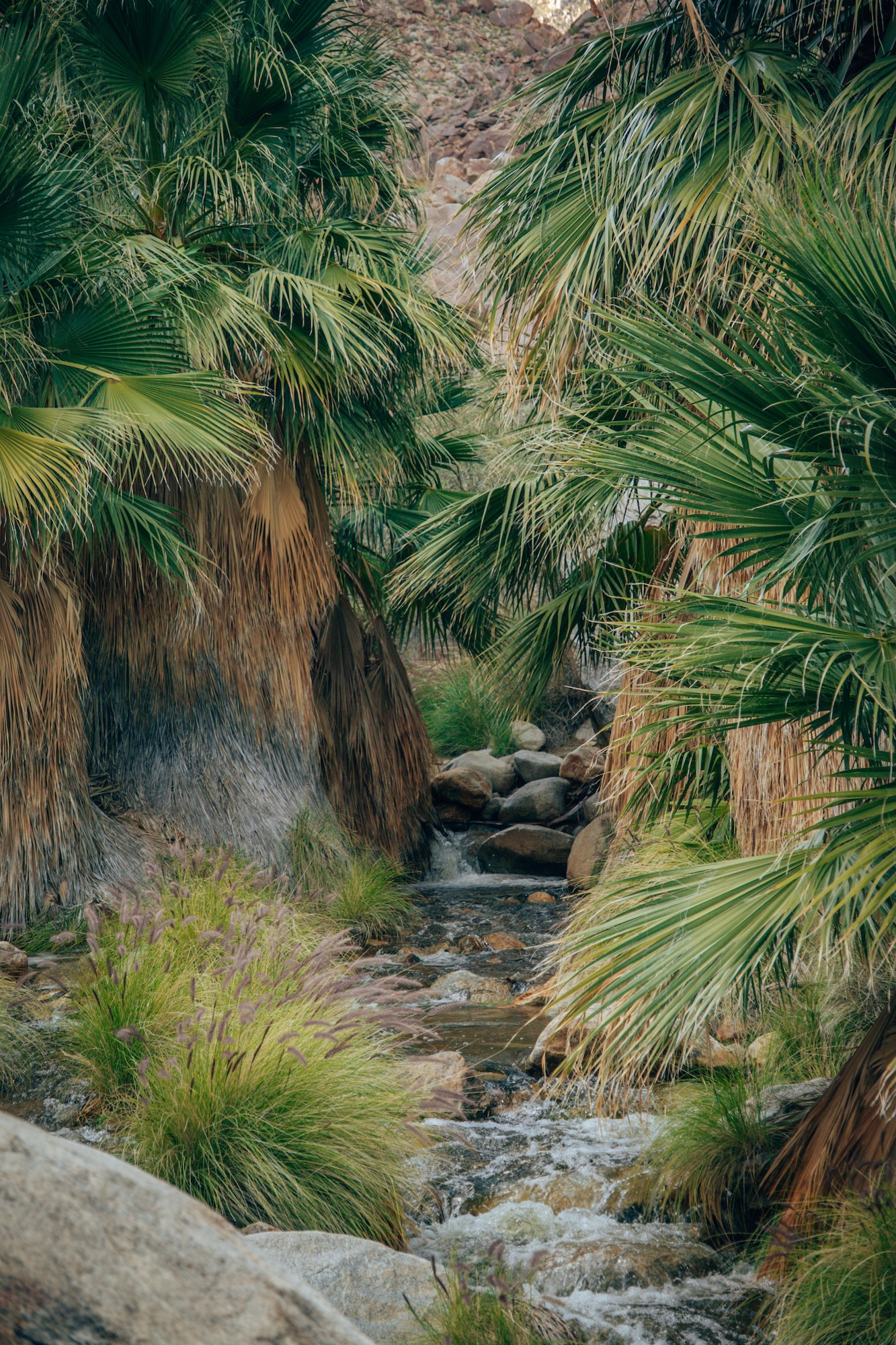
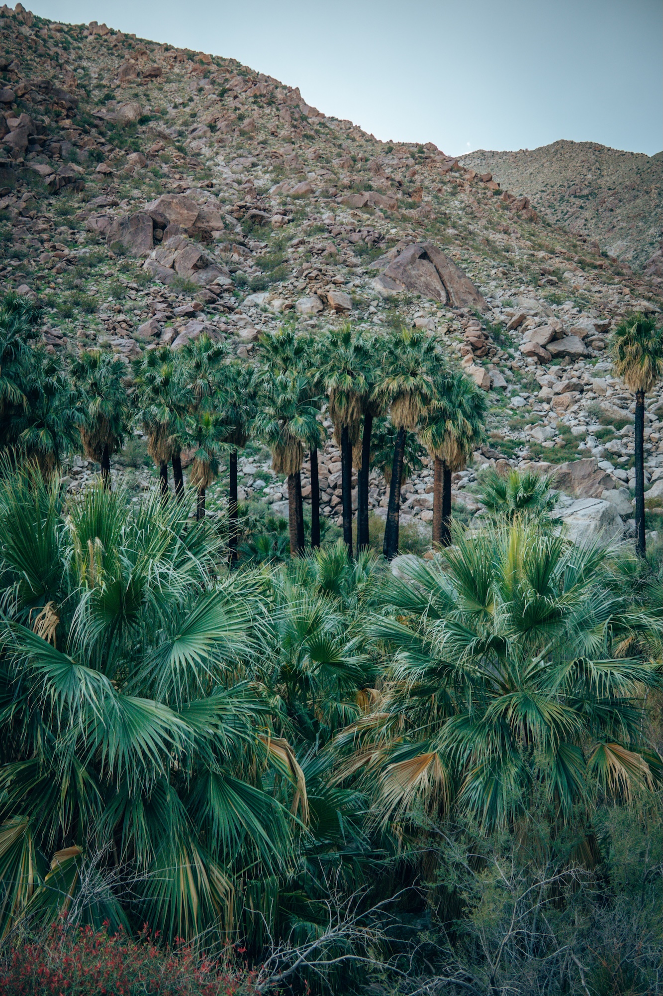
What makes this trail memorable is the sudden emergence of palms in the canyon. The oasis feels almost impossible given the surrounding terrain. Wildlife sightings add another layer of unpredictability in an otherwise quiet desert environment. It’s one of the most dramatic environmental shifts in Southern California hiking.
- DIFFICULTY – Easy
- LENGTH – 2.9mi / 4.7km
- ELEVATION GAIN – 456 ft
- TIME NEEDED – 1-2 hours
- PET FRIENDLY – Pets are not permitted
- Save the hike on AllTrails
WANT TO LEARN MORE ABOUT THIS EPIC PARK? CHECK OUT BORREGO PALM CANYON CAMPGROUND: CAMPING IN ANZA BORREGO
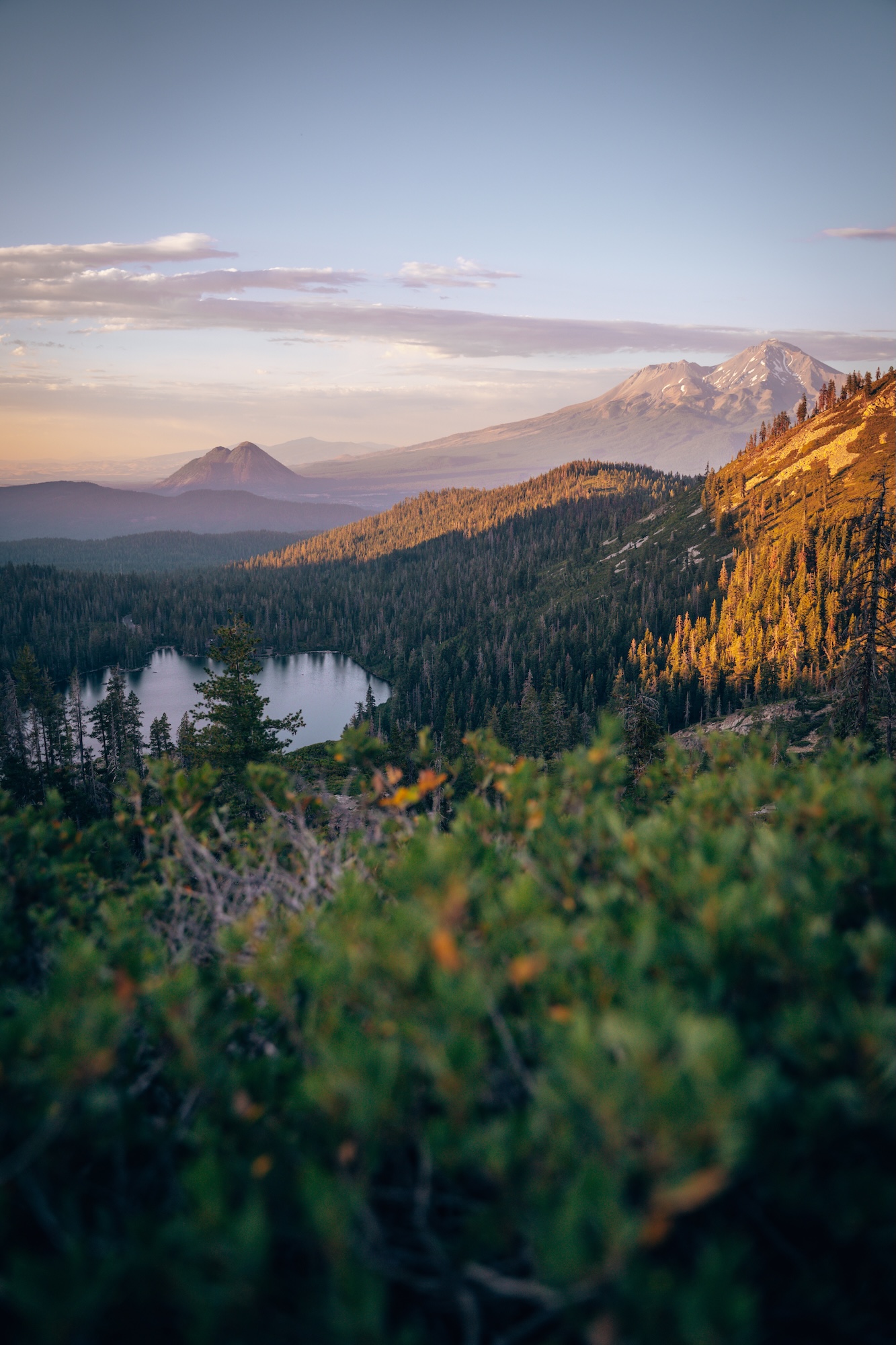
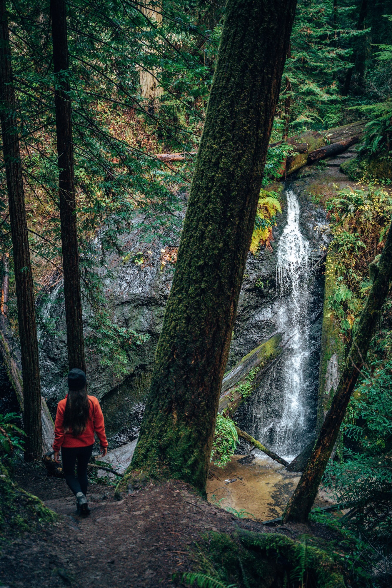
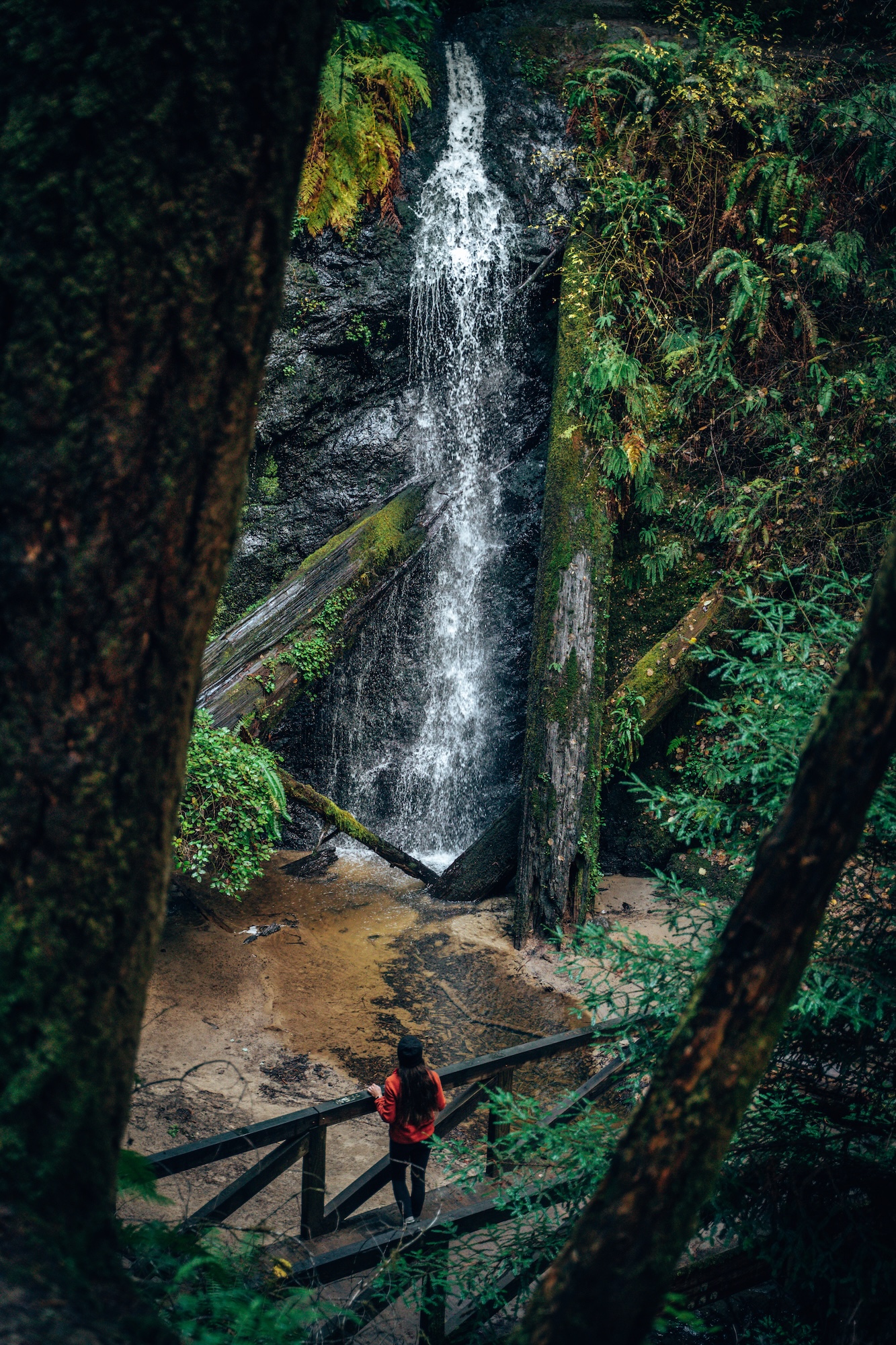
HEART LAKE VIA CASTLE LAKE (CASTLE CRAGS WILDERNESS)
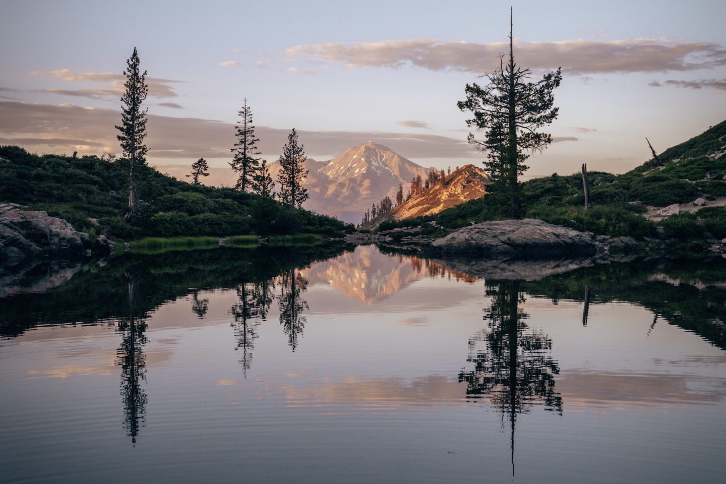
This hike feels like it belongs in a different category than most day hikes in California. The setting shifts quickly from forested terrain to exposed granite and high alpine views. Mount Shasta dominates the horizon for much of the climb, constantly reminding you how high you’ve gone. It’s a steady progression into a more remote-feeling landscape.
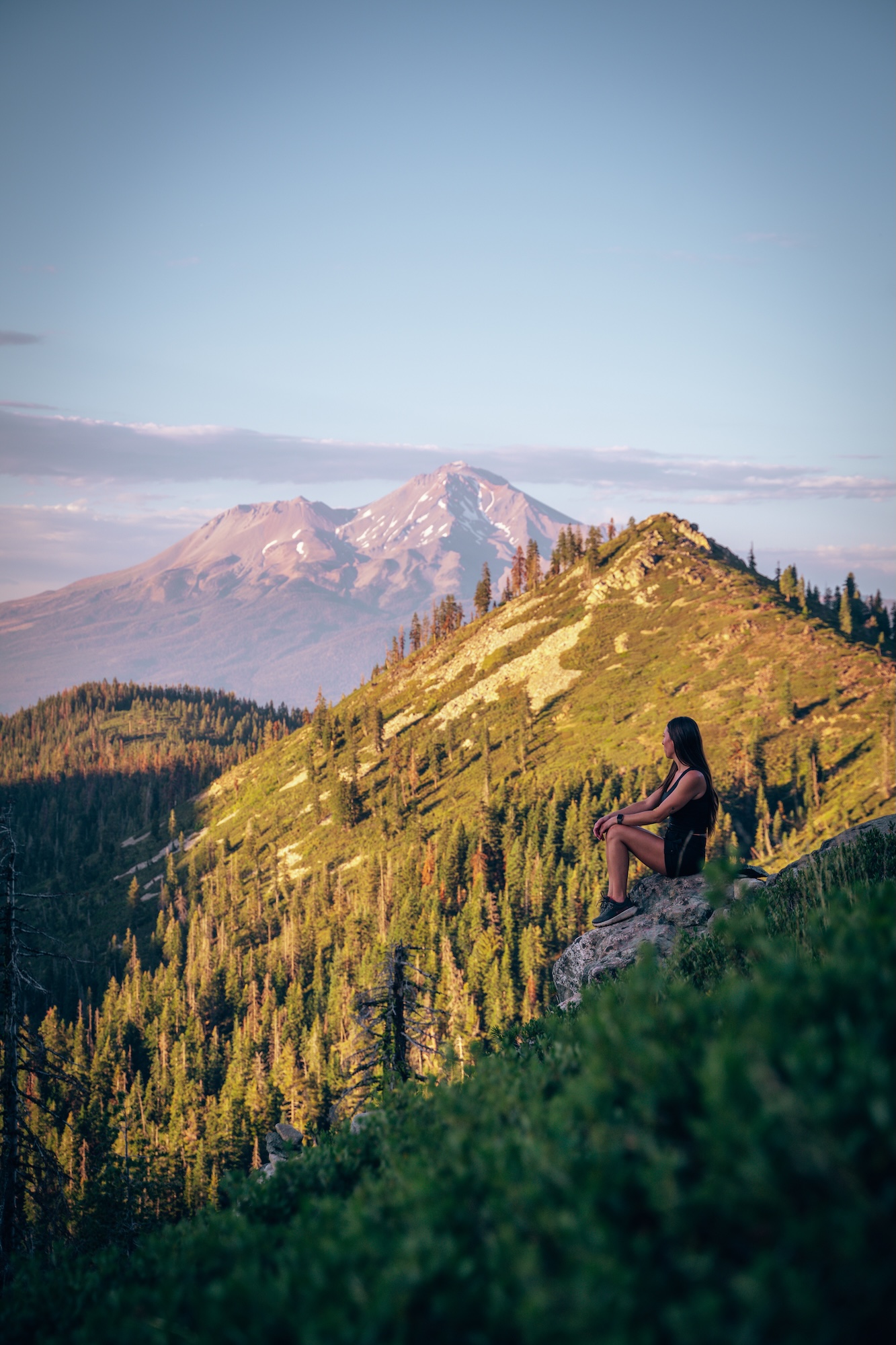
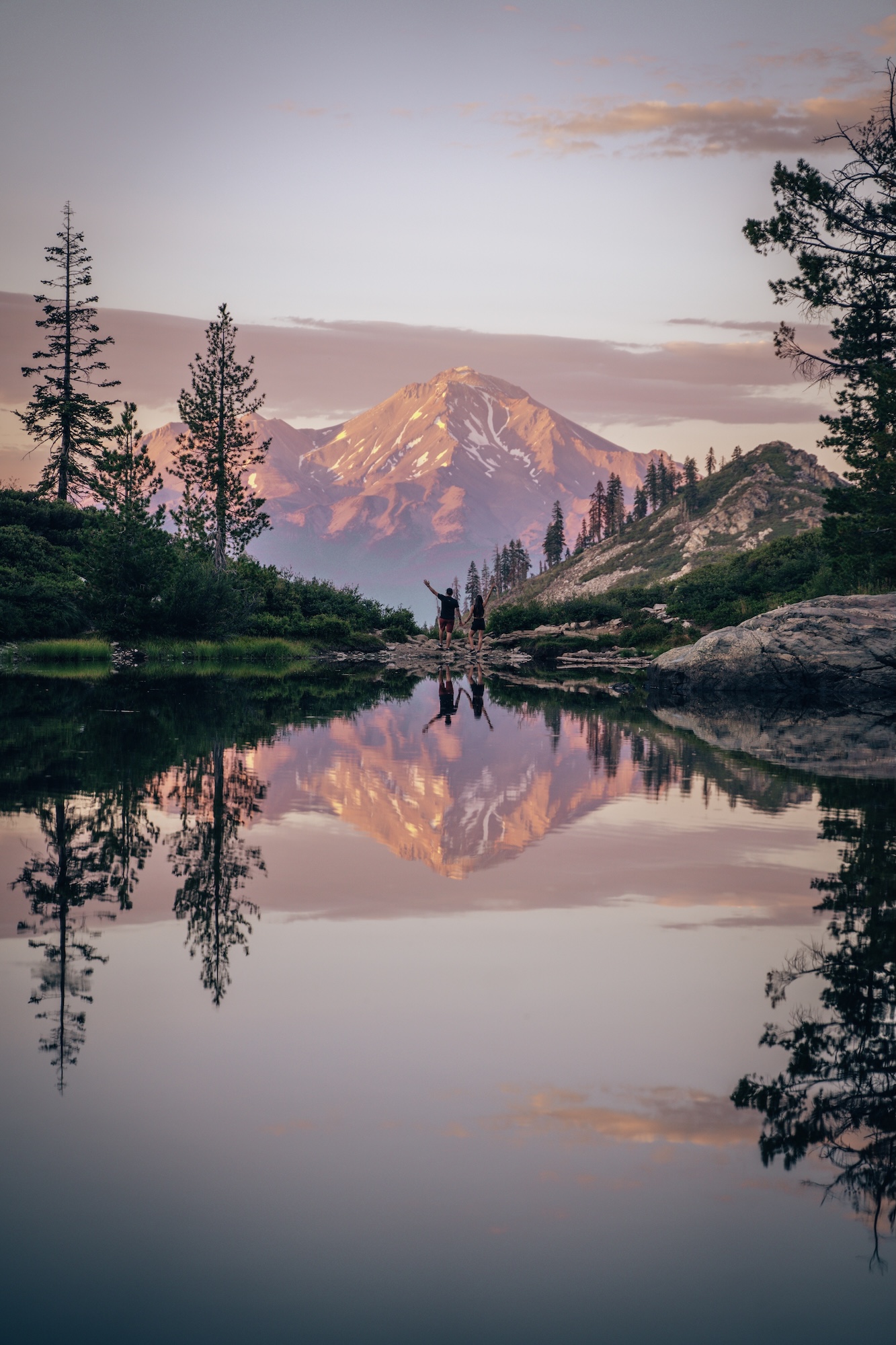
What makes Heart Lake stand out is the mirrored view of Mount Shasta. Especially at Sunset. The basin opens up unexpectedly, and the water sits in near silence surrounded by peaks. It’s not just scenic, it feels tucked away in a way that rewards every step of the climb. This might very well be our favorite hike in California.
- DIFFICULTY – Easy
- LENGTH – 3.0mi / 4.8km
- ELEVATION GAIN – 820 ft
- TIME NEEDED – 1.5-2 hours
- PET FRIENDLY – Pets are permitted
- Save the hike on AllTrails
WANT TO LEARN MORE ABOUT THIS HIKE AND OTHER THINGS TO DO NEAR MOUNT SHASTA? CHECK OUT HOW TO HIKE THE HEART LAKE TRAIL IN MOUNT SHASTA AND 12 THINGS TO DO IN THE MT SHASTA AREA.
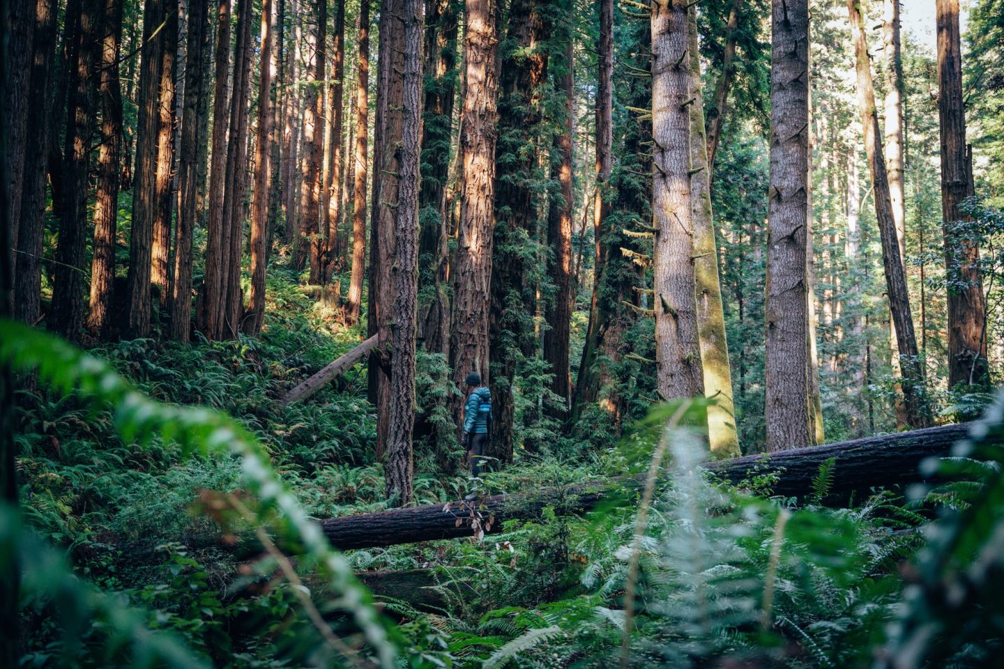
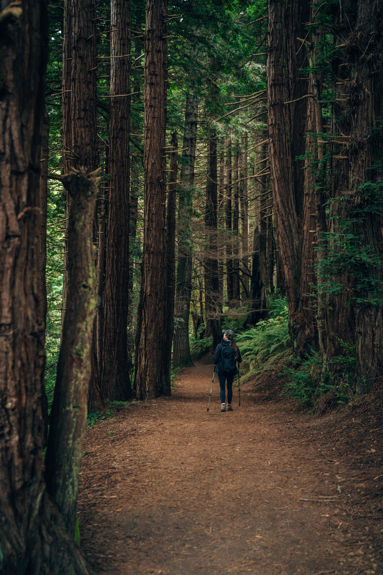
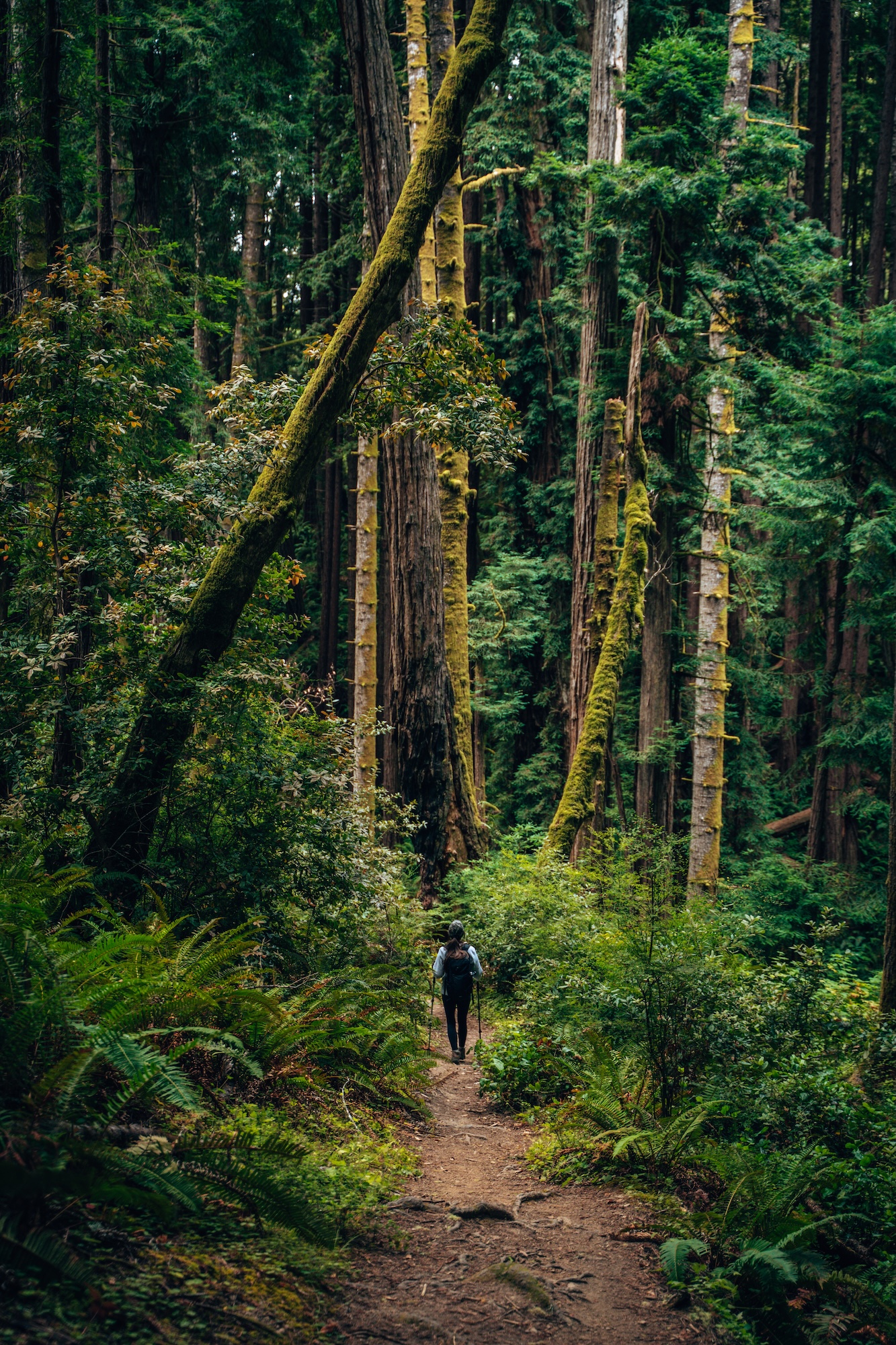
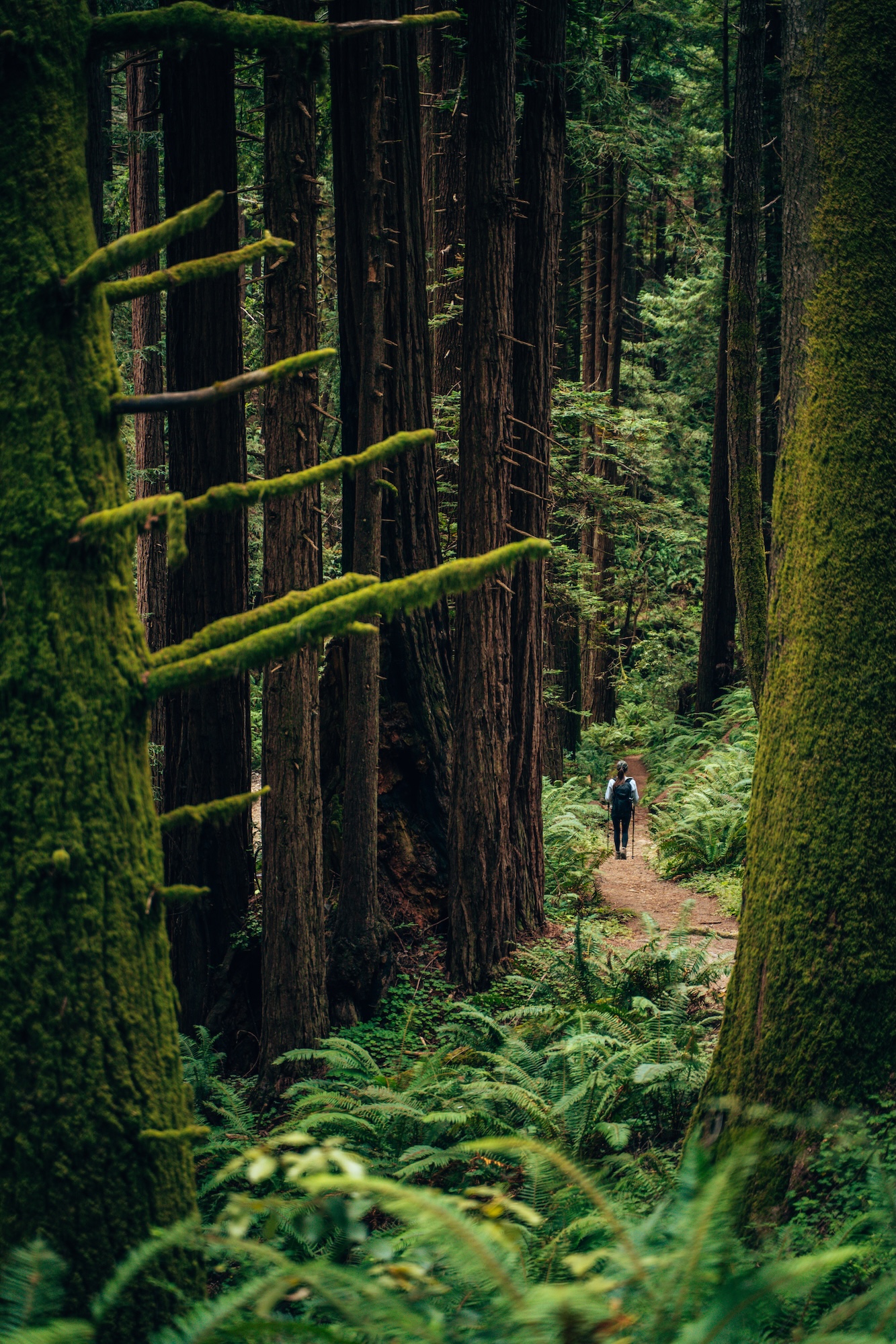
KARL KNAPP TRAIL, BIG TREE & CATHEDRAL TREES LOOP (PRAIRIE CREEK REDWOODS STATE PARK)
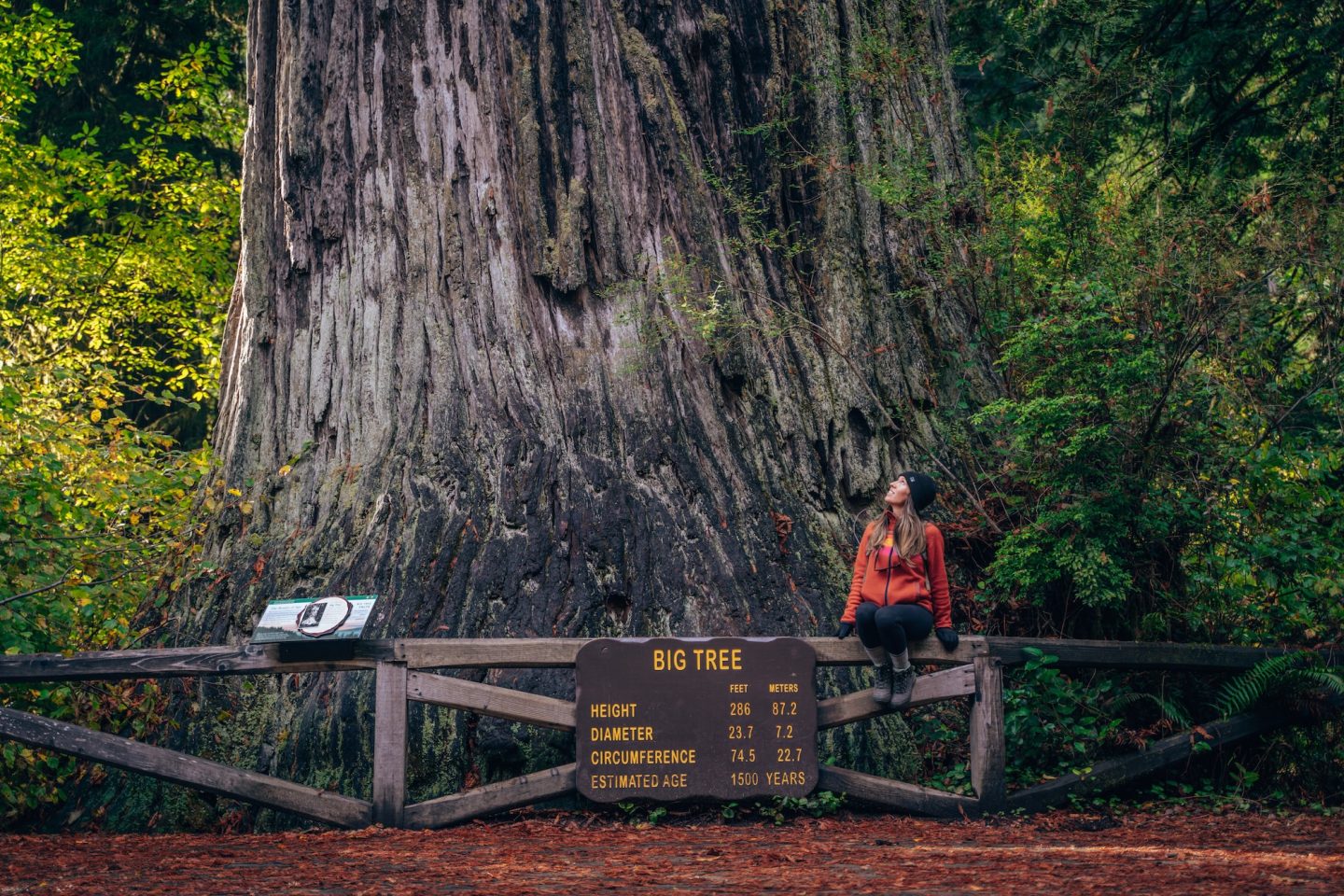
Located in Prairie Creek Redwoods State Park, which is part of Redwood National and State Parks, this is one of the most immersive redwood hikes in Northern California. The forest here feels about as close to untouched as you can get. Massive redwoods tower overhead, filtering sunlight through the canopy and making you feel incredibly small. It’s the kind of place that naturally slows you down, encouraging you to look up, take your time, and appreciate just how impressive these trees really are.
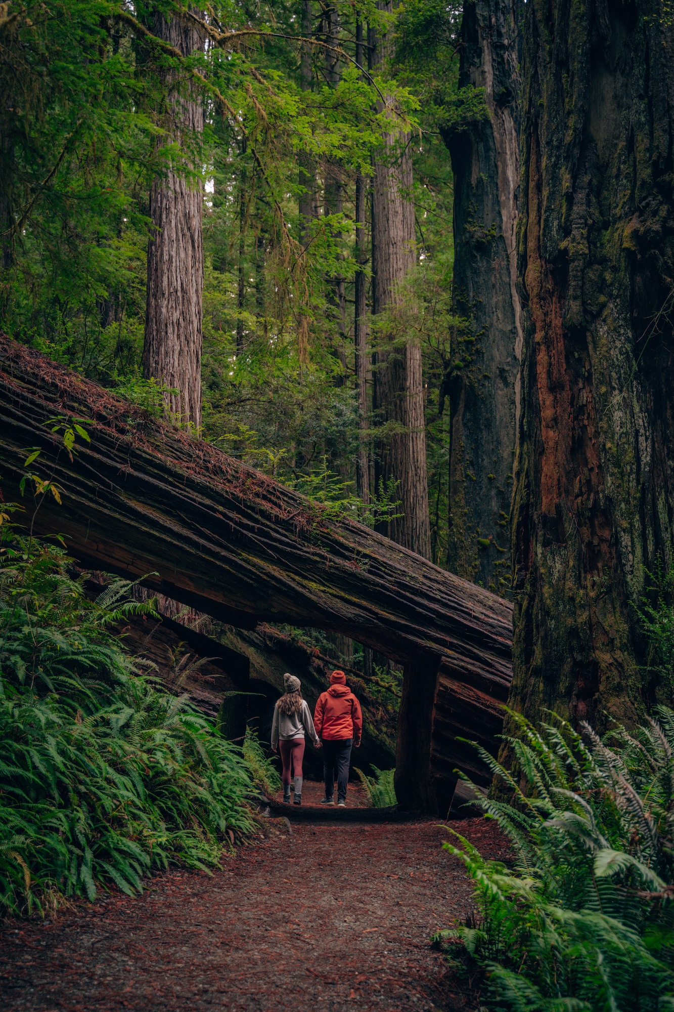
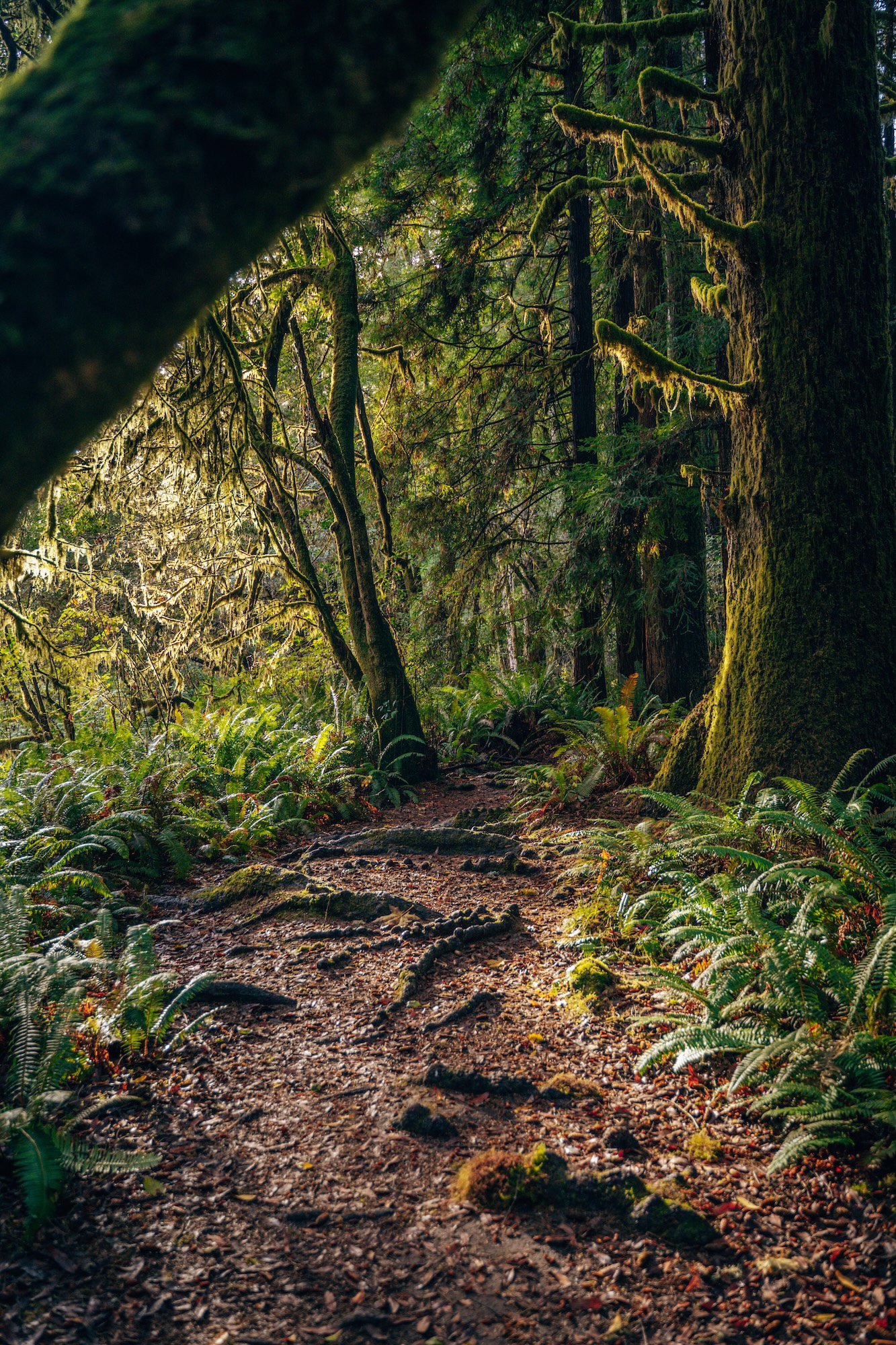
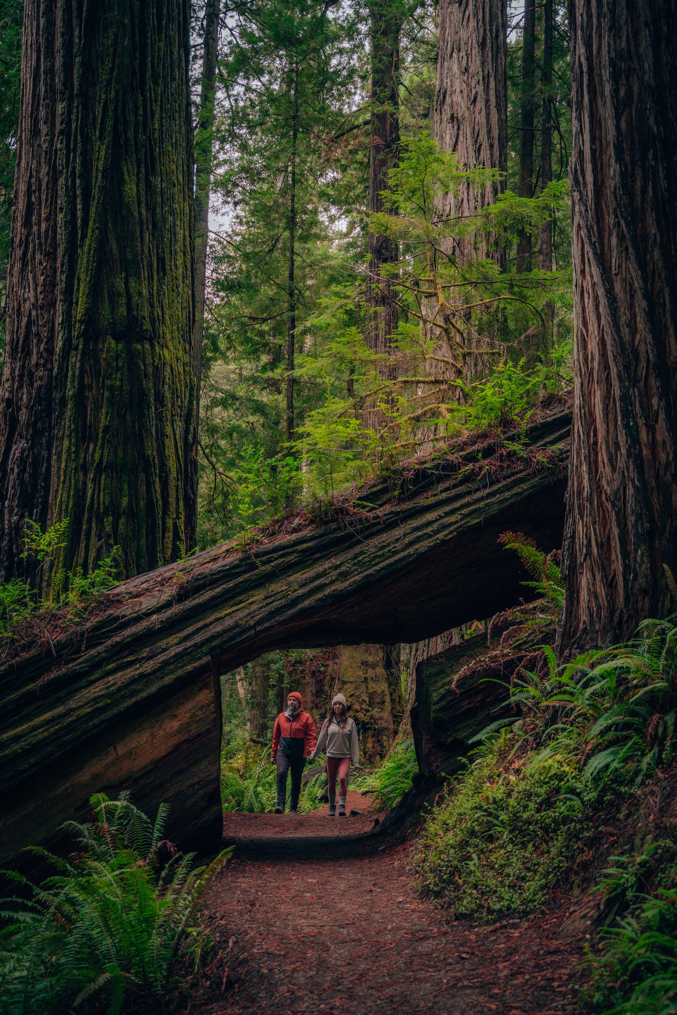
What makes this loop so memorable is how consistently it delivers old-growth redwood scenery without needing major elevation gain. You’re surrounded by towering trunks almost immediately, and that feeling doesn’t fade at any point. Wildlife, especially elk, adds another layer of unpredictability. It’s one of the most reliable places in California to experience true old-growth forest.
- DIFFICULTY – Easy
- LENGTH – 2.9mi / 4.7km
- ELEVATION GAIN – 213 ft.
- TIME NEEDED – 1-1.5 hours
- PET FRIENDLY – Pets are not permitted
- Save the hike on AllTrails
NEED MORE THAN JUST ONE HIKE HERE? 10 MUST-DO ACTIVITIES IN REDWOOD NATIONAL PARK AND STATE PARKS
CONGRESS TRAIL (SEQUOIA NATIONAL PARK)
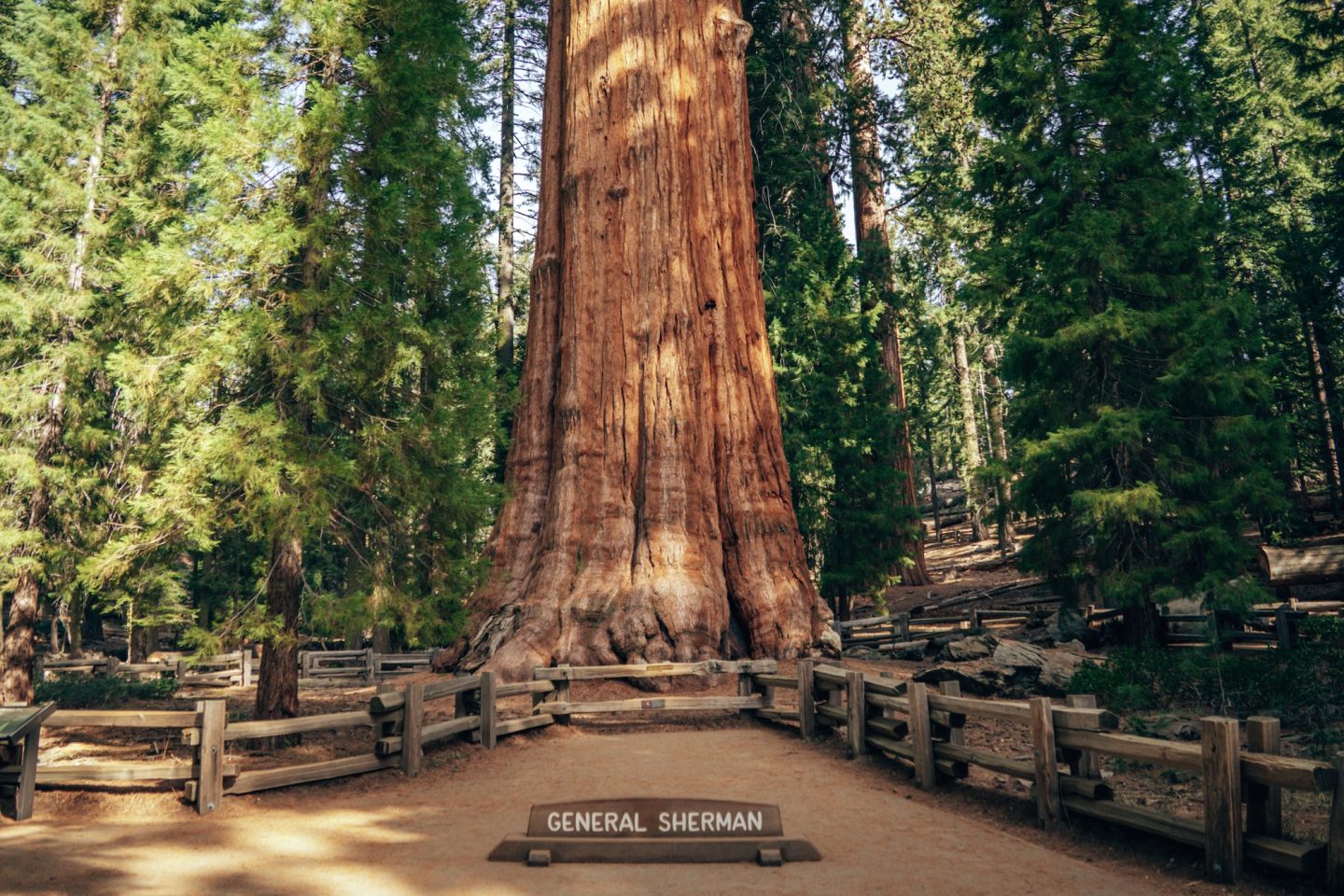
This is one of the easiest ways to experience the scale of giant sequoias without committing to a strenuous hike. The grove of Giant sequoias in Sequoia National Park feels almost overwhelming in size. Even on short sections of trail. You quickly lose perspective on distance once you’re surrounded by trees that dwarf everything around them. It’s a hike that slows you down without trying.
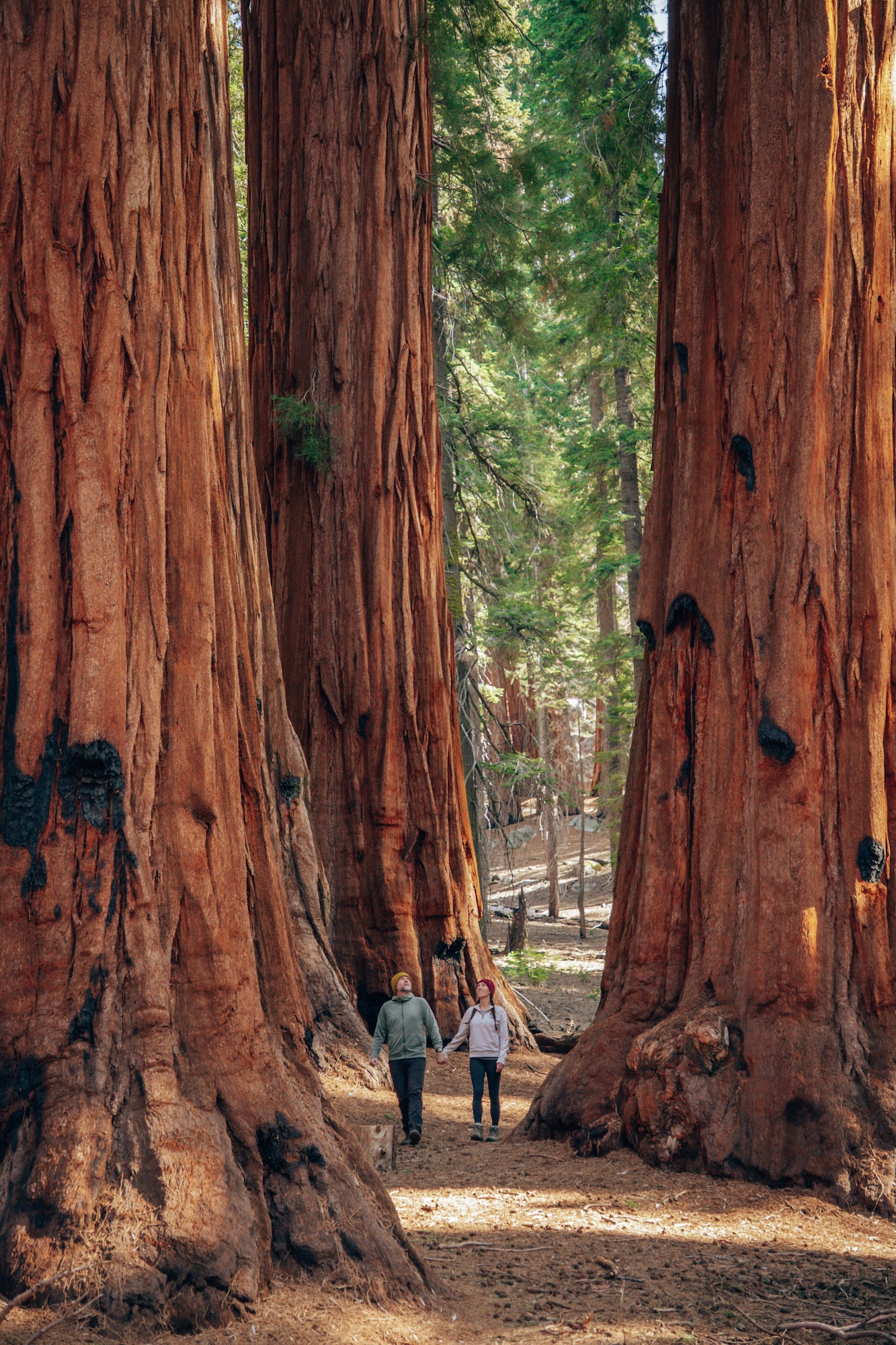
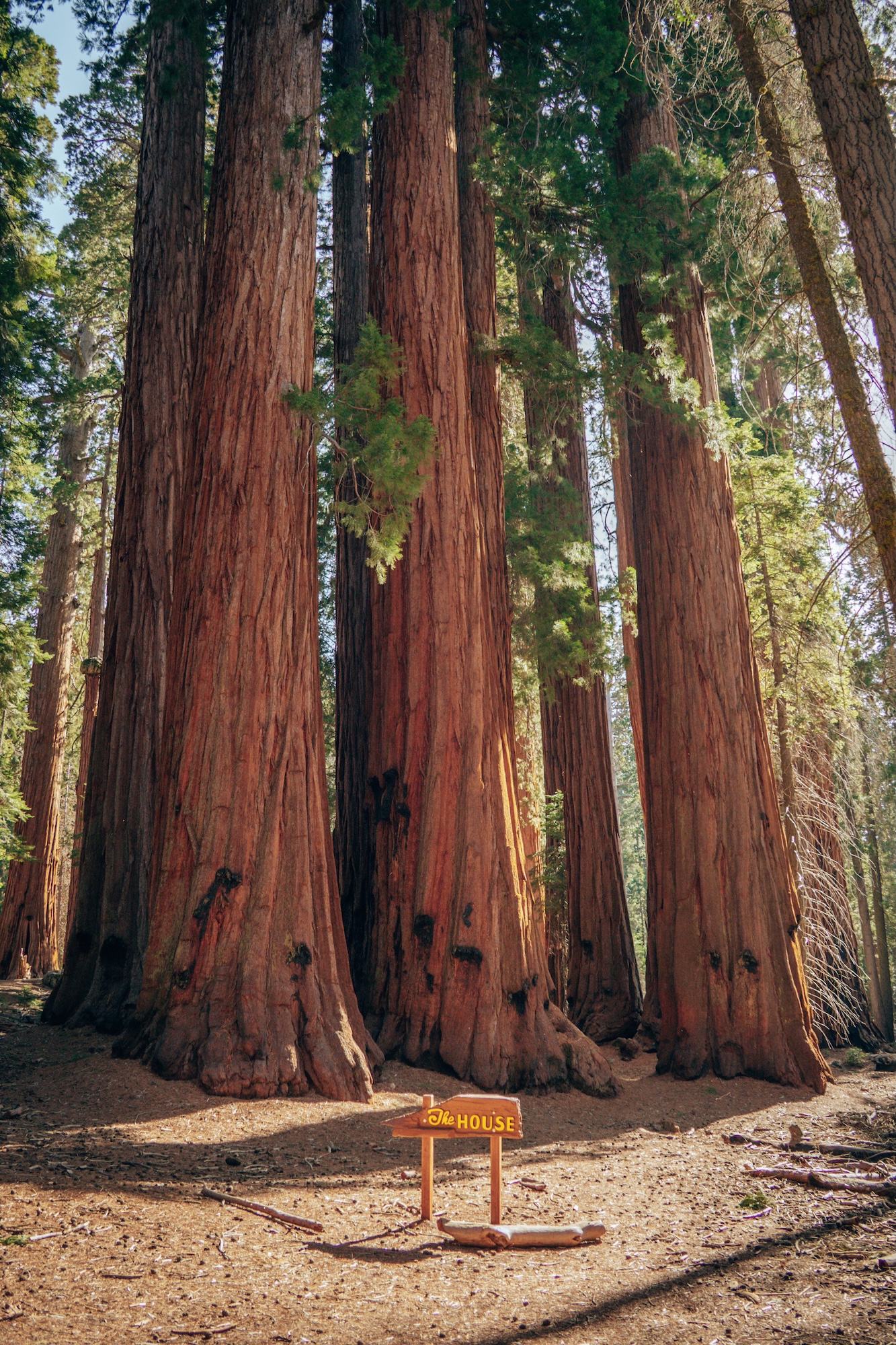
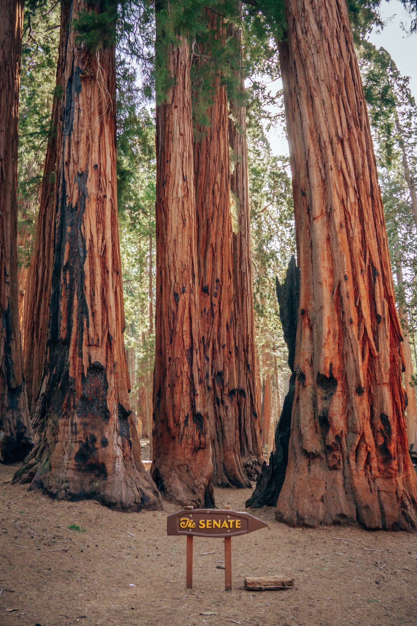
What makes this loop special is how consistently it delivers iconic sequoia moments. There’s no buildup or payoff section because the entire trail is the experience. Every turn reveals another massive grove or landmark tree that feels almost unreal in scale. It’s one of those hikes where you stop repeatedly, not because it’s difficult, but because you can’t help it.
- DIFFICULTY – Easy
- LENGTH – 2.9mi / 4.7km
- ELEVATION GAIN – 482 ft
- TIME NEEDED – 1-2 hours
- PET FRIENDLY – Pets are not permitted
- Save the hike on AllTrails
ONLY HAVE ONE DAY FOR THESE GIANTS? HOW TO SPEND ONE DAY IN SEQUOIA NATIONAL PARK
BIRD ISLAND & SOUTH PLATEAU LOOP (POINT LOBOS STATE NATURAL RESERVE)
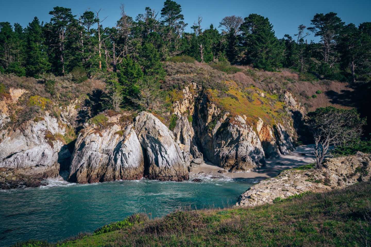
Point Lobos State Natural Reserve provides one of the most concentrated coastal experiences in California. Every part of the trail feels like it was designed to maximize ocean views, wildlife encounters, and dramatic rock formations. The coastline here feels compressed in the best possible way. There’s almost no wasted scenery.
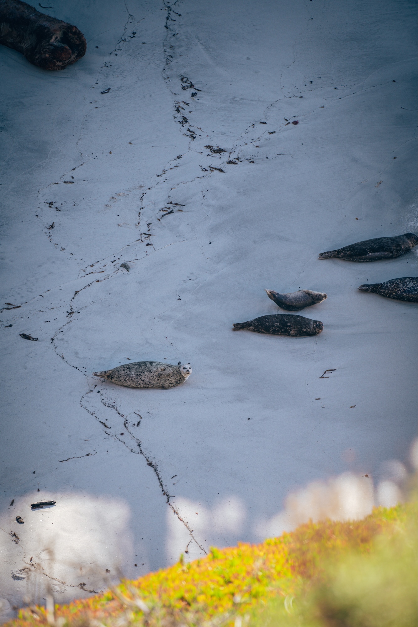
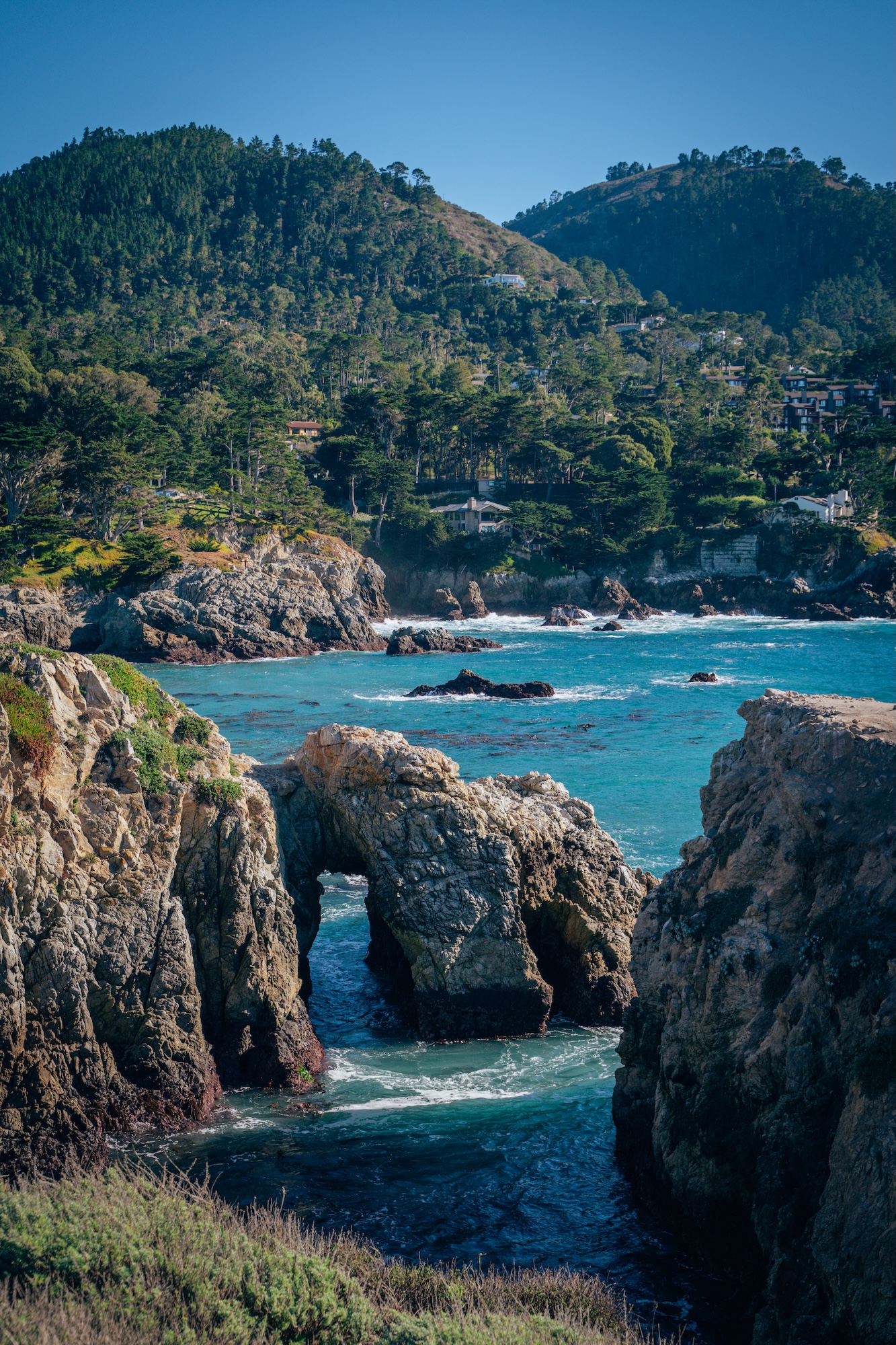
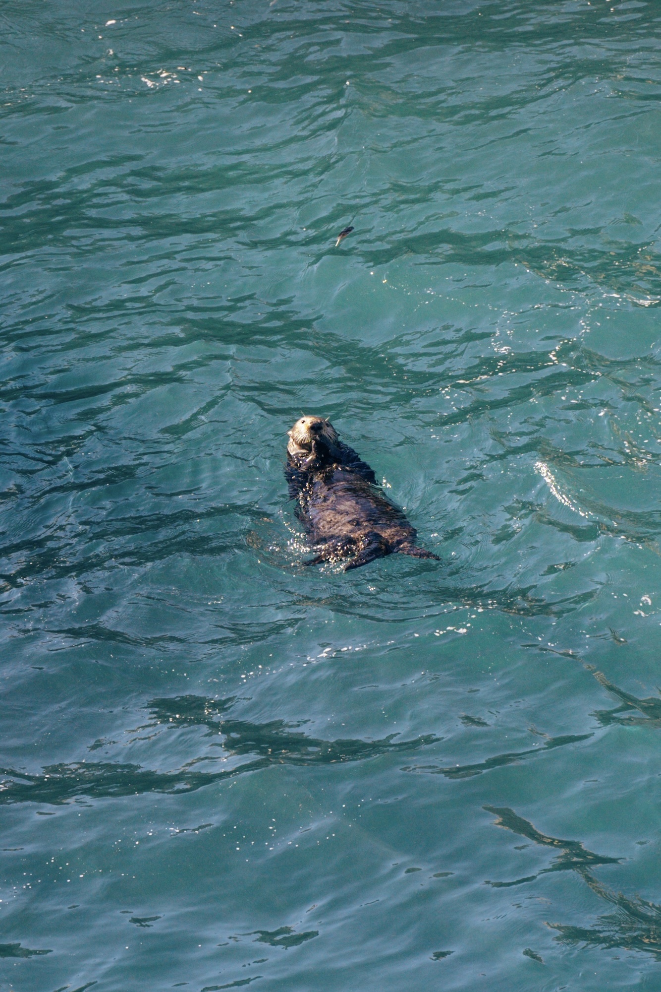
What makes this loop stand out is how close you get to marine life and coastal ecosystems without leaving the trail system. Sea lions, seabirds, and shifting tides are all part of the experience. The terrain changes constantly between cypress groves, cliffs, and coves. It’s a relatively short hike that feels significantly larger than its mileage suggests.
- DIFFICULTY – Easy
- LENGTH – 1.9mi / 3.0km
- ELEVATION GAIN – 200 ft
- TIME NEEDED – 1 hour
- PET FRIENDLY – Pets are not permitted
- Save the hike on AllTrails
BUMPASS HELL TRAIL (LASSEN VOLCANIC NATIONAL PARK)
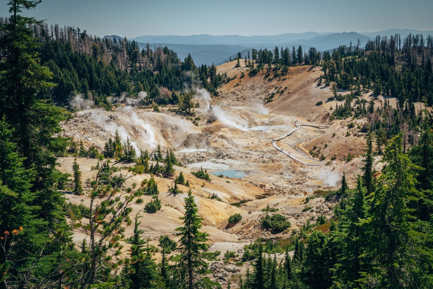
This is one of the most geologically active hikes in California. The landscape in Lassen Volcanic National Park feels unreal in the best possible way, constantly releasing steam and heat. It’s a reminder that this region is still very much alive. The environment is both fascinating and slightly surreal.
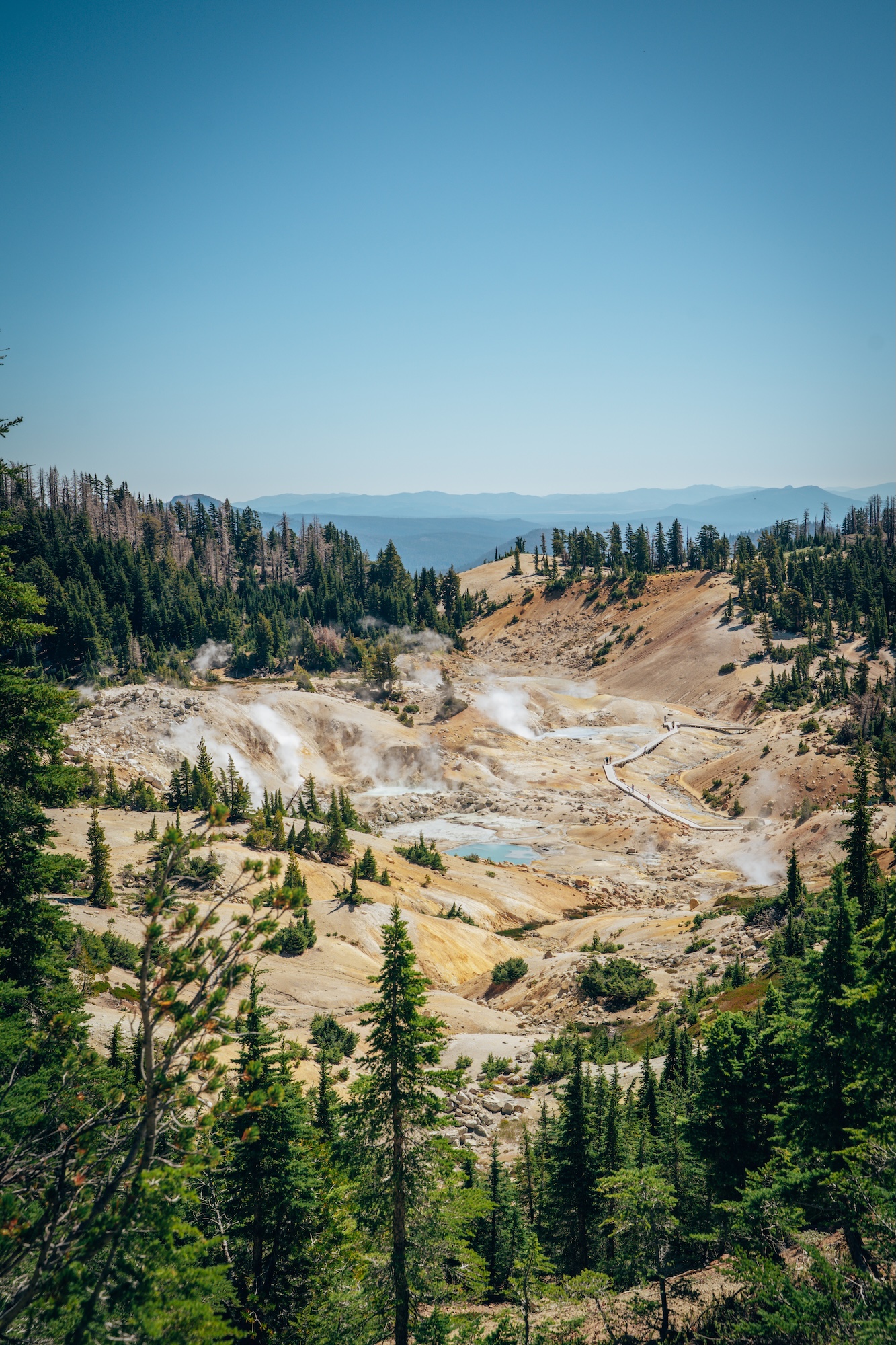
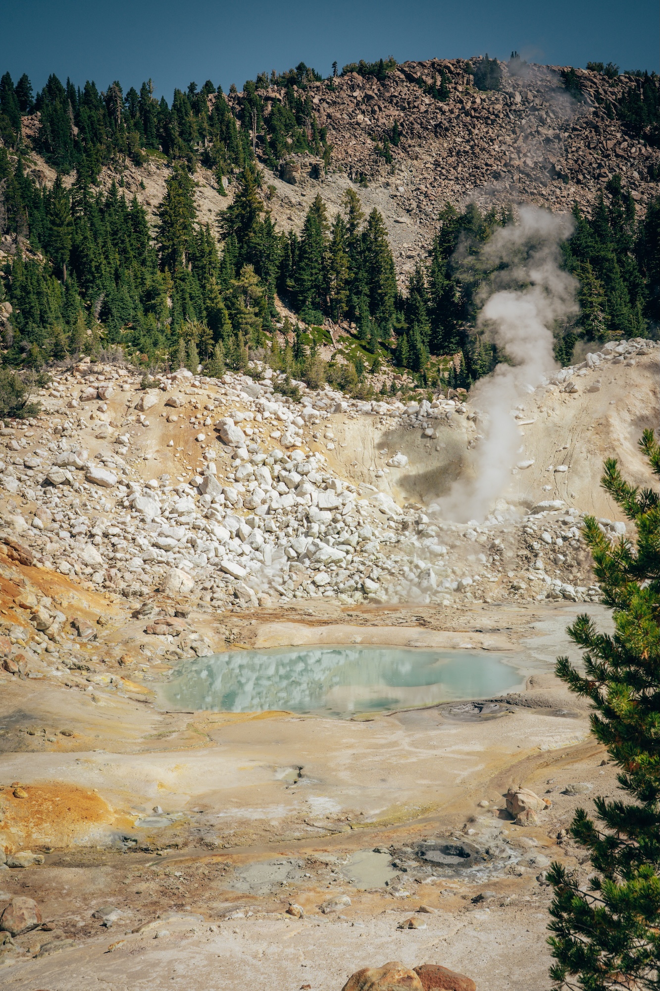
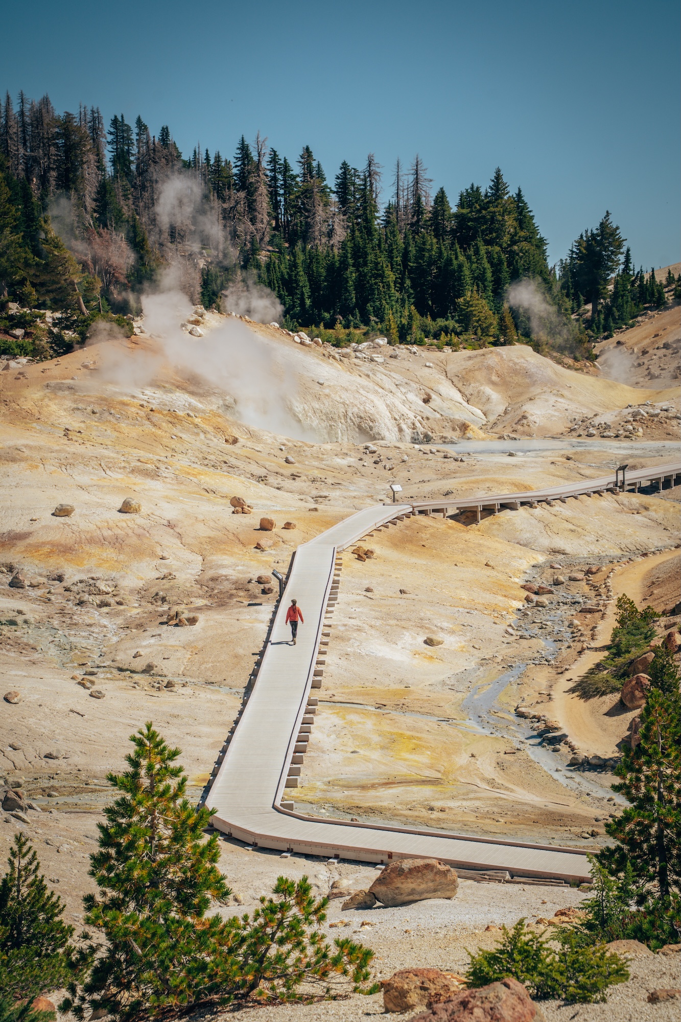
What makes this hike stand out is the direct exposure to geothermal activity. Boiling mud pots and steam vents create a sensory experience unlike most trails. The boardwalk keeps you close while maintaining safety. Seasonal snow dictates access, making timing an important factor. If you’ve never been to Yellowstone National Park, and want to experience similar features, this is your best option!
- DIFFICULTY – Moderate
- LENGTH – 3.0mi / 4.8km
- ELEVATION GAIN – 439 ft
- TIME NEEDED – 1-2 hours
- PET FRIENDLY – Pets are not permitted
- Save the hike on AllTrails
FIND EVERYTHING YOU NEED TO KNOW ABOUT VISITING THIS PARK: ULTIMATE GUIDE TO LASSEN VOLCANIC NATIONAL PARK IN CALIFORNIA AND ONE DAY AT LASSEN VOLCANIC NATIONAL PARK.
TREASURE LAKES TRAIL (SOUTH LAKE / BISHOP AREA)
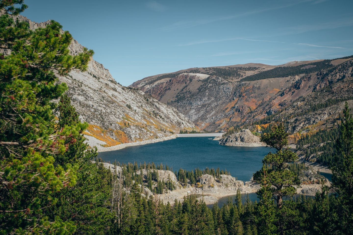
The Eastern Sierra is all about rewarding alpine lake hikes. And this one is no different. The climb builds gradually, revealing more dramatic scenery at every stage. Granite basins and high peaks start to dominate the landscape early on. It feels like a steady progression into alpine territory.
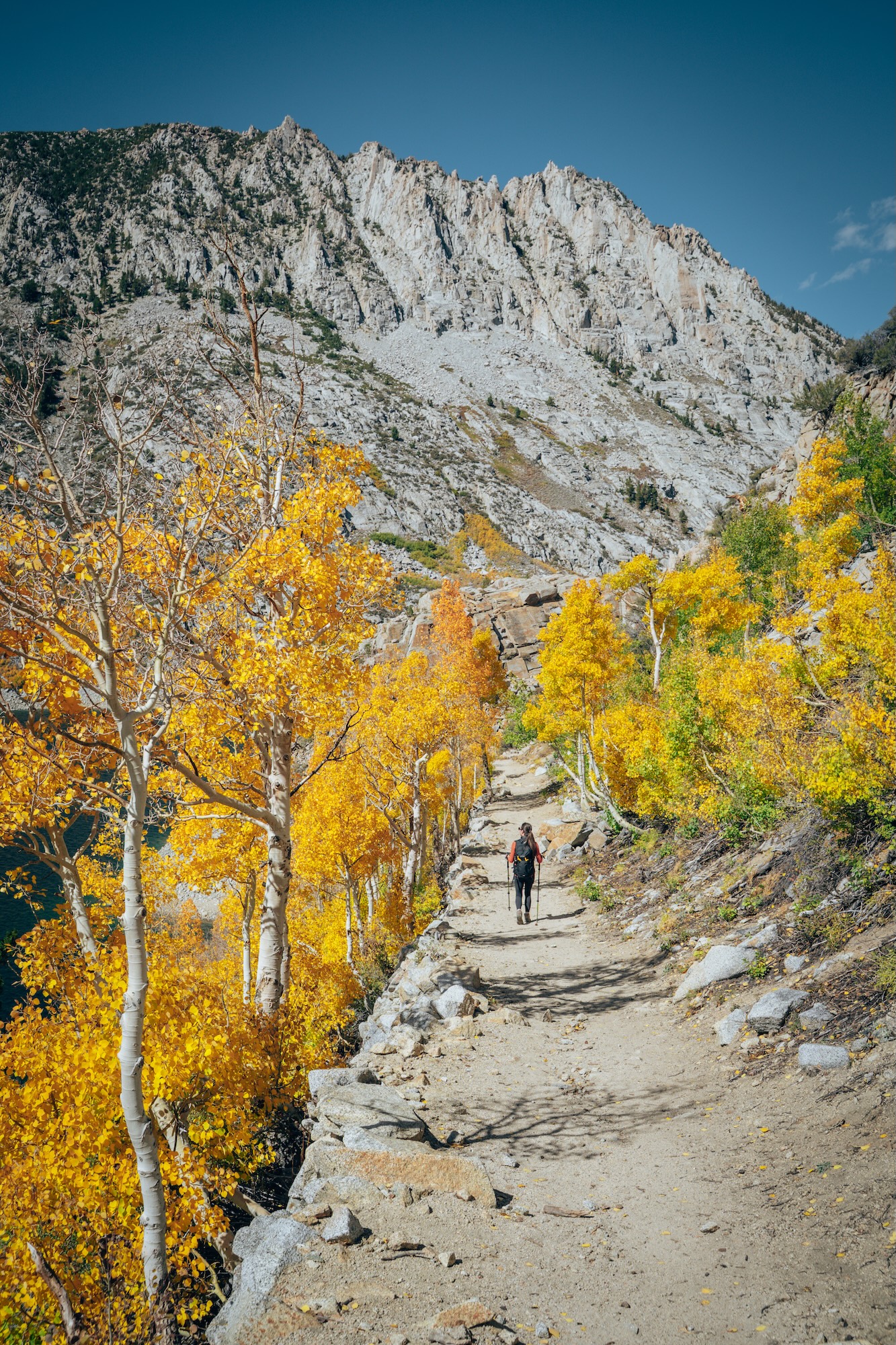
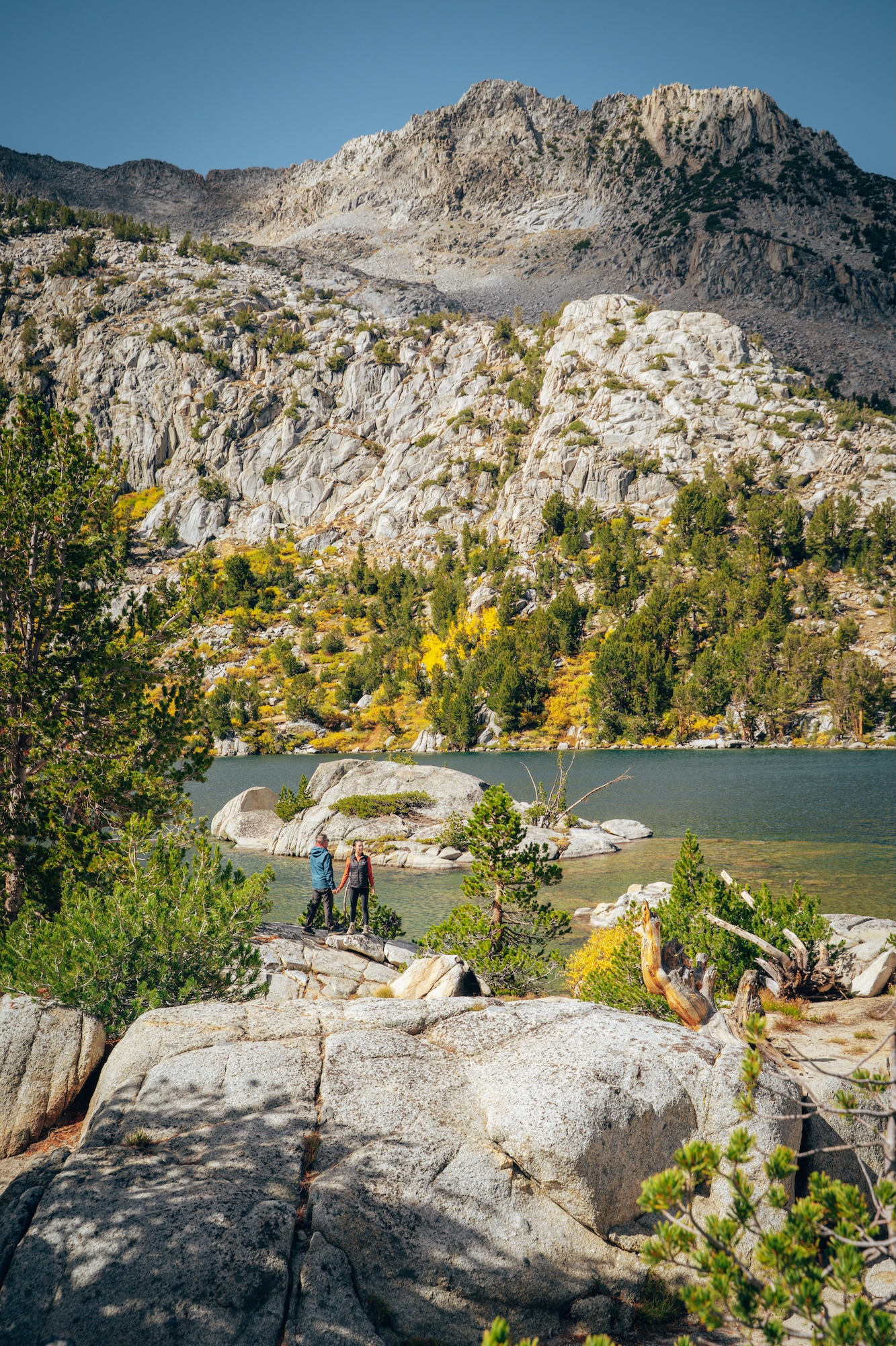
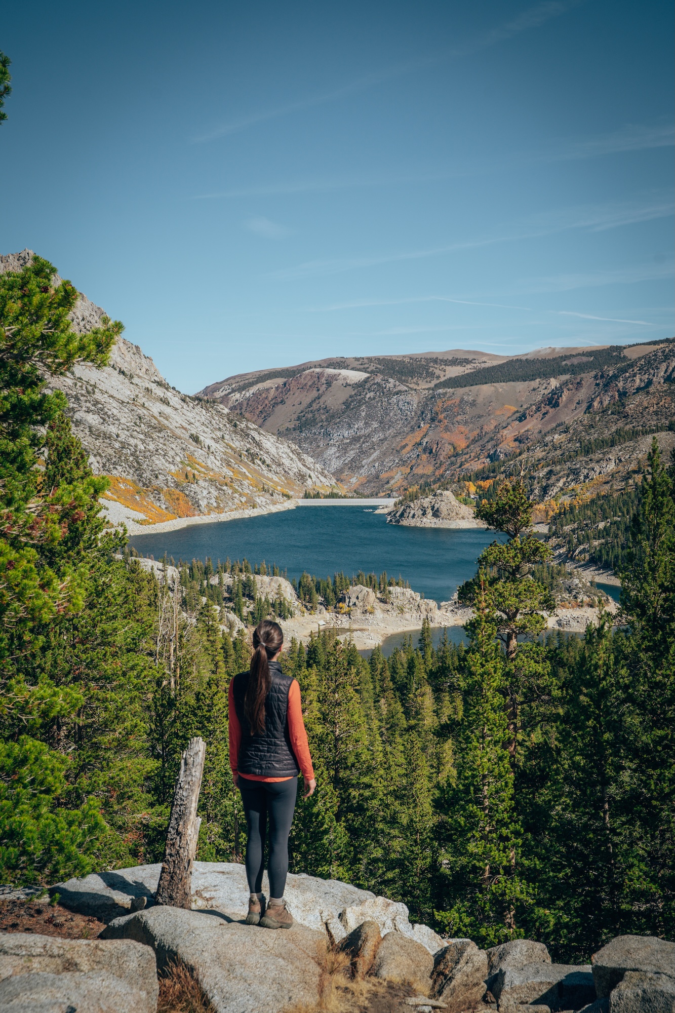
What makes this trail memorable is the sequence of lakes rather than a single destination. Each lake feels slightly more remote than the last. The surrounding peaks create a strong sense of enclosure in the basin. Snowpack often determines how early in the season the hike becomes accessible. But our recommendation? Go in the fall to see all the bright yellows and oranges.
- DIFFICULTY – Challenging
- LENGTH – 5.6mi / 9.0km
- ELEVATION GAIN – 1,371 ft
- TIME NEEDED – 3-4 hours
- PET FRIENDLY – Pets are permitted
- Save the hike on AllTrails
LEARN MORE ABOUT THIS HIKE AND OTHER THINGS TO DO NEAR IT IN OUR HIGHWAY 395: BEGINNER’S GUIDE TO CALIFORNIA’S EASTERN SIERRA.
RED BUTTE, YUCCA POINT & RAZOR POINT LOOP (TORREY PINES STATE NATURAL RESERVE)
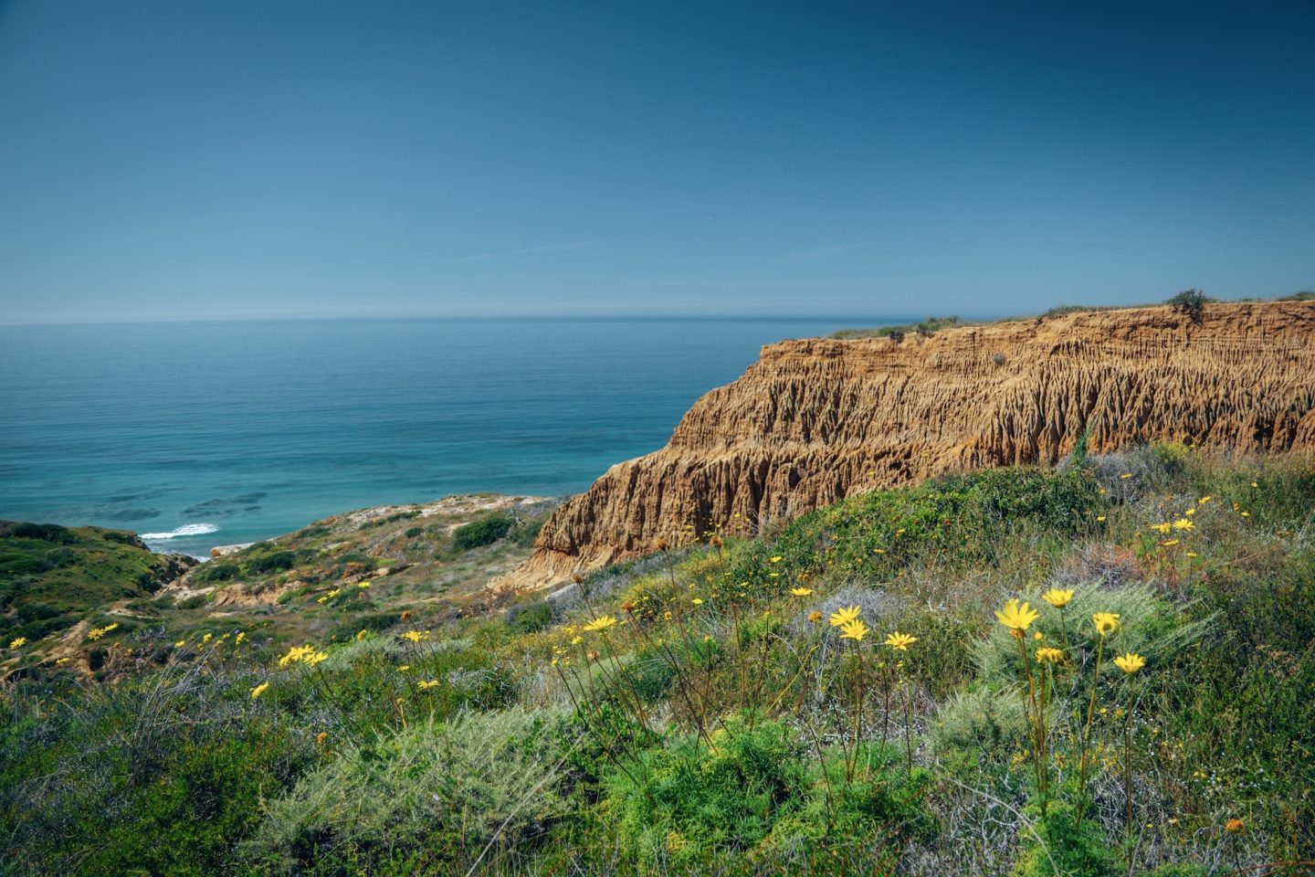
Located in Torrey Pines State Natural Reserve, this is one of the most visually distinctive coastal hikes in California. Few coastal hikes in California pack this much scenery into such a short distance. The trail winds through rare Torrey pine groves, passes dramatic sandstone formations, and delivers sweeping views of the Pacific Ocean almost the entire way. Around nearly every corner, there’s another viewpoint, cliffside overlook, or stretch of coastline worth stopping to admire.
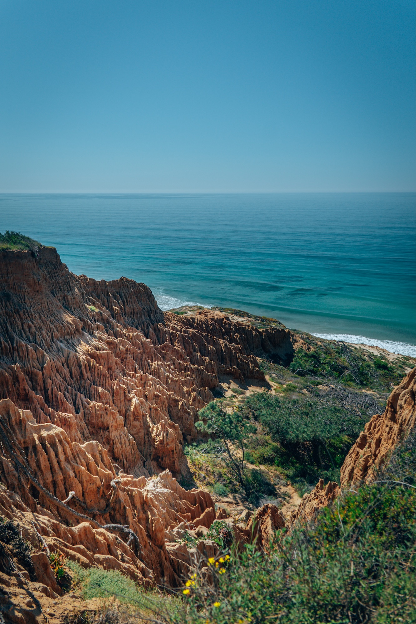
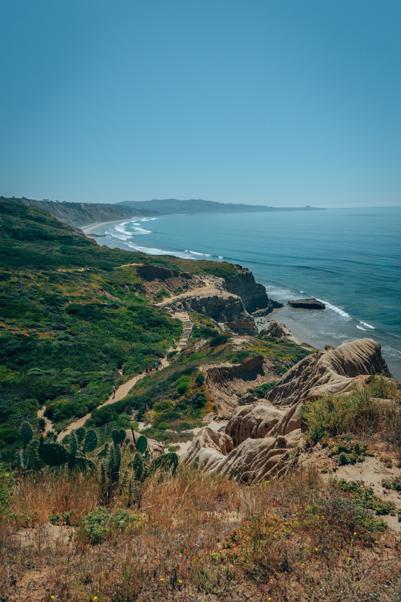
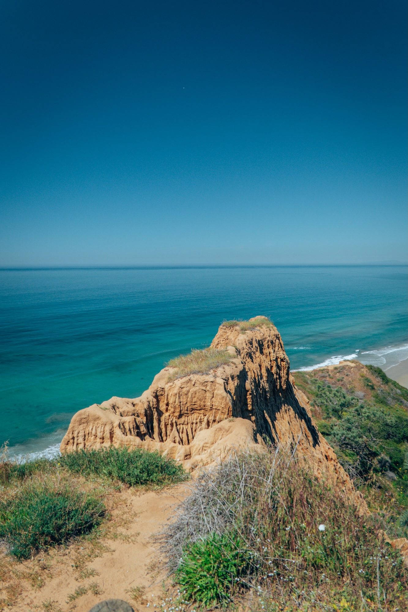
What makes this loop stand out is the erosion patterns and cliffside detail at Razor Point. The textures in the sandstone create a layered, almost abstract landscape. We’ve been told sunset is incredible hear. It’s one of the most photogenic coastal hikes in Southern California. But we prefer the vividness of the ocean mid-day.
- DIFFICULTY – Easy
- LENGTH – 1.6mi / 2.6km
- ELEVATION GAIN – 219 ft
- TIME NEEDED – 1 hour
- PET FRIENDLY – Pets are not permitted
- Save the hike on AllTrails
LEARN MORE ABOUT THIS PARK AND OTHER STATE PARKS TO VISIT IN OUR GUIDE TO EXPLORING THE BEST STATE PARKS OF CALIFORNIA.
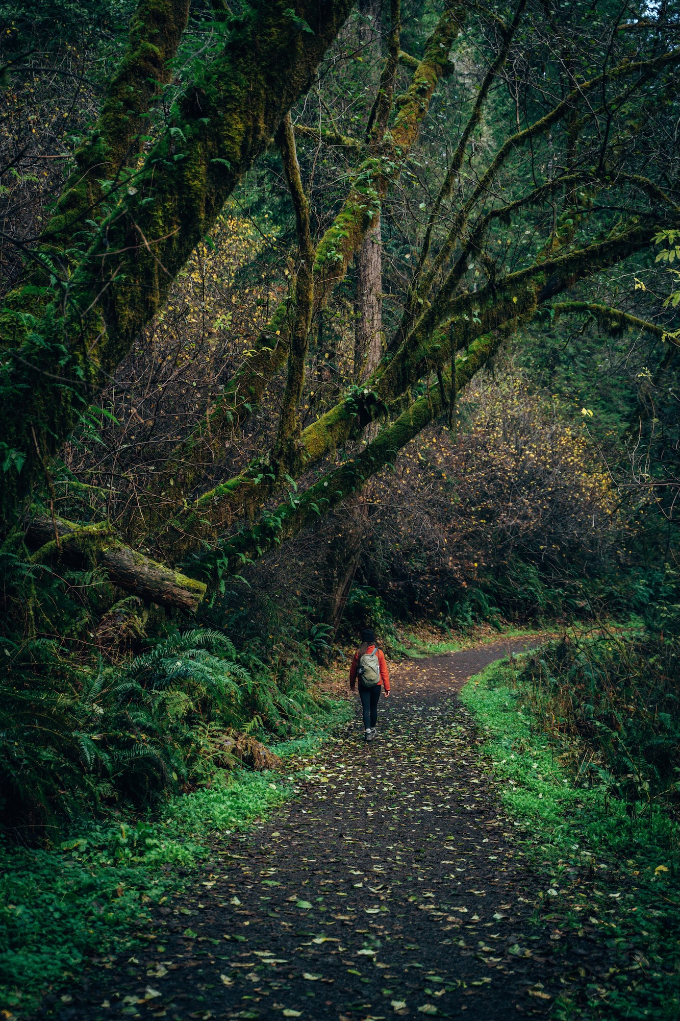
STILLWATER COVE CANYON TRAIL (SONOMA COAST)
This is definitely one of the quieter and lesser-visited coastal hikes along the Sonoma Coast. Located in Stillwater Cove Regional Park, it feels less developed and more naturally preserved than many nearby trails. The canyon environment creates a sheltered contrast to the exposed coastline. It’s a hike that rewards slower pacing.
What makes this trail stand out is the redwood-filled canyon that feels completely removed from the nearby coastline. Towering trees, lush vegetation, and the sound of the creek create a peaceful atmosphere that’s hard to find along much of the Sonoma Coast. The canyon stays cool and shaded throughout much of the hike, making it especially enjoyable during warmer months.
- DIFFICULTY – Easy
- LENGTH – 1.3mi / 2.1km
- ELEVATION GAIN – 134 ft
- TIME NEEDED – 1 hour
- PET FRIENDLY – Pets are permitted
- Save the hike on AllTrails
RUSSIAN GULCH FERN CANYON & WATERFALL LOOP (MENDOCINO COAST)
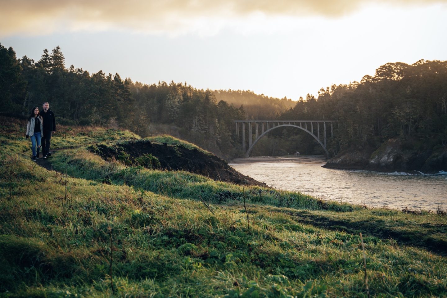
Located in Russian Gulch State Park, this is one of our favorite short hikes along the Northern California coast because it packs in so much variety in a relatively small area. Unlike many coastal trails that stay focused on ocean views, this one pulls you into a lush canyon that feels completely removed from the shoreline. Towering trees, fern-covered walls, and a quiet creek create a calm, immersive atmosphere that immediately stands out. It’s the kind of trail that keeps you engaged the entire way without ever feeling repetitive.
The loop begins in dense forest before gradually following the canyon floor toward Russian Gulch’s seasonal waterfall. During wetter months, the waterfall is at its most impressive and becomes a clear highlight of the hike. From there, the trail transitions again as it climbs toward exposed coastal bluffs overlooking the Pacific Ocean. That shift from shaded canyon to open coastline is what makes this hike feel so dynamic and memorable.
- DIFFICULTY – Challenging
- LENGTH – 6.2mi / 9.9km
- ELEVATION GAIN – 544 ft
- TIME NEEDED – 2-3 hours
- PET FRIENDLY – Pets are not permitted
- Save the hike on AllTrails
LEARN MORE ABOUT THIS HIKE AND OTHER THINGS TO DO NEAR IT IN OUR 10 OUTDOORSY THINGS TO DO ALONG THE MENDOCINO COAST.
SANDSTONE PEAK (SANTA MONICA MOUNTAINS)
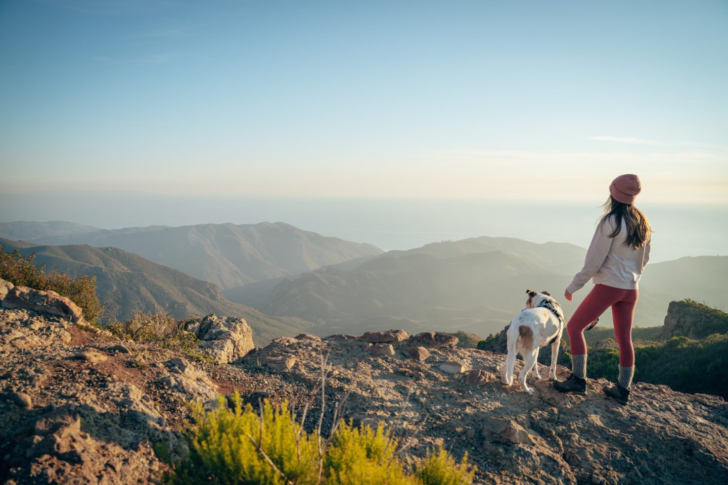
Located in the Santa Monica Mountains, Sandstone Peak is one of the best coastal summit hikes in Southern California and delivers a surprisingly big payoff for the effort required. The trail feels rugged in sections but remains very accessible for most hikers, with steady climbs and open ridgelines that keep the scenery constantly engaging. Throughout the hike, you’re reminded just how close you are to the Pacific Ocean, with mountain terrain and coastal views blending together in a way that feels unique to this part of California. It’s one of those hikes that feels more impressive than you expect going into it.
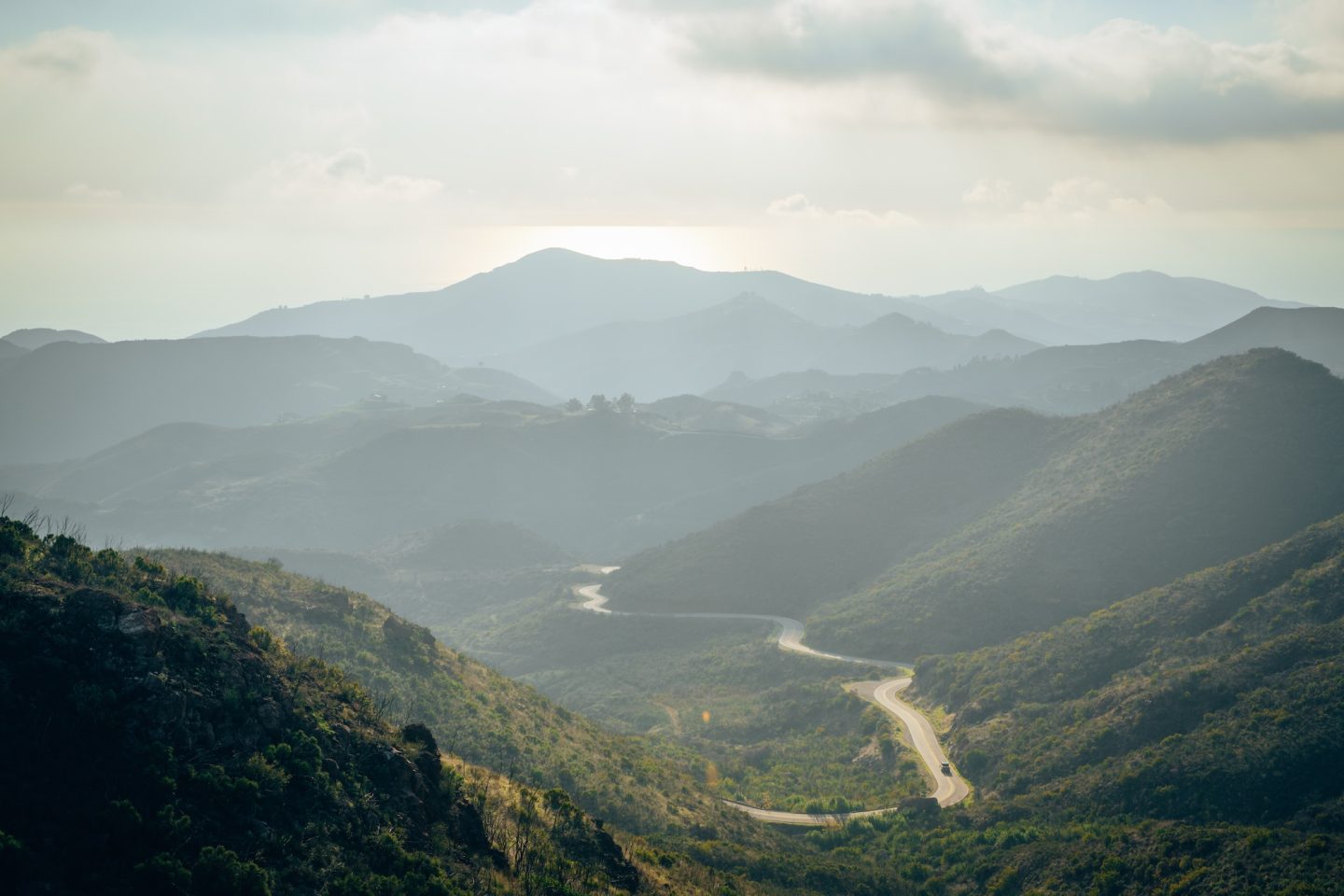
The summit is what makes this hike stand out, especially considering how manageable the mileage is. From the top, you get sweeping views of the Pacific Ocean, Channel Islands, and the layered ridgelines of the Santa Monica Mountains. On clear days, the visibility stretches for miles in every direction. It’s a classic example of a hike that delivers far more than the effort suggests, which is why it remains one of our favorites in the region.
- DIFFICULTY – Challenging
- LENGTH – 3.2mi / 5.1km
- ELEVATION GAIN – 997 ft
- TIME NEEDED – 2-3 hours
- PET FRIENDLY – Pets are permitted
- Save the hike on AllTrails
NORTH RIDGE & SUNSET LOOP (ANGEL ISLAND STATE PARK)
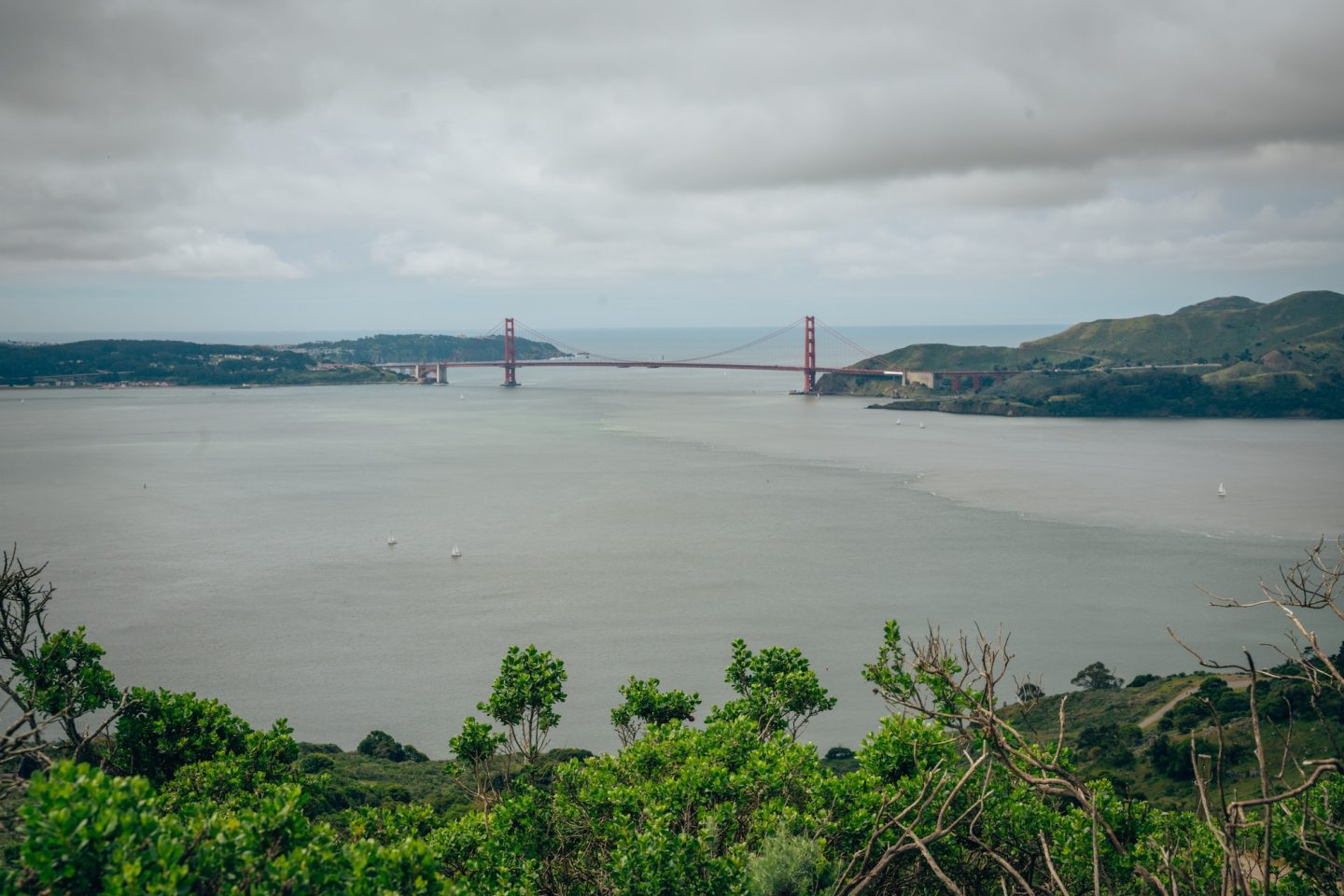
This hike, located in Angel Island State Park, offers one of the best panoramic viewpoints in the entire Bay Area. The island setting immediately separates it from mainland hikes. Everything feels more open and elevated because of the surrounding water. The perspective shifts constantly as you climb.
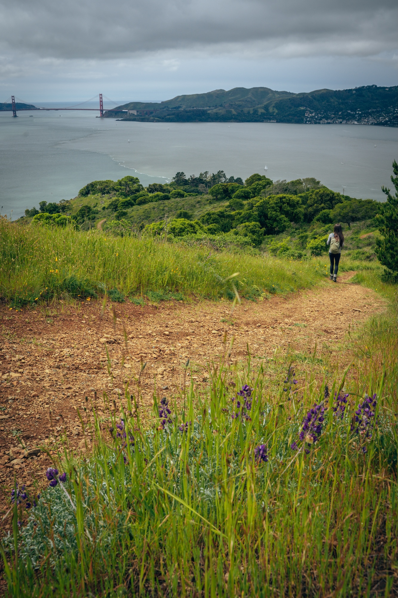
What makes this trail unique is the near 360º views of the San Francisco Bay. Views stretch from San Francisco to Marin and beyond, depending on conditions. The ferry access adds a natural sense of separation from the city. It feels like a full escape despite being close to major population centers.
- DIFFICULTY – Moderate
- LENGTH – 5.1mi / 8.2km
- ELEVATION GAIN – 790 ft
- TIME NEEDED – 2-3 hours
- PET FRIENDLY – Pets are not permitted
- Save the hike on AllTrails
LEARN MORE ABOUT THIS PARK AND OTHER STATE PARKS TO VISIT IN OUR GUIDE TO EXPLORING THE BEST STATE PARKS OF CALIFORNIA AND ANGEL ISLAND STATE PARK – CALIFORNIA’S ONLY FLOATING STATE PARK.
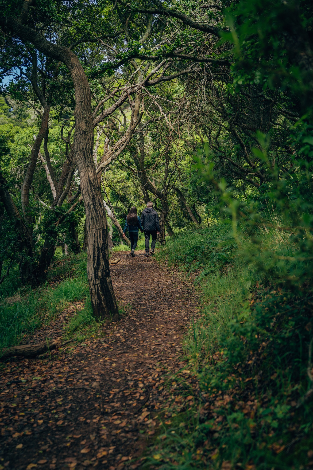
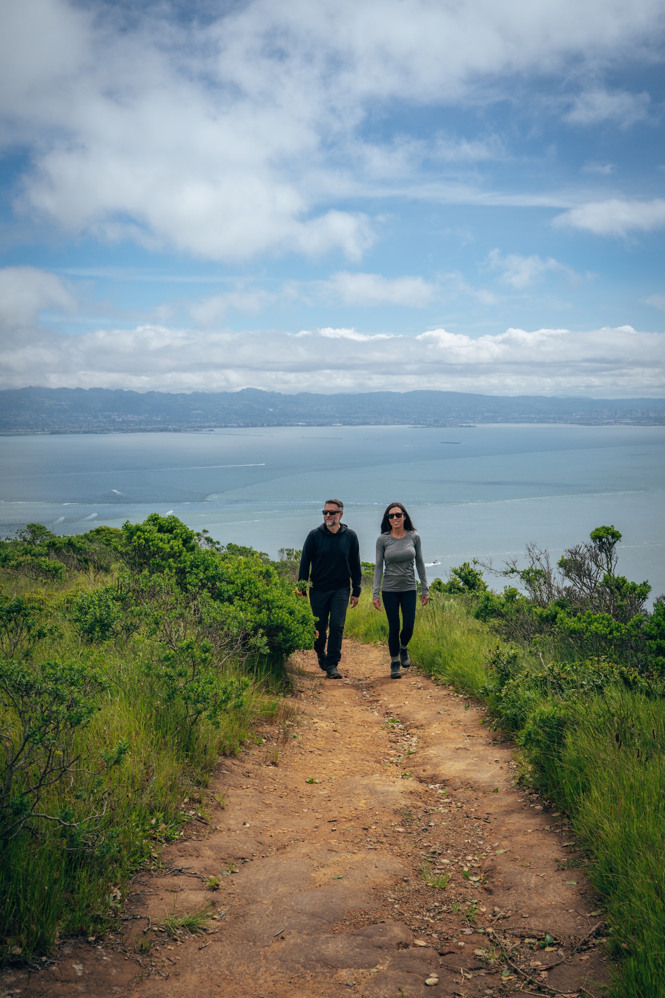
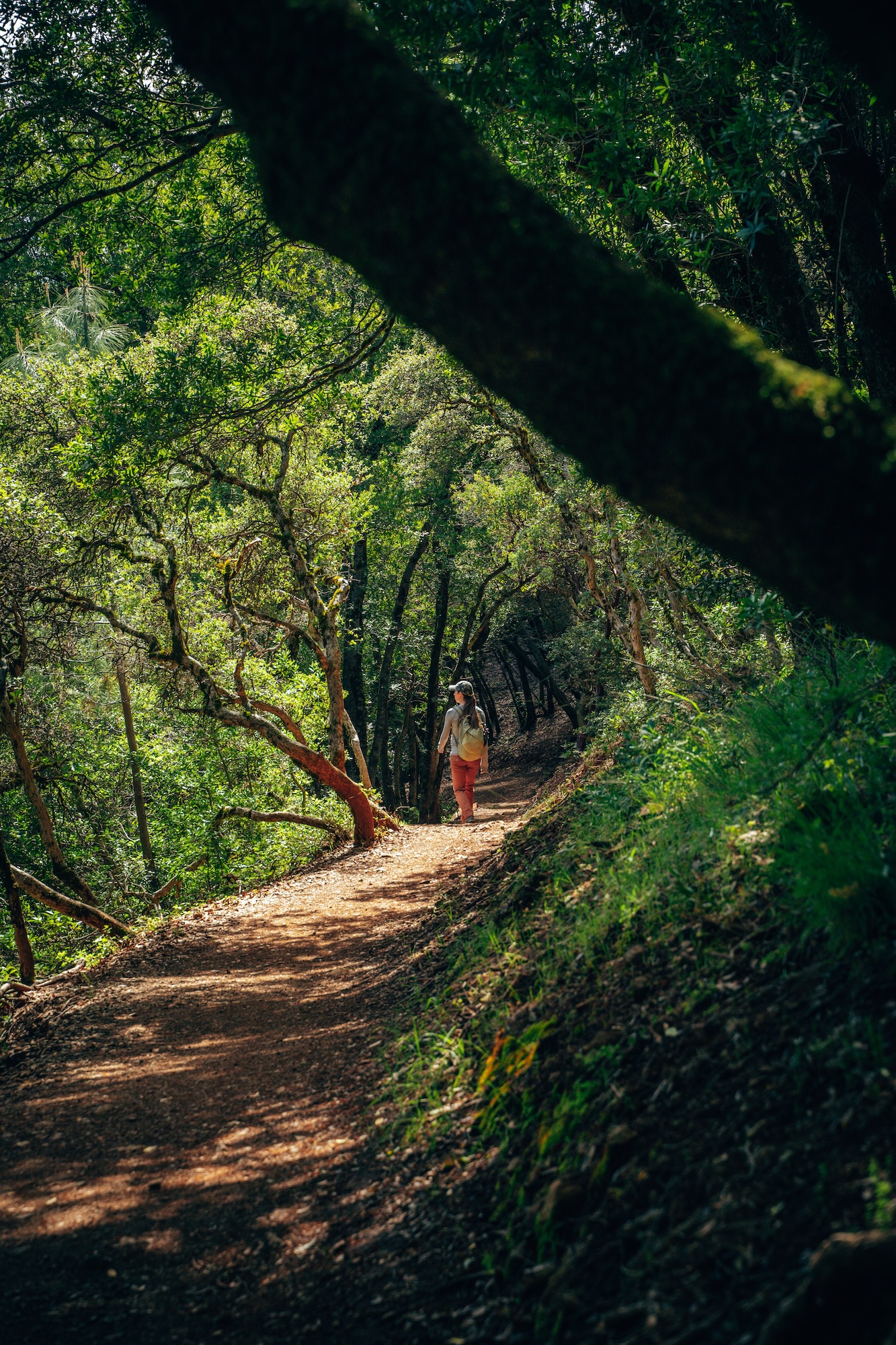
MOUNT UMUNHUM TRAIL (FROM BALD MOUNTAIN PARKING LOT)
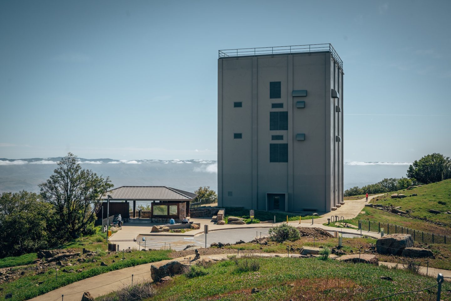
This is one of the most rewarding and underrated summit hikes in the Bay Area. The Mount Umunhum Trail starts in quiet foothills and gradually transitions into exposed ridgelines with expanding views. The elevation gain is significant, but because of the trail length it feels incredibly gradual.
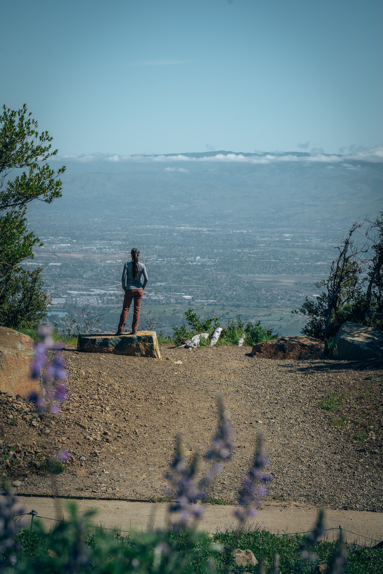
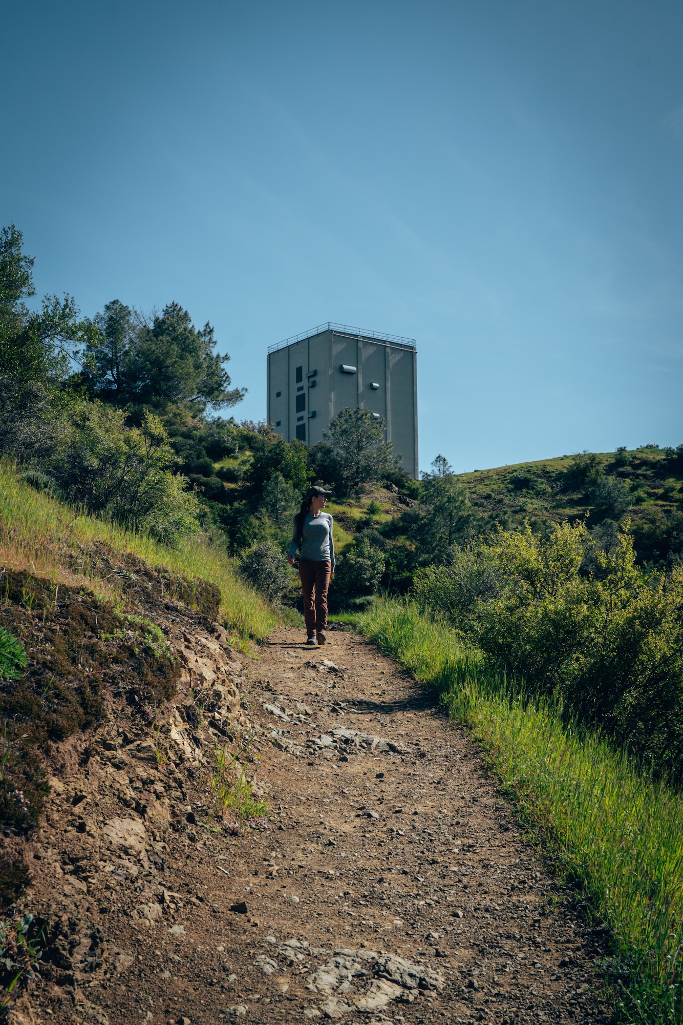
What makes this hike stand out is the final payoff at the summit. The historical radar tower appears suddenly, and the view stretches across nearly the entire Bay Area. On clear days, the visibility feels almost unreal. It’s one of those hikes where the destination completely justifies the effort.
- DIFFICULTY – Moderate
- LENGTH – 8.2mi / 13.2km
- ELEVATION GAIN – 1,187 ft
- TIME NEEDED – 3-4 hours
- PET FRIENDLY – Pets are not permitted
- Save the hike on AllTrails
THE BEST HIKES NEAR ME IN CALIFORNIA
After hiking all over California for more than a decade, these are the trails that continue to stand above the rest. Of course, narrowing California down to just a handful of hikes is near impossible. The state is packed with incredible trails, and there are plenty that could have earned a spot on this list. Still, if you’re looking for a collection of hikes that showcase some of the most beautiful and diverse landscapes California has to offer, these are hard to beat. Whether you’re planning your next weekend adventure or searching for the best hikes near you, any trail on this list is a great place to start.
Have some other hikes you’d recommend? Put them in the comments below! We’d love to check them out.
CALIFORNIA BUCKET LIST MAP & GUIDE
We’ve spent over 10 years exploring and mapping out this incredible state. And we put all the details, info, links, tips and recommendations in to a single California Bucket List Guide. Like GPS location, dog-friendliness, cost, and more. This guide now has over 850 unique locations and things to do around California, with some bonus locations in Oregon and Nevada. So if you’re looking for things to do, or places to go, this guide is for you!
Not much of a planner? No worries! We also have curated itineraries to make the planning process easier for you. And if that isn’t enough, book a call with us or have us create a custom itinerary for you! We are here to help!
Let us know if you have any questions in the comments below. And happy exploring!
- Ryan & Katy
