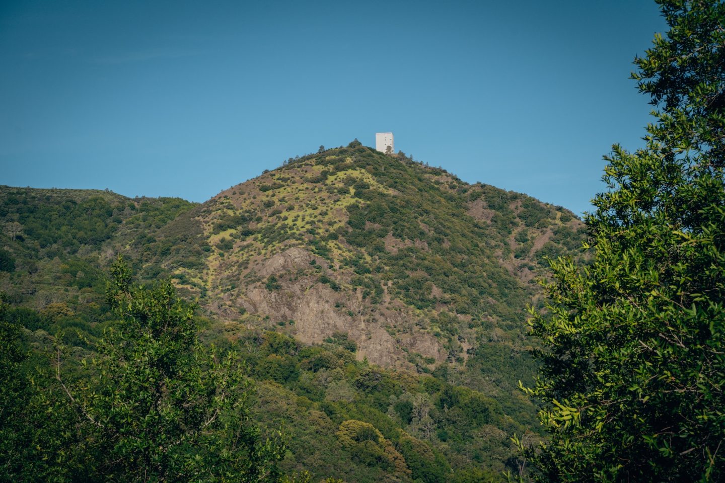
Have you ever been in the San Francisco Bay Area, and noticed a giant cube-like object on top of a mountain off in the distance? If so, you’re not alone! Nestled in the heart of the Santa Cruz Mountains, Mount Umunhum is a hidden gem in the Bay Area that offers breathtaking views and an unforgettable hiking experience.
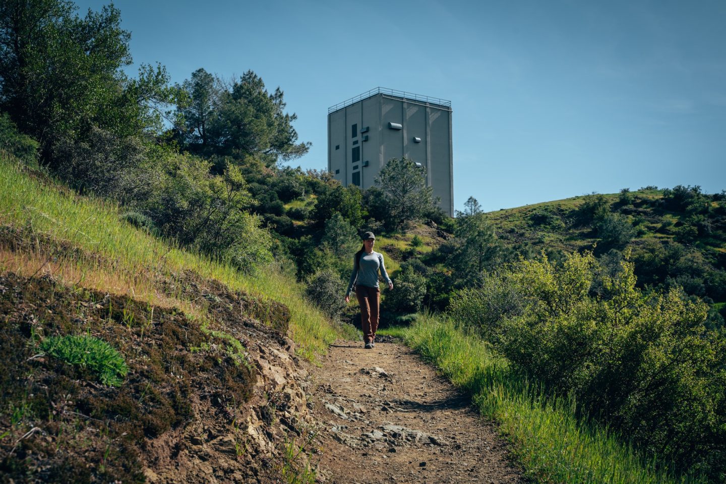
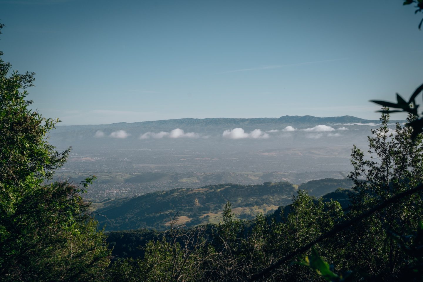
At 3,486 feet, this peak is one of the highest points in the region and is known for its rich history and the iconic cube-shaped radar tower at its summit. Whether you’re a seasoned hiker or just looking for a peaceful escape from city life, the trail to Mount Umunhum has something for everyone. You’ll experience a perfect mix of natural beauty, cultural significance, and panoramic vistas of the surrounding valleys, the ocean, and even the distant Sierra Nevada. If you’re in search of a rewarding outdoor adventure, Mount Umunhum is a hike you absolutely must do!
WHERE IS MOUNT UMUNHUM?
Mount Umunhum is located in the Santa Cruz Mountains, about 20 miles south of downtown San Jose in California’s San Francisco Bay Area. Part of the Sierra Azul Open Space Preserve, the mountain sits within the larger Midpeninsula Regional Open Space District. The peak is easily accessible from the nearby towns of Los Gatos and Almaden Valley, making it a popular destination for locals and visitors alike. Its position within the Santa Clara County foothills allows for expansive views of the Silicon Valley, Monterey Bay, and the Pacific Ocean on clear days.
If you’re visiting San Francisco, it is roughly a 1.5 hour drive south to the trailhead.
THE HISTORY OF MOUNT UMUNHUM
Mount Umunhum holds deep historical significance, both culturally and militarily. Its name, meaning “Resting Place of the Hummingbird” in the Ohlone language, reflects the mountain’s importance to the indigenous Amah Mutsun tribe, who consider it a sacred site. In the mid-20th century, the U.S. Air Force built a radar station at the summit as part of a Cold War-era defense system, with the large, cube-shaped radar tower still standing as a prominent feature. Known as the Almaden Air Force Station, this facility was operational from the 1950s until its closure in 1980. After years of restricted access, the Midpeninsula Regional Open Space District restored the mountain and opened it to the public in 2017. This change allows hikers to explore its rich history while enjoying its stunning natural beauty.
THE AMAH MUTSUN
The Amah Mutsun tribe, part of the larger Ohlone group, are the indigenous people who have lived in the Santa Cruz Mountains and surrounding areas for thousands of years. Mount Umunhum holds great spiritual and cultural significance for the Amah Mutsun. The mountain is considered a sacred site, deeply intertwined with their creation stories and traditional practices. For the Amah Mutsun, Mount Umunhum is a place of reflection, healing, and spiritual connection, where they would historically gather to perform ceremonies and honor the land. The name itself, linked to the hummingbird, a revered animal in their culture, symbolizes peace and life. Despite the disruptions caused by colonization and the construction of the Almaden Air Force Station, the tribe continues to advocate for the protection and recognition of their sacred sites. This includes Mount Umunhum, as part of their ongoing efforts to preserve their heritage and reclaim their ancestral lands.
If you are planning to visit this location, PLEASE be respectful of the land. Practice Leave No Trace and leave the area as if you were never there!
ALMADEN AIR FORCE STATION
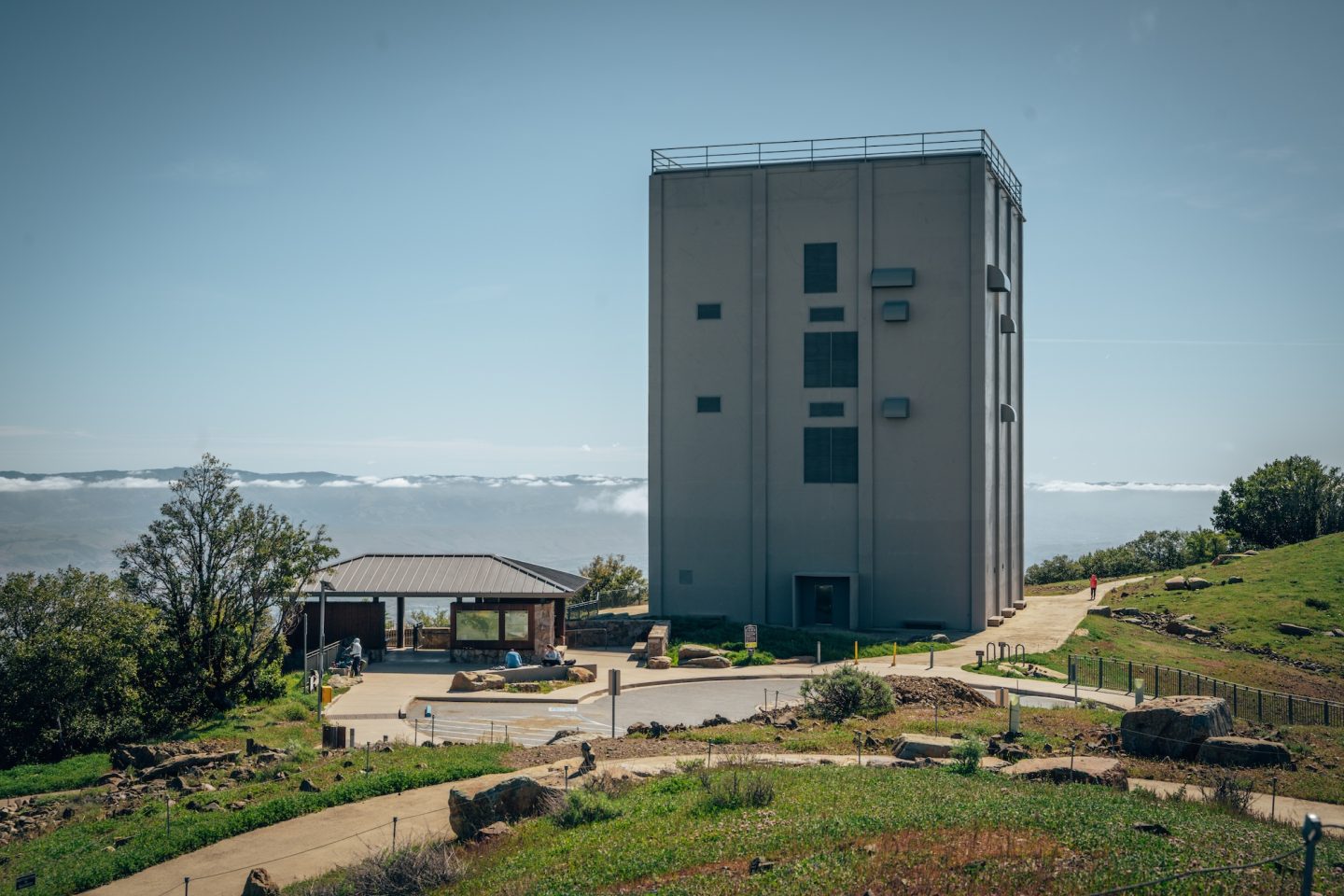
The Almaden Air Force Station, established in the 1950s, was a Cold War radar facility designed to detect Soviet aircraft and missile threats as part of the U.S. early warning defense system. Operated by the 682nd Radar Squadron, it played a key role in the nationwide SAGE (Semi-Automatic Ground Environment) network. The station housed military personnel and their families, creating a small community on the mountain. After advancements in technology reduced the need for such stations, it was decommissioned in 1980 and left abandoned. In 2017, following extensive restoration efforts by the Midpeninsula Regional Open Space District, the site was reopened to the public, with the cube-shaped radar tower preserved as a historical landmark.
NEW ALMADEN QUICKSILVER MINES
Before Mount Umunhum became known for its military history and hiking trails, it was the site of extensive mining operations in the 19th and early 20th centuries. The nearby New Almaden Quicksilver Mines, located in the surrounding hills, were once the richest mercury mines in North America. Mercury, or quicksilver, was crucial for processing gold and silver during the California Gold Rush, making the New Almaden Mines an important industrial site.
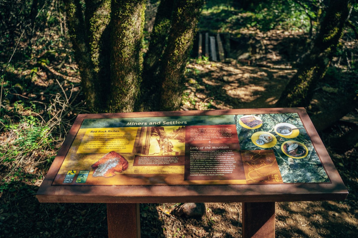
Although Mount Umunhum itself wasn’t a direct mining site, the surrounding area, including nearby Mount Thayer, was heavily impacted by mining activity. The mining infrastructure, including roads and tunnels, transformed the landscape. And you can still see remnants of this era today in the form of old mining equipment and structures scattered throughout the region. The mercury mining industry declined by the early 20th century, but the legacy of these operations remains part of the area’s history.
BEST TIME TO VISIT MOUNT UMUNHUM
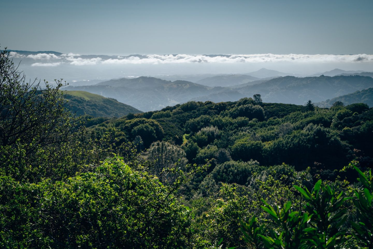
The best times to visit Mount Umunhum are during the spring and fall, when the weather is mild, and the views are often clearest. Springtime offers vibrant wildflowers and lush greenery along the trail, making it ideal for nature enthusiasts. Fall provides cooler temperatures and clear skies, perfect for panoramic views of the Bay Area, the Pacific Ocean, and even the distant Sierra Nevada. Summers can be hot and dry, especially in the afternoons, but early morning hikes can still be enjoyable. Winter is also a good time to visit, as long as the weather cooperates, though fog and rain may limit visibility and trail conditions. Regardless of the season, it’s always best to check the weather forecast before planning a trip.
HIKING MOUNT UMUNHUM
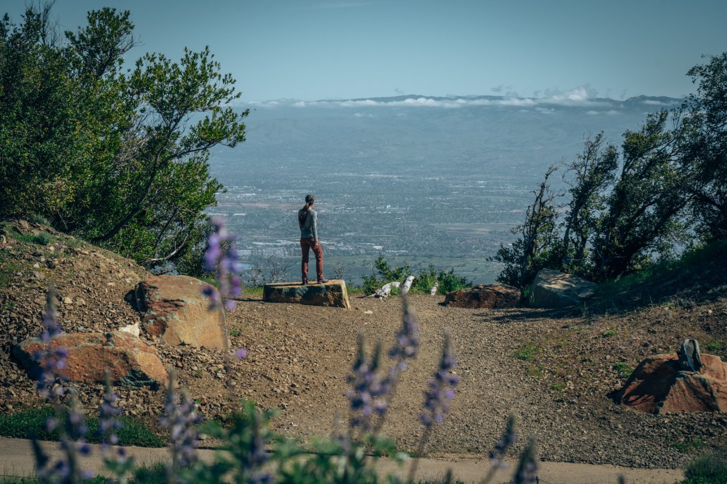
The 4-mile hike up to Mount Umunhum offers a moderate challenge with a well-maintained trail that gradually ascends to the summit. Along the way, hikers can enjoy sweeping views of Silicon Valley, the Santa Cruz Mountains, and the Pacific Ocean. The trail winds through diverse landscapes, from oak woodlands to chaparral. It provides plenty of opportunities to spot wildlife like deer, hawks, and a variety of native plants. In the spring, colorful wildflowers line the path, adding a scenic touch to the hike. Historical markers along the way offer insights into the area’s past. Including the mountain’s significance to the Amah Mutsun tribe and the Cold War-era Almaden Air Force Station. At the summit, hikers can enjoy 360-degree views and can explore the iconic cube-shaped radar tower, a lasting symbol of the mountain’s history.
Despite being an 8-mile hike round-trip, we have found it to be only moderately challenging. The incline is gradual as you make your way up to the summit. And with numerous spots to stop and enjoy the views, it ends up being a very enjoyable hike!
- DIFFICULTY – Moderate
- LENGTH – 8.0mi / 12.9km up and back
- TIME NEEDED – 3-4 hours
- PET FRIENDLY – Pets are not permitted
MAP OF THE SAN FRANCISCO BAY AREA
Looking for other hikes and things to do in the San Francisco Bay Area? If so, this map is for you. Not only does our interactive map of California have ALL the details and location info for this hike, but also over 450 other points of interest in California. With all of the location specific details like GPS location, dog-friendliness, cost, and more, as well as an itinerary creator. This map is the perfect trip planning companion.
Not much of a planner? No worries! We also have curated itineraries to make the planning process easier for you. And if that isn’t enough, book a call with us or have us create a custom itinerary for you! We are here to help!
FOR MORE BAY AREA INSPO:
- 10 WAYS TO VIEW GOLDEN GATE BRIDGE
- A WEEKEND IN MORGAN HILL CALIFORNIA
- 10 THINGS TO DO NEAR SAN JOSE CALIFORNIA
MOUNT UMUNHUM: A BAY AREA HIKE YOU MUST DO!
Hiking Mount Umunhum is an experience you won’t want to miss! As you hike, you’ll soak in stunning views that stretch from Silicon Valley to the Pacific Ocean. All while experiencing the rich history and culture that make this spot so special. Whether you’re exploring the trail surrounded by wildflowers, soaking in the peaceful vibe at the summit, or checking out the cool radar tower, there’s something for everyone. It’s a perfect getaway for nature lovers, history buffs, or anyone just looking to escape the hustle and bustle. So grab your hiking boots, pack some snacks, and hit the trail—Mount Umunhum is calling!
Leave a comment below to let us know what you thought, or if you have any follow-up questions!
