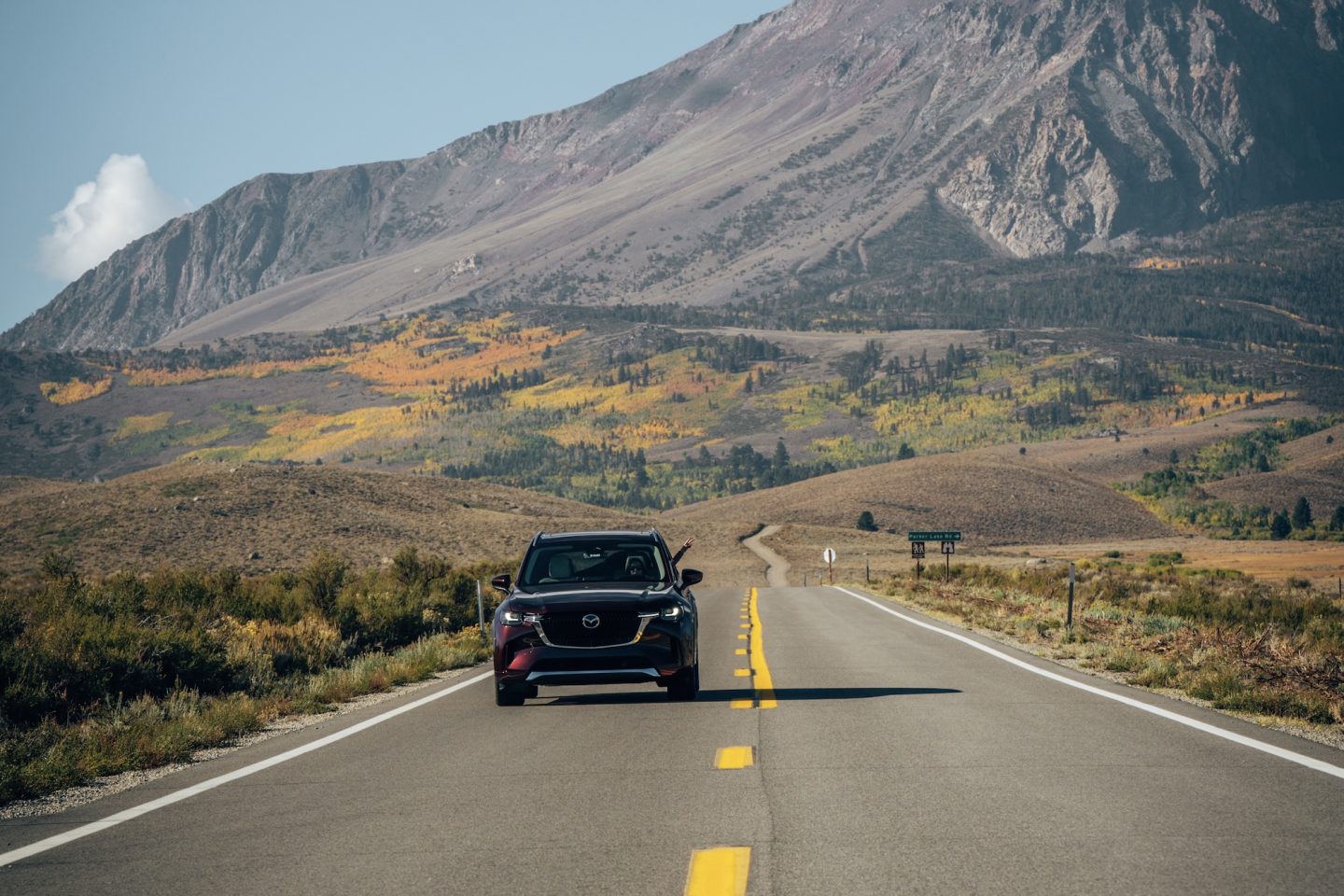
Highway 395 is one of the most scenic and beginner-friendly road trips in California. Running along the eastern edge of the Sierra Nevada, this route connects alpine lakes, volcanic landscapes, historic sites, and wide-open desert views. Unlike California’s coastal highways, Highway 395 feels quieter and more expansive, with fewer crowds and constant scenery changes. This guide is designed to help first-timers plan an easy north-to-south journey, highlighting the must-see stops that make the Eastern Sierra so unforgettable.
WHERE IS HIGHWAY 395
Highway 395 runs along the eastern side of California, tracing the dramatic boundary between the Sierra Nevada mountains and the high desert of the Owens Valley. In California, the route stretches roughly 350 miles from the Nevada border just southeast of Lake Tahoe, to Victorville just east of Los Angeles. The most scenic and well-known portion winds through the Eastern Sierra, passing near Yosemite National Park, Mammoth Lakes, and Lone Pine. This section of the highway is famous for its towering peaks, open valleys, and easy access to some of the state’s most diverse landscapes.
NORTHERN EASTERN SIERRA
The Northern Eastern Sierra is defined by alpine scenery, volcanic features, and easy access to Yosemite’s eastern entrance. This region is home to high-elevation lakes, wide open basins, and some of the most unique geology in California. It’s an ideal starting point for a Highway 395 road trip, especially in late spring through fall when mountain passes are open.
YOSEMITE NATIONAL PARK
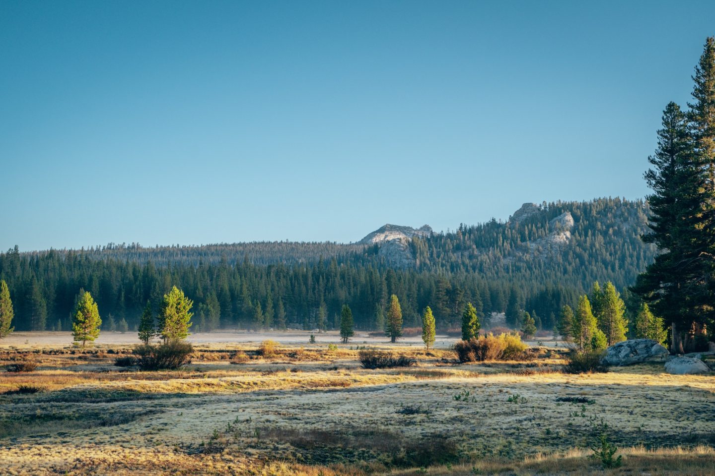
While Yosemite National Park is most often associated with its western entrances, the park’s eastern side plays an important role in a Highway 395 road trip. Accessed via Tioga Pass, this high-elevation section of Yosemite features alpine meadows, granite domes, and scenic pullouts that feel quieter than the valley below. Tuolumne Meadows is the main highlight, offering short walks, river views, and expansive mountain scenery. Keep in mind that Tioga Pass is typically only open seasonally, usually from late spring through fall, depending on snow conditions.
Check out our Yosemite blogs below:
- ULTIMATE GUIDE TO YOSEMITE NATIONAL PARK CALIFORNIA
- 7 SOFT ADVENTURE THINGS TO DO IN YOSEMITE
- DAY TRIP TO YOSEMITE NATIONAL PARK: YOUR ULTIMATE GUIDE
- YOSEMITE FIREFALL: WHAT TO KNOW BEFORE YOU GO
BODIE STATE HISTORIC PARK
A fascinating glimpse into California’s Gold Rush past and, one of the best-preserved ghost towns in the West is Bodie State Historic Park. Once a booming mining town, Bodie now exists in a state of “arrested decay,” with buildings, interiors, and artifacts left largely as they were. Visitors can explore the dirt streets, peer into old homes and shops, and imagine life during the town’s short-lived peak. Located just off Highway 395, Bodie makes for a memorable detour that adds history and context to an Eastern Sierra road trip.
- Day-use entry fee: $8 per adult
- Pet-friendly: Yes, on leash and only in designated areas
- Time needed: 1-2 hours
- Soft adventure: Yes, definitely!
MONO LAKE
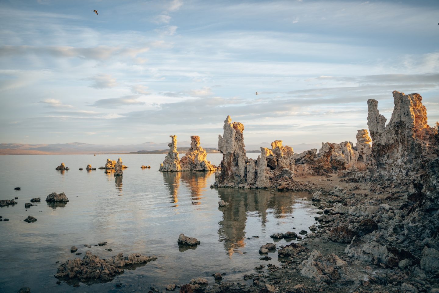
One of the most unique natural landmarks along Highway 395 is Mono Lake, best known for its otherworldly tufa formations. The South Tufa Area offers the easiest access to these calcium-carbonate towers, with short trails leading right to the shoreline. This ancient, saline lake is thousands of years old and supports a delicate ecosystem found nowhere else. Sunrise and sunset are especially striking here, when the light reflects off the lake and the Sierra Nevada rises dramatically in the distance.
- Day-use entry fee: $3 per vehicle
- Pet-friendly: Yes, on leash and only in designated areas
- Time needed: 1-2 hours
- Soft adventure: Yes, definitely!
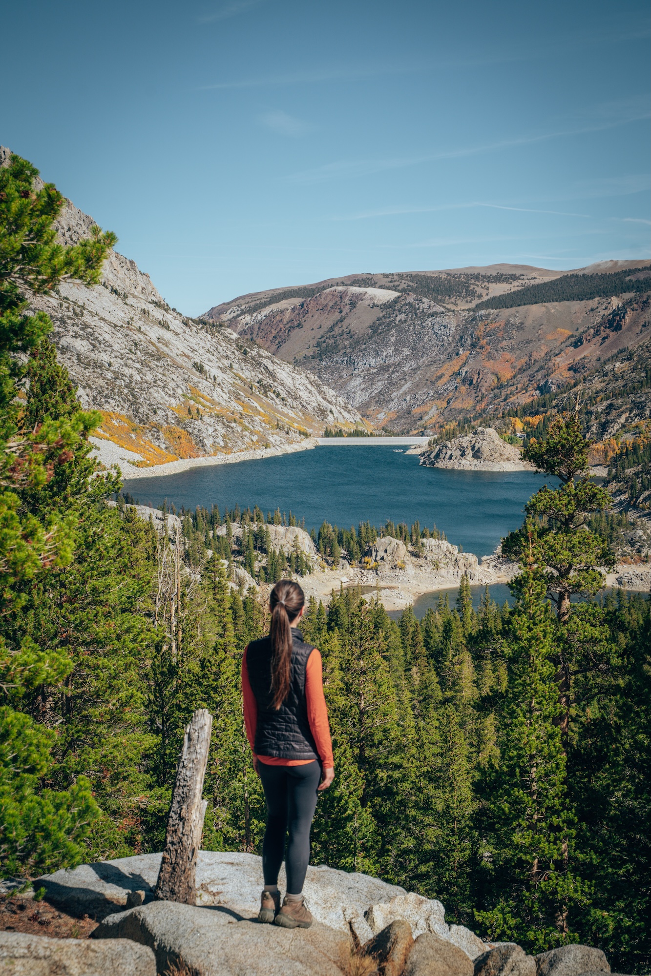
JUNE LAKE LOOP
The June Lake Loop is a short but incredibly scenic 16-mile drive just off Highway 395. The route winds past turquoise lakes, forested slopes, and dramatic mountain backdrops, making it worth the detour even without stopping. The small town of June Lake sits along the loop and offers a laid-back mountain feel. With frequent pullouts and sweeping views, the drive itself is one of the highlights of this stretch of the Eastern Sierra.
- Day-use entry fee: Free
- Pet-friendly: Yes, on leash and only in designated areas
- Time needed: 1-2 hours
- Soft adventure: Yes, definitely!
MAMMOTH LAKES AREA
The Mammoth Lakes area is one of the most activity-packed regions along Highway 395. Known for its alpine lakes, volcanic features, and dramatic mountain scenery, it offers something in every season. Summer brings hiking, lakes, and waterfalls, while winter transforms the area into a major ski destination. Its central location makes Mammoth an ideal base for exploring nearby parks and natural landmarks.
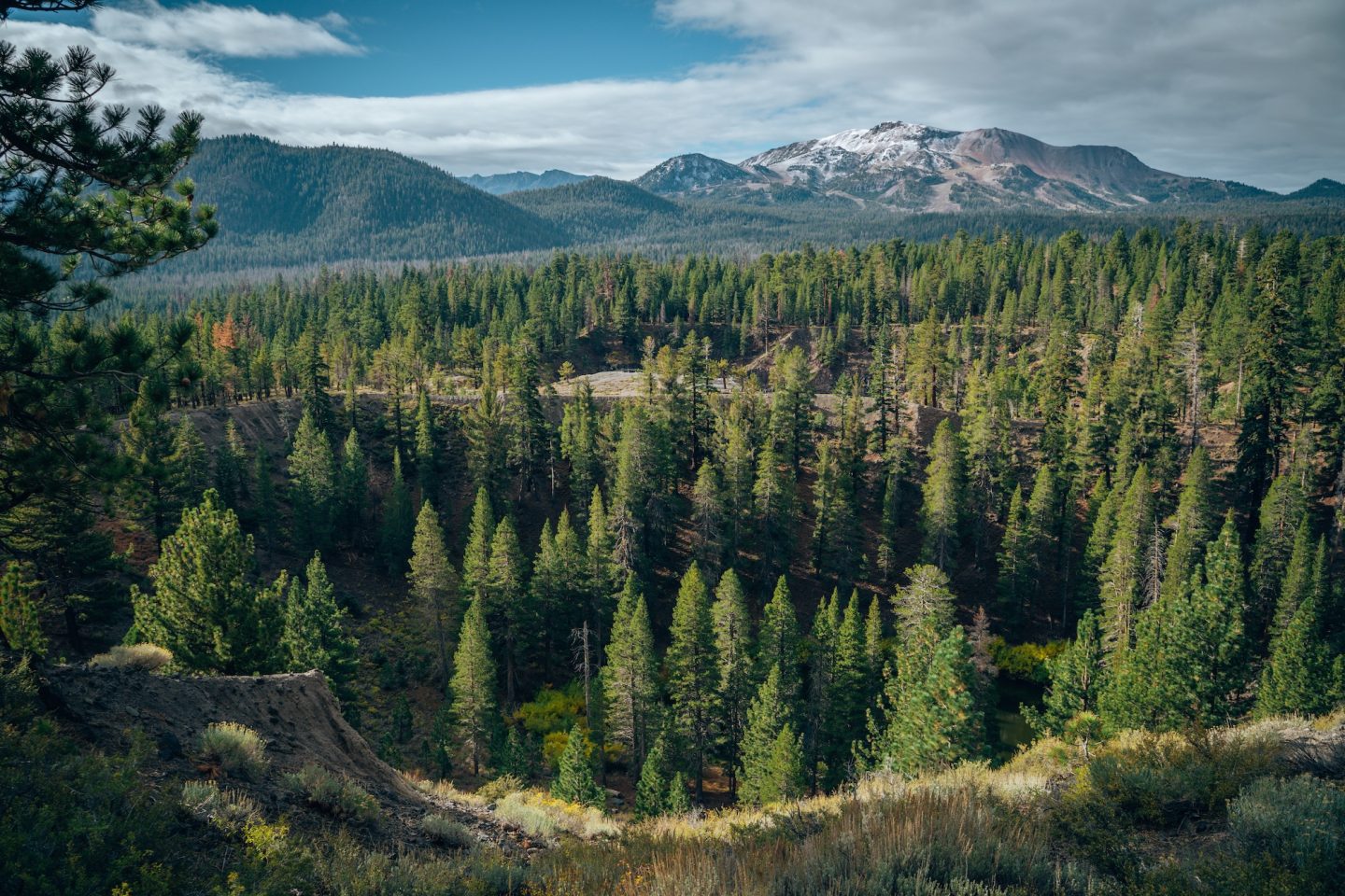
INYO CRATERS
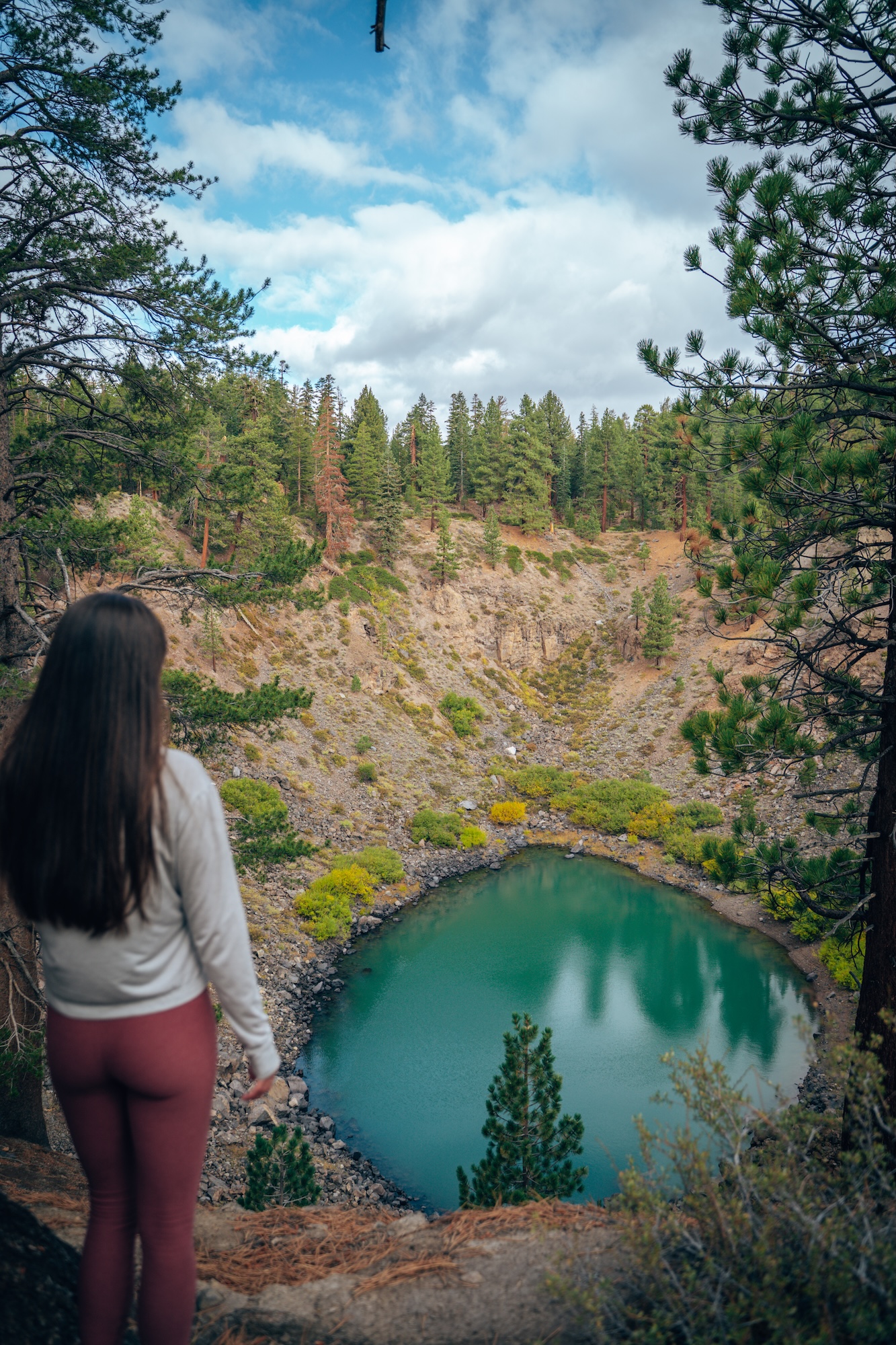
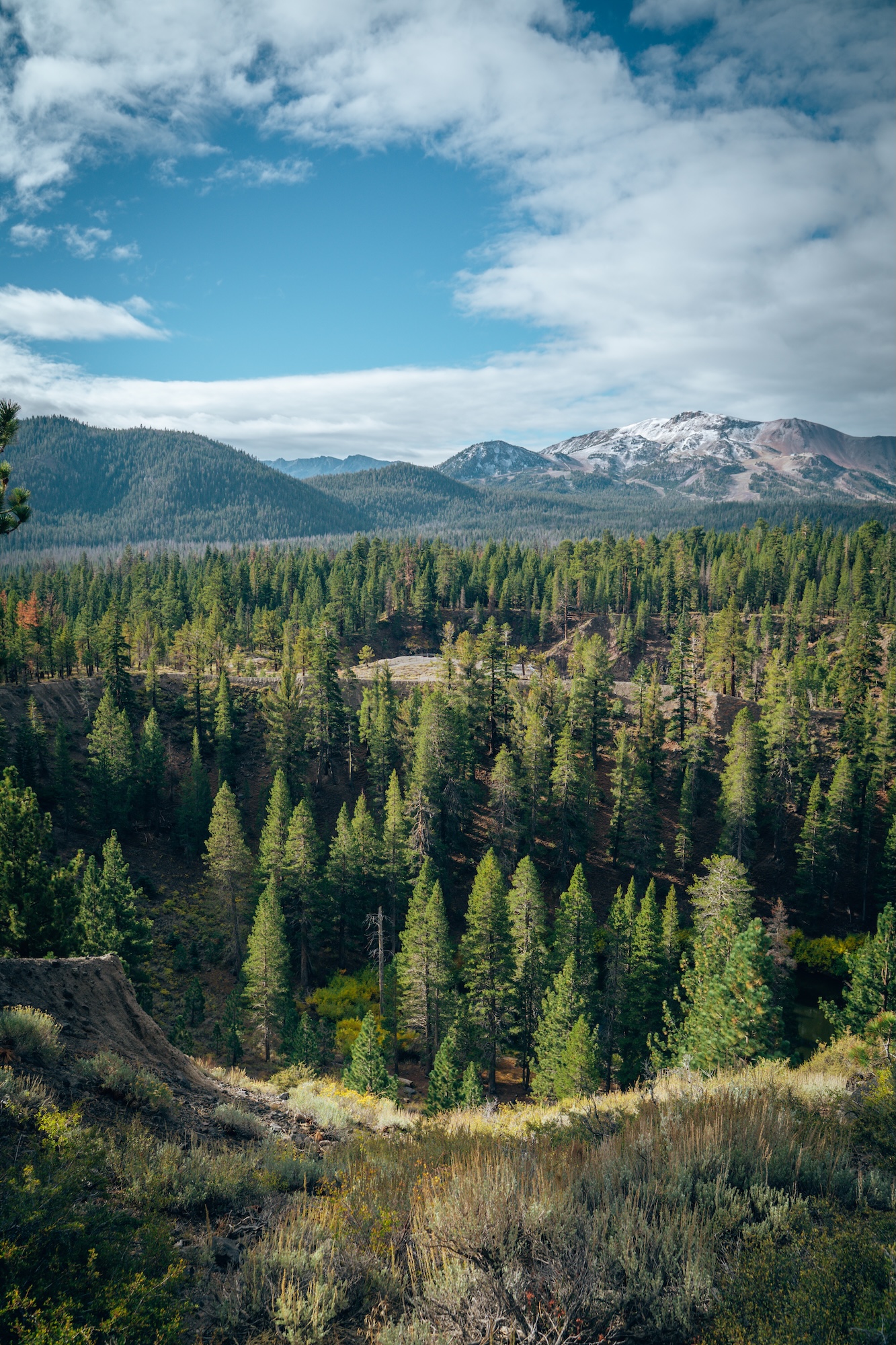
The Inyo Craters offer a relatively quick and interesting stop along Highway 395, showcasing the Eastern Sierra’s volcanic history. This small chain of explosion craters is easily accessed via a short drive along a forest road and a moderate 1.5mi looped trail. The most prominent crater features a deep blue lake surrounded by forest, creating a striking contrast against the rugged landscape. It’s an easy stop that adds a unique geological element to a Northern Eastern Sierra itinerary.
- Day-use entry fee: Free
- Pet-friendly: Yes, on leash and only in designated areas
- Time needed: 1-2 hours
- Soft adventure: Yes, definitely!
DEVILS POSTPILE NATIONAL MONUMENT
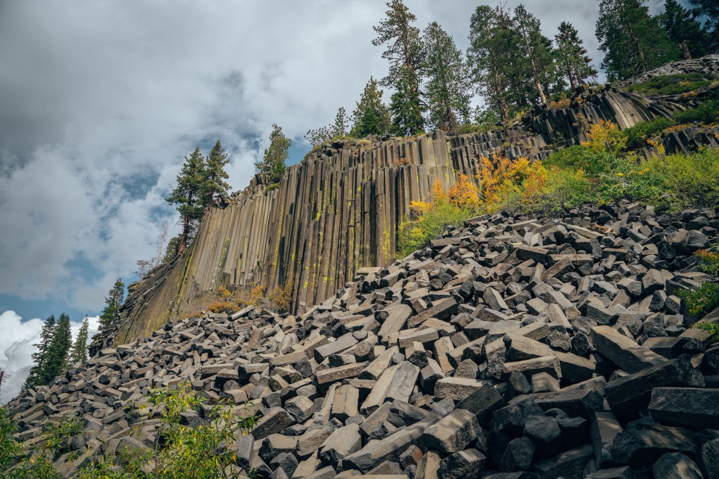
Another one of the most unique geological features in the Eastern Sierra is Devils Postpile National Monument. The monument is best known for its towering basalt columns, formed by ancient lava flows that cooled and fractured into hexagonal shapes. Access is seasonal, and during peak summer months visitors typically use a mandatory shuttle from Mammoth Mountain. A short, mostly flat walk leads to the base of the formation, making it an easy and rewarding stop along Highway 395.
- Day-use entry fee: None (but there is a $15 per person shuttle service fee)
- Pet-friendly: Yes, on leash and only in designated areas
- Time needed: 1-2 hours
- Soft adventure: Yes, definitely!
RAINBOW FALLS
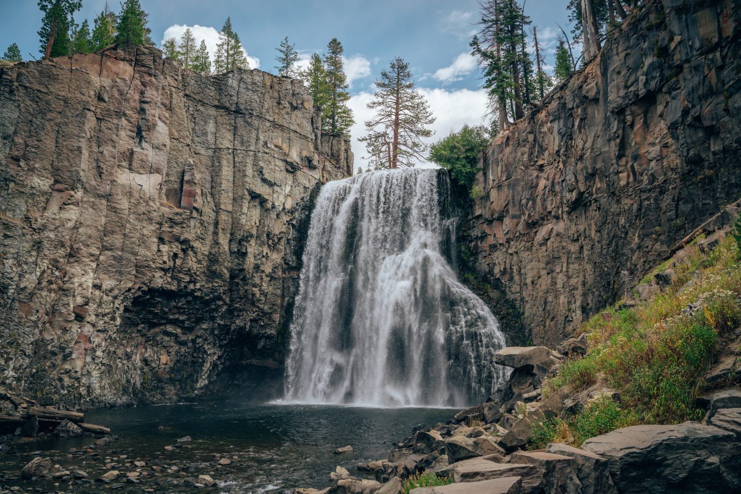
If you’re planning to visit Devils Postpile, Rainbow Falls is one of the most impressive waterfalls in the Mammoth Lakes area and a must-visit. The 101-foot waterfall is fed by the Middle Fork of the San Joaquin River and is known for the rainbows that form in the mist on sunny days. The hike to Rainbow Falls is about five miles round trip from the same shuttle stop and follows a scenic, mostly moderate trail. It’s a rewarding outing for visitors looking to pair dramatic scenery with a longer walk.
- Day-use entry fee: None (but there is a $15 per person shuttle service fee)
- Pet-friendly: Yes, on leash and only in designated areas
- Time needed: 2-3 hours
- Soft adventure: No, this is a more moderate adventure
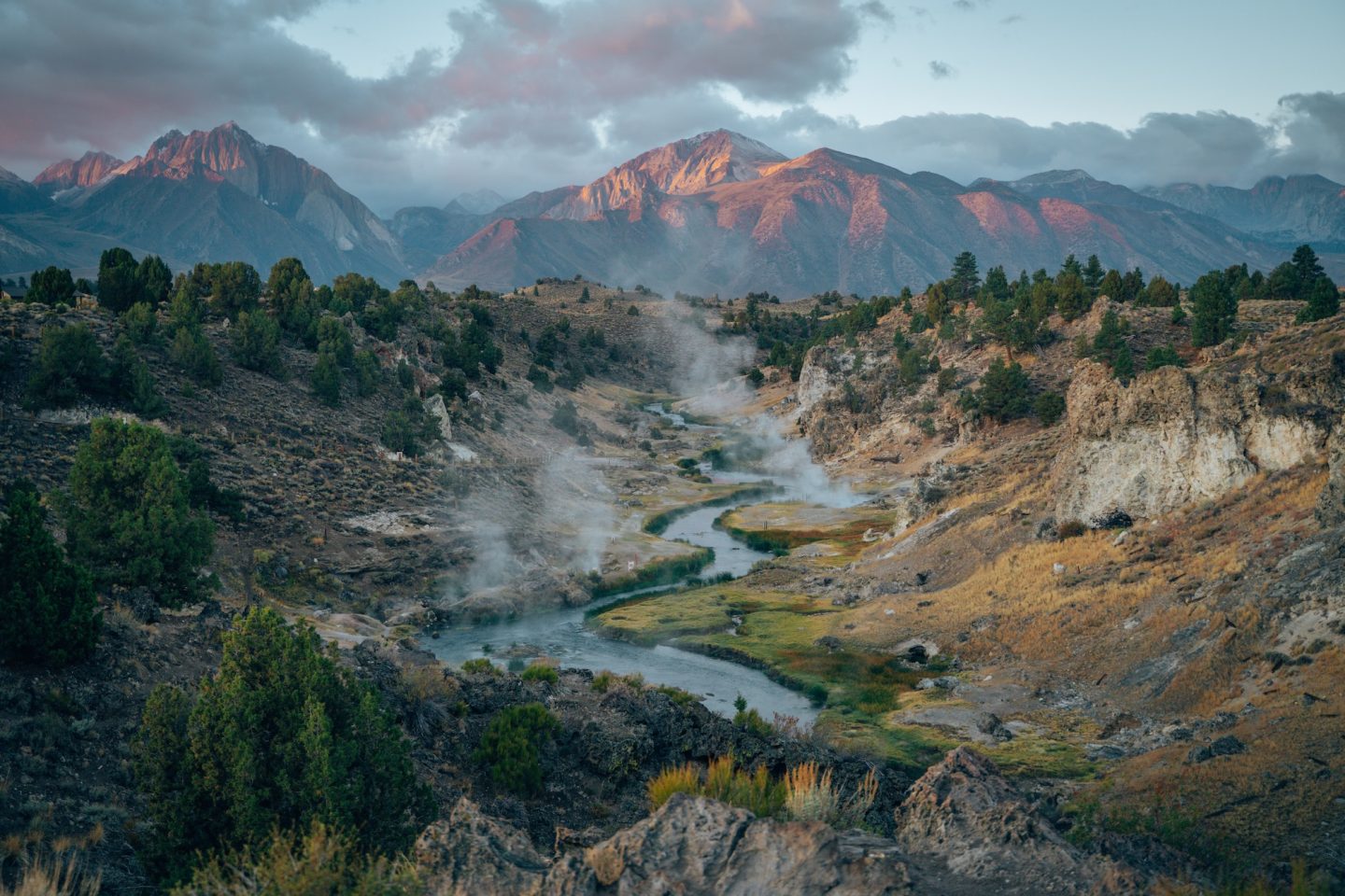
HOT CREEK GEOLOGIC SITE
This is easily one of the most incredible views along Highway 395. Hot Creek Geologic Site offers a striking look at the Eastern Sierra’s active geothermal landscape. Steaming vents, bubbling springs, and mineral-stained rock line the creek, creating an almost surreal setting. The site is easily accessed from Highway 395, with short walks and designated viewpoints along the rim. Due to unstable geothermal activity and sudden temperature changes, swimming and soaking are strictly prohibited. Even so, Hot Creek remains a worthwhile stop for its scenery and educational value.
- Day-use entry fee: None
- Pet-friendly: Yes, on leash and only in designated areas
- Time needed: 30mins – 1 hour
- Soft adventure: Yes, definitely!
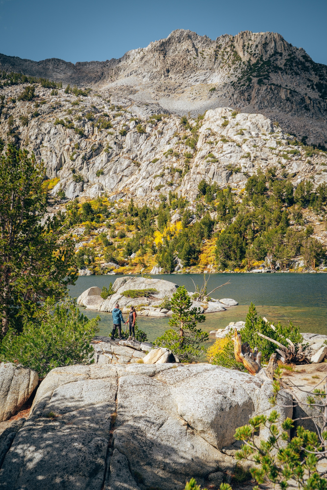
CONVICT LAKE
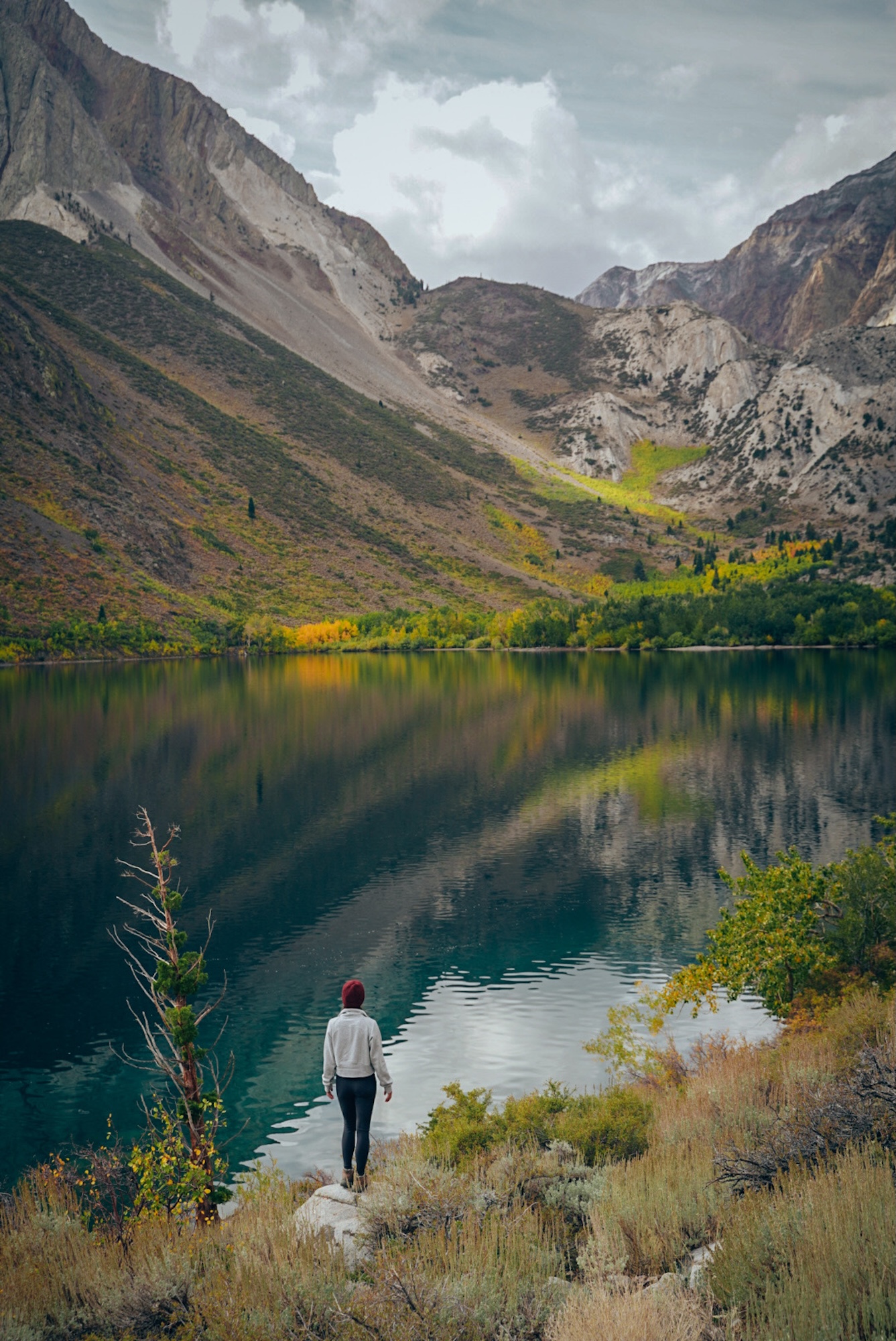
One of the most picturesque alpine lakes in the Eastern Sierra is Convict Lake. Surrounded by steep granite peaks, the lake is known for its deep blue water and dramatic reflections, especially in the morning. A flat, three-mile loop trail circles the shoreline, making it an easy and scenic walk for most visitors. With picnic areas and year-round access, Convict Lake is a popular stop for both quick visits and longer stays.
- Day-use entry fee: None
- Pet-friendly: Yes, on leash and only in designated areas
- Time needed: 1-2 hours
- Soft adventure: Yes
CROWLEY LAKE COLUMNS
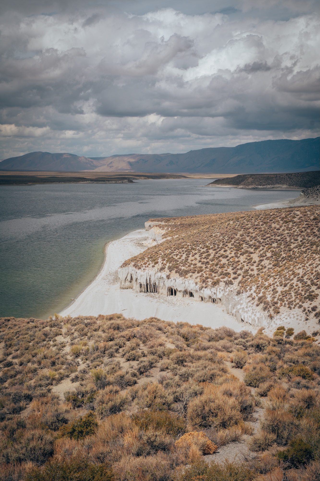
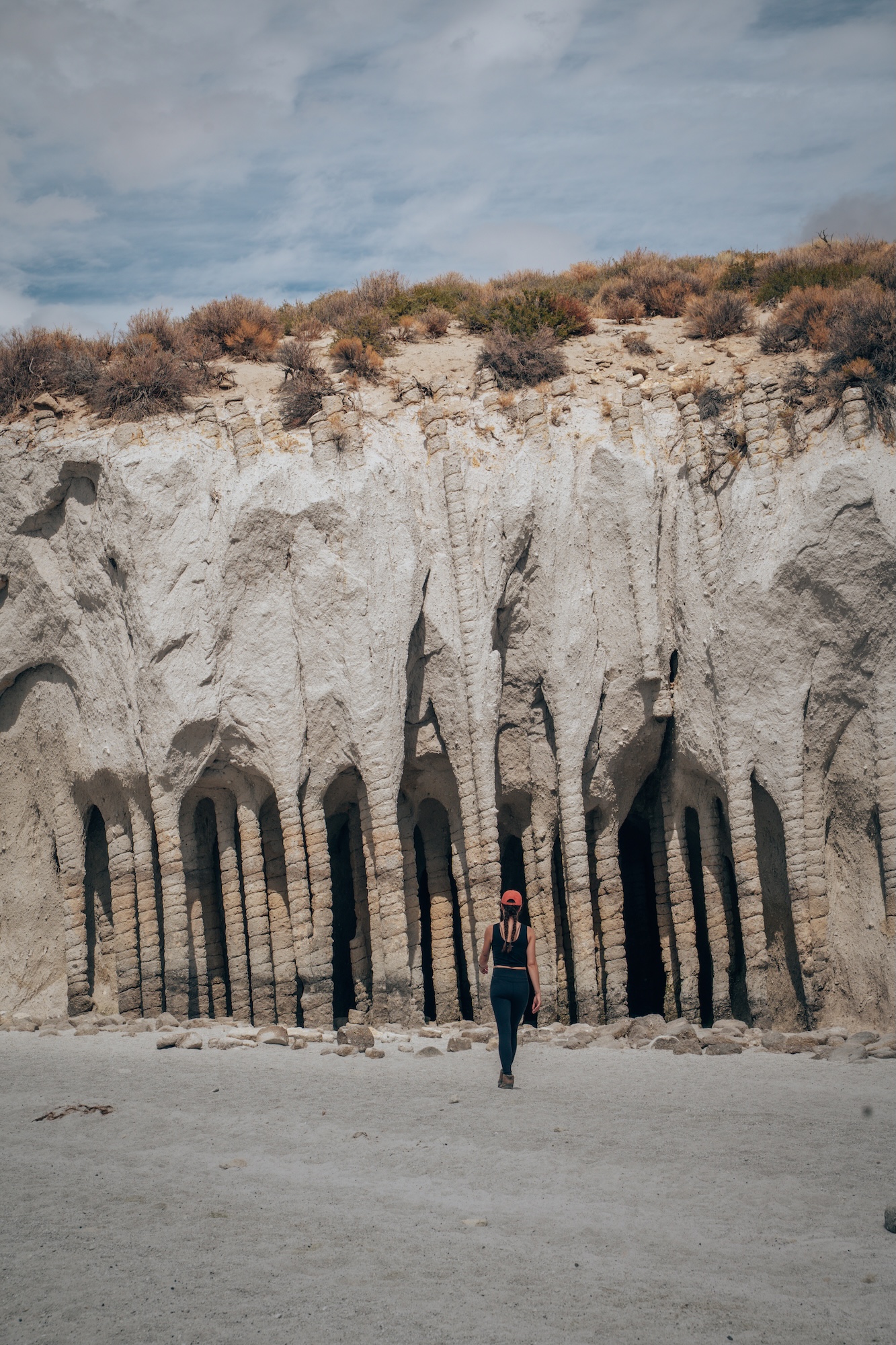
The Crowley Lake Columns are one of the most striking geological features near Mammoth Lakes. Reaching them is challenging though. There is a rough dirt road drive that takes you almost entirely to the columns, but requires a lifted 4×4 vehicle. The alternative is to park at a pullout, and hike the remaining 2.0 miles. When water levels are low, towering volcanic columns are revealed along the shoreline, similar in appearance to Devils Postpile. Because access depends on lake levels and road conditions, checking current conditions before visiting is essential.
- Day-use entry fee: None
- Pet-friendly: Yes, on leash and only in designated areas
- Time needed: 2-3 hours
- Soft adventure: No, this is a more moderate adventure
CENTRAL EASTERN SIERRA
The Central Eastern Sierra blends wide-open high desert with layers of history and rugged mountain landscapes. This region feels more remote, with fewer towns and longer stretches of open road along Highway 395. It’s known for preserved historic sites, ancient landscapes, and dramatic elevation changes. Travelers moving through this section experience a quieter, slower-paced side of the Eastern Sierra that contrasts sharply with the busier northern areas.
ANCIENT BRISTLECONE PINE FOREST
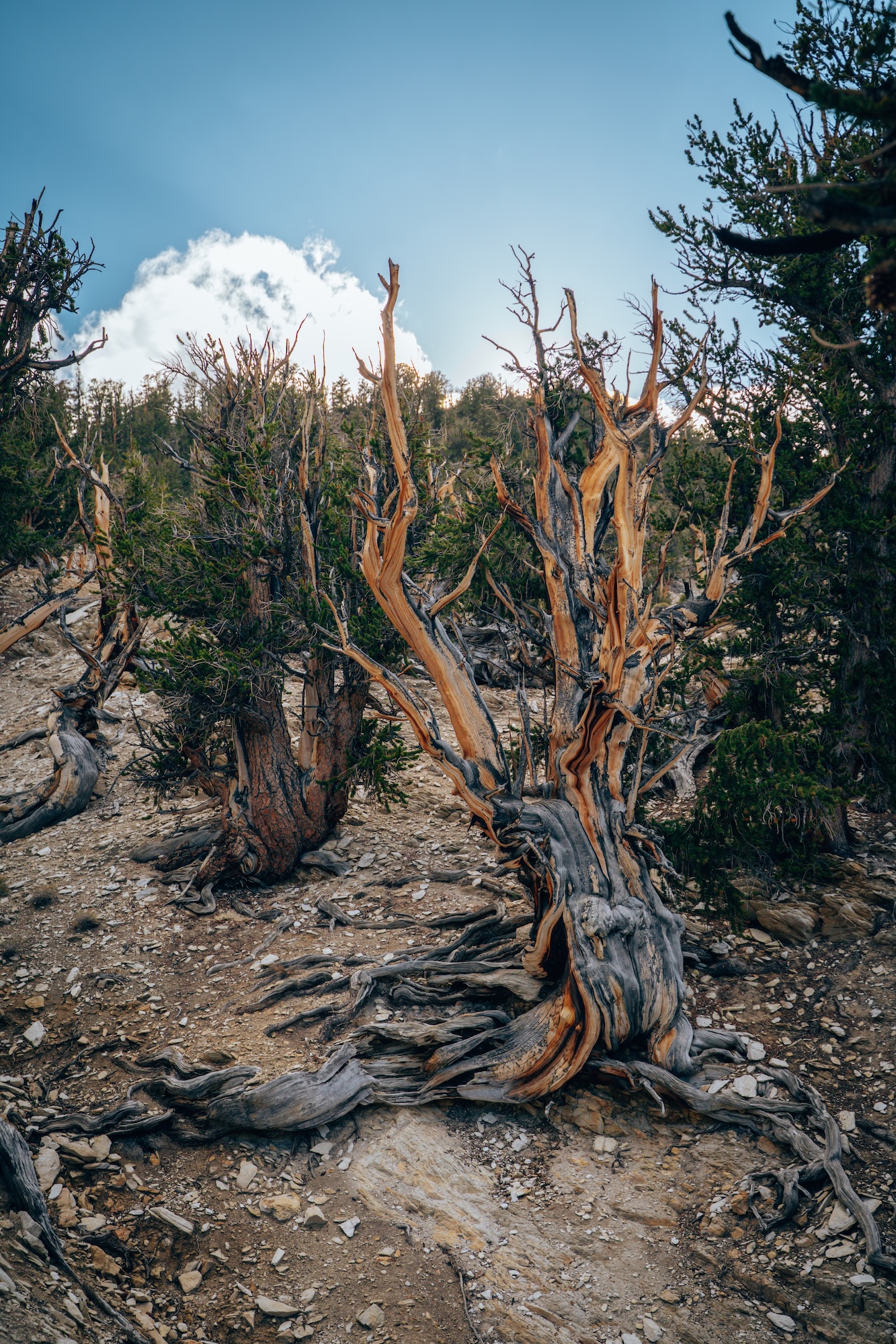
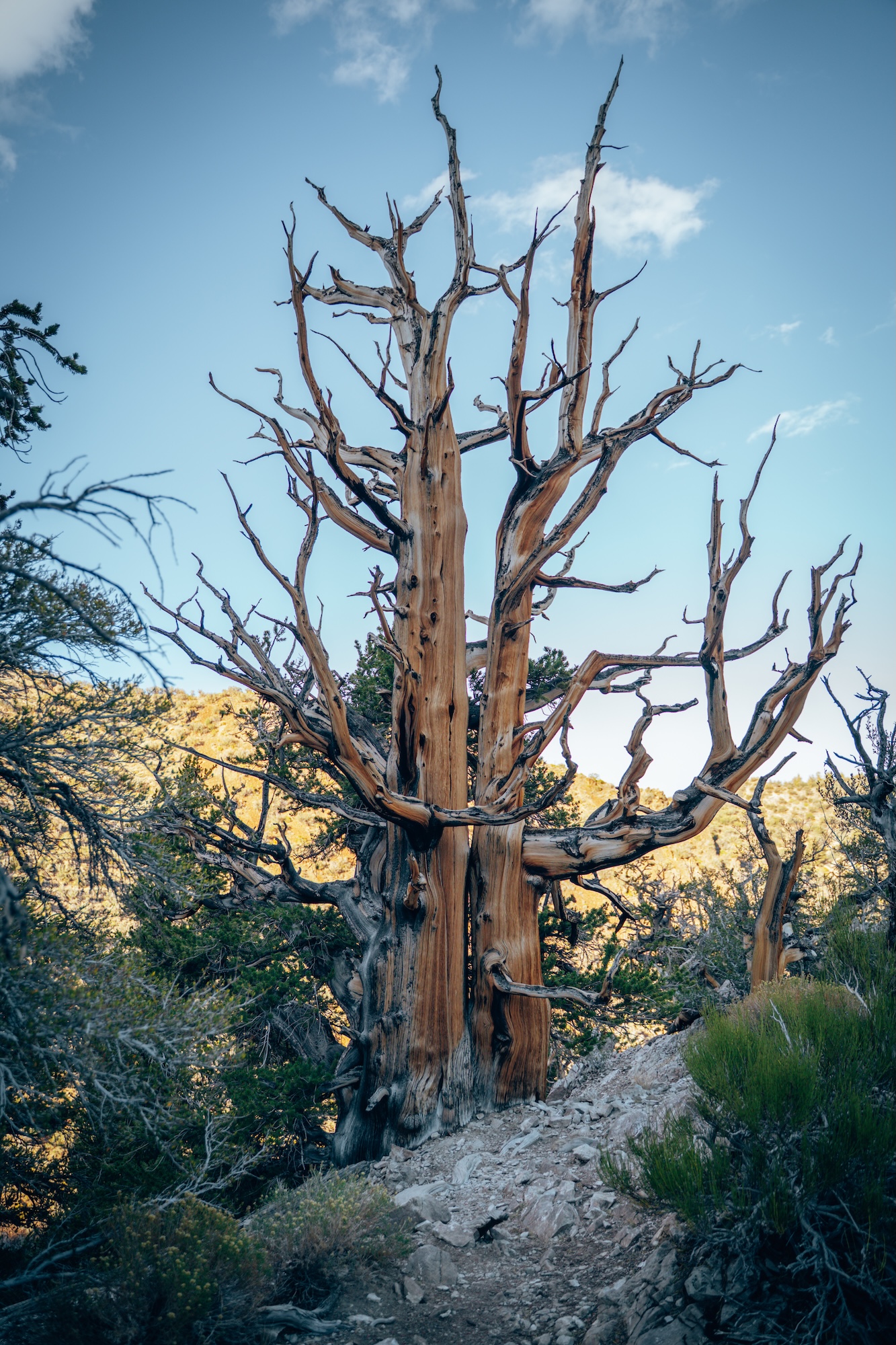
The Ancient Bristlecone Pine Forest protects one of the most extraordinary landscapes in the Eastern Sierra. Many of the bristlecone pines here are over 4,000 years old, making them among the oldest living trees on Earth. Their twisted shapes reflect centuries of survival in harsh, high-elevation conditions. The Methuselah Trail is the most popular way to experience the forest, offering a moderate loop hike through ancient groves with interpretive signs and sweeping mountain views.
- Day-use entry fee: $6 per vehicle
- Pet-friendly: Yes, on leash and only in designated areas
- Time needed: 2-3 hours
- Soft adventure: No, this is more of a moderate adventure
GRANDVIEW CAMPGROUND
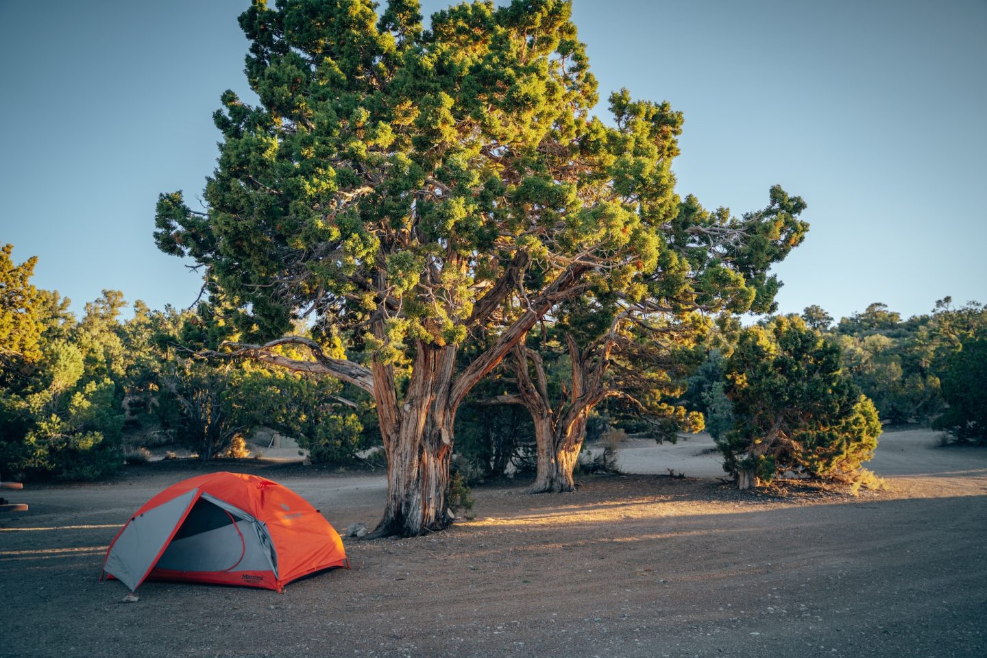
The Grandview Campground is one of the most scenic places to stay in the Ancient Bristlecone Pine Forest area. Perched at high elevation just 20 minutes from the Methuselah Trail, the campground offers sweeping views of the Owens Valley and the White Mountains below. Sites are spread out and surrounded by open, rugged terrain, giving the area a quiet and remote feel. Due to its elevation, nights can be cold even in summer, but the dark skies and sunrise views make it a memorable stop along Highway 395.
- Campsite fee: $10 per site
- Reservations: No, they are first come first serve
- Pet-friendly: Yes, on leash
PAIUTE SHOSHONE CULTURAL CENTER
The Paiute Shoshone Cultural Center offers an important opportunity to learn about the Indigenous history of the Owens Valley. The center highlights the culture, traditions, and resilience of the Paiute and Shoshone peoples who have lived in this region for thousands of years. Exhibits include artifacts, photographs, and storytelling that provide deeper context to the land travelers experience along Highway 395. Visiting the cultural center adds meaningful perspective to an Eastern Sierra road trip, connecting the landscape to the people who have long called it home.
- Day-use entry fee: None
- Pet-friendly: Yes, on leash and only in designated areas
- Time needed: 30mins – 1 hour
- Soft adventure: Yes, definitely!
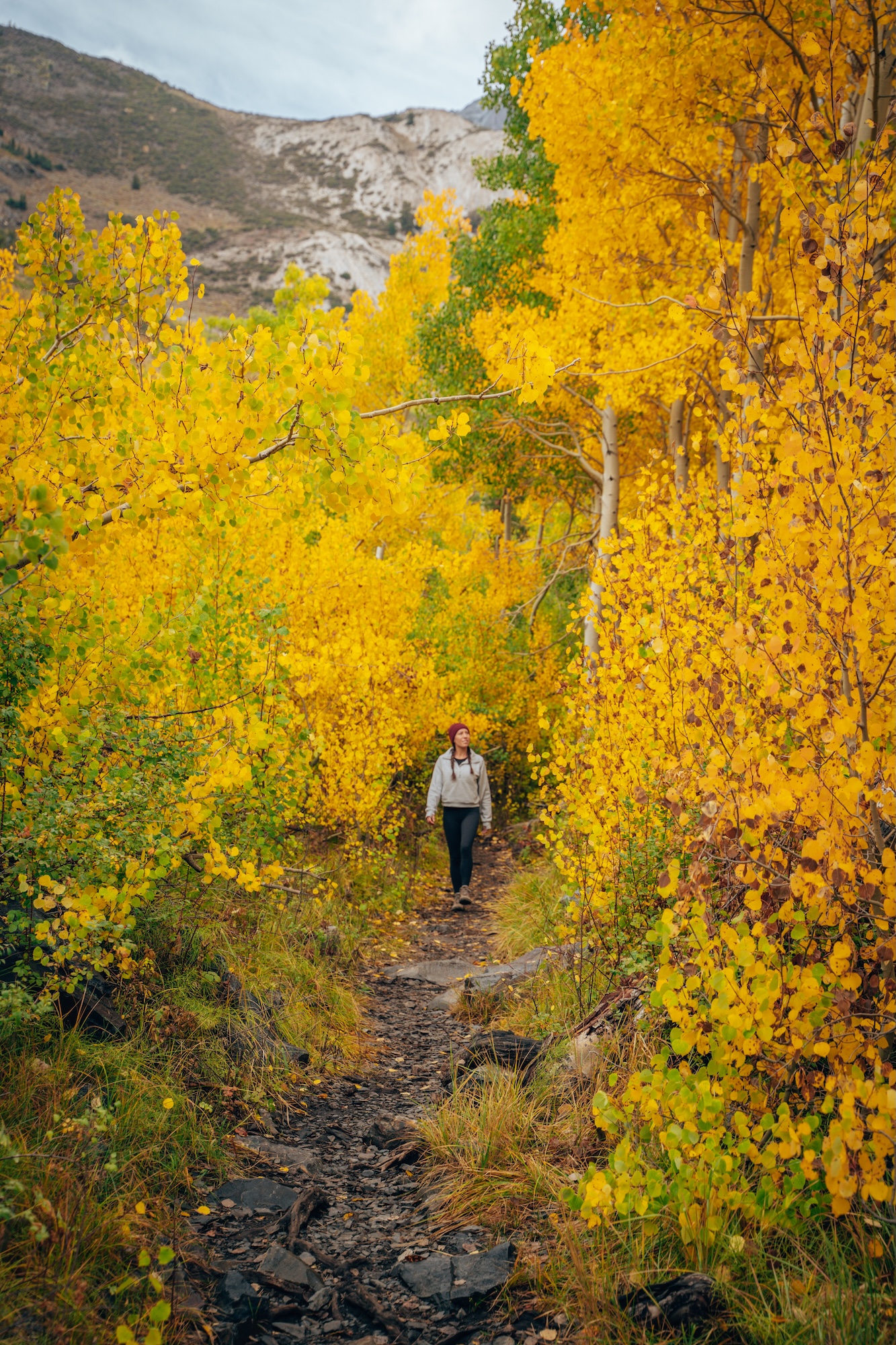
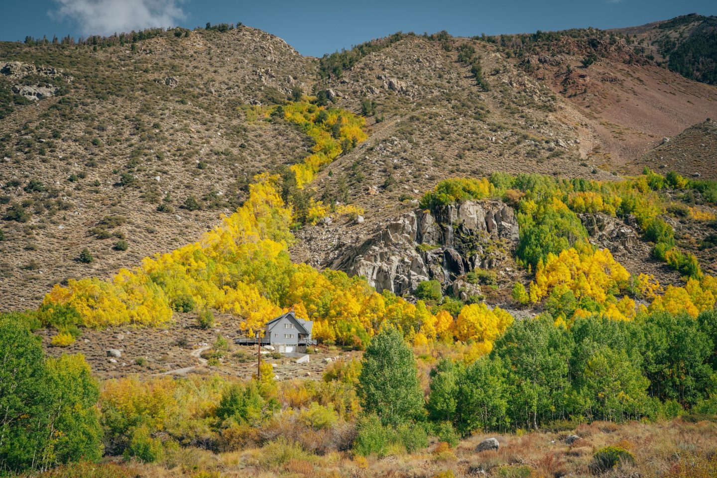
BISHOP CREEK CANYON
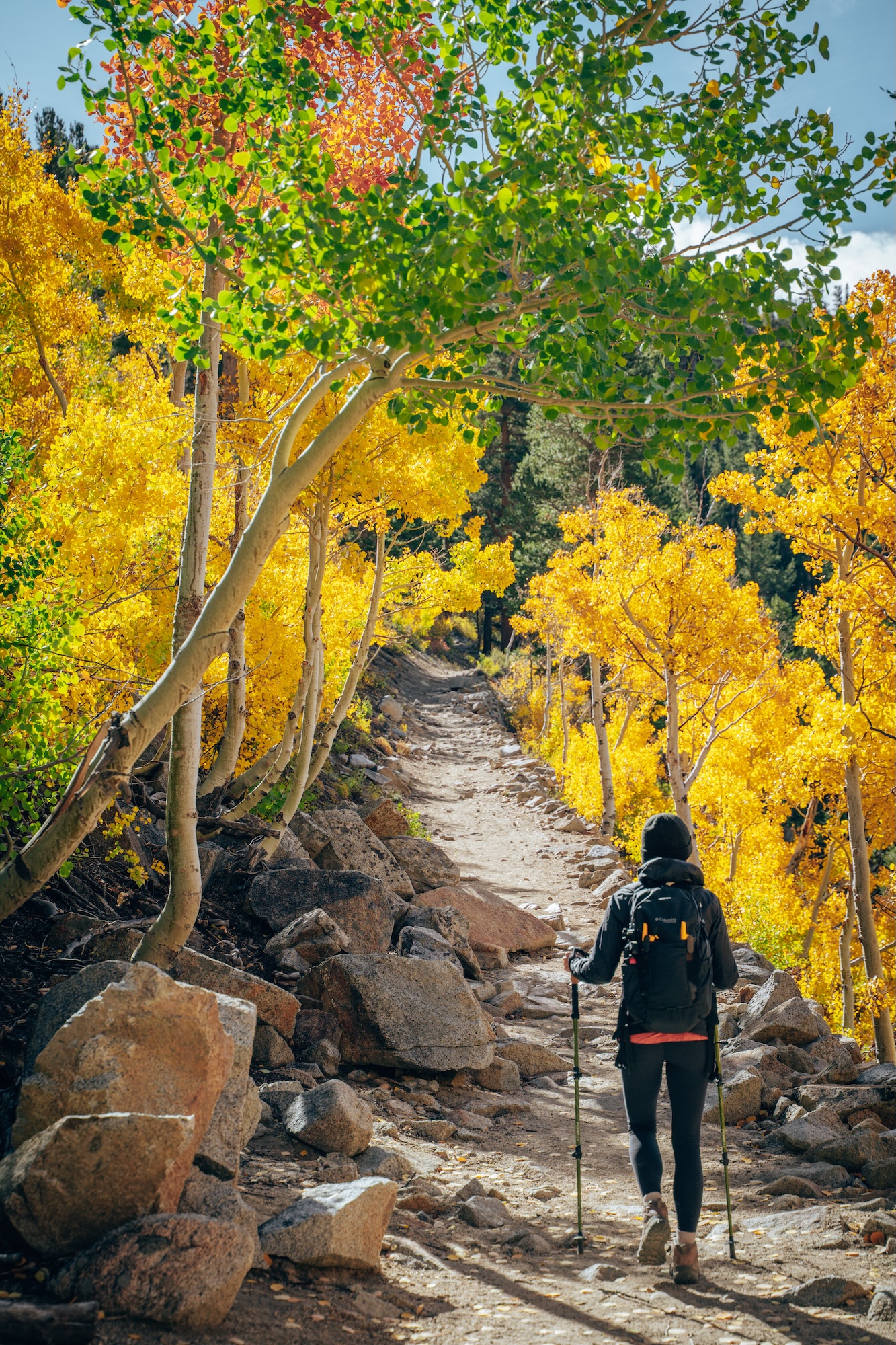
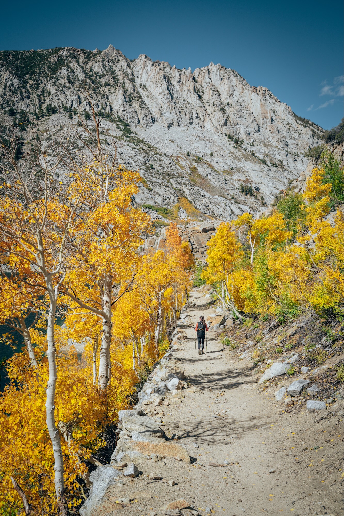
If you’re looking for alpine views, or fall colors, this is the place. Bishop Creek Canyon is one of the most scenic and accessible mountain areas in the Central Eastern Sierra. The canyon climbs quickly from the Owens Valley into a landscape of alpine lakes, aspen groves, and granite peaks. Its paved roads, frequent pullouts, and variety of trailheads make it a popular destination for both day trips and longer stays. In the fall, the canyon is especially well known for vibrant autumn colors that draw visitors from across the state.
Three of the canyon’s standout destinations are South Lake, Treasure Lakes, and Lake Sabrina. South Lake sits at the end of the road and serves as a gateway to high-elevation hiking and backpacking routes. Treasure Lakes offers a rewarding hike with panoramic views and quieter alpine scenery. Lake Sabrina is the most easily accessed, with shoreline paths, picnic areas, and postcard-worthy mountain reflections right from the parking area.
- Day-use entry fee: None
- Pet-friendly: Yes, on leash and only in designated areas
- Time needed: 30mins – 5 hours
- Soft adventure: South Lake and Lake Sabrina are, but Treasure Lakes is not
SOUTHERN EASTERN SIERRA
The Southern Eastern Sierra is defined by dramatic desert-meets-mountain scenery and some of the most iconic views along Highway 395. This region is where the towering Sierra Nevada rise sharply from the Owens Valley, creating striking contrasts and wide-open landscapes. It’s home to famous landmarks, historic sites, and classic road trip stops near Lone Pine. With fewer crowds and expansive views, the Southern Eastern Sierra offers a slower, more cinematic feel to a Highway 395 journey.
MANZANAR NATIONAL HISTORIC SITE
Manzanar National Historic Site preserves the history of one of ten incarceration camps where Japanese Americans were unjustly imprisoned during World War II. Located in the Owens Valley beneath the Sierra Nevada, the site includes a visitor center, reconstructed buildings, and interpretive exhibits. Personal stories, photographs, and artifacts help convey the human impact of this period in American history. A visit to Manzanar adds an important and sobering layer of context to a Highway 395 road trip.
- Day-use entry fee: None
- Pet-friendly: Yes, on leash and only in designated areas
- Time needed: 30mins – 1 hour
- Soft adventure: Yes, definitely!
ALABAMA HILLS
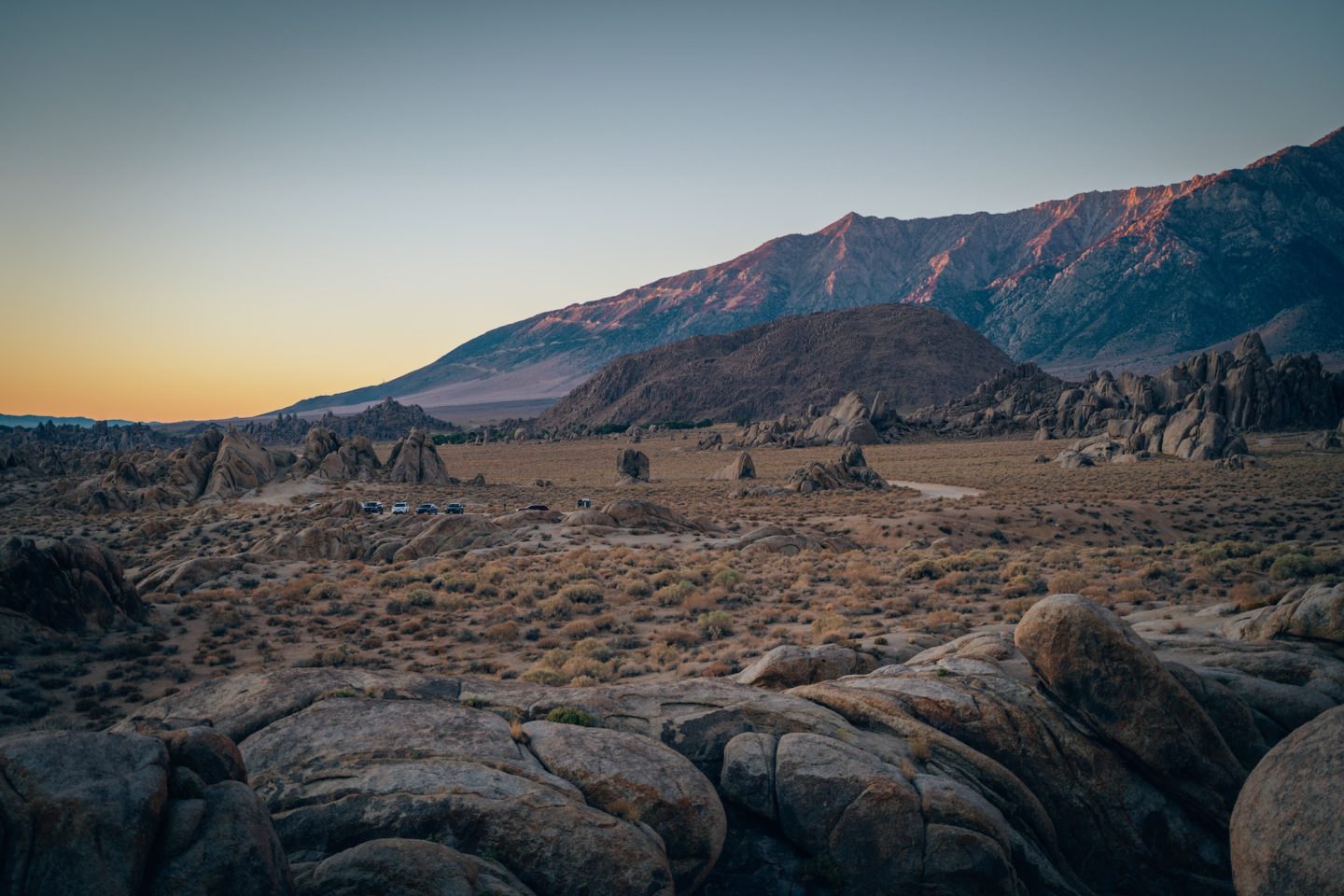
Located just west of Lone Pine, Alabama Hills is a striking landscape of rounded rock formations set against the dramatic backdrop of the Sierra Nevada. This area is known for its desert terrain, natural arches, and iconic views of Mount Whitney. A network of dirt roads makes the area easy to explore by car, with plenty of pullouts for short walks and photos. The combination of rugged foregrounds and towering peaks makes Alabama Hills one of the most visually memorable stops along Highway 395.
- Day-use entry fee: None
- Pet-friendly: Yes, on leash and only in designated areas
- Time needed: 30mins – 1 hour
- Soft adventure: Yes, definitely!
THE MOVIE ROAD
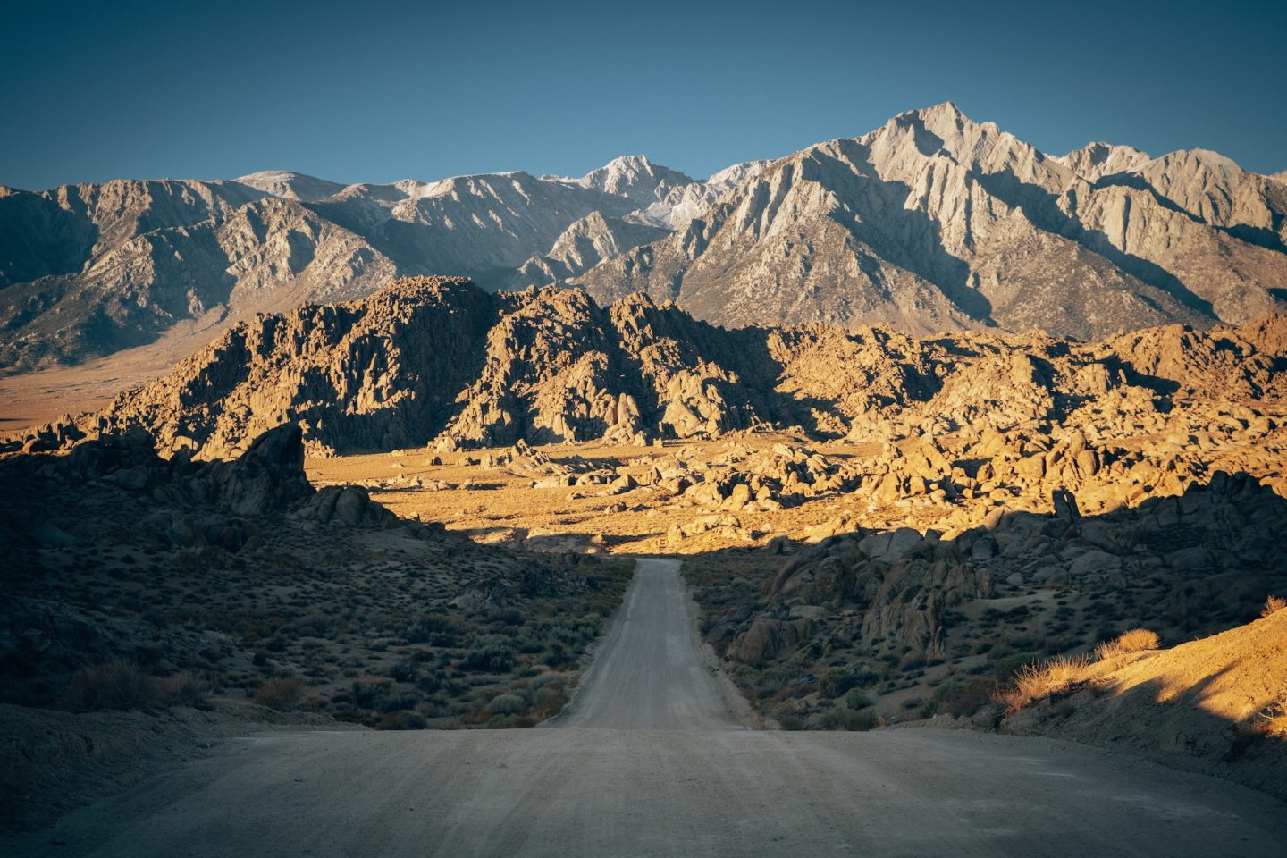
For once, the hype is earned. In fact, the Movie Road is the most iconic stretch of the Alabama Hills. This short dirt road winds through rounded granite boulders while the Sierra Nevada rises sharply behind it, creating one of the most photographed views in the Eastern Sierra. Because of this, it has appeared in hundreds of films, TV shows, and commercials—the landscape does the work for you, with open desert in the foreground, dramatic peaks in the background, and light that feels cinematic most of the day.
That said, you don’t need to hike far to get the payoff, since most viewpoints sit right off the road. However, that same accessibility brings crowds, especially around sunrise and sunset. To make the most of it, arrive early, pull over responsibly, and be mindful of private property and seasonal closures. Overall, it’s a quick stop, but when conditions line up, it delivers one of the most striking roadside views in California.
- Day-use entry fee: None
- Pet-friendly: Yes, on leash and only in designated areas
- Time needed: 30mins – 1 hour
- Soft adventure: Yes, definitely!
MOBIUS ARCH
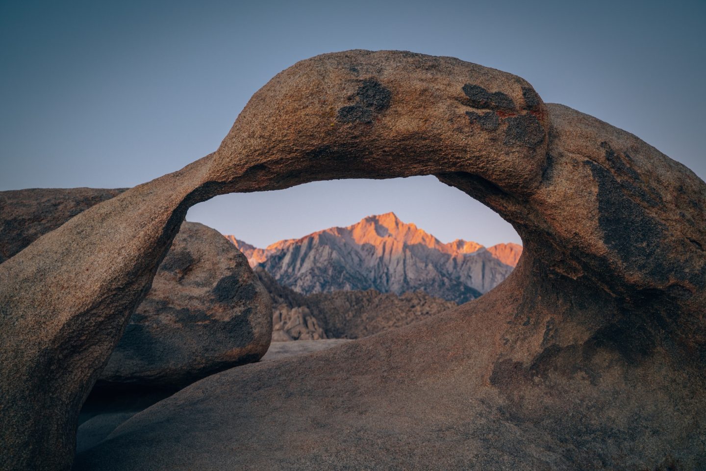
One of the most recognizable formations in the Alabama Hills is Mobius Arch, and it earns its reputation—especially at sunrise when the arch perfectly frames Mount Whitney. The short looped trail that leads to it is flat, sandy, and easy to follow, making it accessible for most visitors, but don’t mistake “easy” for empty. This is one of the busiest spots in the area, and timing matters more than effort here. The full loop lets you see multiple arches and rock formations beyond just Mobius, which is where most people stop, so it’s worth completing instead of turning around early. Stay on established paths to protect the fragile desert environment, and don’t climb on the arch—it’s tempting, but erosion and damage are real issues. Quick hike, big payoff, and one of the best introductions to the Alabama Hills landscape.
- Day-use entry fee: None
- Pet-friendly: Yes, on leash and only in designated areas
- Time needed: 30mins – 1 hour
- Soft adventure: Yes, definitely!
TUTTLE CREEK CAMPGROUND
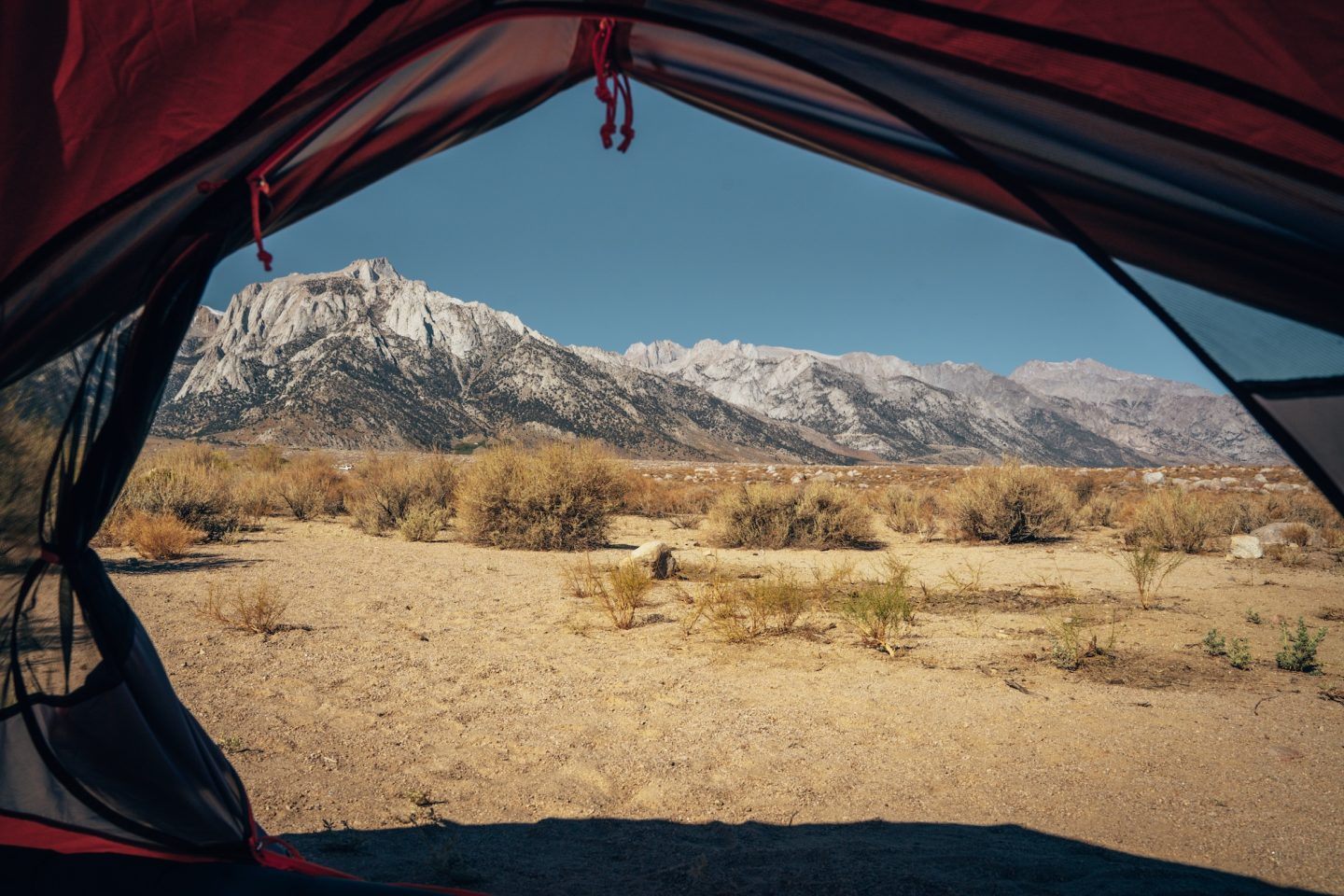
The Tuttle Creek Campground sits just outside Lone Pine at the base of the Alabama Hills, offering one of the most scenic desert camping experiences in the Eastern Sierra. The campground is first-come, first-served and known for its wide-open views of Mount Whitney and the Sierra crest. Sites are spread out and feel remote, despite being only minutes from town. As a result, Tuttle Creek is an excellent base for exploring the Alabama Hills, Movie Road, and nearby trailheads, especially for travelers who want dramatic scenery without high-elevation temperatures.
- Campsite fee: $10 per site
- Reservations: No, they are first come first serve
- Pet-friendly: Yes, on leash
MOUNT WHITNEY PEAK
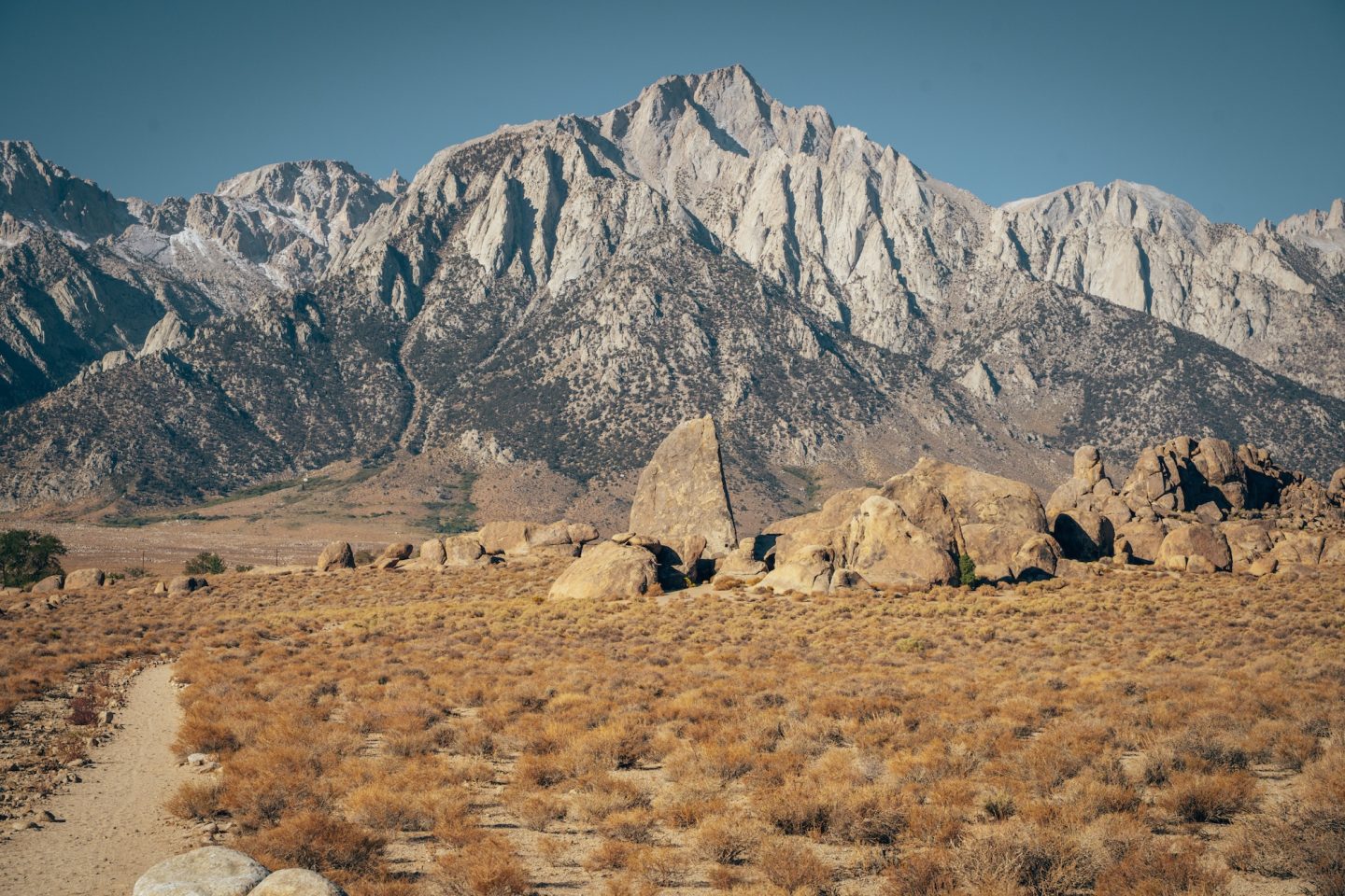
The highest peak in the contiguous United States is Mount Whitney at 14,505 feet, dominating the Eastern Sierra skyline whether you hike it or not. The Mount Whitney Trail from Whitney Portal reaches the summit but requires permits, serious preparation, and a demanding 22-mile round trip. You can still enjoy iconic views from the Alabama Hills, especially along Movie Road, as well as from Lone Pine and Whitney Portal. Overall, for most visitors, seeing Mount Whitney from below is the smarter move—equally impressive without the altitude, permits, or physical toll.
- Fees: There is an application fee and permit fee to hike Mount Whitney
- Pet-friendly: No, dogs are not permitted
- Time needed: 1-3 days
- Soft adventure: Definite not
DEATH VALLEY NATIONAL PARK
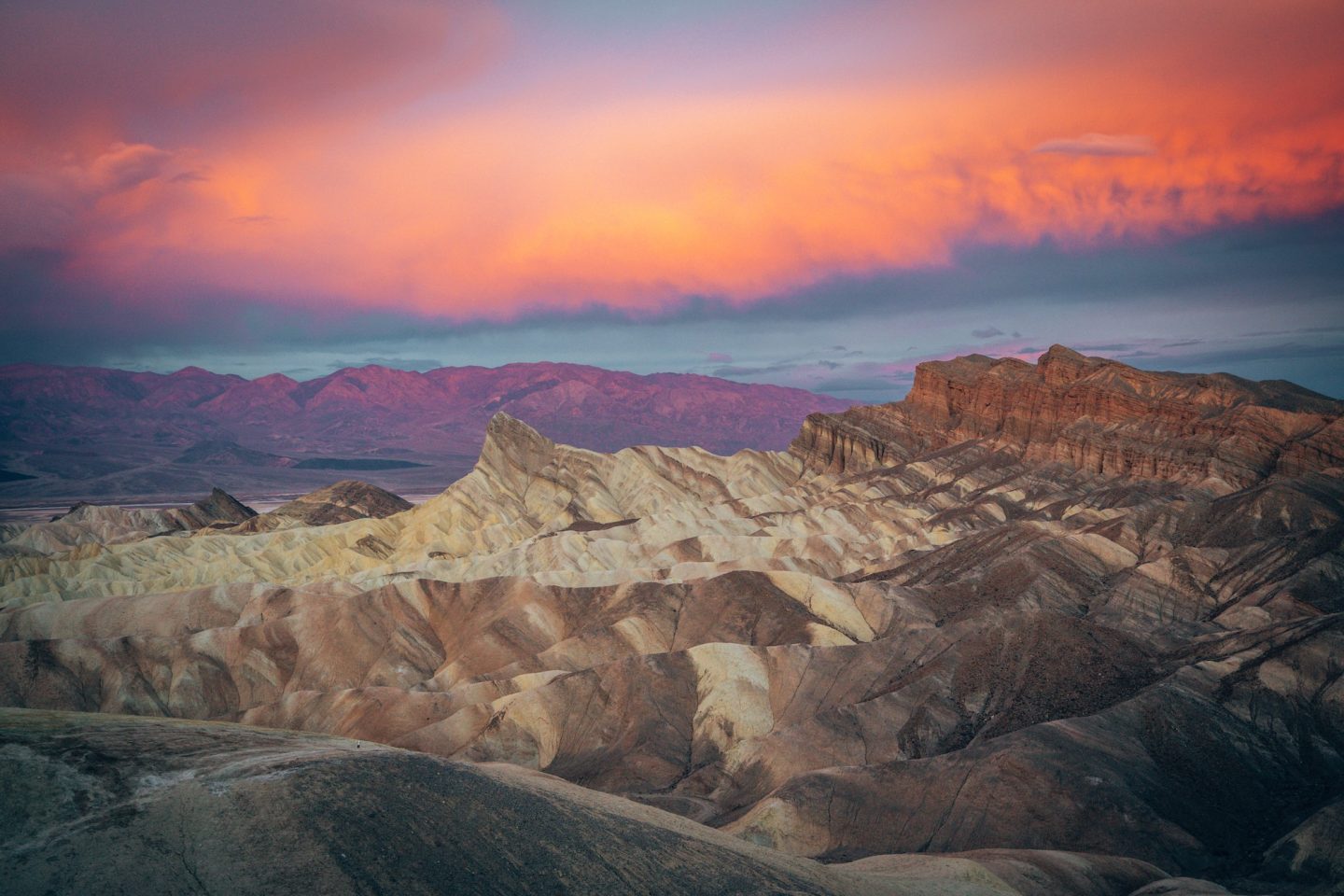
Known as the hottest, driest, and lowest national park in the country, Death Valley National Park is the final stop. Its vast landscape features salt flats, sand dunes, rugged canyons, colorful badlands, and towering mountain ranges. Iconic spots like Badwater Basin, Mesquite Flat Sand Dunes, Artist’s Drive, and Dante’s View offer just a small glimpse of what the park has to offer, which is why we’ve created several in-depth blog articles covering specific hikes, viewpoints, and itineraries throughout Death Valley.
Check out our Death Valley blogs below:
- ULTIMATE GUIDE TO DEATH VALLEY NATIONAL PARK
- 5 SOFT ADVENTURE THINGS TO DO IN DEATH VALLEY NATIONAL PARK
- ONE DAY IN DEATH VALLEY NP CA
- ARTIST’S PALETTE DEATH VALLEY: THE COMPLETE GUIDE
THE EASTERN SIERRA TOUR
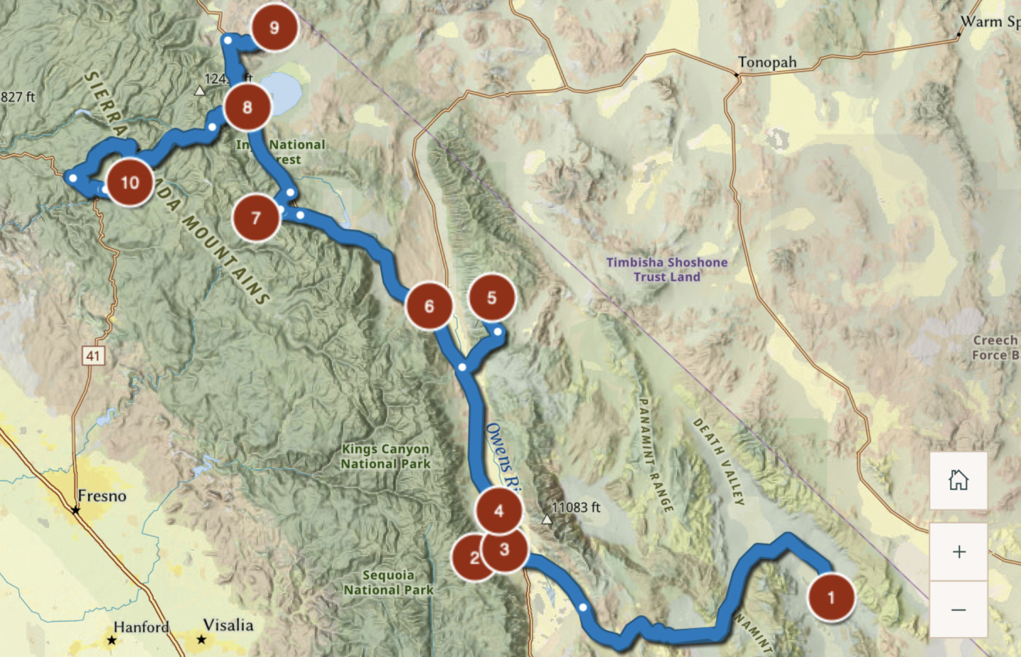
The Eastern Sierra Tour is a self-guided driving route that follows Highway 395 through one of California’s most diverse and scenic regions. It connects alpine lakes, volcanic landscapes, historic sites, and desert valleys into a single, logical journey. For this reason, the tour is designed to encourage slow travel, short walks, and frequent pullouts. It’s ideal for road trippers who want variety without constantly packing up or backtracking.
All of the official stops along the Eastern Sierra Tour route are covered in this article, making it easy to plan your itinerary in one place. You can follow the route north to south or reverse it, depending on your schedule and season. While some travelers tackle it in a long weekend, the tour rewards those who spread it out over several days. For this reason, flexibility is key—the landscapes change fast, and you’ll want time to explore what catches your eye.
HIGHWAY 395: FREQUENTLY ASKED QUESTIONS
- How long is Highway 395 in California? Highway 395 runs roughly 350 miles through California, from the Nevada border to the Mojave Desert near Hesperia.
- How many days do you need for a Highway 395 road trip? At minimum, plan 3–4 days to hit major highlights. A more realistic and enjoyable trip is 5–7 days, especially if you want time for hikes, scenic drives, and short detours.
- What is the best time of year to drive Highway 395? Late spring through early fall is ideal. Summer offers full access to high-elevation areas, while fall brings fewer crowds and dramatic fall colors. Winter travel is possible but often limited by snow and road closures.
- Is Highway 395 accessible year-round? Yes, but conditions vary. Snow can close side roads, trailheads, and high passes in winter. Always check weather and road conditions, especially between November and April.
- Are dogs allowed along Highway 395 stops? It depends. Many lakes, scenic drives, and towns are dog-friendly, but national parks and monuments sometimes have restrictions. Many of these areas are also bear-country, so extra caution is recommended. Always check specific site rules before visiting.
- Do you need a high-clearance or 4WD vehicle? No for the main highway and most stops. A few locations, like the Crowley Lake Columns or some Alabama Hills roads, may require high clearance depending on conditions.
- Are there gas stations along Highway 395? Yes, but they’re spaced out. Fill up in larger towns like Lee Vining, Mammoth Lakes, Bishop, and Lone Pine. Don’t assume the next stop is close.
- Do you need permits for any locations along Highway 395? Yes, for certain activities. Mount Whitney requires a hiking permit, and some campgrounds and wilderness areas require reservations.
- Are there campgrounds along Highway 395? Yes—plenty. Options range from developed campgrounds near lakes to dispersed camping on BLM land. Availability varies by season and location.
OTHER WEBSITES & RESOURCES
HIGHWAY 395: BEGINNER’S GUIDE TO CALIFORNIA’S EASTERN SIERRA
Highway 395 through the Eastern Sierra isn’t about checking boxes—it’s about experiencing California at its most dramatic and least crowded. From ancient bristlecone forests to volcanic craters, alpine lakes, and desert valleys, the diversity along this route is unmatched. Whether you drive the full corridor or focus on a single region, this is a road trip that rewards curiosity and patience. That said, take your time, respect the landscapes, and let the Eastern Sierra set the pace.
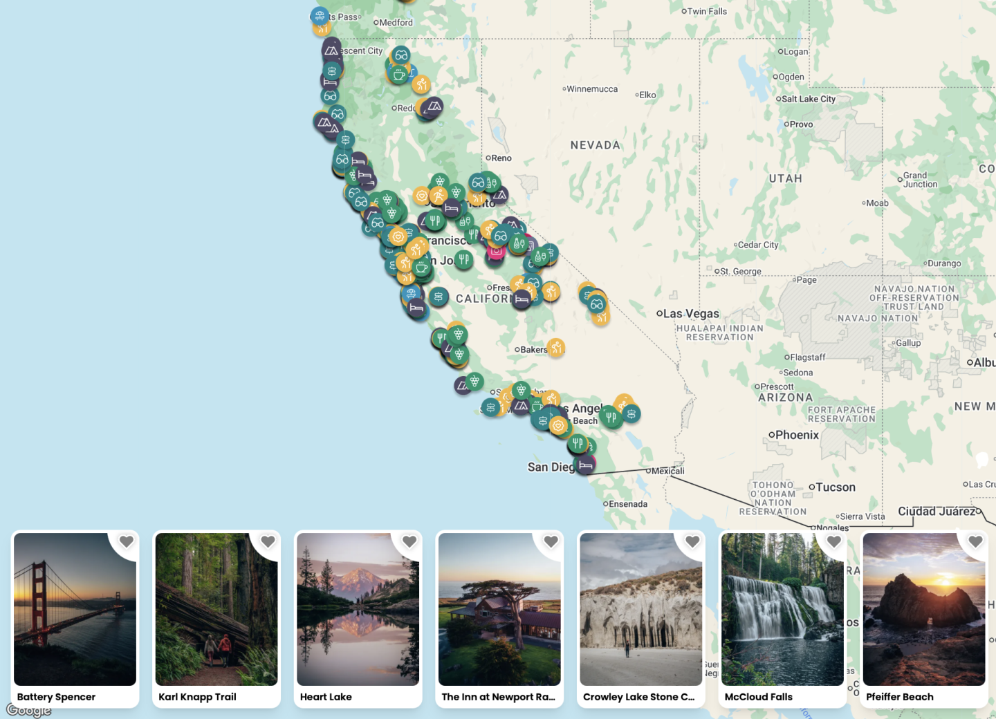
CALIFORNIA BUCKET LIST MAP
Want to see all these locations as well as other things to do nearby all in one place? If so, this map is for you. Not only does our bucket list map and guide to California have ALL the details and location info for these places, but it also has over 850 other points of interest in California in it. With all of the location specific details and information like GPS location, dog-friendliness, cost, and more. And with an itinerary creator, this map is the perfect trip planning companion.
Not much of a planner? No worries! We also have curated itineraries to make the planning process easier for you. In addition to that, book a call with us or have us create a custom itinerary for you! We are here to help!
Happy exploring!
