California’s state parks protect some of the most diverse landscapes in the country, from rugged coastlines and redwood forests to desert canyons and alpine lakes. While the national parks tend to get most of the attention, many of the most memorable outdoor experiences in the state happen inside the state park system. This guide highlights some of our favorite state parks of California, focusing on the places that continue to stand out after years of road trips, camping, hiking, and exploring the state. Rather than turning into a full guide for each destination, this article offers a practical overview of what makes each park worth visiting, including standout hikes, camping opportunities, scenic highlights, and the overall experience you can expect when you arrive.
- HOW WE CHOSE THE BEST STATE PARKS OF CALIFORNIA
- STATE PARKS OF CALIFORNIA MAP
- EXPLORING THE BEST STATE PARKS OF CALIFORNIA
- HENRY COWELL REDWOODS STATE PARK
- ANZA-BORREGO DESERT STATE PARK
- RUSSIAN GULCH STATE PARK
- TORREY PINES STATE NATURAL RESERVE
- PRAIRIE CREEK REDWOODS STATE PARK
- ANGEL ISLAND STATE PARK
- BIG BASIN REDWOODS STATE PARK
- POINT LOBOS STATE NATURAL RESERVE
- PFEIFFER BIG SUR STATE PARK
- POINT MUGU STATE PARK
- INDIAN GRINDING ROCK STATE HISTORIC PARK
- EMERALD BAY STATE PARK
- MOUNT DIABLO STATE PARK
- MCARTHUR-BURNEY FALLS MEMORIAL STATE PARK
- WHAT TO KNOW BEFORE EXPLORING IN CALIFORNIA
- EXPLORING THE BEST STATE PARKS OF CALIFORNIA
- CALIFORNIA BUCKET LIST MAP & GUIDE
HOW WE CHOSE THE BEST STATE PARKS OF CALIFORNIA
When putting together this list of the best state parks of California, we looked beyond just popularity or social media hype. We focused on parks that offer a strong mix of scenery, outdoor recreation, and a sense of uniqueness that makes them memorable long after visiting. Some parks stand out because of dramatic coastal cliffs or towering forests, while others earned their place through unusual geology, diverse hiking trails, or incredible camping experiences. In the end, the parks that made this list are the ones that consistently left us feeling inspired, surprised, or wanting to come back and explore even more.
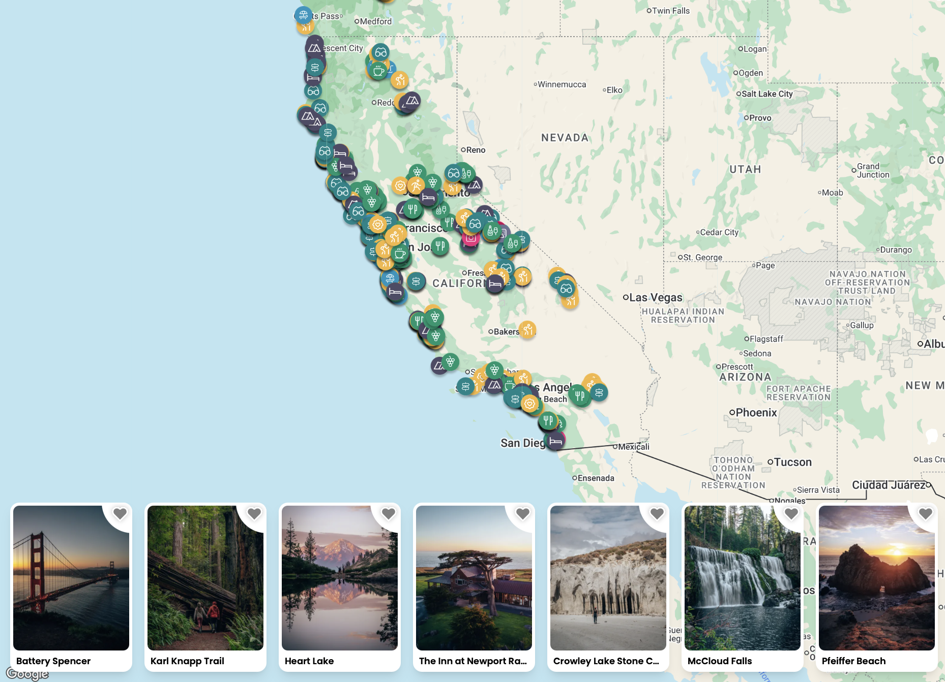
STATE PARKS OF CALIFORNIA MAP
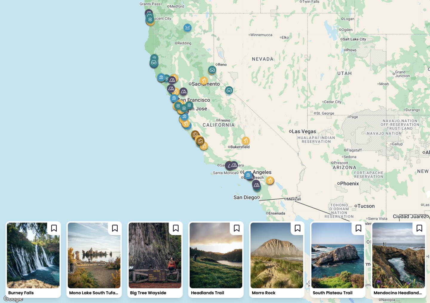
Want to skip the reading and just go straight to our California Bucket List Map and Guide which has every state park, hike and campground we’ve ever visited? Click on the map below to not only see exactly where all the state parks listed below are, but all best things to do around them as well! You’ll also find over 800 other points of interest around California!
EXPLORING THE BEST STATE PARKS OF CALIFORNIA
Pack up your hiking boots, tent, RV, or camper van and let’s take a trip to the best state parks of California! These are in no particular order, but can confirm you’ll need to add all of these to your list. And maybe we’ll see you out at one of them this year.
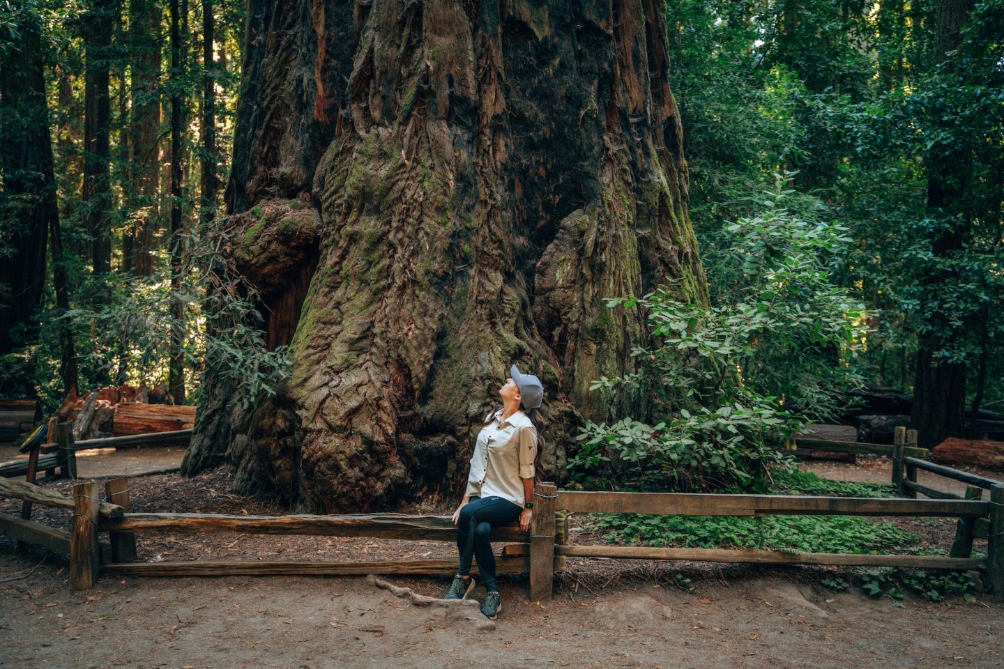
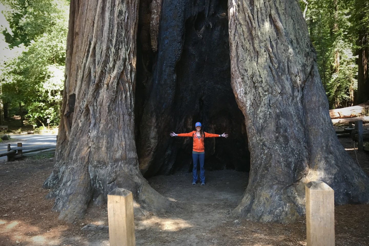
HENRY COWELL REDWOODS STATE PARK
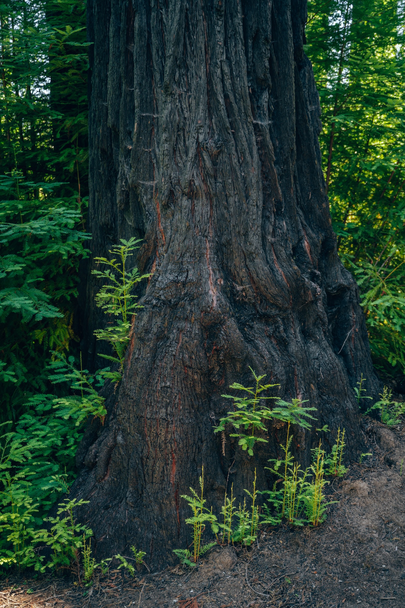
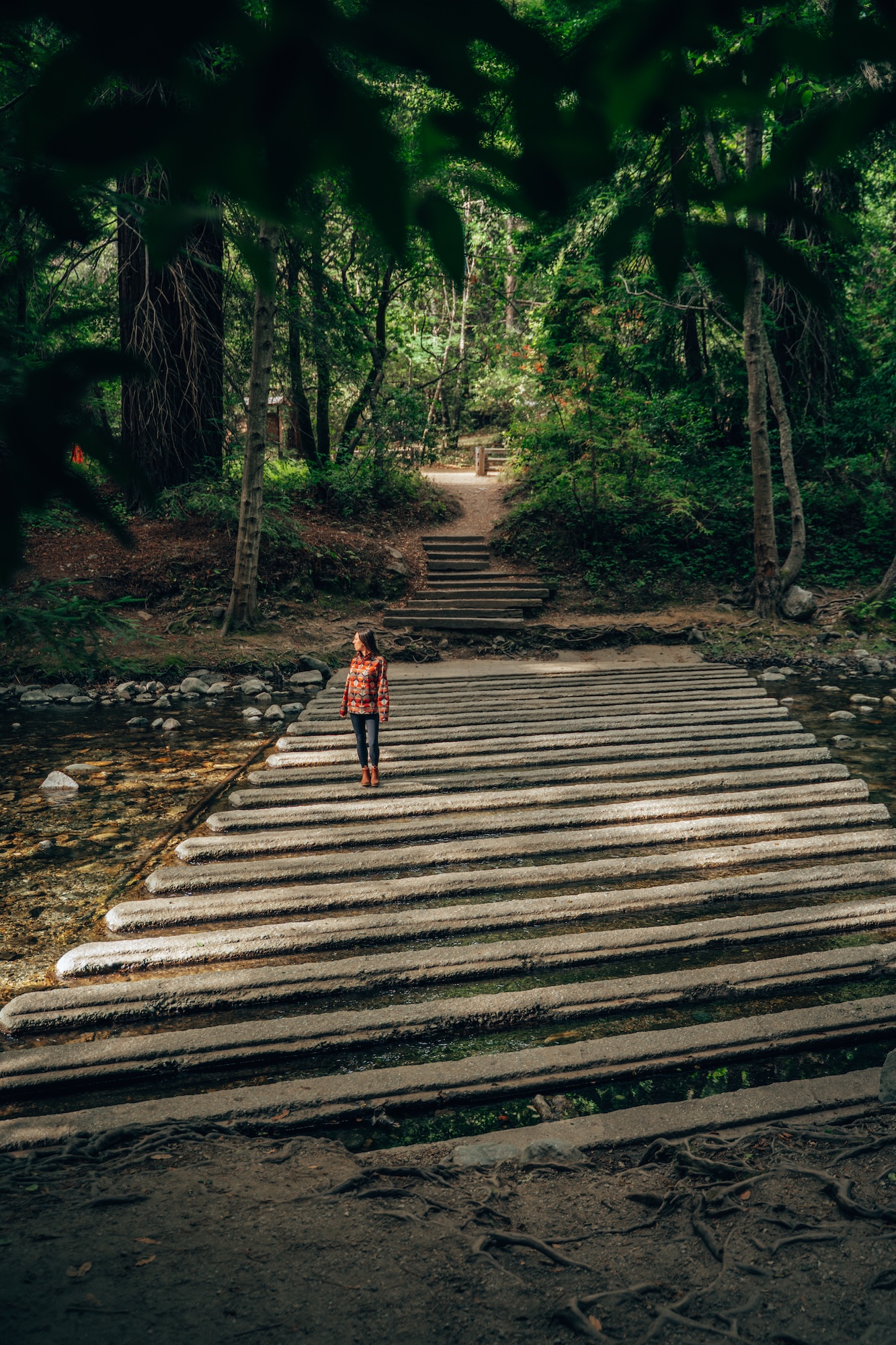
Towering old-growth redwoods, peaceful forest trails, and easy accessibility make Henry Cowell Redwoods State Park one of the best places in California to experience coastal redwoods. Located in the Santa Cruz Mountains, the park protects a beautiful mix of redwood forest, river corridors, and rolling hills, all within a short drive of the Bay Area. What makes the park especially appealing is that visitors can experience massive old-growth trees without making the long drive north to Redwood National & State Parks. For anyone looking for a convenient redwood adventure that still feels immersive and awe-inspiring, Henry Cowell is hard to beat.
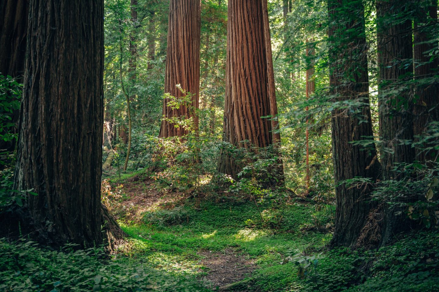
One of the best ways to experience Henry Cowell Redwoods State Park is by combining the Redwood Grove and Cowell Highlights Loop. This 4.4mi route takes hikers through the heart of the park’s old-growth forest, where towering redwoods rise high above the trail and create a cool, shaded atmosphere. The hike also climbs beyond the main grove to an Observation Deck, located near the connection between the Pine Trail and Ridge Fire Road, where the scenery opens up with wider views of the surrounding Santa Cruz Mountains. The combination of massive redwoods, peaceful forest trails, and elevated viewpoints makes this one of the most well-rounded hikes in the park.
- LOCATION: Felton, Santa Cruz County
- ENTRY FEE: $10 vehicle day use fee
- CAMPGROUND: Graham Hill Campground
- PET POLICY: Dogs welcome in campground
- SEASONALITY: Operating season is usually April-November
- BEST TIME TO VISIT: Spring and fall
- OFFICIAL SITE: Henry Cowell Redwood State Park
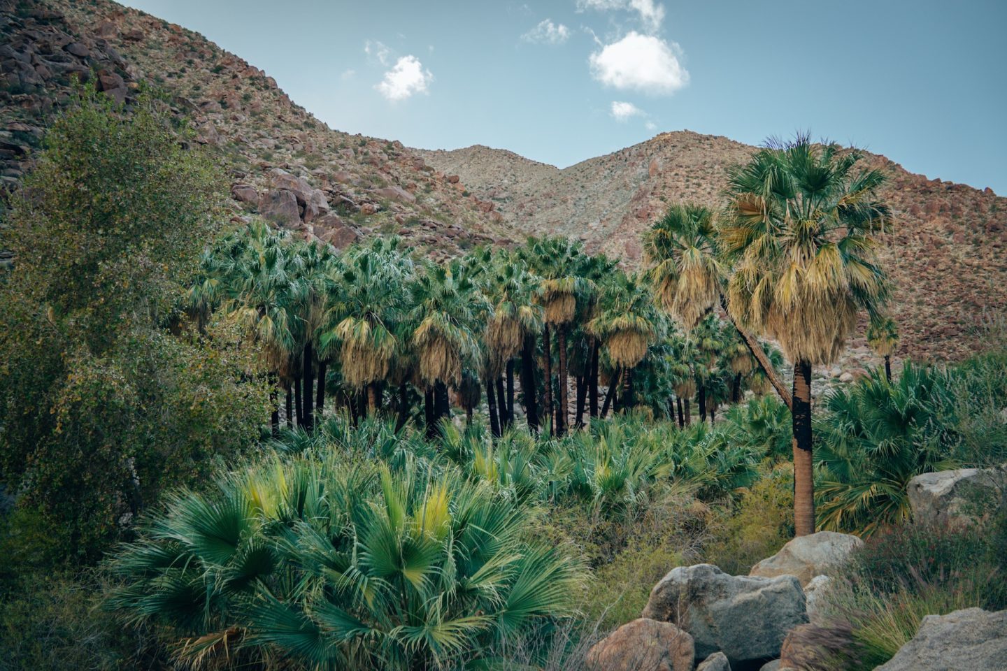
ANZA-BORREGO DESERT STATE PARK
Wide-open desert landscapes, dramatic badlands, and rugged canyons make Anza-Borrego Desert State Park feel completely different from almost anywhere else in California. As the state’s largest state park, it protects hundreds of thousands of acres filled with slot canyons, palm oases, wildflower fields, and remote desert scenery. The park feels especially expansive once you leave the paved roads behind, with huge mountain ranges and eroded desert formations stretching in every direction. Despite its harsh environment, Anza-Borrego has a surprising amount of diversity, which is a big part of what makes it one of the most unique state parks in California.
Two of the best experiences in the park are the Borrego Palm Canyon Trail and Font’s Point. The 3.0mi Palm Canyon hike leads visitors through a rocky desert canyon toward one of the park’s famous palm oases, where native California fan palms grow beside a seasonal stream. For a completely different perspective, Font’s Point delivers sweeping views over the Borrego Badlands, especially around sunrise or sunset when the desert landscape glows with color. Reaching Font’s Point requires either driving a sandy dirt road, or hiking 8.0mi round trip, but the dramatic overlook is one of the most unforgettable viewpoints anywhere in Southern California.
- LOCATION: Borrego Springs, San Diego County
- ENTRY FEE: $10 vehicle day use fee
- CAMPGROUNDS: Borrego Palm Canyon & Tamarisk Grove Campground
- PET POLICY: Dogs welcome in campgrounds & some trails
- SEASONALITY: Operating season is year-round
- BEST TIME TO VISIT: Fall-Spring
- OFFICIAL SITE: Anza-Borrego Desert State Park
PLAN YOUR CAMPING ESCAPE: BORREGO PALM CANYON CAMPGROUND: CAMPING IN ANZA BORREGO
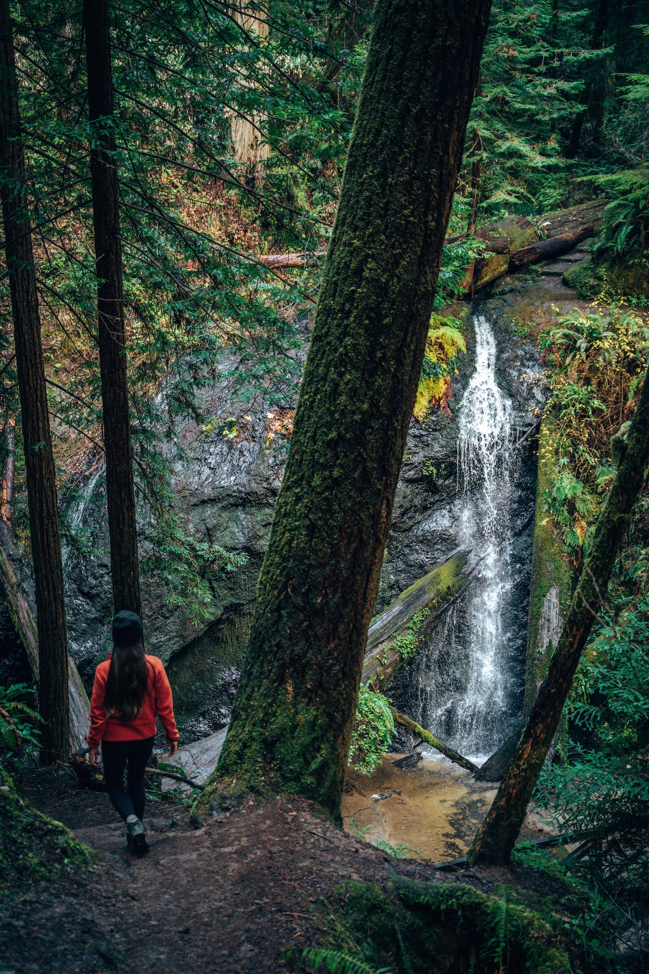
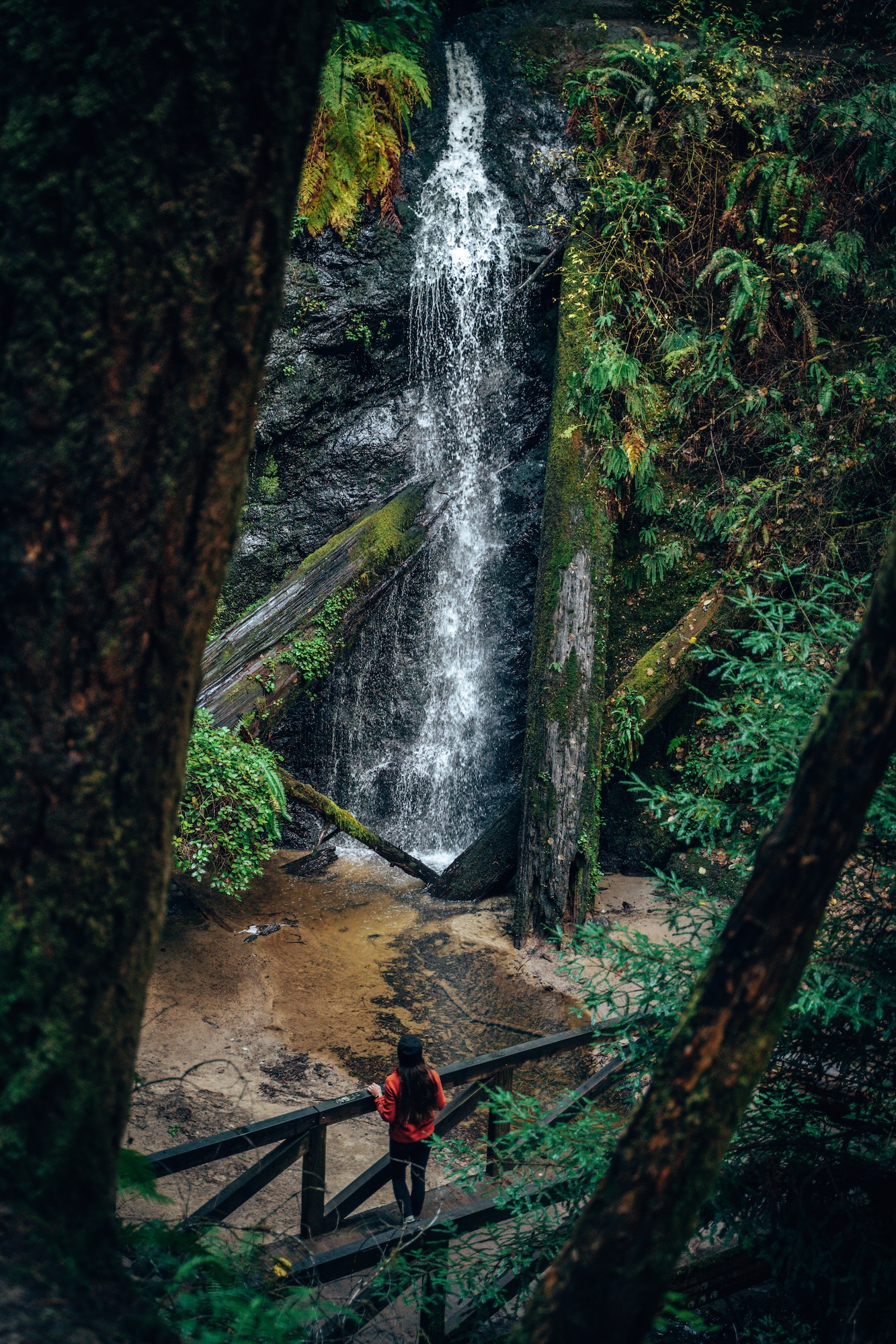
RUSSIAN GULCH STATE PARK
Crashing Pacific waves, rugged sea cliffs, and forested canyons come together at Russian Gulch State Park, making it one of our favorite, and most scenic stops along California’s North Coast. The park sits just north of Mendocino and blends coastal and forest environments in a relatively small and easy-to-explore area. Visitors can move quickly from dense redwood groves to dramatic ocean viewpoints, all within a short drive or hike. That contrast between lush inland canyon and wild shoreline is what makes Russian Gulch feel so dynamic compared to many other coastal parks in the state.
One of the most popular hikes is the 6.2mi Fern Canyon and Waterfall Loop, which leads through a shaded canyon filled with lush vegetation and culminates at a seasonal waterfall. For a completely different perspective, the dog-friendly 0.5mi Headlands and Devil’s Punchbowl Trail follows the coastline, offering dramatic bluff-top views, sea caves, and powerful surf below. Together, these hikes showcase the park’s defining contrast between peaceful forest canyons and raw, exposed coastline, making Russian Gulch a standout on any North Coast road trip.
- LOCATION: Mendocino, Mendocino County
- ENTRY FEE: $10 vehicle day use fee
- CAMPGROUNDS: Russian Gulch Campground
- PET POLICY: Dogs welcome in campgrounds & some trails
- SEASONALITY: Operating season is year-round
- BEST TIME TO VISIT: Spring-Fall
- OFFICIAL SITE: Russian Gulch State Park
FOR MORE DETAILS: 10 OUTDOORSY THINGS TO DO ALONG THE MENDOCINO COAST
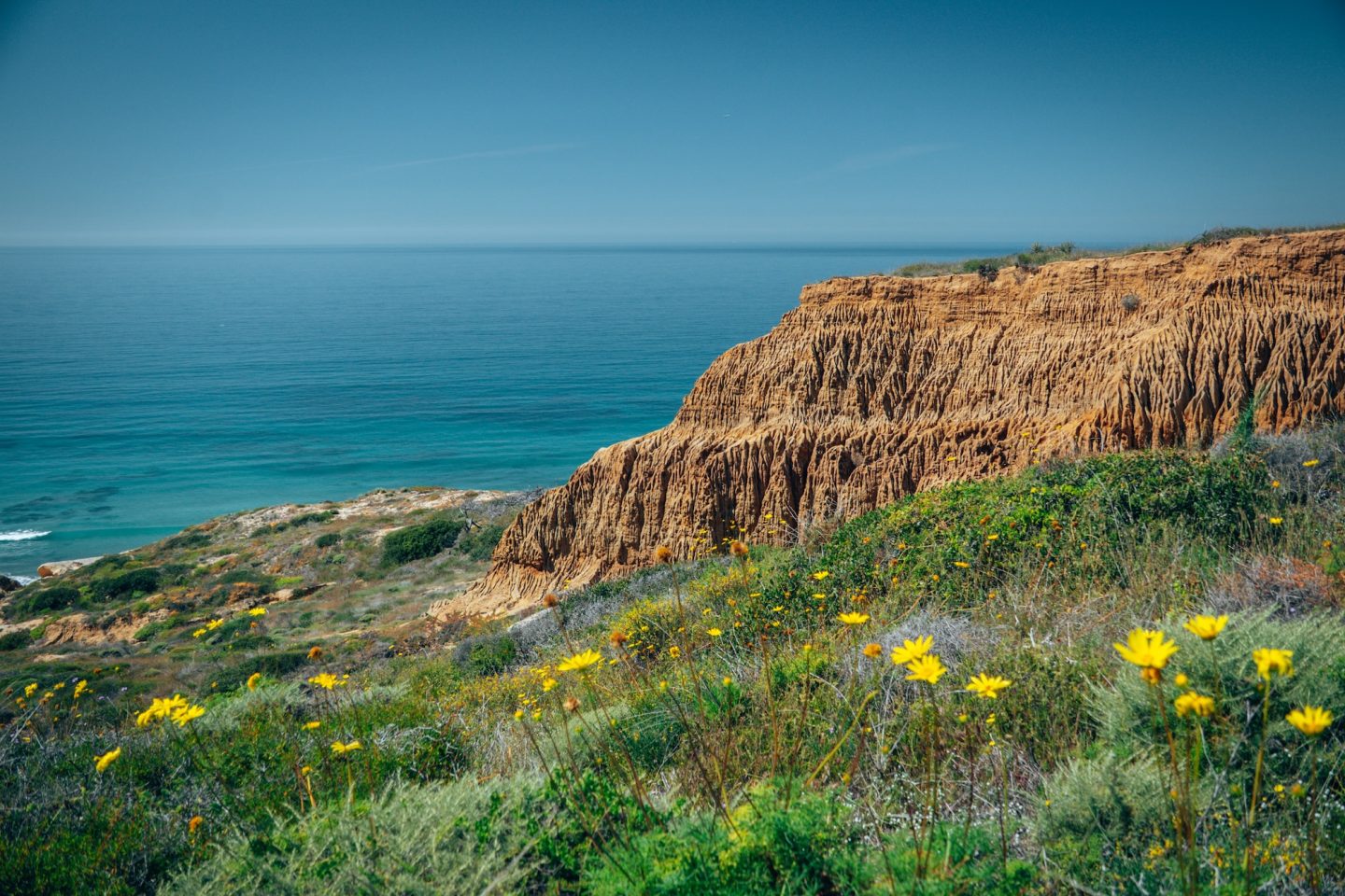
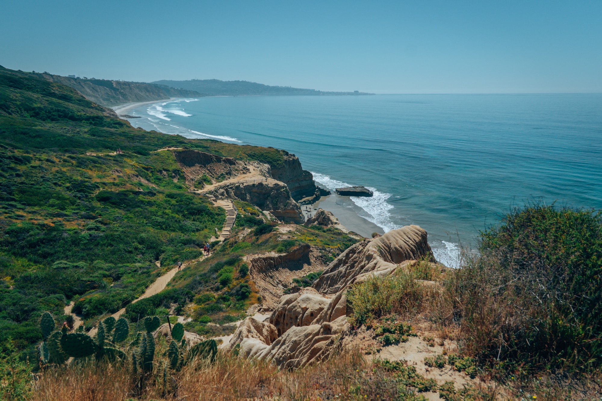
TORREY PINES STATE NATURAL RESERVE
Golden sandstone cliffs, rare coastal habitats, and sweeping ocean views define Torrey Pines State Natural Reserve, one of the most unique protected areas along Southern California’s coastline. The reserve sits above the Pacific near La Jolla and preserves one of the rarest pine species in the world, the Torrey pine, found naturally in only a few locations. Beyond the trees, the real draw is the dramatic coastal landscape, where wind-carved cliffs drop into the ocean and native coastal sage scrub stretches across the bluffs. Despite being just minutes from San Diego, the reserve feels surprisingly wild and untouched in many areas.
The best way to experience the reserve is by linking together the Red Butte, Yucca Point, and Razor Point Trails, for a roughly 2.0mi hike which showcase the park’s most iconic scenery. Red Butte offers elevated coastal views and access to interior trails lined with native vegetation. Yucca Point delivers sweeping overlooks of the Pacific with wide-open cliffside perspectives. Razor Point stands out for its dramatic sandstone formations, carved canyons, and layered badlands-like textures that feel almost otherworldly. Combined, these trails create one of the most scenic short hiking loops in Southern California, especially around sunset when the cliffs glow with warm light.
- LOCATION: Del Mar, San Diego County
- ENTRY FEE: $10-$12 vehicle day use fee
- CAMPGROUNDS: None
- PET POLICY: Dogs are not permitted in the park
- SEASONALITY: Operating season is year-round
- BEST TIME TO VISIT: Fall-Spring
- OFFICIAL SITE: Torrey Pines State Natural Reserve
PRAIRIE CREEK REDWOODS STATE PARK
Towering old-growth forests, fern-filled understories, and a deep sense of quiet define Prairie Creek Redwoods State Park, one of the most iconic redwood destinations in Northern California. Located along the northern stretch of the Redwood Highway, the park protects some of the tallest and most impressive coastal redwoods in the world. Unlike more developed parks, Prairie Creek feels raw and immersive, with dense forest, roaming elk herds, and misty conditions that often linger throughout the day.
REDWOOD NATIONAL & STATE PARKS
Prairie Creek Redwoods State Park is also part of a larger protected ecosystem that includes Redwood National and State Parks. Redwood National Park is jointly managed alongside three California state parks: Prairie Creek Redwoods State Park, Del Norte Coast Redwoods State Park, and Jedediah Smith Redwoods State Park. Together, these protected areas operate as Redwood National and State Parks, helping preserve nearly half of the world’s remaining old-growth coastal redwoods through the only partnership between the National Park Service and California State Parks.
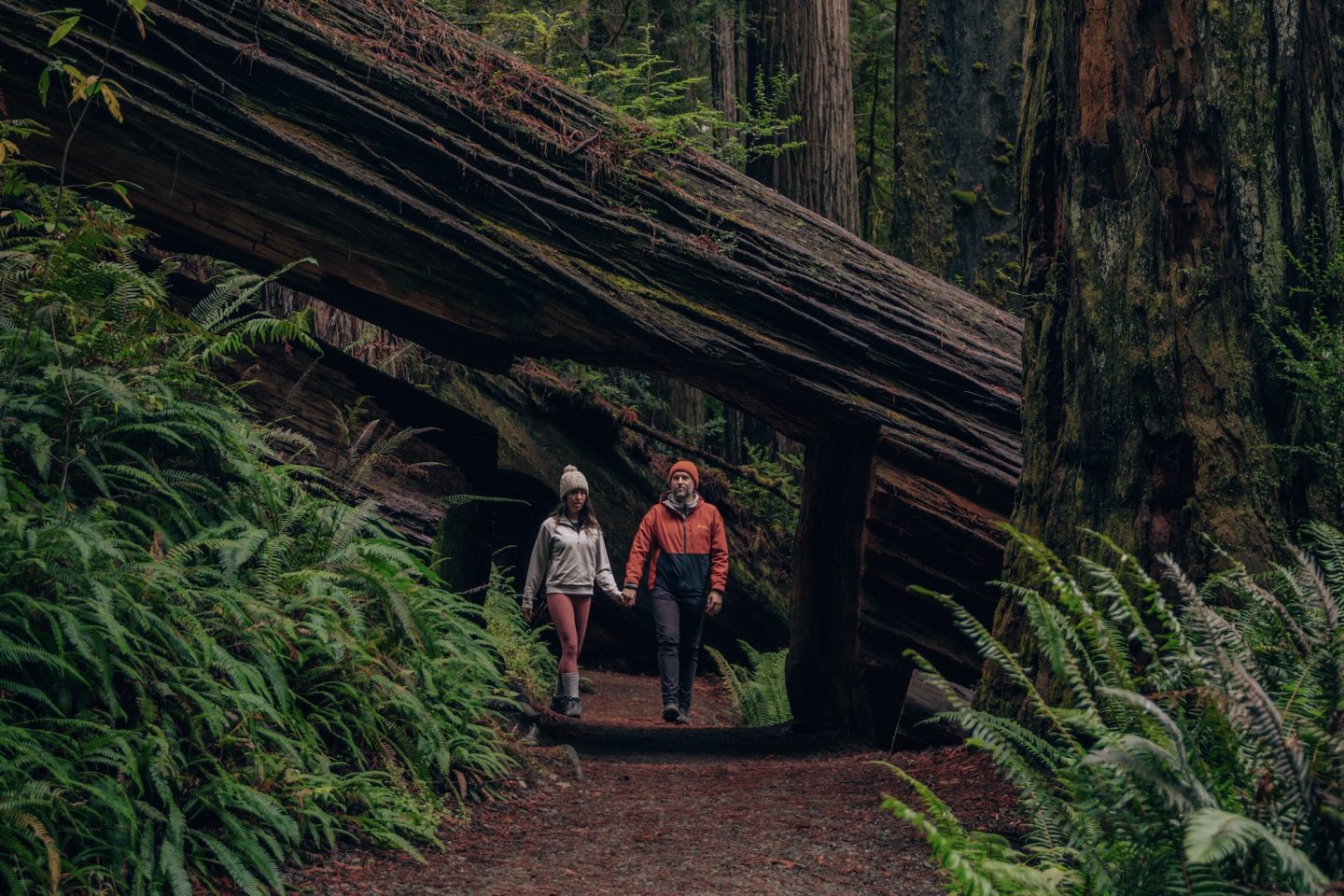
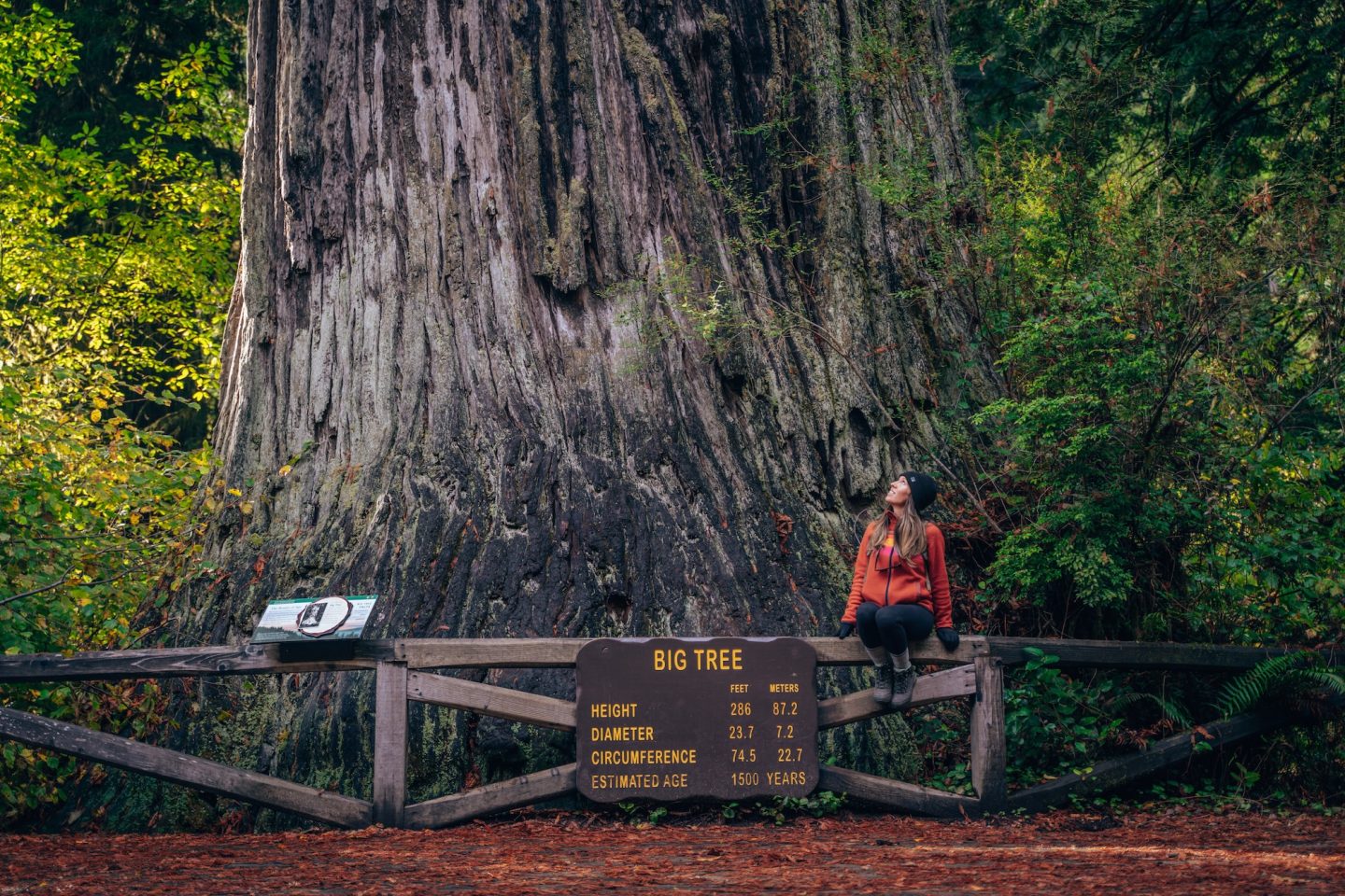
One of the most iconic experiences in Prairie Creek Redwoods State Park is the Fern Canyon Loop. A short 1.2mi trail that winds through a narrow, vertical-walled canyon covered in lush hanging ferns and dripping greenery. It feels almost prehistoric, especially after rain, when the walls turn fully vibrant and the creek runs through the canyon floor. For a classic old-growth redwood experience, the Big Tree via Karl Knapp Trail and Cathedral Trees delivers a 3.0mi, relatively easy hike through a quiet grove of towering redwoods that feel like natural cathedrals to one of the park’s most impressive giants, surrounded by massive trunks and dense forest. Together, these trails capture the best of Prairie Creek Redwoods State Park.
- LOCATION: Orick, Humboldt County
- ENTRY FEE: Free
- CAMPGROUNDS: Gold Bluffs Beach Campground, Elk Prairie Campground
- PET POLICY: Dogs welcome in campgrounds only
- SEASONALITY: Operating season is year-round
- BEST TIME TO VISIT: Fall-Spring
- OFFICIAL SITE: Prairie Creek Redwoods State Park
CHECK OUT OUR OTHER REDWOOD NATIONAL & STATE PARK ARTICLES:
- REDWOOD NATIONAL AND STATE PARKS: HOW TO PLAN YOUR VISIT
- 10 MUST-DO ACTIVITIES IN REDWOOD NATIONAL PARK AND STATE PARKS
- ONE DAY IN REDWOOD NATIONAL PARK IN CALIFORNIA
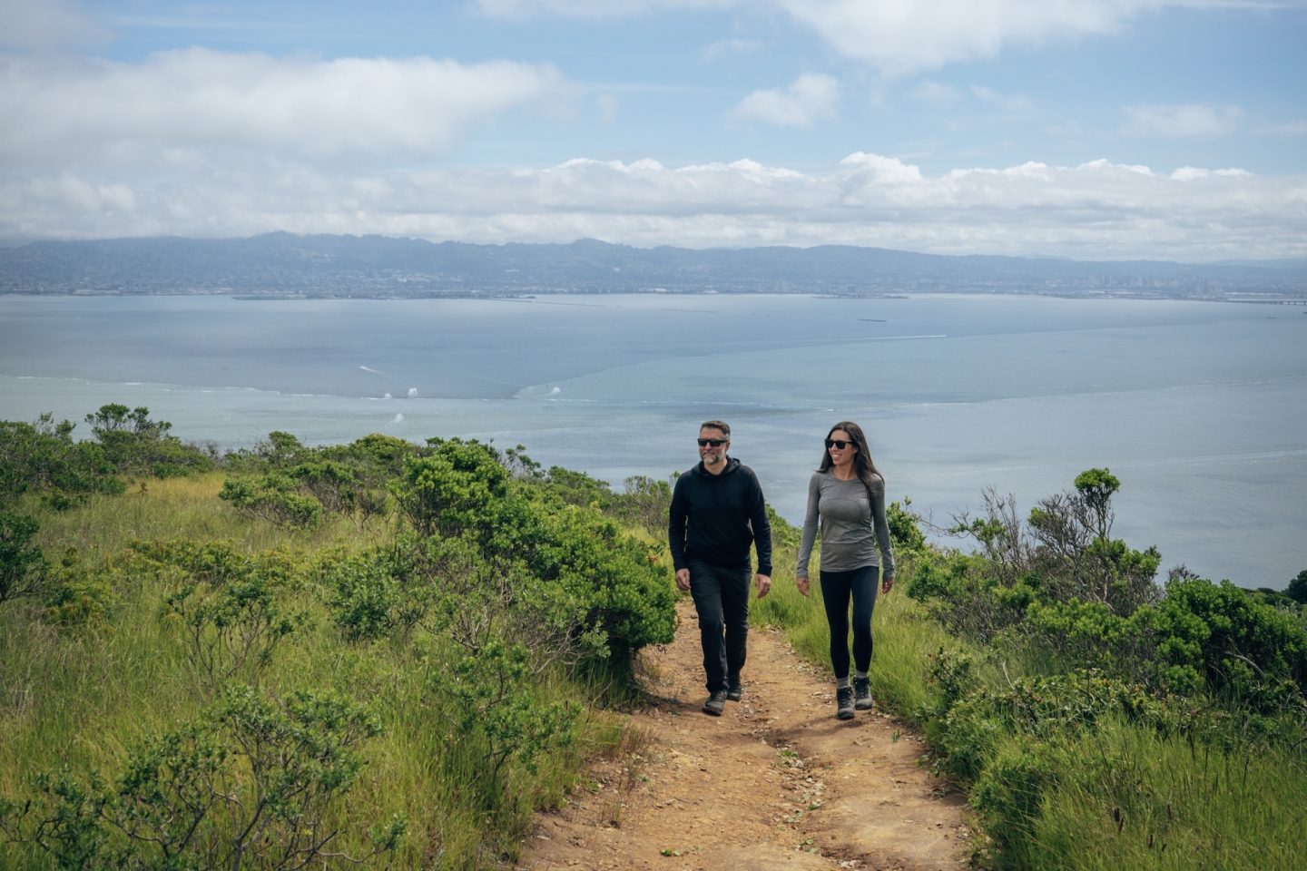
ANGEL ISLAND STATE PARK
Wide-open bay views, rolling hills, and a surprising sense of solitude define Angel Island State Park, one of the most scenic escapes in the San Francisco Bay. The island also carries deep cultural history, having served as a military post and later as an immigration station where thousands of people—many from Asia—were processed upon arrival in the United States. You can still explore historic buildings and interpretive exhibits that reflect this complex past, adding a meaningful layer to the island’s natural beauty. From the skyline of San Francisco to the distant peaks of Marin and Mount Tamalpais, the views alone make the trip worth it, but the combination of history and landscape gives Angel Island a much deeper sense of place.
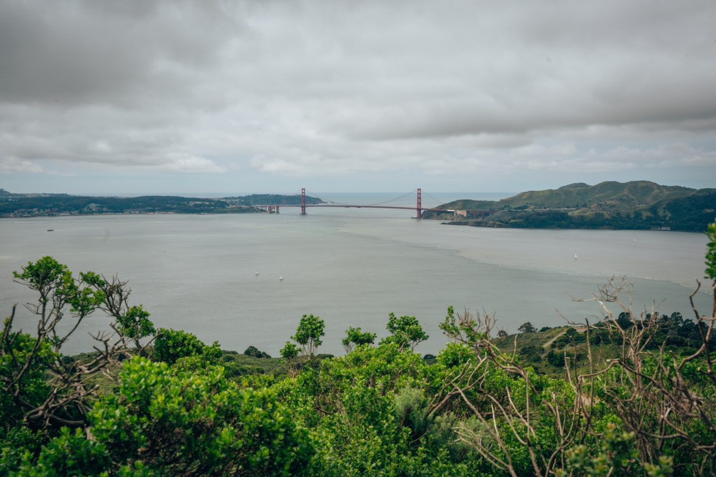
The North Ridge and Sunset Loop Trail is one of the best ways to experience the island. This roughly 5.0mi loop climbs steadily to open ridgelines before reaching the peak at Mount Caroline Livermore offering 360º views of the Bay Area and beyond. The trail then wraps around the western side of the island, offering quieter stretches away from the main crowds. Together, these trails showcase the best of Angel Island’s mix of natural landscapes and dramatic viewpoints, making it one of the most rewarding state park day trips near San Francisco.
- LOCATION: Tiburon, Marin County
- ENTRY FEE: Free, but a ~$19 ferry ride is required
- CAMPGROUNDS: The park has 6 hike-in campgrounds
- PET POLICY: Dogs are not permitted in the park
- SEASONALITY: Operating season is year-round
- BEST TIME TO VISIT: Fall-Spring
- OFFICIAL SITE: Angel Island State Park
NEED MORE INFO? ANGEL ISLAND STATE PARK – CALIFORNIA’S ONLY FLOATING STATE PARK
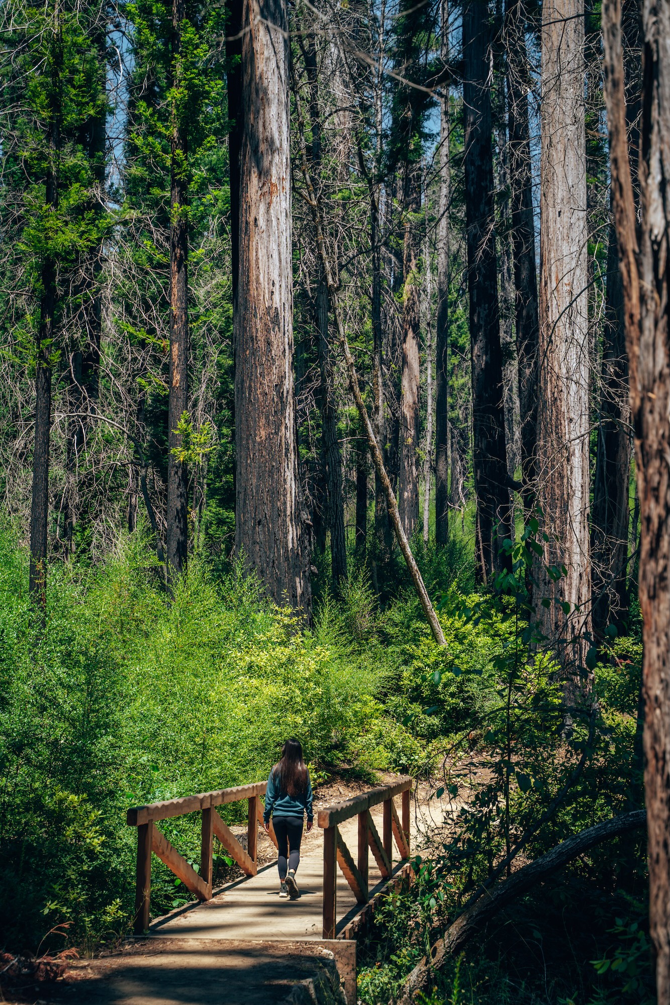
BIG BASIN REDWOODS STATE PARK
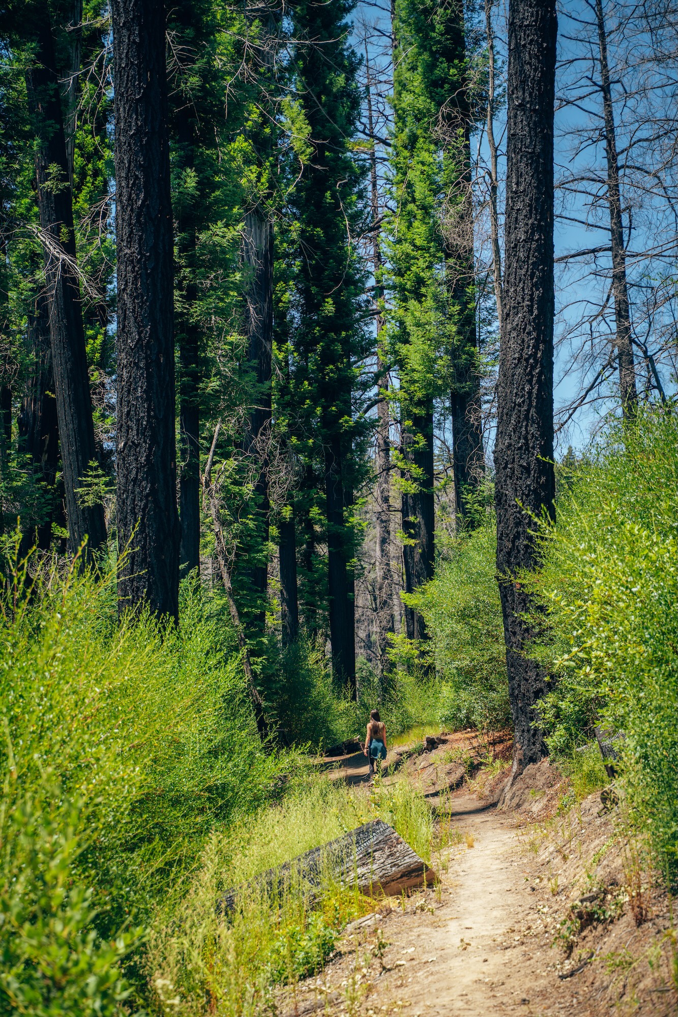
Ancient coastal redwoods, deep canyon forests, and a powerful sense of history define Big Basin Redwoods State Park, the oldest state park of California. Established in 1902, it helped launch the state’s entire park system and protects some of the largest and oldest redwood trees in the region. Before the major fire events in recent years, the park was known for its dense old-growth groves, shaded waterfalls, and quiet, moss-covered trails that felt worlds away from nearby coastal towns. Even today, the landscape still reflects both its resilience and its long history of conservation.
In 2020, the CZU Lightning Complex Fire severely impacted Big Basin, burning through much of the park and forcing a long closure for restoration and safety work. While parts of the park have reopened, large sections remain closed or limited, as recovery and rebuilding efforts continue across trails, facilities, and forest areas. Visitors can still experience select accessible areas and nearby trails, but much of the original old-growth core is not currently open to the public. Despite the damage, the park remains an important symbol of California’s redwood legacy and ongoing ecological recovery, making a visit both impactful and reflective.
- LOCATION: Boulder Creek, Santa Cruz County
- ENTRY FEE: $8-$10 vehicle day use fee
- CAMPGROUNDS: None at the moment
- PET POLICY: Dogs are not permitted in the park
- SEASONALITY: Operating season is usually year-round
- BEST TIME TO VISIT: Spring-Fall
- OFFICIAL SITE: Big Basin Redwoods State Park
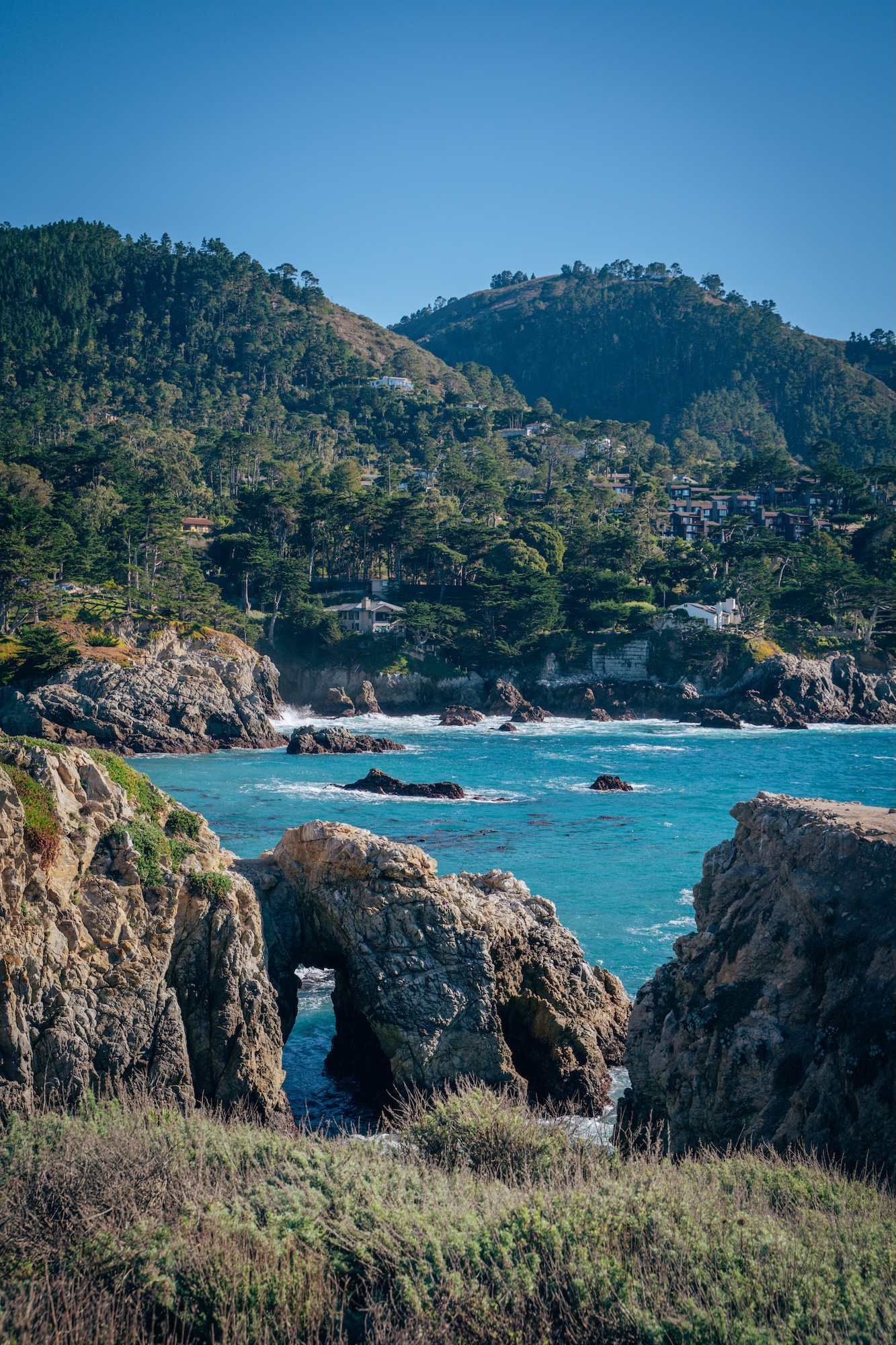
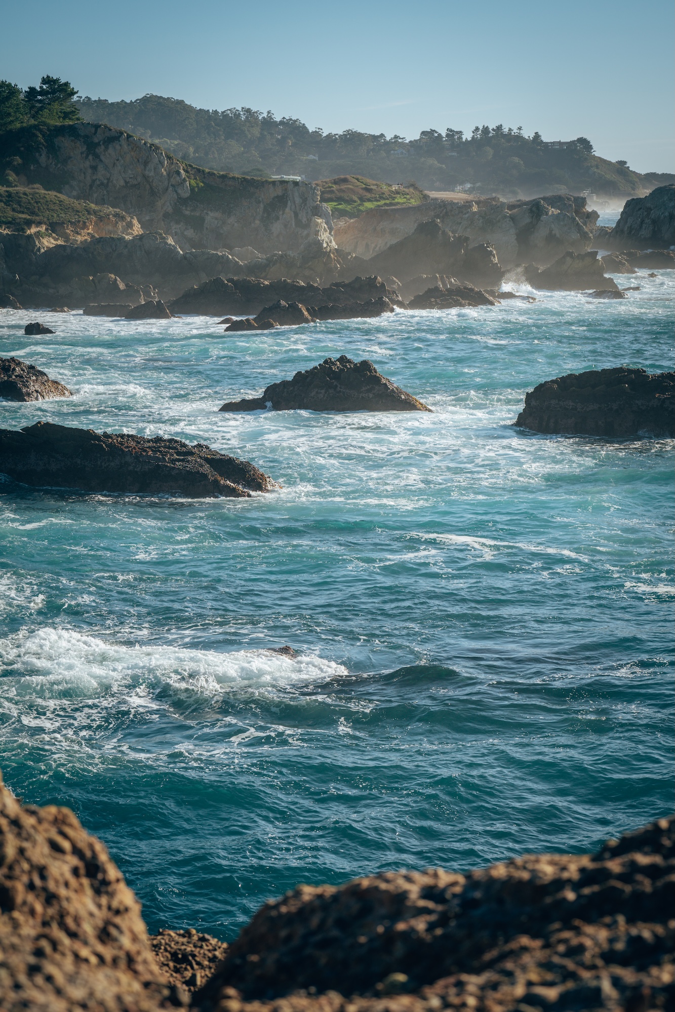
POINT LOBOS STATE NATURAL RESERVE
Dramatic coastal cliffs, turquoise coves, and windswept cypress trees make Point Lobos State Natural Reserve one of the most beautiful stretches of coastline in California. Located just south of Carmel, the reserve protects a compact but incredibly diverse coastal landscape filled with hidden beaches, rocky headlands, and dense coastal forest.
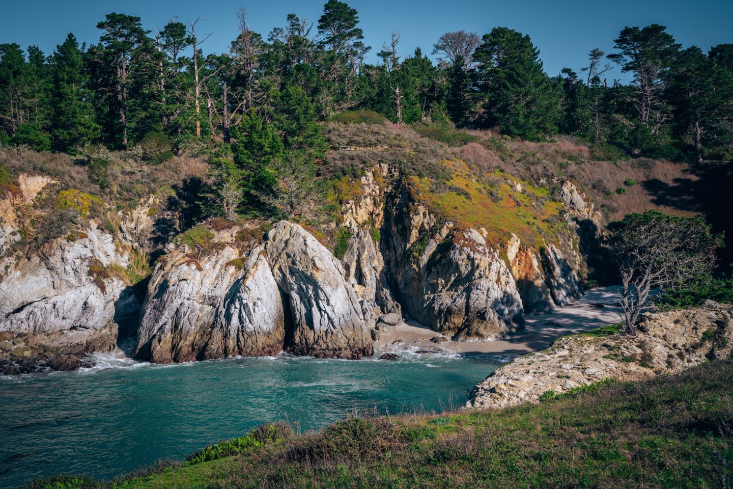
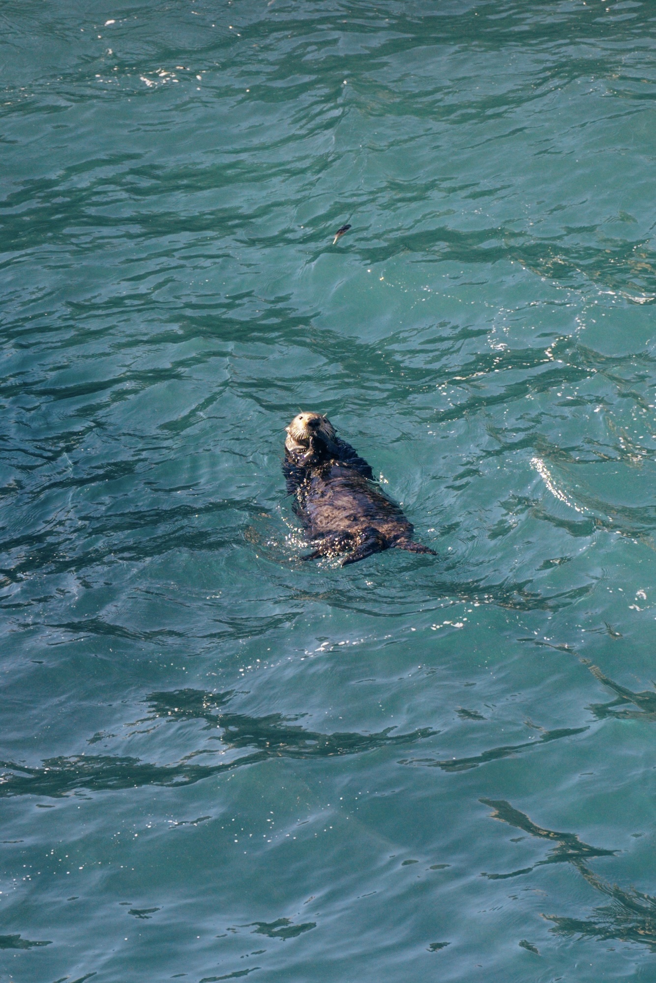
Wildlife sightings are common here, with sea lions, harbor seals, sea otters, and migrating whales often visible from shore. Despite its relatively small size, Point Lobos delivers some of the most scenic ocean views anywhere on the California coast.
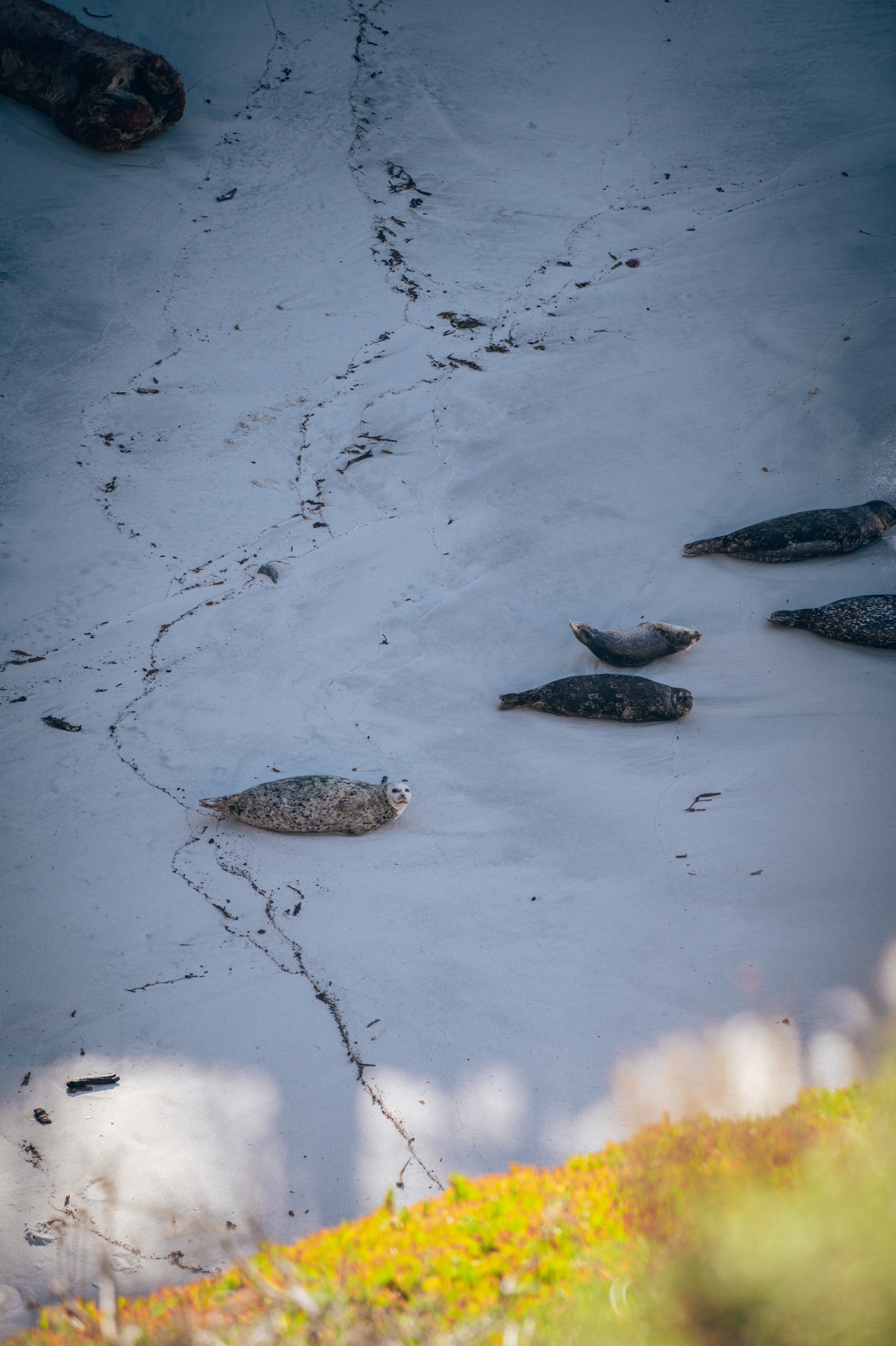
The best way to experience the reserve is by exploring several of its short interconnected trails. The Cypress Grove Trail loops through twisted Monterey cypress trees and overlooks dramatic ocean cliffs. The Bird Island and South Plateau Trail offers the most iconic views in the park, along with excellent wildlife viewing, especially during harbor seal pupping season. Together, these trails showcase the rugged beauty that makes Point Lobos such an iconic California destination.
- LOCATION: Carmel, Monterey County
- ENTRY FEE: $10 vehicle day use fee
- CAMPGROUNDS: None
- PET POLICY: Dogs are not permitted in the park
- SEASONALITY: Open year-round
- BEST TIME TO VISIT: Year-round
- OFFICIAL SITE: Point Lobos State Natural Reserve
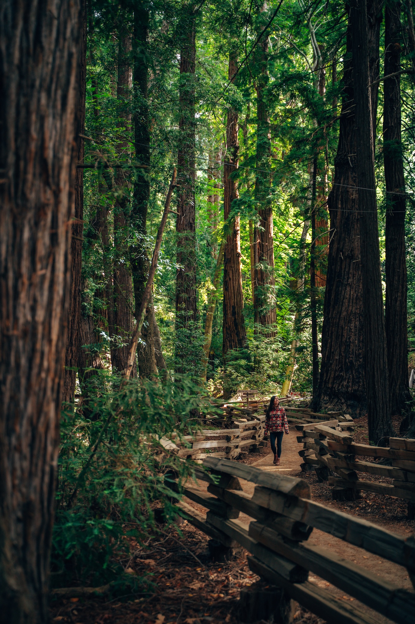
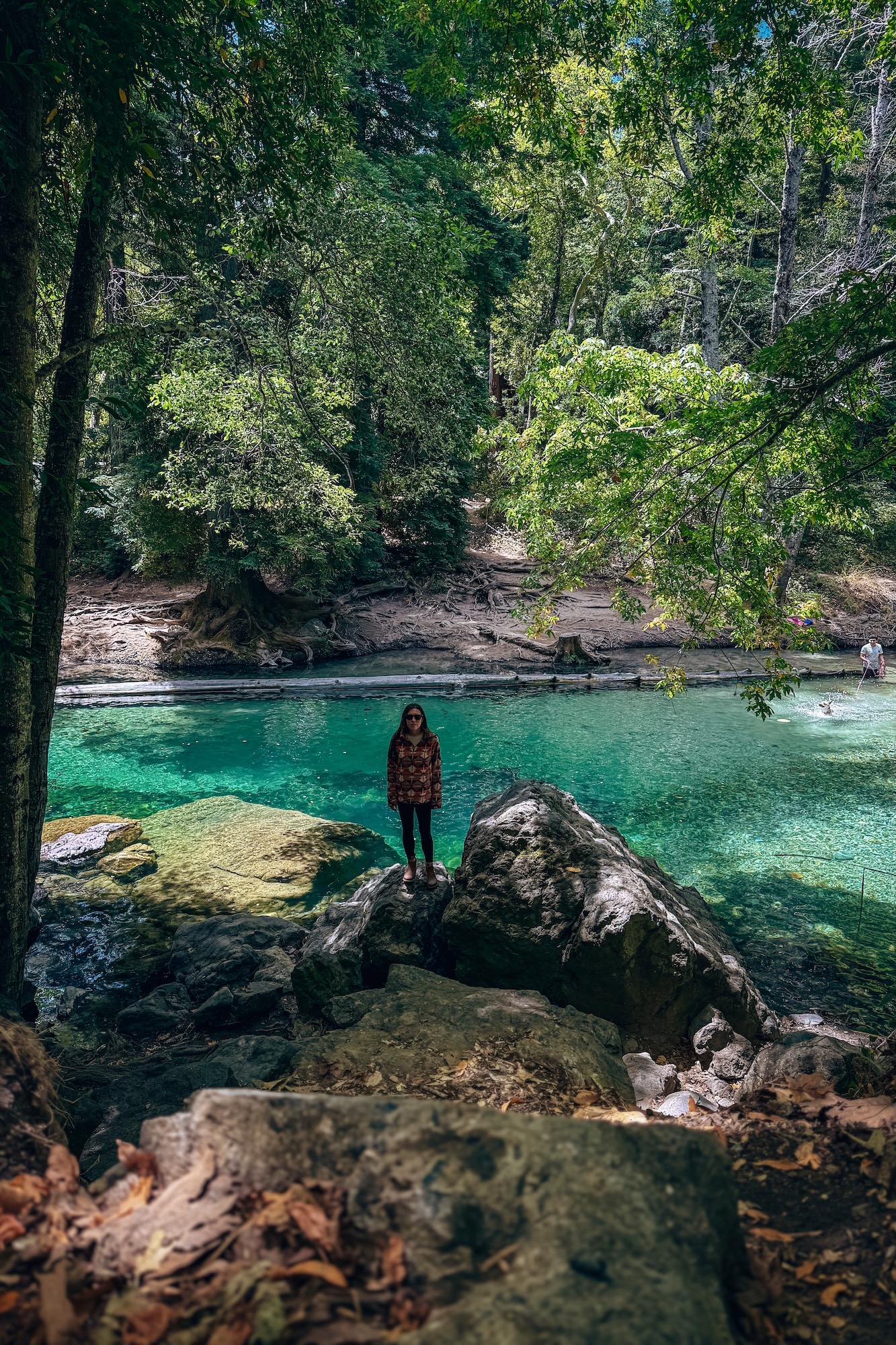
PFEIFFER BIG SUR STATE PARK
Towering redwoods, rugged mountains, and the Big Sur River make Pfeiffer Big Sur State Park one of the most iconic parks along California’s central coast. Located in the heart of Big Sur, just 30 minutes south of Point Lobos SNR, the park combines dense redwood forest with dramatic canyon scenery and easy river access. Unlike many coastal parks, Pfeiffer Big Sur feels more forested and sheltered. With cool shade and peaceful campsites tucked beneath massive trees. Its central location also makes it a perfect basecamp for exploring the surrounding Big Sur area.
Some of the best experiences in the park center around the Big Sur River and the surrounding redwood forest. The Big Sur River Gorge Trail leads visitors to a beautiful section of the river with clear pools, massive boulders, and shaded canyon scenery. It’s one of the most popular spots in the park during warmer months, especially for relaxing beside the water.
The Pfeiffer Falls and Valley View Trail currently functions as a combined 1.7mi hike and passes through dense redwood groves before crossing a scenic suspension bridge on the way toward Pfeiffer Falls. Continuing farther along the Valley View section opens up elevated views over the Big Sur River Valley, creating a great mix of forest and scenic overlooks in a relatively short hike.
- LOCATION: Big Sur, Monterey County
- ENTRY FEE: $10 vehicle day use fee
- CAMPGROUNDS: Pfeiffer Big Sur State Park Campground
- PET POLICY: Dogs welcome in campgrounds and river only
- SEASONALITY: Operating season is usually year-round
- BEST TIME TO VISIT: Year-round
- OFFICIAL SITE: Pfeiffer Big Sur State Park
NEED MORE INFO?
- PFEIFFER BIG SUR STATE PARK: THE ULTIMATE BIG SUR CAMPGROUND
- ULTIMATE TRAVEL GUIDE TO BIG SUR CALIFORNIA, USA
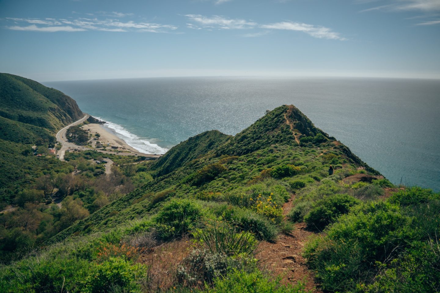
POINT MUGU STATE PARK
Steep coastal mountains, hidden beaches, and sweeping ocean views make Point Mugu State Park one of the most diverse state parks in Southern California. Stretching along the Malibu coastline, the park protects a dramatic mix of rugged shoreline, deep canyons, and chaparral-covered hillsides. The scenery feels especially impressive because the Santa Monica Mountains rise directly from the Pacific, creating constant elevation changes and wide-open coastal views. Despite being close to Los Angeles, many parts of the park still feel surprisingly wild and uncrowded.
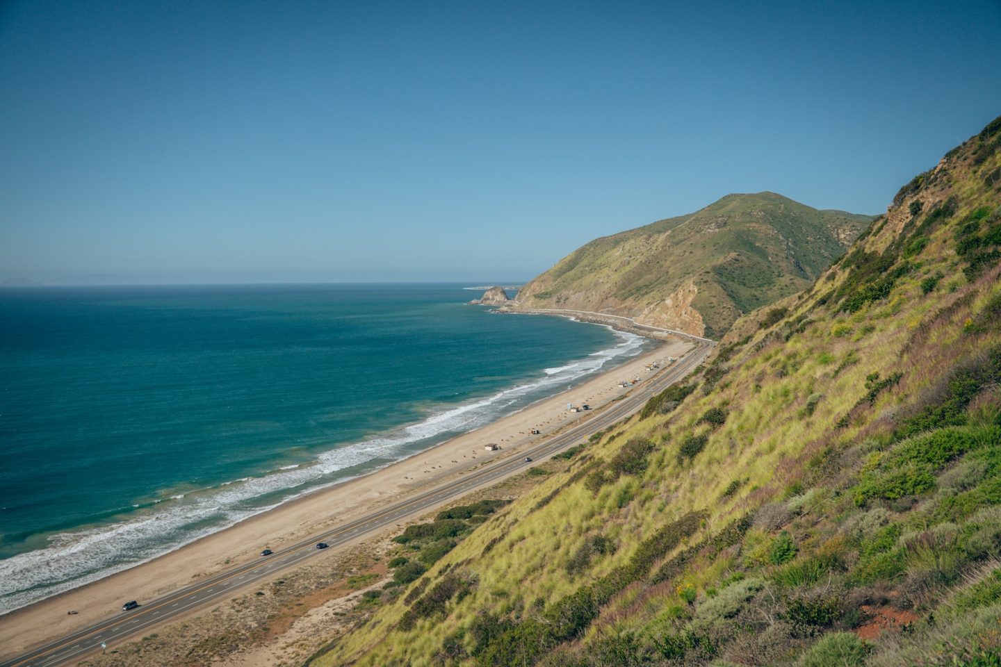
One of the best hikes in the park is the 2.5mi Scenic and Overlook Trails Loop, which combines steady elevation gain with panoramic views of the Pacific Ocean and surrounding mountains. The route climbs above the coastline through coastal sage scrub before reaching several scenic overlooks with sweeping perspectives over the beaches below. On clear days, the views stretch for miles along the Malibu coast.
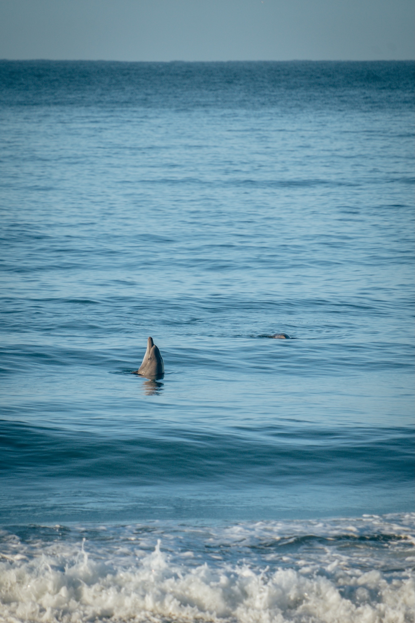
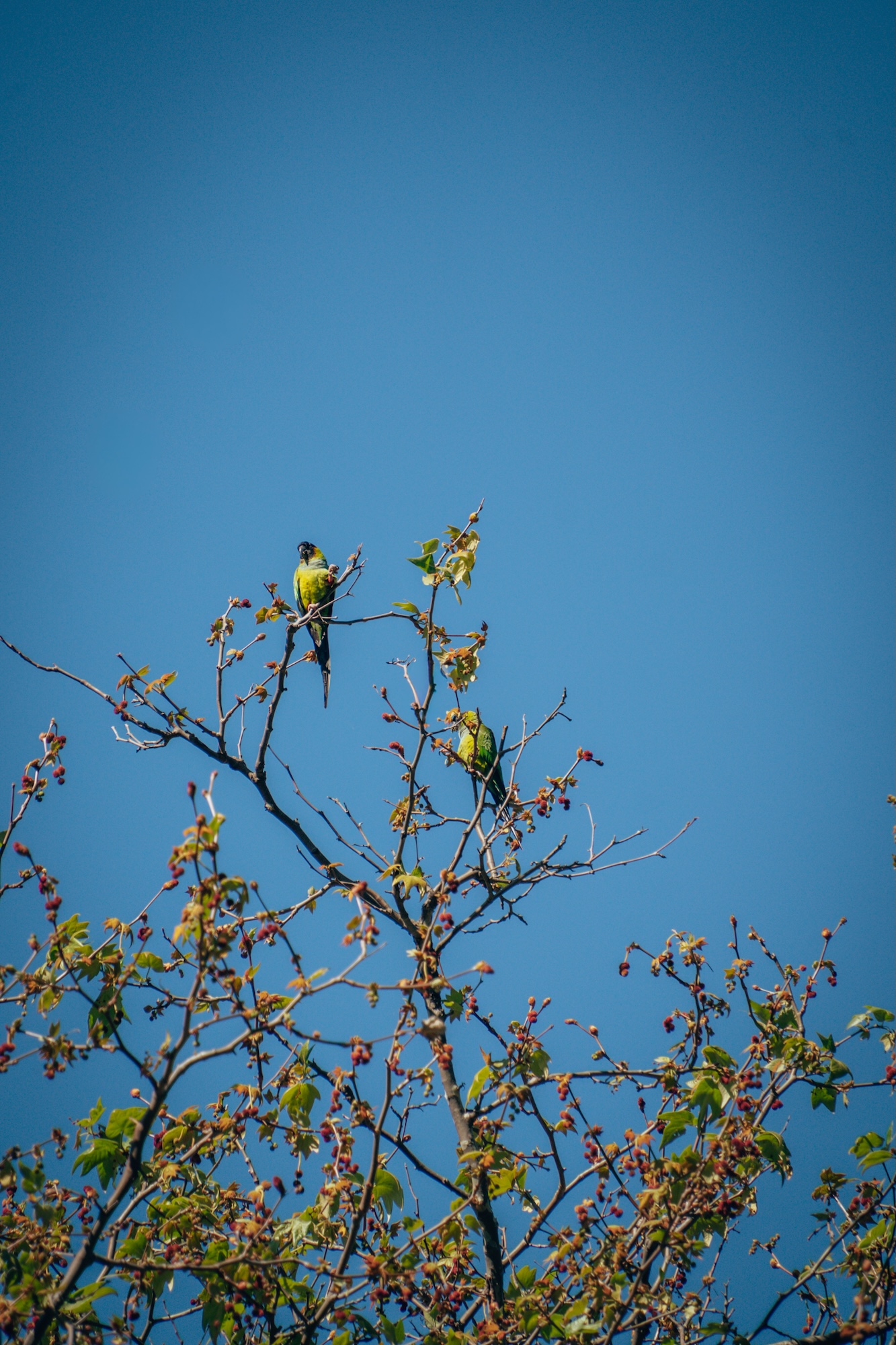
Wildlife is also abundant throughout Point Mugu State Park, especially in the quieter canyon areas and along the coastline. Visitors may spot dolphins offshore, hawks soaring overhead, and even colorful wild parrots and parakeets flying through parts of the Santa Monica Mountains. The combination of ocean scenery, mountain terrain, and relatively accessible hiking makes this one of the standout trails in the Santa Monica Mountains.
- LOCATION: Malibu, Ventura County
- ENTRY FEE: $10 vehicle day use fee
- CAMPGROUNDS: Thornhill Broome and Sycamore Canyon
- PET POLICY: Dogs welcome in campgrounds and day-use areas only
- SEASONALITY: Operating season is year-round
- BEST TIME TO VISIT: Year-round
- OFFICIAL SITE: Point Mugu State Park
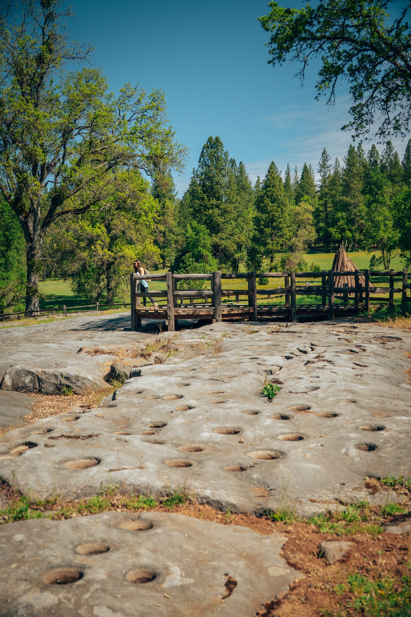
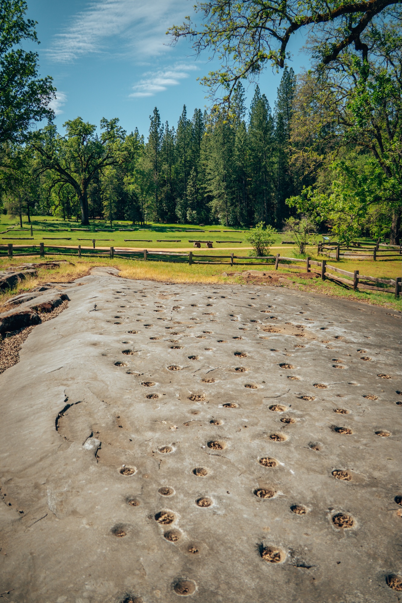
INDIAN GRINDING ROCK STATE HISTORIC PARK
Ancient cultural history, oak woodlands, and rolling Sierra foothills define Indian Grinding Rock State Historic Park, one of the most historically significant state parks in California. The park protects a large marble outcropping filled with hundreds of grinding holes once used by the Miwok and other Native California tribes to process acorns into meal. Unlike many parks focused primarily on scenery or hiking, Indian Grinding Rock offers a deeper connection to California’s Indigenous history and cultural traditions. The peaceful forest setting and interpretive exhibits help create an experience that feels both educational and reflective.
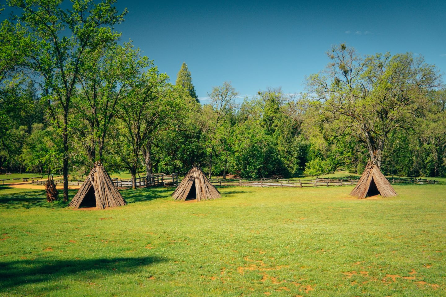
One of the best ways to experience the park is along the Indian Grinding Rock South Nature Trail, a short interpretive route that connects key cultural and natural features. The trail highlights the Chaw’se grinding rock, where hundreds of bedrock mortar holes can still be seen carved into the marble by the Miwok and other Native California tribes. It also passes by the Chaw’se Regional Indian Museum, which adds important context through exhibits and reconstructed traditional structures. Together, the trail offers a compact but meaningful walk that ties the park’s landscape directly to its deep cultural history.
- LOCATION: Pine Grove, Amador County
- ENTRY FEE: $8 vehicle day use fee
- CAMPGROUNDS: Indian Grinding Rock Campground
- PET POLICY: Dogs welcome in campgrounds and paved areas only
- SEASONALITY: Operating season is year-round
- BEST TIME TO VISIT: Year-round
- OFFICIAL SITE: Indian Grinding Rock State Historic Park
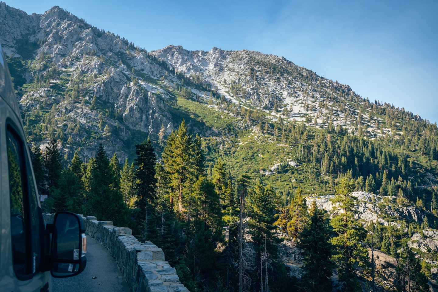
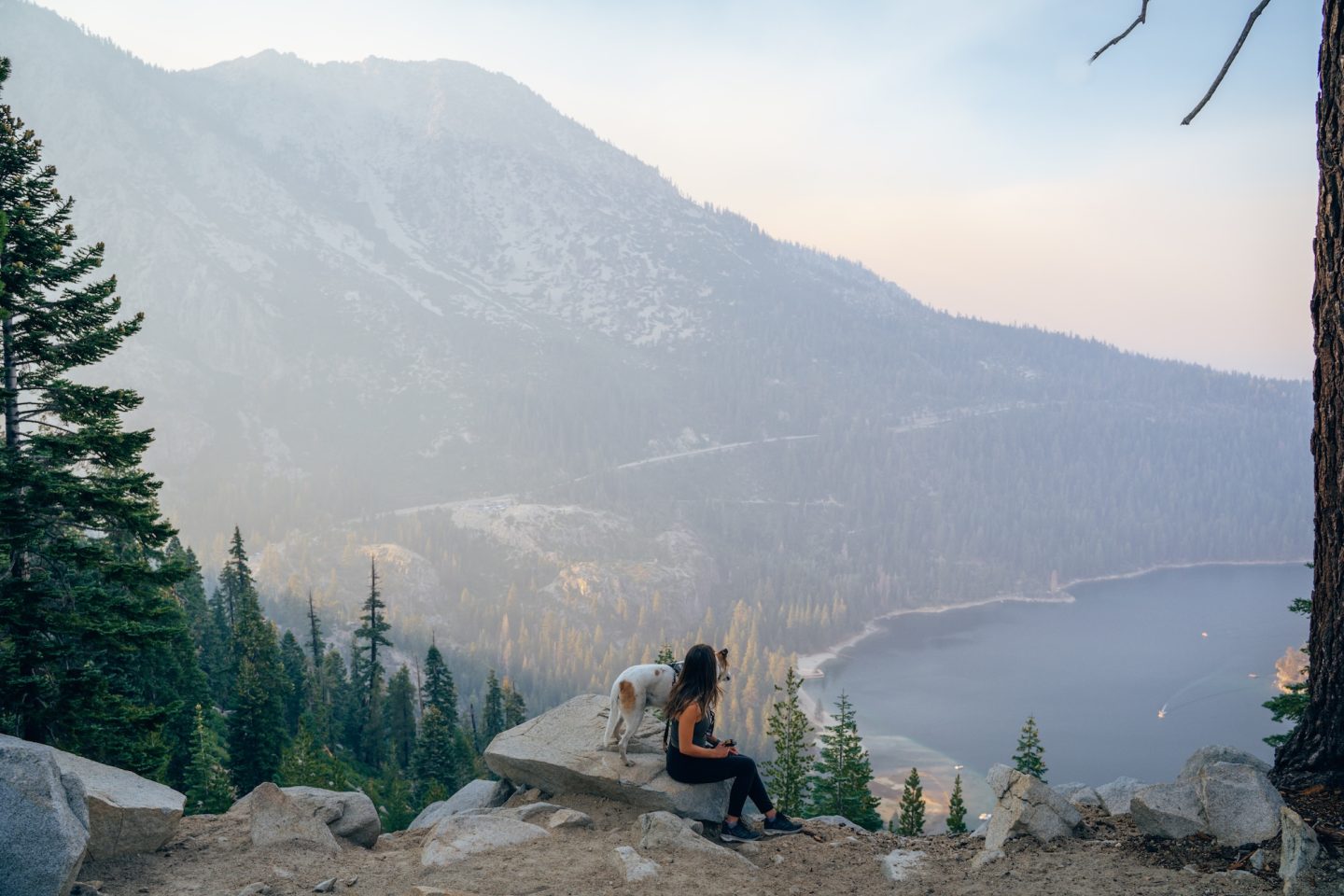
EMERALD BAY STATE PARK
Glacially carved cliffs, turquoise water, and alpine scenery make Emerald Bay State Park one of the most photographed places in California. Located on the southwest shore of Lake Tahoe, the park centers around a dramatic bay framed by steep granite walls and dense forest. The water here shifts between deep blue and bright emerald depending on light and season, creating a striking contrast against the surrounding Sierra Nevada peaks. Even from the roadside overlooks, the scale and color of the landscape feel almost unreal.
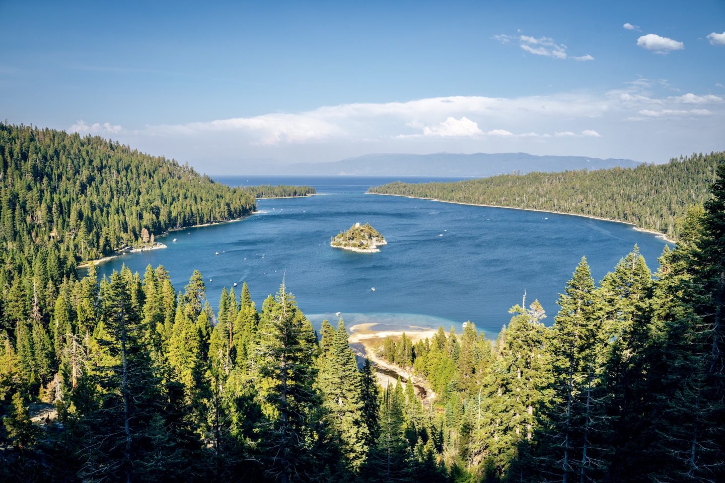
The best-known access point inside the park is the Eagle Falls to Eagle Lake Trail, which climbs quickly from the highway into alpine terrain and rewards hikers with a small mountain lake surrounded by granite cliffs. Down at the shoreline, the Emerald Bay and Vikingsholm area offers steep access trails leading to one of Lake Tahoe’s most photographed coves, with views of Fannette Island and the historic lakeside mansion.
Just outside the park boundaries, the Granite Lake and Maggie’s Peaks Trail is one of the best ways to experience Emerald Bay from above. The climb is steep but incredibly rewarding, opening up sweeping, elevated views over the entire bay, the deep blue of Lake Tahoe, and the surrounding Sierra peaks. It’s one of those hikes that completely changes your perspective of the landscape, giving you a far more dramatic and panoramic view than anything you’ll see from the shoreline.
- LOCATION: South Lake Tahoe, El Dorado County
- ENTRY FEE: $10 vehicle day use fee
- CAMPGROUNDS: Eagle Point Campground
- PET POLICY: Dogs are not permitted
- SEASONALITY: Operating season is usual spring-fall
- BEST TIME TO VISIT: Early summer or late fall
- OFFICIAL SITE: Emerald Bay State Park
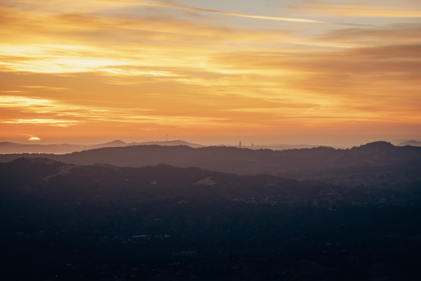
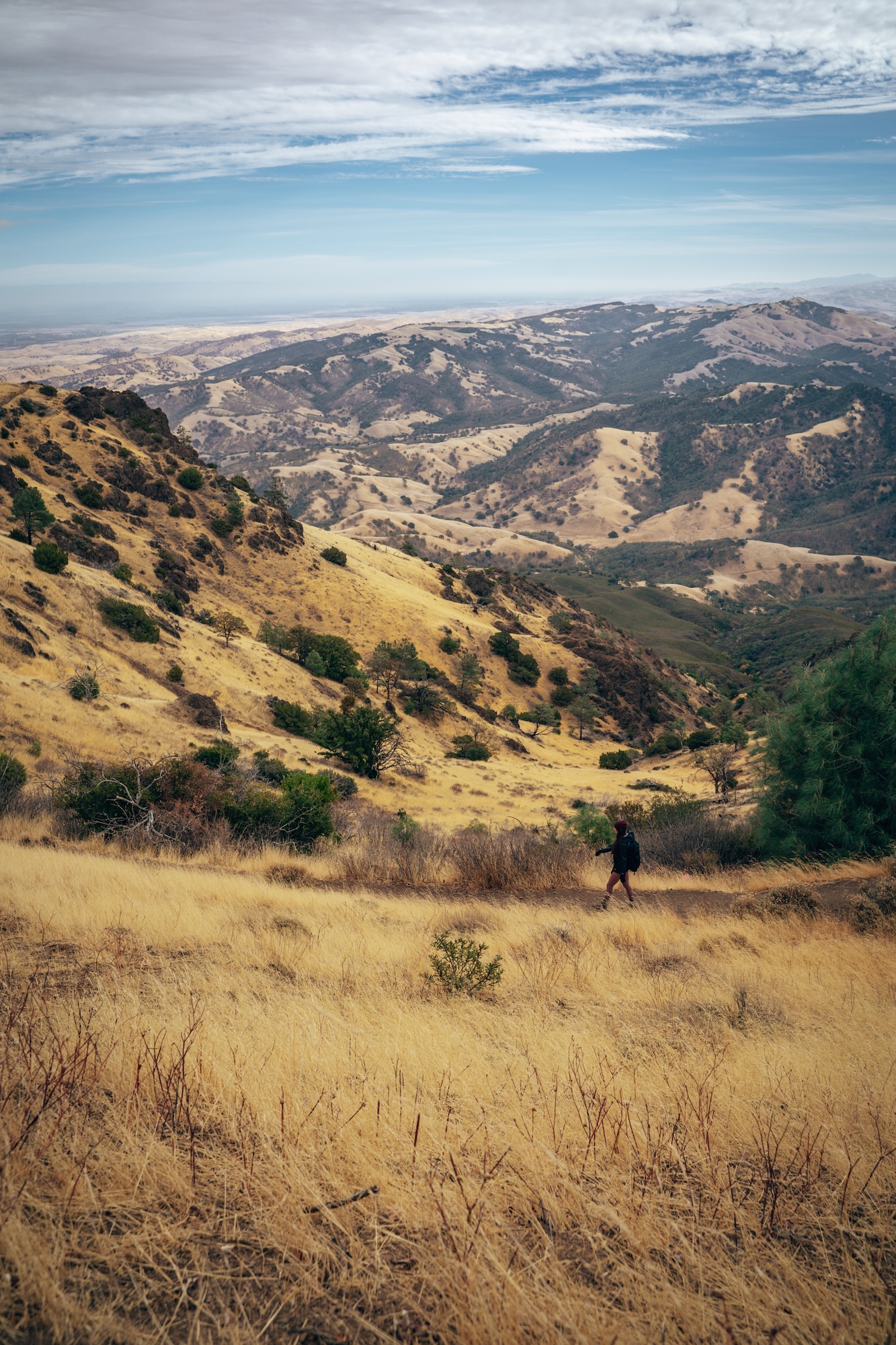
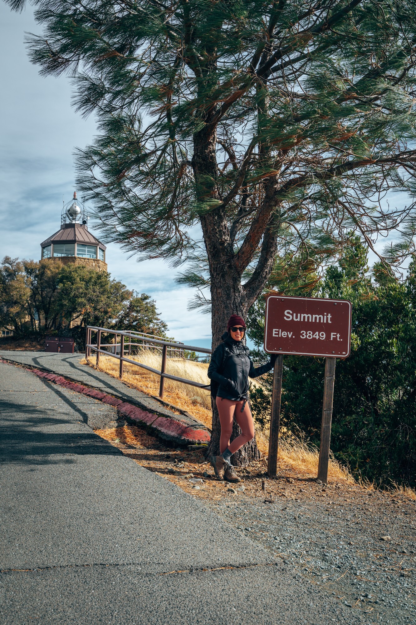
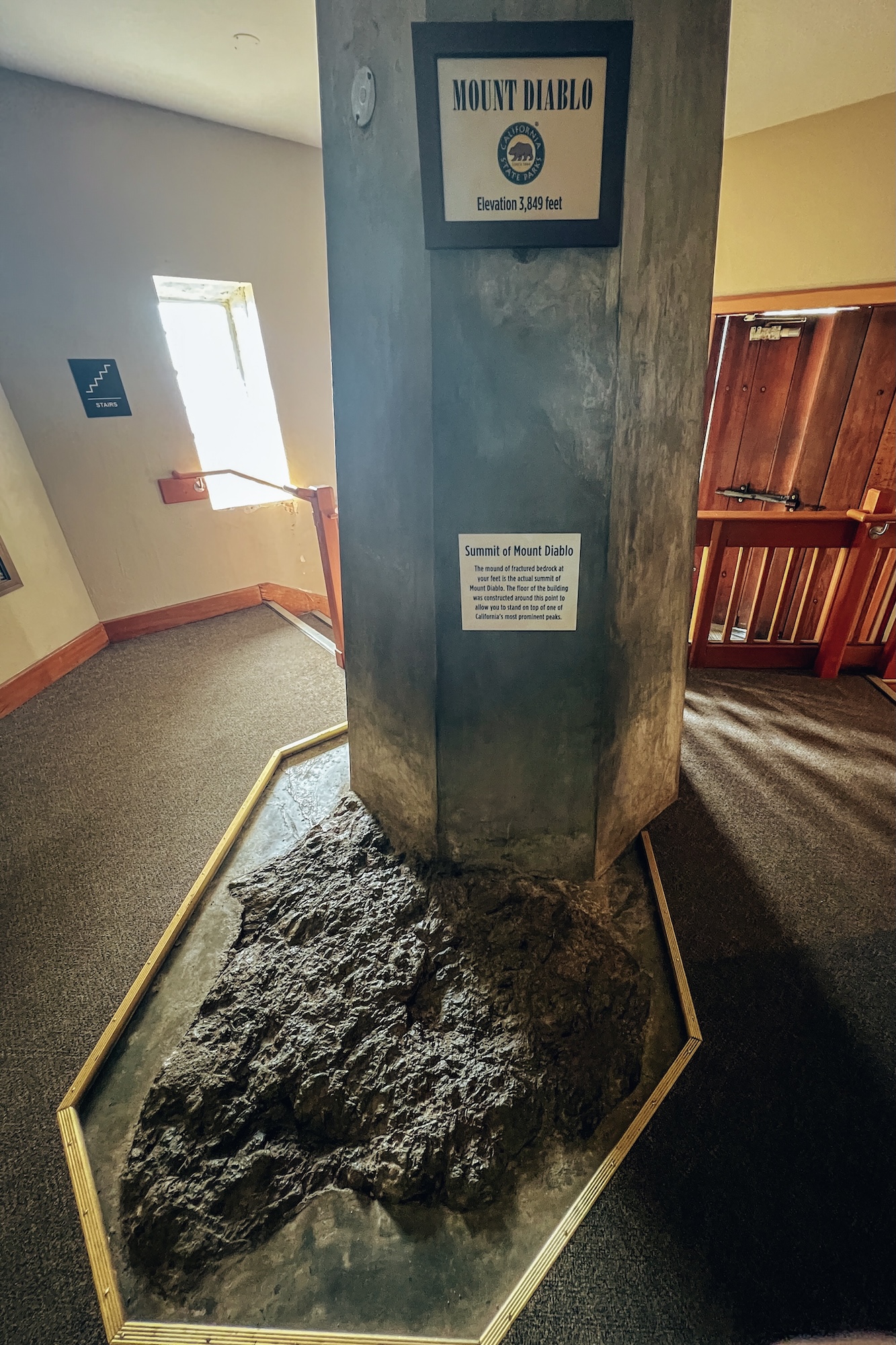
MOUNT DIABLO STATE PARK
Sweeping 360-degree views, rugged ridgelines, and rolling golden hills define Mount Diablo State Park, one of the most iconic peaks in the Bay Area (and California). On clear days, the summit offers visibility that stretches across most of Northern California, from the Sierra Nevada to the Golden Gate Bridge. The mountain rises sharply from the surrounding suburbs, creating a dramatic contrast between urban development and wild open space. Despite its proximity to dense population centers, the park still feels expansive, quiet, and surprisingly remote once you gain elevation.
The most popular route to the summit is the Mount Diablo Summit Trail, a challenging but rewarding climb that passes through oak woodlands and exposed ridgelines. At the top, visitors can explore the historic summit tower and take in panoramic views in every direction. Another standout hike is the Rock City and Sentinel Rock Loop, which features sandstone formations, caves, and unique wind-carved shapes that make this area especially popular with families and photographers. Together, these experiences showcase both the physical challenge and the incredible payoff that make Mount Diablo one of the most memorable state parks in California.
- LOCATION: Danville, Contra Costa County
- ENTRY FEE: $10 vehicle day use fee
- CAMPGROUNDS: Juniper Campground and Live Oak Campground
- PET POLICY: Dogs welcome in campgrounds and paved areas only
- SEASONALITY: Operating season is year-round
- BEST TIME TO VISIT: Fall-Spring
- OFFICIAL SITE: Mount Diablo State Park
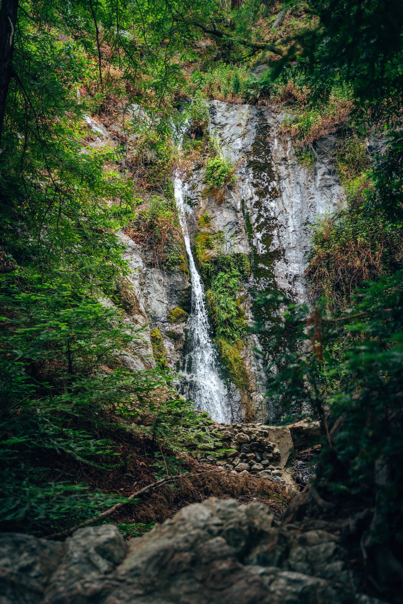
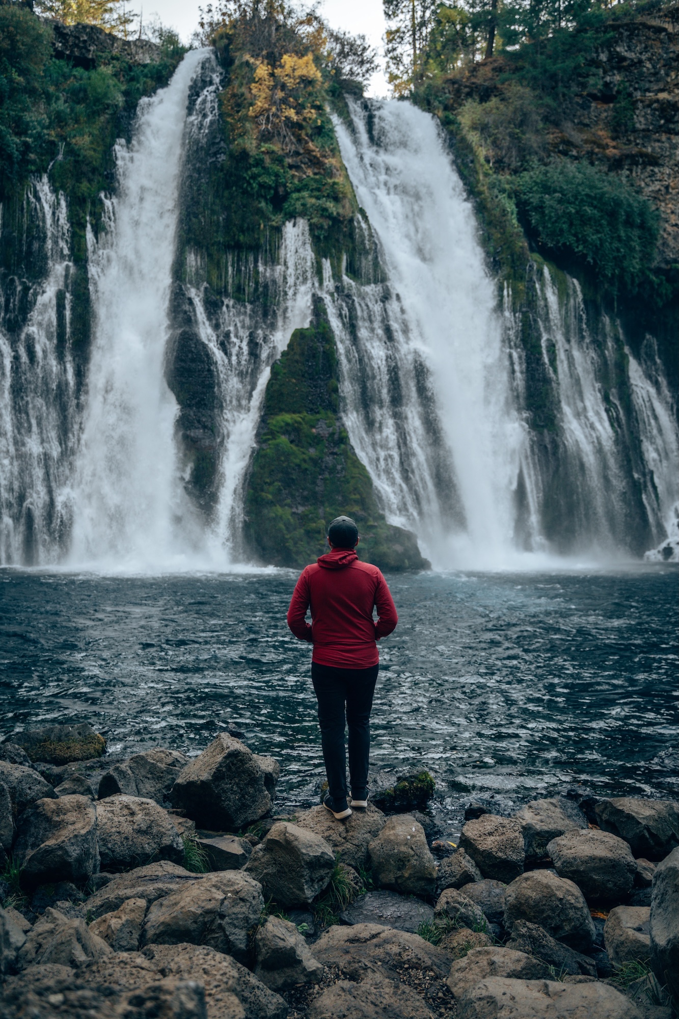
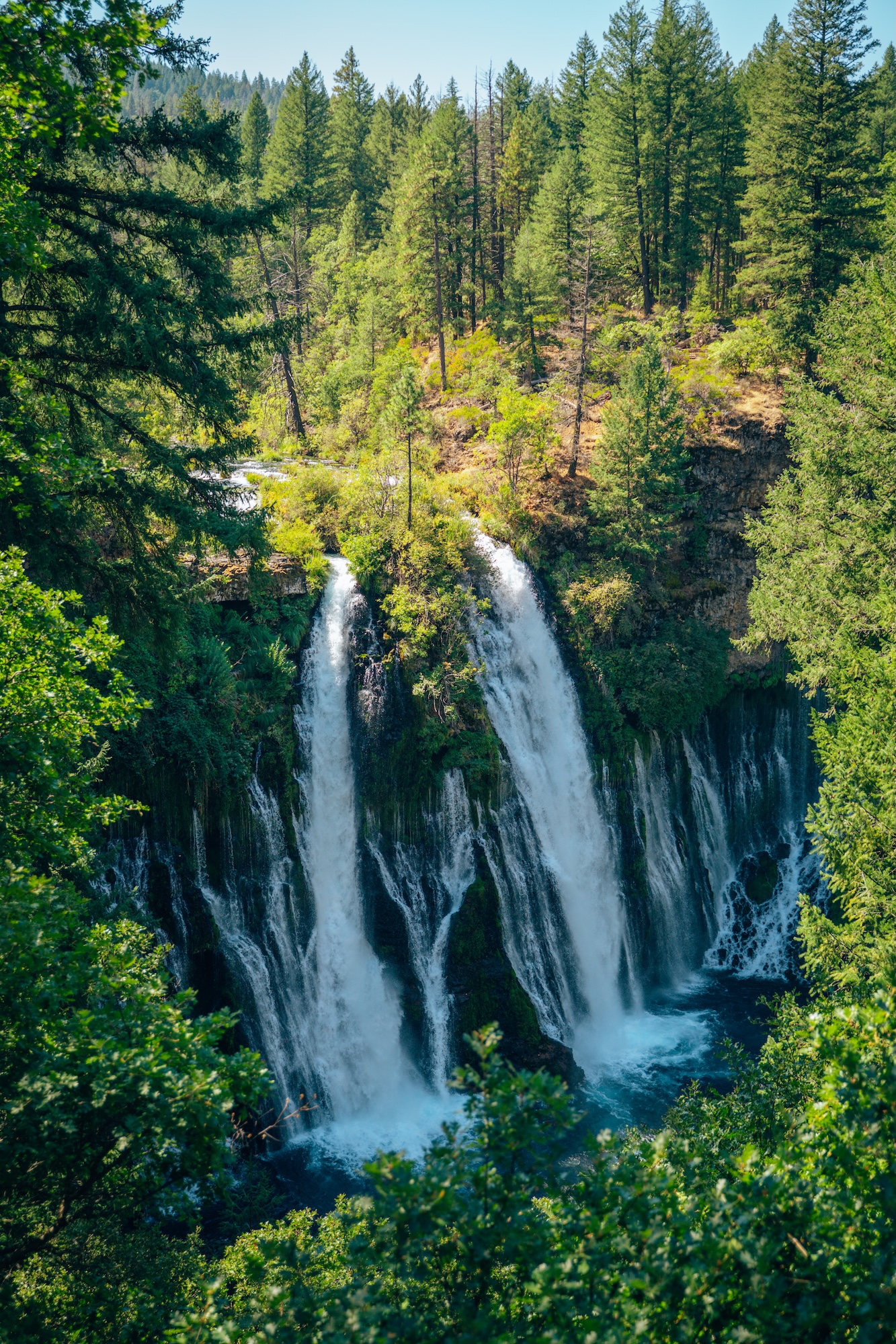
MCARTHUR-BURNEY FALLS MEMORIAL STATE PARK
A dramatic 129-foot waterfall, lush forested canyons, and volcanic geology make McArthur-Burney Falls Memorial State Park one of the most visually striking state parks in California. Located in Northern California near the edge of the Cascade Range, the park is centered around Burney Falls. Groundwater flows year-round through volcanic rock and spills over a moss-covered cliff face. The result is a constant, powerful cascade surrounded by dense evergreen forest, creating a setting that feels cooler, greener, and more refreshing than much of the surrounding region.
President Theodore Roosevelt reportedly called Burney Falls the “Eighth Wonder of the World,” a reflection of just how striking the waterfall is even by national standards.
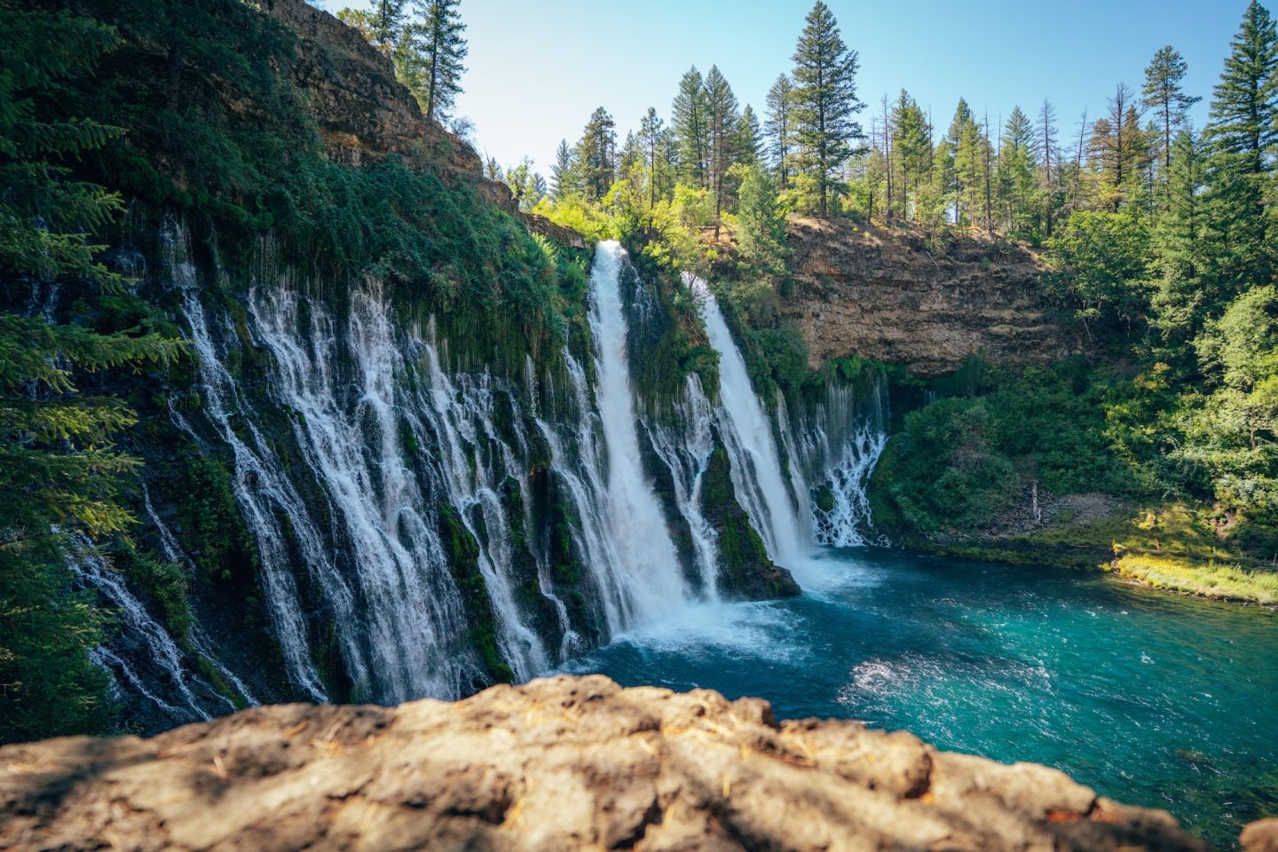
The main highlight of the park is the Burney Falls Loop Trail, a short 1.0mi and accessible path that circles the base of the falls and offers multiple viewpoints from both above and below the cascade. For a longer and more immersive experience, the Pacific Crest Trail section through the park provides a different perspective, following forested terrain and offering quieter views away from the main overlook crowds. Together, these routes give visitors a chance to experience both the iconic waterfall itself and the broader volcanic landscape that defines this part of Northern California.
- LOCATION: Burney, Shasta County
- ENTRY FEE: $10 vehicle day use fee (reservations required)
- CAMPGROUNDS: Rim Campground and Pioneer Campground
- PET POLICY: Dogs welcome in campgrounds and paved areas only
- SEASONALITY: Operating season is year-round
- BEST TIME TO VISIT: Spring-Fall
- OFFICIAL SITE: McArthur-Burney Falls Memorial State Park
WHAT TO KNOW BEFORE EXPLORING IN CALIFORNIA
The biggest piece of advice we would give you for exploring California’s state parks is this: Plan ahead but be flexible. Some parks in the state require reservations months in advance, and some do not take reservations at all. Some are lesser known, and therefore less crowded. While others will have lines of vehicles waiting to get in for hours. If you’re planning to visit on a weekend, GO EARLY. As close to sunrise as possible. This will give you the best chance of getting a parking spot, and seeing the areas you’d like to see without massive crowds.
EXPLORING THE BEST STATE PARKS OF CALIFORNIA
California’s state parks showcase just how much variety exists within a single state. From towering redwood forests and rugged coastal cliffs to desert canyons, alpine lakes, and historic cultural sites. Each park offers a completely different experience. What ties them together is the sense of access and immersion they provide. Allowing you to step directly into landscapes that feel both iconic and deeply personal once you’re standing in them.
This collection of state parks of California highlights places that continue to stand out through repeated visits, not just one-time stops. Whether you’re planning a weekend hike, a camping trip, or a full road trip across the state, these parks offer a reliable starting point for exploration. No matter the season or region, there’s always another trail, viewpoint, or hidden corner waiting to be discovered.
IMPORTANT LINKS & RESOURCES
CALIFORNIA BUCKET LIST MAP & GUIDE
We’ve spent over 10 years exploring and mapping out this incredible state. And we put all the details, info, links, tips and recommendations in to a single California Bucket List Guide. Like GPS location, dog-friendliness, cost, and more. This guide now has over 850 unique locations and things to do around California, with some bonus locations in Oregon and Nevada. So if you’re looking for things to do, or places to go, this guide is for you!


Not much of a planner? No worries! We also have curated itineraries to make the planning process easier for you. And if that isn’t enough, book a call with us or have us create a custom itinerary for you! We are here to help!
Let us know if you have any questions in the comments below. And happy exploring!
- Ryan & Katy
